
A1 · Beginner
Calgary Stampede: Planned Access and Movement During Event Week
During ten days in July, thousands of people move through Calgary by train, bus, and foot to reach the summer grounds.
The July Event and the Park Grounds
The Calgary Stampede is an annual ten-day festival and agricultural exhibition held every July in Calgary, Alberta.
The event grounds occupy Stampede Park along the green Elbow River near downtown Calgary. The physical footprint covers about two hundred acres of outdoor grounds, arenas, and exhibition halls. The park borders city districts like the Beltline, East Village, and Victoria Park. The formal 2027 calendar schedules the ten-day festival from July 9 through July 18. Over one million visitors routinely pass through the open gates during this busy operating window.
Taking the Train and Bus to the Grounds
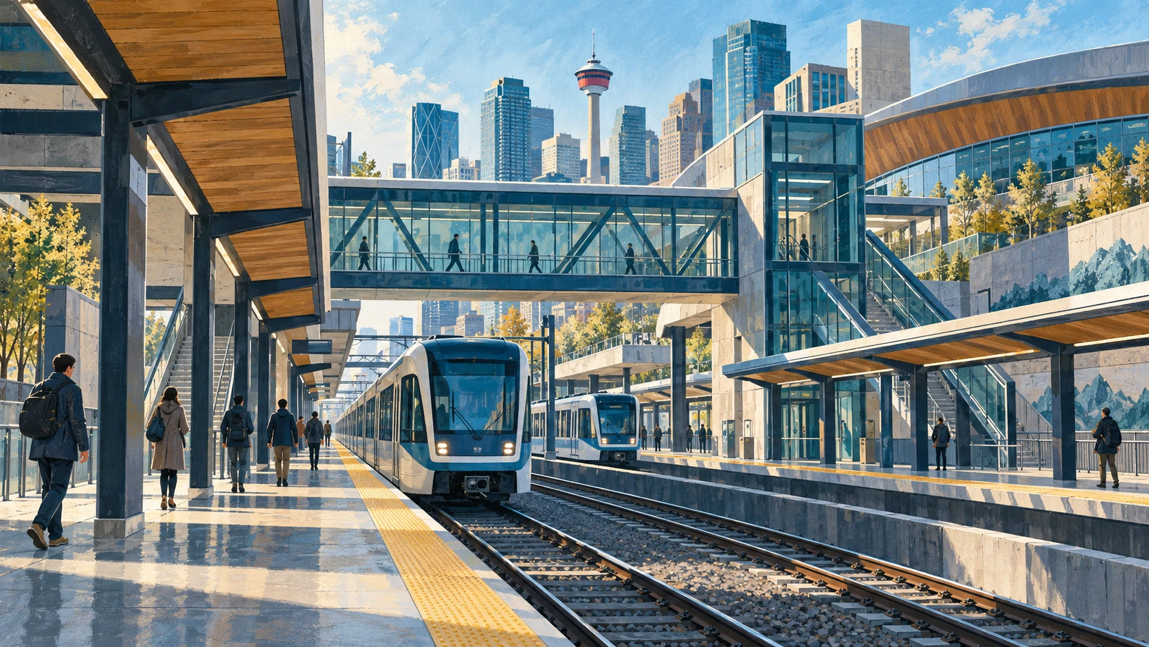
Calgary Transit operates the CTrain light rail system as the primary transit access mode into Stampede Park.
The Red Line brings riders straight to Victoria Park / Stampede Station and Erlton / Stampede Station. Trains run with continuous twenty-four-hour service through the ten-day event period. Victoria Park / Stampede Station serves as the principal northern portal connecting directly to the BMO Centre and Scotia Place. Special express shuttle bus routes connect suburban park-and-ride facilities directly to the grounds perimeter. Public transit usage accounts for the majority of all daily visitor arrivals.
Walking Routes and Vehicle Drop-off Points
Dedicated pedestrian promenades channel visitor foot traffic from downtown and the Beltline to the park gates.
Olympic Way functions as the central corridor leading south from 9th Avenue SE into the main northern gate. Active regional multi-use pathways along the Elbow River accommodate walking, cycling, and scooter traffic toward perimeter gates. Drop-off zones and rideshare staging areas are restricted to perimeters along 12th Avenue SE and 25th Avenue SE. Licensed city taxicabs utilize designated queue ranks situated outside active foot channels. Street-level wayfinding signage and crossing marshals regulate movement at key arterial intersections.

Street Rules and Parking in Nearby Areas
The City of Calgary implements temporary street closures and turn prohibitions around Stampede Park.
Access to residential streets in the Beltline and Victoria Park requires temporary residential parking permits during event week. On-street parking along primary arterial corridors is strictly prohibited to maintain clear lanes for emergency vehicles and transit. Macleod Trail and 12th Avenue experience travel delays and modified traffic signals during peak afternoon arrival periods. Temporary concrete barriers and pedestrian fences secure perimeter sidewalks and restrict unauthorized vehicle access. City parking enforcement patrols actively tow unauthorized vehicles parked in resident-only zones.
Teams and Communities Working on the Event
The Calgary Exhibition and Stampede Limited operates as a non-profit community organization administering internal operations.
The City of Calgary Transportation department coordinates off-site traffic management, traffic signals, and roadway closures. Calgary Transit manages expanded bus networks, light rail train frequency, and platform crowd control. The Calgary Police Service deploys dedicated foot patrols and traffic officers across surrounding street corridors. Treaty 7 First Nations participate through the Elbow River Camp, representing Siksika, Kainai, Piikani, Stoney Nakoda, and Tsuut'ina Nations. Elbow River Camp occupies a dedicated site within the park featuring traditional tipis, cultural demonstrations, and artisan markets.

Understanding What Official Maps Show
Published transportation maps and gate advisories represent administrative operational plans rather than comprehensive impact assessments.
Organizer access notices cannot quantify the secondary traffic displacement experienced by surrounding residential neighbourhoods. Scheduled transit operations do not capture the economic barriers that admission pricing presents for lower-income residents. Event movement plans prioritize high-volume visitor throughput over everyday local community transit needs. Official logistics guides omit informal gathering spaces, impromptu street parties, and unlicensed commercial activities outside park gates. Analyzing transit schedules reveals municipal logistics choreography rather than the full social reality of Calgary during Stampede week.
A2 · Elementary
Calgary Stampede: Planned Access and Movement During Event Week
Every July, thousands of visitors travel across Calgary to reach the festival grounds along the Elbow River using trains, buses, and designated walking routes.
The July Event and the Park Grounds
The Calgary Stampede operates as an annual ten-day festival and agricultural exhibition held every July in Calgary, Alberta.
The main event grounds occupy Stampede Park, situated southeast of downtown Calgary along the winding Elbow River. The entire physical footprint encompasses approximately two hundred acres of outdoor grounds, performance stages, indoor arenas, and spacious exhibition halls. The park directly borders surrounding residential and commercial districts including the Beltline, East Village, and historic Victoria Park. The formal 2027 event calendar schedules the ten-day festival from July 9 through July 18. More than one million visitors routinely pass through the perimeter gates across this concentrated ten-day operating window.
Taking the Train and Bus to the Grounds
Calgary Transit operates the CTrain light rail system as the primary mass transit access mode into Stampede Park.
The CTrain Red Line provides direct station access at Victoria Park / Stampede Station and Erlton / Stampede Station. Light rail trains operate around the clock with continuous twenty-four-hour service throughout the ten-day festival period. Victoria Park / Stampede Station serves as the principal northern transit portal connecting directly to the BMO Centre and Scotia Place. Special express Stampede shuttle bus routes connect suburban park-and-ride facilities directly to the perimeter of the grounds. Public transit usage accounts for the majority of all daily visitor arrivals across the ten-day period.
Walking Routes and Vehicle Drop-off Points
Dedicated pedestrian promenades channel visitor foot traffic from downtown Calgary and the Beltline toward the park gates.
Olympic Way functions as the central pedestrian corridor leading south from 9th Avenue SE into the main northern entrance. Active regional multi-use pathways along the Elbow River accommodate walking, cycling, and scooter traffic toward perimeter gates. Private vehicle drop-off zones and rideshare staging areas are restricted to designated perimeters along 12th Avenue SE and 25th Avenue SE. Licensed city taxicabs utilize designated queue ranks situated outside active pedestrian flow channels. Street-level wayfinding signage and crossing marshals regulate pedestrian movement at key arterial intersections.
Street Rules and Parking in Nearby Areas
The City of Calgary implements extensive temporary street closures and turn prohibitions surrounding Stampede Park.
Access to residential streets in the Beltline and Victoria Park requires temporary residential parking permits during event week. On-street parking along primary arterial corridors is strictly prohibited to maintain clear lanes for emergency vehicles and transit. Macleod Trail and 12th Avenue experience significant travel delays and modified traffic signals during peak afternoon arrival periods. Temporary concrete barriers and pedestrian fences secure perimeter sidewalks and restrict unauthorized vehicle access. City parking enforcement patrols actively tow unauthorized vehicles parked in resident-only zones.
Teams and Communities Working on the Event
The Calgary Exhibition and Stampede Limited operates as a non-profit community organization administering internal park operations.
The City of Calgary Transportation department coordinates off-site traffic management, traffic signals, and roadway closures. Calgary Transit manages expanded bus networks, light rail train frequency, and platform crowd control. The Calgary Police Service deploys dedicated foot patrols and traffic officers across surrounding street corridors. Treaty 7 First Nations participate through the Elbow River Camp, representing Siksika, Kainai, Piikani, Stoney Nakoda, and Tsuut'ina Nations. Elbow River Camp occupies a dedicated site within the park featuring traditional tipis, cultural demonstrations, and artisan markets.
Understanding What Official Maps Show
Published transportation maps and gate advisories represent administrative operational plans rather than comprehensive impact assessments.
Organizer access notices cannot quantify the secondary traffic displacement experienced by surrounding residential neighbourhoods. Scheduled transit operations do not capture the economic barriers that admission pricing presents for lower-income residents. Event movement plans prioritize high-volume visitor throughput over everyday local community transit needs. Official logistics guides omit informal gathering spaces, impromptu street parties, and unlicensed commercial activities outside park gates. Analyzing transit schedules reveals municipal logistics choreography rather than the full social reality of Calgary during Stampede week.
B1 · Intermediate
Calgary Stampede: Planned Access and Movement During Event Week
Across ten summer days in July, coordinated transit corridors, regulated pedestrian boulevards, and strict perimeter controls govern the movement of over one million visitors through Calgary.
The July Event and the Park Grounds
The Calgary Stampede operates as an annual ten-day festival and agricultural exhibition held every July in Calgary, Alberta.
The primary event grounds occupy Stampede Park, situated southeast of downtown Calgary along the banks of the Elbow River. The entire physical footprint encompasses approximately two hundred acres of outdoor grounds, performance stages, arenas, and extensive exhibition halls. The park directly borders surrounding residential and commercial districts including the Beltline, East Village, and historic Victoria Park. The formal 2027 event calendar schedules the ten-day festival from July 9 through July 18. Over one million visitors routinely pass through the open park gates across this concentrated ten-day operating window.
Taking the Train and Bus to the Grounds
Calgary Transit operates the CTrain light rail system as the primary mass transit access mode into Stampede Park.
The CTrain Red Line provides direct station access at Victoria Park / Stampede Station and Erlton / Stampede Station. Light rail trains operate around the clock with continuous twenty-four-hour service during the ten-day event period. Victoria Park / Stampede Station serves as the principal northern transit portal connecting directly to the BMO Centre and Scotia Place. Special express Stampede shuttle bus routes connect suburban park-and-ride facilities directly to the perimeter of the grounds. Public transit usage accounts for the majority of all daily visitor arrivals to Stampede Park.
Walking Routes and Vehicle Drop-off Points
Dedicated pedestrian promenades channel visitor foot traffic from downtown Calgary and the Beltline toward park gates.
Olympic Way functions as the central pedestrian corridor leading south from 9th Avenue SE into the main northern gate. Active regional multi-use pathways along the Elbow River accommodate walking, cycling, and scooter traffic toward perimeter gates. Private vehicle drop-off zones and rideshare staging areas are restricted to designated perimeters along 12th Avenue SE and 25th Avenue SE. Licensed city taxicabs utilize designated queue ranks situated outside active pedestrian flow channels. Street-level wayfinding signage and crossing marshals regulate pedestrian movement at key arterial intersections.
Street Rules and Parking in Nearby Areas
The City of Calgary implements extensive temporary street closures and turn prohibitions surrounding Stampede Park.
Access to residential streets in the Beltline and Victoria Park requires temporary residential parking permits during event week. On-street parking along primary arterial corridors is strictly prohibited to maintain clear lanes for emergency vehicles and transit. Macleod Trail and 12th Avenue experience significant travel delays and modified traffic signals during peak afternoon arrival periods. Temporary concrete barriers and pedestrian fences secure perimeter sidewalks and restrict unauthorized vehicle access. City parking enforcement patrols actively tow unauthorized vehicles parked in resident-only zones.
Teams and Communities Working on the Event
The Calgary Exhibition and Stampede Limited operates as a non-profit community organization administering internal park operations.
The City of Calgary Transportation department coordinates off-site traffic management, traffic signals, and roadway closures. Calgary Transit manages expanded bus networks, light rail train frequency, and platform crowd control. The Calgary Police Service deploys dedicated foot patrols and traffic officers across surrounding street corridors. Treaty 7 First Nations participate through the Elbow River Camp, representing Siksika, Kainai, Piikani, Stoney Nakoda, and Tsuut'ina Nations. Elbow River Camp occupies a dedicated site within the park featuring traditional tipis, cultural demonstrations, and artisan markets.
Understanding What Official Maps Show
Published transportation maps and gate advisories represent administrative operational plans rather than comprehensive impact assessments.
Organizer access notices cannot quantify the secondary traffic displacement experienced by surrounding residential neighbourhoods. Scheduled transit operations do not capture the economic barriers that admission pricing presents for lower-income residents. Event movement plans prioritize high-volume visitor throughput over everyday local community transit needs. Official logistics guides omit the informal gathering spaces, impromptu street parties, and unlicensed commercial activities outside park gates. Analyzing transit schedules reveals municipal logistics choreography rather than the full social reality of Calgary during Stampede week.
B2 · Upper Intermediate
Calgary Stampede: Planned Access and Movement During Event Week
Across ten summer days in July, coordinated transit corridors, regulated pedestrian boulevards, and strict perimeter controls govern the movement of over one million visitors through Calgary.
The July Event and the Park Grounds
The Calgary Stampede operates as an annual ten-day festival and agricultural exhibition held every July in Calgary, Alberta.
The primary event grounds occupy Stampede Park, situated southeast of downtown Calgary along the banks of the Elbow River. The entire physical footprint encompasses approximately two hundred acres of outdoor grounds, performance stages, arenas, and extensive exhibition halls. The park directly borders surrounding residential and commercial districts including the Beltline, East Village, and historic Victoria Park. The formal 2027 event calendar schedules the ten-day festival from July 9 through July 18. Over one million visitors routinely pass through the open park gates across this concentrated ten-day operating window.
Taking the Train and Bus to the Grounds
Calgary Transit operates the CTrain light rail system as the primary mass transit access mode into Stampede Park.
The CTrain Red Line provides direct station access at Victoria Park / Stampede Station and Erlton / Stampede Station. Light rail trains operate around the clock with continuous twenty-four-hour service during the ten-day event period. Victoria Park / Stampede Station serves as the principal northern transit portal connecting directly to the BMO Centre and Scotia Place. Special express Stampede shuttle bus routes connect suburban park-and-ride facilities directly to the perimeter of the grounds. Public transit usage accounts for the majority of all daily visitor arrivals to Stampede Park.
Walking Routes and Vehicle Drop-off Points
Dedicated pedestrian promenades channel visitor foot traffic from downtown Calgary and the Beltline toward park gates.
Olympic Way functions as the central pedestrian corridor leading south from 9th Avenue SE into the main northern gate. Active regional multi-use pathways along the Elbow River accommodate walking, cycling, and scooter traffic toward perimeter gates. Private vehicle drop-off zones and rideshare staging areas are restricted to designated perimeters along 12th Avenue SE and 25th Avenue SE. Licensed city taxicabs utilize designated queue ranks situated outside active pedestrian flow channels. Street-level wayfinding signage and crossing marshals regulate pedestrian movement at key arterial intersections.
Street Rules and Parking in Nearby Areas
The City of Calgary implements extensive temporary street closures and turn prohibitions surrounding Stampede Park.
Access to residential streets in the Beltline and Victoria Park requires temporary residential parking permits during event week. On-street parking along primary arterial corridors is strictly prohibited to maintain clear lanes for emergency vehicles and transit. Macleod Trail and 12th Avenue experience significant travel delays and modified traffic signals during peak afternoon arrival periods. Temporary concrete barriers and pedestrian fences secure perimeter sidewalks and restrict unauthorized vehicle access. City parking enforcement patrols actively tow unauthorized vehicles parked in resident-only zones.
Teams and Communities Working on the Event
The Calgary Exhibition and Stampede Limited operates as a non-profit community organization administering internal park operations.
The City of Calgary Transportation department coordinates off-site traffic management, traffic signals, and roadway closures. Calgary Transit manages expanded bus networks, light rail train frequency, and platform crowd control. The Calgary Police Service deploys dedicated foot patrols and traffic officers across surrounding street corridors. Treaty 7 First Nations participate through the Elbow River Camp, representing Siksika, Kainai, Piikani, Stoney Nakoda, and Tsuut'ina Nations. Elbow River Camp occupies a dedicated site within the park featuring traditional tipis, cultural demonstrations, and artisan markets.
Understanding What Official Maps Show
Published transportation maps and gate advisories represent administrative operational plans rather than comprehensive impact assessments.
Organizer access notices cannot quantify the secondary traffic displacement experienced by surrounding residential neighbourhoods. Scheduled transit operations do not capture the economic barriers that admission pricing presents for lower-income residents. Event movement plans prioritize high-volume visitor throughput over everyday local community transit needs. Official logistics guides omit the informal gathering spaces, impromptu street parties, and unlicensed commercial activities outside park gates. Analyzing transit schedules reveals municipal logistics choreography rather than the full social reality of Calgary during Stampede week.
C1 · Advanced
Calgary Stampede: Planned Access and Movement During Event Week
Across ten summer days in July, coordinated transit corridors, regulated pedestrian boulevards, and strict perimeter controls govern the movement of over one million visitors through Calgary.
The July Event and the Park Grounds
The Calgary Stampede operates as an annual ten-day festival and agricultural exhibition held every July in Calgary, Alberta.
The primary event grounds occupy Stampede Park, situated southeast of downtown Calgary along the banks of the Elbow River. The physical footprint encompasses approximately two hundred acres of outdoor grounds, performance stages, arenas, and exhibition halls. The park directly borders surrounding residential and commercial districts including the Beltline, East Village, and Victoria Park. The formal 2027 event calendar schedules the ten-day festival from July 9 through July 18. Over one million visitors routinely pass through the park gates across this concentrated ten-day operating window.
Taking the Train and Bus to the Grounds
Calgary Transit operates the CTrain light rail system as the primary mass transit access mode into Stampede Park.
The CTrain Red Line provides direct station access at Victoria Park / Stampede Station and Erlton / Stampede Station. Light rail trains operate around the clock with continuous twenty-four-hour service during the ten-day event period. Victoria Park / Stampede Station serves as the principal northern transit portal connecting directly to the BMO Centre and Scotia Place. Special express Stampede shuttle bus routes connect suburban park-and-ride facilities directly to the perimeter of the grounds. Public transit usage accounts for the majority of all daily visitor arrivals to Stampede Park.
Walking Routes and Vehicle Drop-off Points
Dedicated pedestrian promenades channel visitor foot traffic from downtown Calgary and the Beltline toward park gates.
Olympic Way functions as the central pedestrian corridor leading south from 9th Avenue SE into the main northern gate. Active regional multi-use pathways along the Elbow River accommodate walking, cycling, and scooter traffic toward perimeter gates. Private vehicle drop-off zones and rideshare staging areas are restricted to designated perimeters along 12th Avenue SE and 25th Avenue SE. Licensed city taxicabs utilize designated queue ranks situated outside active pedestrian flow channels. Street-level wayfinding signage and crossing marshals regulate pedestrian movement at key arterial intersections.
Street Rules and Parking in Nearby Areas
The City of Calgary implements extensive temporary street closures and turn prohibitions surrounding Stampede Park.
Access to residential streets in the Beltline and Victoria Park requires temporary residential parking permits during event week. On-street parking along primary arterial corridors is strictly prohibited to maintain clear lanes for emergency vehicles and transit. Macleod Trail and 12th Avenue experience significant travel delays and modified traffic signals during peak afternoon arrival periods. Temporary concrete barriers and pedestrian fences secure perimeter sidewalks and restrict unauthorized vehicle access. City parking enforcement patrols actively tow unauthorized vehicles parked in resident-only zones.
Teams and Communities Working on the Event
The Calgary Exhibition and Stampede Limited operates as a non-profit community organization administering internal park operations.
The City of Calgary Transportation department coordinates off-site traffic management, traffic signals, and roadway closures. Calgary Transit manages expanded bus networks, light rail train frequency, and platform crowd control. The Calgary Police Service deploys dedicated foot patrols and traffic officers across surrounding street corridors. Treaty 7 First Nations participate through the Elbow River Camp, representing Siksika, Kainai, Piikani, Stoney Nakoda, and Tsuut'ina Nations. Elbow River Camp occupies a dedicated site within the park featuring traditional tipis, cultural demonstrations, and artisan markets.
Understanding What Official Maps Show
Published transportation maps and gate advisories represent administrative operational plans rather than comprehensive impact assessments.
Organizer access notices cannot quantify the secondary traffic displacement experienced by surrounding residential neighbourhoods. Scheduled transit operations do not capture the economic barriers that admission pricing presents for lower-income residents. Event movement plans prioritize high-volume visitor throughput over everyday local community transit needs. Official logistics guides omit the informal gathering spaces, impromptu street parties, and unlicensed commercial activities outside park gates. Analyzing transit schedules reveals municipal logistics choreography rather than the full social reality of Calgary during Stampede week.
C2 · Mastery
Calgary Stampede: Planned Access and Movement During Event Week
Across ten summer days in July, coordinated transit corridors, regulated pedestrian boulevards, and strict perimeter controls govern the movement of over one million visitors through Calgary.
The July Event and the Park Grounds
The Calgary Stampede operates as an annual ten-day festival and agricultural exhibition held every July in Calgary, Alberta.
The primary event grounds occupy Stampede Park, situated southeast of downtown Calgary along the banks of the Elbow River. The physical footprint encompasses approximately two hundred acres of outdoor grounds, performance stages, arenas, and exhibition halls. The park directly borders surrounding residential and commercial districts including the Beltline, East Village, and Victoria Park. The formal 2027 event calendar schedules the ten-day festival from July 9 through July 18. Over one million visitors routinely pass through the park gates across this concentrated ten-day operating window.
Taking the Train and Bus to the Grounds
Calgary Transit operates the CTrain light rail system as the primary mass transit access mode into Stampede Park.
The CTrain Red Line provides direct station access at Victoria Park / Stampede Station and Erlton / Stampede Station. Light rail trains operate around the clock with continuous twenty-four-hour service during the ten-day event period. Victoria Park / Stampede Station serves as the principal northern transit portal connecting directly to the BMO Centre and Scotia Place. Special express Stampede shuttle bus routes connect suburban park-and-ride facilities directly to the perimeter of the grounds. Public transit usage accounts for the majority of all daily visitor arrivals to Stampede Park.
Walking Routes and Vehicle Drop-off Points
Dedicated pedestrian promenades channel visitor foot traffic from downtown Calgary and the Beltline toward park gates.
Olympic Way functions as the central pedestrian corridor leading south from 9th Avenue SE into the main northern gate. Active regional multi-use pathways along the Elbow River accommodate walking, cycling, and scooter traffic toward perimeter gates. Private vehicle drop-off zones and rideshare staging areas are restricted to designated perimeters along 12th Avenue SE and 25th Avenue SE. Licensed city taxicabs utilize designated queue ranks situated outside active pedestrian flow channels. Street-level wayfinding signage and crossing marshals regulate pedestrian movement at key arterial intersections.
Street Rules and Parking in Nearby Areas
The City of Calgary implements extensive temporary street closures and turn prohibitions surrounding Stampede Park.
Access to residential streets in the Beltline and Victoria Park requires temporary residential parking permits during event week. On-street parking along primary arterial corridors is strictly prohibited to maintain clear lanes for emergency vehicles and transit. Macleod Trail and 12th Avenue experience significant travel delays and modified traffic signals during peak afternoon arrival periods. Temporary concrete barriers and pedestrian fences secure perimeter sidewalks and restrict unauthorized vehicle access. City parking enforcement patrols actively tow unauthorized vehicles parked in resident-only zones.
Teams and Communities Working on the Event
The Calgary Exhibition and Stampede Limited operates as a non-profit community organization administering internal park operations.
The City of Calgary Transportation department coordinates off-site traffic management, traffic signals, and roadway closures. Calgary Transit manages expanded bus networks, light rail train frequency, and platform crowd control. The Calgary Police Service deploys dedicated foot patrols and traffic officers across surrounding street corridors. Treaty 7 First Nations participate through the Elbow River Camp, representing Siksika, Kainai, Piikani, Stoney Nakoda, and Tsuut'ina Nations. Elbow River Camp occupies a dedicated site within the park featuring traditional tipis, cultural demonstrations, and artisan markets.
Understanding What Official Maps Show
Published transportation maps and gate advisories represent administrative operational plans rather than comprehensive impact assessments.
Organizer access notices cannot quantify the secondary traffic displacement experienced by surrounding residential neighbourhoods. Scheduled transit operations do not capture the economic barriers that admission pricing presents for lower-income residents. Event movement plans prioritize high-volume visitor throughput over everyday local community transit needs. Official logistics guides omit the informal gathering spaces, impromptu street parties, and unlicensed commercial activities outside park gates. Analyzing transit schedules reveals municipal logistics choreography rather than the full social reality of Calgary during Stampede week.
Check your understanding
Choose how closely you want to revisit the article. You can refer back while answering, and review explanations when you finish.
Quick Quiz A1
Try one question, then create a free account for the full Quick Quiz. Sign Up Free
Answer every question before checking. There is no time limit.
Your results
/ 1 correct (%)
Read the explanations to see how each answer connects to the article.
-
What type of festival and exhibition is the Calgary Stampede?
1. Answer:
Quick Quiz A2
Try one question, then create a free account for the full Quick Quiz. Sign Up Free
Answer every question before checking. There is no time limit.
Your results
/ 1 correct (%)
Read the explanations to see how each answer connects to the article.
-
What kind of festival and exhibition is held every July in Calgary?
1. Answer:
Quick Quiz B1
Try one question, then create a free account for the full Quick Quiz. Sign Up Free
Answer every question before checking. There is no time limit.
Your results
/ 1 correct (%)
Read the explanations to see how each answer connects to the article.
-
What kind of recurring exhibition and festival takes place every July in Calgary?
1. Answer:
Quick Quiz B2
Try one question, then create a free account for the full Quick Quiz. Sign Up Free
Answer every question before checking. There is no time limit.
Your results
/ 1 correct (%)
Read the explanations to see how each answer connects to the article.
-
What kind of recurring exhibition and festival takes place every July in Calgary?
1. Answer:
Quick Quiz C1
Try one question, then create a free account for the full Quick Quiz. Sign Up Free
Answer every question before checking. There is no time limit.
Your results
/ 1 correct (%)
Read the explanations to see how each answer connects to the article.
-
What kind of recurring exhibition and festival takes place every July in Calgary?
1. Answer:
Quick Quiz C2
Try one question, then create a free account for the full Quick Quiz. Sign Up Free
Answer every question before checking. There is no time limit.
Your results
/ 1 correct (%)
Read the explanations to see how each answer connects to the article.
-
What kind of recurring exhibition and festival takes place every July in Calgary?
1. Answer:
