A1 · Beginner
The Camino de Santiago Across Northern Spain
An ancient walking trail crosses mountains, wheat plains, and rivers on its journey to the Atlantic coast.
The Medieval Trans-Pyrenean Highway and Route Topography
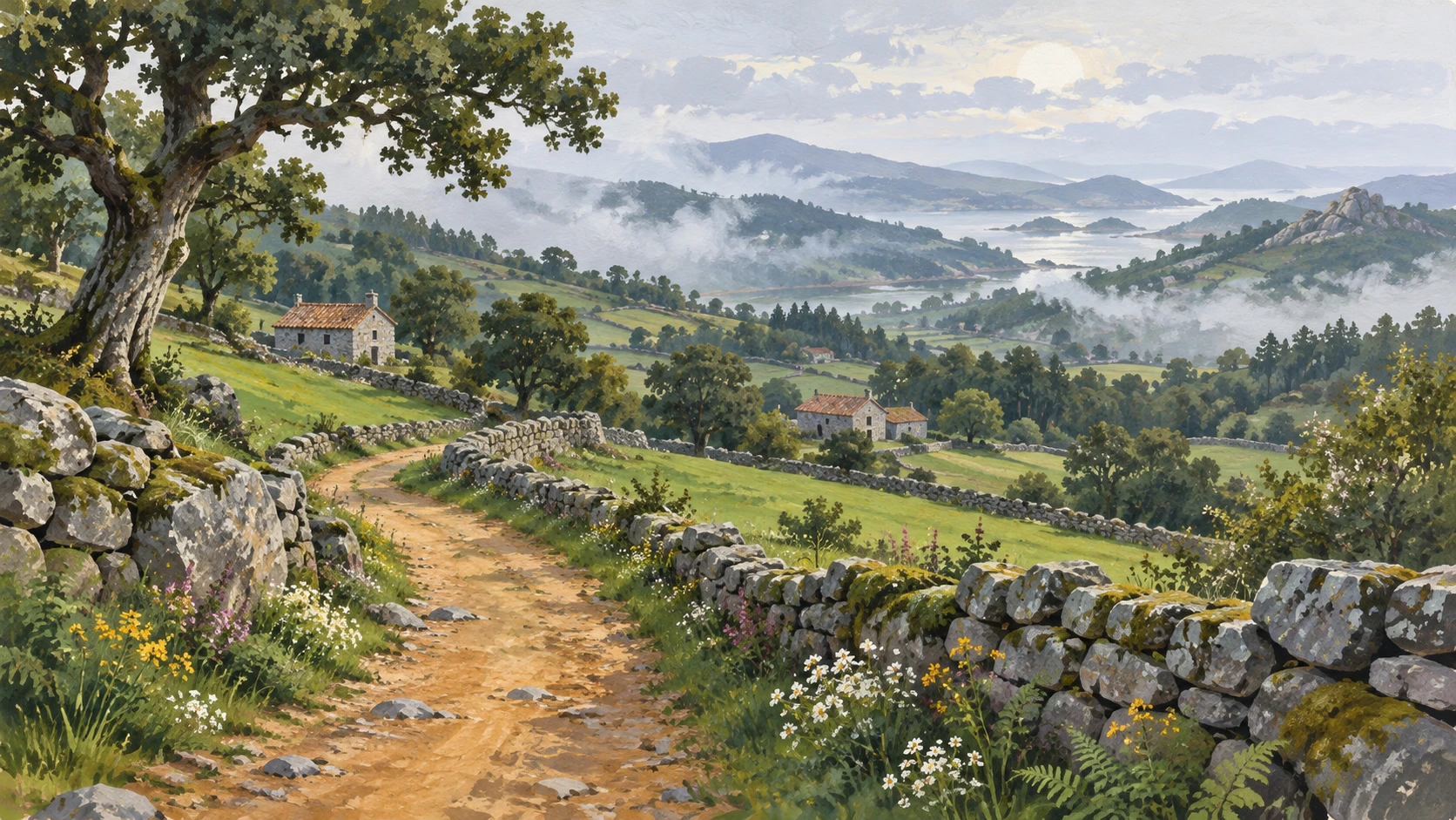
The Camino de Santiago is an ancient walking route across northern Spain. Pilgrims have walked these stone trails for over a thousand years. The popular French Route covers almost eight hundred kilometers of varied terrain. It begins high in the Pyrenees mountains along the border with France.
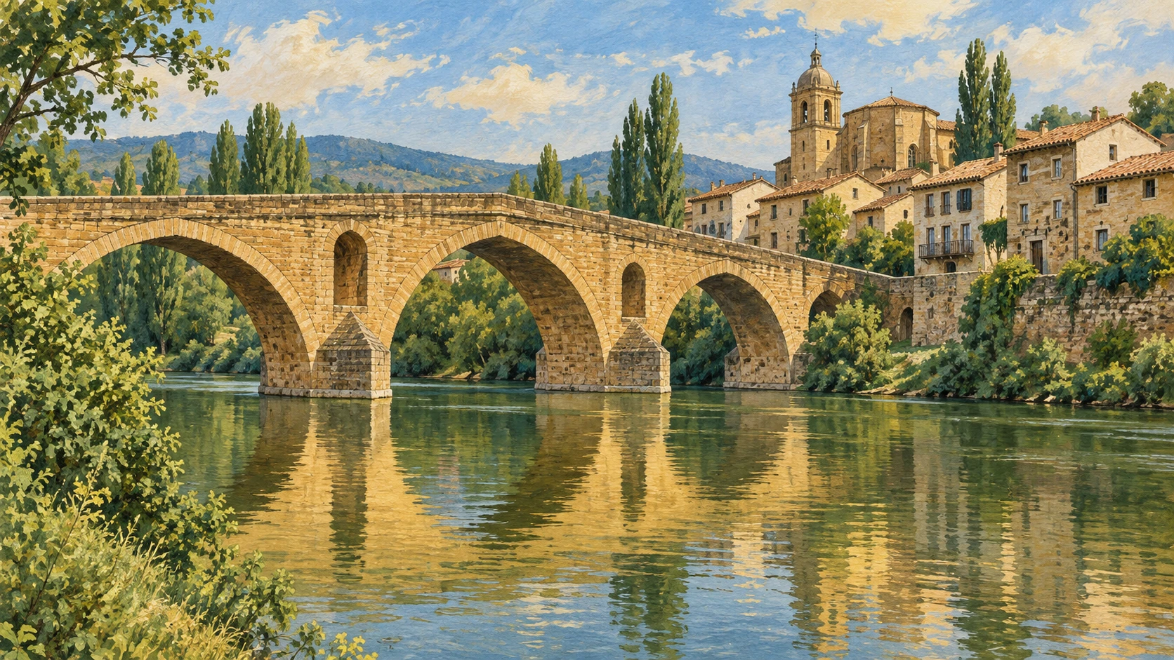
The pathway crosses green valleys, flat wheat plains, and granite hills. Ancient stone bridges help walkers cross wide northern rivers safely. The famous bridge at Puente la Reina features six massive arches. The ancient Codex Calixtinus manuscript described daily walking stages and river water quality. Historic towns along the trail grew by offering food and shelter to travelers.
Pilgrim Infrastructure, Albergues, and Waymarking
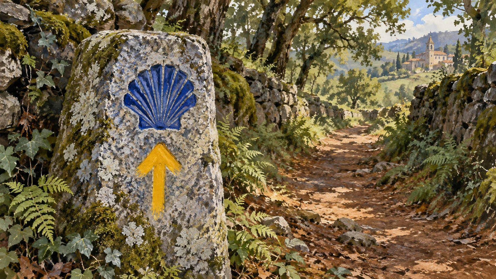
Simple hostels known as albergues provide shared rooms for tired walkers. Pilgrims carry an official credential card made of heavy paper. Local churches and village town halls stamp the card with ink marks. Yellow painted arrows mark the trail through towns and country woods.
Granite stone monoliths display a carved yellow scallop shell along the path. Father Elias Valina began painting the yellow arrows during the nineteen eighties. Volunteer groups clean the stone paths and trim roadside bushes each spring. Clear signs help walkers follow the trail without getting lost.
Urban Geography, Terminus, and the Compostela Record
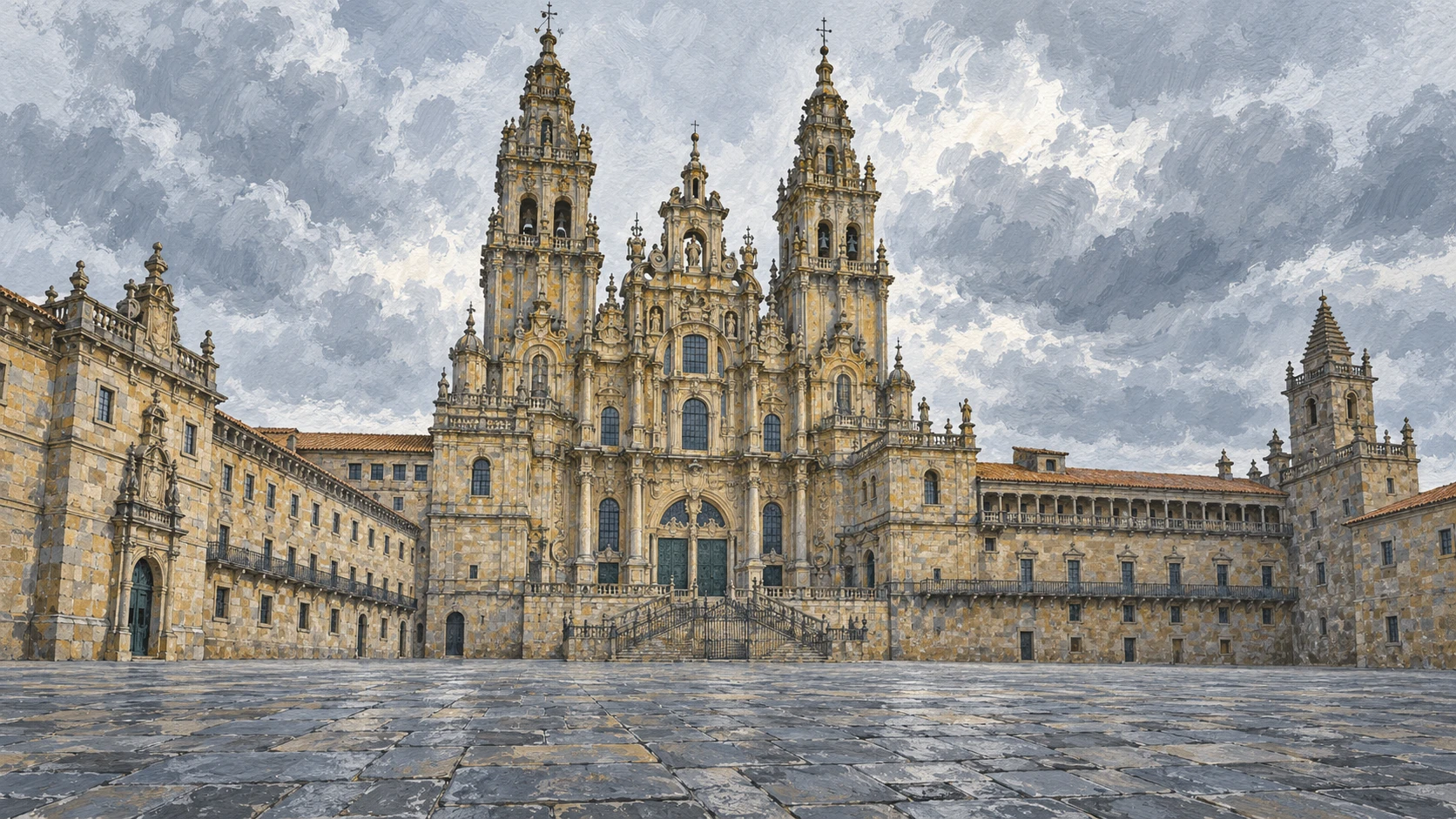
The long trail finishes in the grand Obradoiro square in Santiago de Compostela. The monumental granite cathedral towers over the stone plaza. The Pilgrim Office checks the stamps inside each walker paper passport. Walkers who finish one hundred kilometers receive the Latin Compostela certificate.
Records show that hundreds of thousands of pilgrims arrive in Santiago each year. Inside the cathedral, a giant silver censer swings high across the ceiling. The historic center of Santiago contains quiet stone streets and archways. Travelers celebrate reaching the end of their long journey across Spain.
Rural Economic Revitalization and Heritage Conservation
Walking visitors bring vital economic life to quiet farming villages. Small village bakeries, cafes, and family shops welcome pilgrims every day. Regional laws protect the beautiful countryside against modern industrial building. Wooden boardwalks protect delicate marsh plants from heavy walking boots.
Spanish and French authorities work together to keep mountain trails safe. New smartphone apps help travelers find open hostels and water fountains. Modern technology supports the path while keeping the traditional walk alive. The ancient way continues to connect people with nature and history.
A2 · Elementary
The Camino de Santiago: A Route That Shaped Iberian Settlement
Spanning hundreds of kilometers across northern Spain, the pilgrimage network transformed medieval trade, civil engineering, and rural communities.
The Medieval Trans-Pyrenean Highway and Route Topography
The Camino de Santiago represents one of the most durable cultural and topographical corridors in Western Europe, encompassing an extensive network of ancient trans-Pyrenean arteries converging on the shrine of Saint James in Galicia. Inscribed as a UNESCO World Heritage site in 1993, the primary trunk route, the Camino Francés, extends approximately 780 kilometers across nine autonomous communities and provinces from the mountain passes of Roncesvalles and Somport. The trail traverses distinct biogeographical zones, ascending through alpine beech forests in Navarre, descending into the vineyard valleys of La Rioja, crossing the semi-arid meseta plateau of Castile and León, and culminating in the granite highlands of Galicia.
Monumental civil engineering along the route historically facilitated large-scale human transit across hazardous mountain defiles and wide seasonal river basins. The eleventh-century stone bridge at Puente la Reina, erected under royal patronage to span the Arga river with six soaring masonry arches, stands as an exemplar of Romanesque bridge construction. Medieval municipal charters and cartularies extended royal safe-passage protections and market privileges to bridgeheads and fortified towns, shaping urban settlement patterns that persist along the northern transport spine of Spain to this day. Early topographical guides, notably the twelfth-century Codex Calixtinus manuscript, recorded daily stages, river water potability, and regional hospital networks.
Pilgrim Infrastructure, Albergues, and Waymarking
The physical durability of the pilgrimage network relies on a continuous infrastructure of hospitality evolved from medieval monastic infirmaries and charitable hospices. Today, municipal, parochial, and private albergues offer modest communal dormitory accommodations exclusively to pilgrims traveling on foot, bicycle, or horseback. Access to this public hostel network requires the credencial, a folded paper passport stamped with distinctive ink and wax marks at parish churches, rural hermitages, village town halls, and albergues to authenticate the consecutive stages of the journey.
Waymarking across the trail follows a universally recognized visual syntax, characterized by bright yellow painted arrows and stylized yellow scallop shells mounted on cobalt ceramic tiles or roadside granite monoliths. Standardized during the 1980s through the pioneering fieldwork of Galician parish priest Elías Valiña and federated Camino associations, this intuitive signaling system guides walkers across complex intersections and isolated rural commons. Inter-provincial maintenance crews conduct seasonal condition audits, stabilizing eroded earthen banks, clearing thorny gorse, and replacing weathered granite waymarkers.
Urban Geography, Terminus, and the Compostela Record
The pilgrimage culminates at the monumental Praza do Obradoiro in Santiago de Compostela, where travelers emerge before the towering baroque granite facade of the Romanesque cathedral. Within the nearby Pilgrim Reception Office, cathedral registrars inspect each credential to verify that the final one hundred kilometers on foot, or two hundred kilometers by bicycle, were traversed sequentially without vehicular assistance. Qualifying travelers receive the Compostela, an official Latin certificate of completion issued continuously since the fourteenth century.
Statistical archives maintained by the cathedral chapter record the demographic surge of the modern pilgrimage, documenting more than four hundred thousand certified arrivals annually during recent Holy Years. Within the cathedral transept, the monumental Botafumeiro, a massive silver-plated brass thurible suspended from the crossing dome, swings in vast parabolic arcs across the nave, preserving a medieval ritual originally designed to fumigate and cleanse tightly packed congregations. The surrounding historic core of Santiago, designated a UNESCO World Heritage site in 1985, preserves arcaded granite thoroughfares and monumental collegiate residences.
Rural Economic Revitalization and Heritage Conservation
Beyond its devotional and cultural resonance, the Camino de Santiago functions as a vital socioeconomic lifeline for hundreds of depopulated agrarian villages across the northern Spanish interior. Daily pedestrian traffic channels direct seasonal revenue into family-operated bakeries, artisan cheese producers, rural inns, and traditional taverns, countering rural abandonment across sparsely populated comarcas. Regional authorities enforce comprehensive visual corridor protections, prohibiting ribbon development, wind turbine installations, and intrusive industrial zoning within designated heritage buffer zones.
Ecological trail management mitigates environmental wear along vulnerable landscapes, installing raised oak boardwalks over sensitive wetlands and laying permeable crushed limestone beds along waterlogged forest paths. Bilateral coordination between Spanish and French regional authorities standardizes emergency telemetry and mountain rescue waypoints along hazardous border cols. Concurrently, digital credential applications and real-time hostel registries provide telemetry for visitor dispersal while safeguarding the authentic physical walking experience that defines the Jacobean heritage.
B1 · Intermediate
The Camino de Santiago: Topography, Infrastructure, and Cultural Heritage
Spanning hundreds of kilometers across northern Spain, the pilgrimage network transformed medieval trade, civil engineering, and rural communities.
The Medieval Trans-Pyrenean Highway and Route Topography
The Camino de Santiago represents one of the most durable cultural and topographical corridors in Western Europe, encompassing an extensive network of ancient trans-Pyrenean arteries converging on the shrine of Saint James in Galicia. Inscribed as a UNESCO World Heritage site in 1993, the primary trunk route, the Camino Francés, extends approximately 780 kilometers across nine autonomous communities and provinces from the mountain passes of Roncesvalles and Somport. The trail traverses distinct biogeographical zones, ascending through alpine beech forests in Navarre, descending into the vineyard valleys of La Rioja, crossing the semi-arid meseta plateau of Castile and León, and culminating in the granite highlands of Galicia.
Monumental civil engineering along the route historically facilitated large-scale human transit across hazardous mountain defiles and wide seasonal river basins. The eleventh-century stone bridge at Puente la Reina, erected under royal patronage to span the Arga river with six soaring masonry arches, stands as an exemplar of Romanesque bridge construction. Medieval municipal charters and cartularies extended royal safe-passage protections and market privileges to bridgeheads and fortified towns, shaping urban settlement patterns that persist along the northern transport spine of Spain to this day. Early topographical guides, notably the twelfth-century Codex Calixtinus manuscript, recorded daily stages, river water potability, and regional hospital networks.
Pilgrim Infrastructure, Albergues, and Waymarking
The physical durability of the pilgrimage network relies on a continuous infrastructure of hospitality evolved from medieval monastic infirmaries and charitable hospices. Today, municipal, parochial, and private albergues offer modest communal dormitory accommodations exclusively to pilgrims traveling on foot, bicycle, or horseback. Access to this public hostel network requires the credencial, a folded paper passport stamped with distinctive ink and wax marks at parish churches, rural hermitages, village town halls, and albergues to authenticate the consecutive stages of the journey.
Waymarking across the trail follows a universally recognized visual syntax, characterized by bright yellow painted arrows and stylized yellow scallop shells mounted on cobalt ceramic tiles or roadside granite monoliths. Standardized during the 1980s through the pioneering fieldwork of Galician parish priest Elías Valiña and federated Camino associations, this intuitive signaling system guides walkers across complex intersections and isolated rural commons. Inter-provincial maintenance crews conduct seasonal condition audits, stabilizing eroded earthen banks, clearing thorny gorse, and replacing weathered granite waymarkers.
Urban Geography, Terminus, and the Compostela Record
The pilgrimage culminates at the monumental Praza do Obradoiro in Santiago de Compostela, where travelers emerge before the towering baroque granite facade of the Romanesque cathedral. Within the nearby Pilgrim Reception Office, cathedral registrars inspect each credential to verify that the final one hundred kilometers on foot, or two hundred kilometers by bicycle, were traversed sequentially without vehicular assistance. Qualifying travelers receive the Compostela, an official Latin certificate of completion issued continuously since the fourteenth century.
Statistical archives maintained by the cathedral chapter record the demographic surge of the modern pilgrimage, documenting more than four hundred thousand certified arrivals annually during recent Holy Years. Within the cathedral transept, the monumental Botafumeiro, a massive silver-plated brass thurible suspended from the crossing dome, swings in vast parabolic arcs across the nave, preserving a medieval ritual originally designed to fumigate and cleanse tightly packed congregations. The surrounding historic core of Santiago, designated a UNESCO World Heritage site in 1985, preserves arcaded granite thoroughfares and monumental collegiate residences.
Rural Economic Revitalization and Heritage Conservation
Beyond its devotional and cultural resonance, the Camino de Santiago functions as a vital socioeconomic lifeline for hundreds of depopulated agrarian villages across the northern Spanish interior. Daily pedestrian traffic channels direct seasonal revenue into family-operated bakeries, artisan cheese producers, rural inns, and traditional taverns, countering rural abandonment across sparsely populated comarcas. Regional authorities enforce comprehensive visual corridor protections, prohibiting ribbon development, wind turbine installations, and intrusive industrial zoning within designated heritage buffer zones.
Ecological trail management mitigates environmental wear along vulnerable landscapes, installing raised oak boardwalks over sensitive wetlands and laying permeable crushed limestone beds along waterlogged forest paths. Bilateral coordination between Spanish and French regional authorities standardizes emergency telemetry and mountain rescue waypoints along hazardous border cols. Concurrently, digital credential applications and real-time hostel registries provide telemetry for visitor dispersal while safeguarding the authentic physical walking experience that defines the Jacobean heritage.
B2 · Upper Intermediate
The Camino de Santiago: Civil Engineering and Pilgrimage Geography
Spanning hundreds of kilometers across northern Spain, the pilgrimage network transformed medieval trade, civil engineering, and rural communities.
The Medieval Trans-Pyrenean Highway and Route Topography
The Camino de Santiago represents one of the most durable cultural and topographical corridors in Western Europe, encompassing an extensive network of ancient trans-Pyrenean arteries converging on the shrine of Saint James in Galicia. Inscribed as a UNESCO World Heritage site in 1993, the primary trunk route, the Camino Francés, extends approximately 780 kilometers across nine autonomous communities and provinces from the mountain passes of Roncesvalles and Somport. The trail traverses distinct biogeographical zones, ascending through alpine beech forests in Navarre, descending into the vineyard valleys of La Rioja, crossing the semi-arid meseta plateau of Castile and León, and culminating in the granite highlands of Galicia.
Monumental civil engineering along the route historically facilitated large-scale human transit across hazardous mountain defiles and wide seasonal river basins. The eleventh-century stone bridge at Puente la Reina, erected under royal patronage to span the Arga river with six soaring masonry arches, stands as an exemplar of Romanesque bridge construction. Medieval municipal charters and cartularies extended royal safe-passage protections and market privileges to bridgeheads and fortified towns, shaping urban settlement patterns that persist along the northern transport spine of Spain to this day. Early topographical guides, notably the twelfth-century Codex Calixtinus manuscript, recorded daily stages, river water potability, and regional hospital networks.
Pilgrim Infrastructure, Albergues, and Waymarking
The physical durability of the pilgrimage network relies on a continuous infrastructure of hospitality evolved from medieval monastic infirmaries and charitable hospices. Today, municipal, parochial, and private albergues offer modest communal dormitory accommodations exclusively to pilgrims traveling on foot, bicycle, or horseback. Access to this public hostel network requires the credencial, a folded paper passport stamped with distinctive ink and wax marks at parish churches, rural hermitages, village town halls, and albergues to authenticate the consecutive stages of the journey.
Waymarking across the trail follows a universally recognized visual syntax, characterized by bright yellow painted arrows and stylized yellow scallop shells mounted on cobalt ceramic tiles or roadside granite monoliths. Standardized during the 1980s through the pioneering fieldwork of Galician parish priest Elías Valiña and federated Camino associations, this intuitive signaling system guides walkers across complex intersections and isolated rural commons. Inter-provincial maintenance crews conduct seasonal condition audits, stabilizing eroded earthen banks, clearing thorny gorse, and replacing weathered granite waymarkers.
Urban Geography, Terminus, and the Compostela Record
The pilgrimage culminates at the monumental Praza do Obradoiro in Santiago de Compostela, where travelers emerge before the towering baroque granite facade of the Romanesque cathedral. Within the nearby Pilgrim Reception Office, cathedral registrars inspect each credential to verify that the final one hundred kilometers on foot, or two hundred kilometers by bicycle, were traversed sequentially without vehicular assistance. Qualifying travelers receive the Compostela, an official Latin certificate of completion issued continuously since the fourteenth century.
Statistical archives maintained by the cathedral chapter record the demographic surge of the modern pilgrimage, documenting more than four hundred thousand certified arrivals annually during recent Holy Years. Within the cathedral transept, the monumental Botafumeiro, a massive silver-plated brass thurible suspended from the crossing dome, swings in vast parabolic arcs across the nave, preserving a medieval ritual originally designed to fumigate and cleanse tightly packed congregations. The surrounding historic core of Santiago, designated a UNESCO World Heritage site in 1985, preserves arcaded granite thoroughfares and monumental collegiate residences.
Rural Economic Revitalization and Heritage Conservation
Beyond its devotional and cultural resonance, the Camino de Santiago functions as a vital socioeconomic lifeline for hundreds of depopulated agrarian villages across the northern Spanish interior. Daily pedestrian traffic channels direct seasonal revenue into family-operated bakeries, artisan cheese producers, rural inns, and traditional taverns, countering rural abandonment across sparsely populated comarcas. Regional authorities enforce comprehensive visual corridor protections, prohibiting ribbon development, wind turbine installations, and intrusive industrial zoning within designated heritage buffer zones.
Ecological trail management mitigates environmental wear along vulnerable landscapes, installing raised oak boardwalks over sensitive wetlands and laying permeable crushed limestone beds along waterlogged forest paths. Bilateral coordination between Spanish and French regional authorities standardizes emergency telemetry and mountain rescue waypoints along hazardous border cols. Concurrently, digital credential applications and real-time hostel registries provide telemetry for visitor dispersal while safeguarding the authentic physical walking experience that defines the Jacobean heritage.
C1 · Advanced
The Camino de Santiago: Territorial Integration, Waymarking, and Conservation
Spanning hundreds of kilometers across northern Spain, the pilgrimage network transformed medieval trade, civil engineering, and rural communities.
The Medieval Trans-Pyrenean Highway and Route Topography
The Camino de Santiago represents one of the most durable cultural and topographical corridors in Western Europe, encompassing an extensive network of ancient trans-Pyrenean arteries converging on the shrine of Saint James in Galicia. Inscribed as a UNESCO World Heritage site in 1993, the primary trunk route, the Camino Francés, extends approximately 780 kilometers across nine autonomous communities and provinces from the mountain passes of Roncesvalles and Somport. The trail traverses distinct biogeographical zones, ascending through alpine beech forests in Navarre, descending into the vineyard valleys of La Rioja, crossing the semi-arid meseta plateau of Castile and León, and culminating in the granite highlands of Galicia.
Monumental civil engineering along the route historically facilitated large-scale human transit across hazardous mountain defiles and wide seasonal river basins. The eleventh-century stone bridge at Puente la Reina, erected under royal patronage to span the Arga river with six soaring masonry arches, stands as an exemplar of Romanesque bridge construction. Medieval municipal charters and cartularies extended royal safe-passage protections and market privileges to bridgeheads and fortified towns, shaping urban settlement patterns that persist along the northern transport spine of Spain to this day. Early topographical guides, notably the twelfth-century Codex Calixtinus manuscript, recorded daily stages, river water potability, and regional hospital networks.
Pilgrim Infrastructure, Albergues, and Waymarking
The physical durability of the pilgrimage network relies on a continuous infrastructure of hospitality evolved from medieval monastic infirmaries and charitable hospices. Today, municipal, parochial, and private albergues offer modest communal dormitory accommodations exclusively to pilgrims traveling on foot, bicycle, or horseback. Access to this public hostel network requires the credencial, a folded paper passport stamped with distinctive ink and wax marks at parish churches, rural hermitages, village town halls, and albergues to authenticate the consecutive stages of the journey.
Waymarking across the trail follows a universally recognized visual syntax, characterized by bright yellow painted arrows and stylized yellow scallop shells mounted on cobalt ceramic tiles or roadside granite monoliths. Standardized during the 1980s through the pioneering fieldwork of Galician parish priest Elías Valiña and federated Camino associations, this intuitive signaling system guides walkers across complex intersections and isolated rural commons. Inter-provincial maintenance crews conduct seasonal condition audits, stabilizing eroded earthen banks, clearing thorny gorse, and replacing weathered granite waymarkers.
Urban Geography, Terminus, and the Compostela Record
The pilgrimage culminates at the monumental Praza do Obradoiro in Santiago de Compostela, where travelers emerge before the towering baroque granite facade of the Romanesque cathedral. Within the nearby Pilgrim Reception Office, cathedral registrars inspect each credential to verify that the final one hundred kilometers on foot, or two hundred kilometers by bicycle, were traversed sequentially without vehicular assistance. Qualifying travelers receive the Compostela, an official Latin certificate of completion issued continuously since the fourteenth century.
Statistical archives maintained by the cathedral chapter record the demographic surge of the modern pilgrimage, documenting more than four hundred thousand certified arrivals annually during recent Holy Years. Within the cathedral transept, the monumental Botafumeiro, a massive silver-plated brass thurible suspended from the crossing dome, swings in vast parabolic arcs across the nave, preserving a medieval ritual originally designed to fumigate and cleanse tightly packed congregations. The surrounding historic core of Santiago, designated a UNESCO World Heritage site in 1985, preserves arcaded granite thoroughfares and monumental collegiate residences.
Rural Economic Revitalization and Heritage Conservation
Beyond its devotional and cultural resonance, the Camino de Santiago functions as a vital socioeconomic lifeline for hundreds of depopulated agrarian villages across the northern Spanish interior. Daily pedestrian traffic channels direct seasonal revenue into family-operated bakeries, artisan cheese producers, rural inns, and traditional taverns, countering rural abandonment across sparsely populated comarcas. Regional authorities enforce comprehensive visual corridor protections, prohibiting ribbon development, wind turbine installations, and intrusive industrial zoning within designated heritage buffer zones.
Ecological trail management mitigates environmental wear along vulnerable landscapes, installing raised oak boardwalks over sensitive wetlands and laying permeable crushed limestone beds along waterlogged forest paths. Bilateral coordination between Spanish and French regional authorities standardizes emergency telemetry and mountain rescue waypoints along hazardous border cols. Concurrently, digital credential applications and real-time hostel registries provide telemetry for visitor dispersal while safeguarding the authentic physical walking experience that defines the Jacobean heritage.
C2 · Mastery
The Camino de Santiago: Trans-Pyrenean Corridors, Material Heritage, and Rural Resilience
Spanning hundreds of kilometers across northern Spain, the pilgrimage network transformed medieval trade, civil engineering, and rural communities.
The Medieval Trans-Pyrenean Highway and Route Topography
The Camino de Santiago represents one of the most durable cultural and topographical corridors in Western Europe, encompassing an extensive network of ancient trans-Pyrenean arteries converging on the shrine of Saint James in Galicia. Inscribed as a UNESCO World Heritage site in 1993, the primary trunk route, the Camino Francés, extends approximately 780 kilometers across nine autonomous communities and provinces from the mountain passes of Roncesvalles and Somport. The trail traverses distinct biogeographical zones, ascending through alpine beech forests in Navarre, descending into the vineyard valleys of La Rioja, crossing the semi-arid meseta plateau of Castile and León, and culminating in the granite highlands of Galicia.
Monumental civil engineering along the route historically facilitated large-scale human transit across hazardous mountain defiles and wide seasonal river basins. The eleventh-century stone bridge at Puente la Reina, erected under royal patronage to span the Arga river with six soaring masonry arches, stands as an exemplar of Romanesque bridge construction. Medieval municipal charters and cartularies extended royal safe-passage protections and market privileges to bridgeheads and fortified towns, shaping urban settlement patterns that persist along the northern transport spine of Spain to this day. Early topographical guides, notably the twelfth-century Codex Calixtinus manuscript, recorded daily stages, river water potability, and regional hospital networks.
Pilgrim Infrastructure, Albergues, and Waymarking
The physical durability of the pilgrimage network relies on a continuous infrastructure of hospitality evolved from medieval monastic infirmaries and charitable hospices. Today, municipal, parochial, and private albergues offer modest communal dormitory accommodations exclusively to pilgrims traveling on foot, bicycle, or horseback. Access to this public hostel network requires the credencial, a folded paper passport stamped with distinctive ink and wax marks at parish churches, rural hermitages, village town halls, and albergues to authenticate the consecutive stages of the journey.
Waymarking across the trail follows a universally recognized visual syntax, characterized by bright yellow painted arrows and stylized yellow scallop shells mounted on cobalt ceramic tiles or roadside granite monoliths. Standardized during the 1980s through the pioneering fieldwork of Galician parish priest Elías Valiña and federated Camino associations, this intuitive signaling system guides walkers across complex intersections and isolated rural commons. Inter-provincial maintenance crews conduct seasonal condition audits, stabilizing eroded earthen banks, clearing thorny gorse, and replacing weathered granite waymarkers.
Urban Geography, Terminus, and the Compostela Record
The pilgrimage culminates at the monumental Praza do Obradoiro in Santiago de Compostela, where travelers emerge before the towering baroque granite facade of the Romanesque cathedral. Within the nearby Pilgrim Reception Office, cathedral registrars inspect each credential to verify that the final one hundred kilometers on foot, or two hundred kilometers by bicycle, were traversed sequentially without vehicular assistance. Qualifying travelers receive the Compostela, an official Latin certificate of completion issued continuously since the fourteenth century.
Statistical archives maintained by the cathedral chapter record the demographic surge of the modern pilgrimage, documenting more than four hundred thousand certified arrivals annually during recent Holy Years. Within the cathedral transept, the monumental Botafumeiro, a massive silver-plated brass thurible suspended from the crossing dome, swings in vast parabolic arcs across the nave, preserving a medieval ritual originally designed to fumigate and cleanse tightly packed congregations. The surrounding historic core of Santiago, designated a UNESCO World Heritage site in 1985, preserves arcaded granite thoroughfares and monumental collegiate residences.
Rural Economic Revitalization and Heritage Conservation
Beyond its devotional and cultural resonance, the Camino de Santiago functions as a vital socioeconomic lifeline for hundreds of depopulated agrarian villages across the northern Spanish interior. Daily pedestrian traffic channels direct seasonal revenue into family-operated bakeries, artisan cheese producers, rural inns, and traditional taverns, countering rural abandonment across sparsely populated comarcas. Regional authorities enforce comprehensive visual corridor protections, prohibiting ribbon development, wind turbine installations, and intrusive industrial zoning within designated heritage buffer zones.
Ecological trail management mitigates environmental wear along vulnerable landscapes, installing raised oak boardwalks over sensitive wetlands and laying permeable crushed limestone beds along waterlogged forest paths. Bilateral coordination between Spanish and French regional authorities standardizes emergency telemetry and mountain rescue waypoints along hazardous border cols. Concurrently, digital credential applications and real-time hostel registries provide telemetry for visitor dispersal while safeguarding the authentic physical walking experience that defines the Jacobean heritage.
Check your understanding
Choose how closely you want to revisit the article. You can refer back while answering, and review explanations when you finish.
Quick Quiz A1
Try one question, then create a free account for the full Quick Quiz. Sign Up Free
Answer every question before checking. There is no time limit.
Your results
/ 1 correct (%)
Read the explanations to see how each answer connects to the article.
-
What is the Camino de Santiago across northern Spain?
1. Answer:
Quick Quiz A2
Try one question, then create a free account for the full Quick Quiz. Sign Up Free
Answer every question before checking. There is no time limit.
Your results
/ 1 correct (%)
Read the explanations to see how each answer connects to the article.
-
What ancient pilgrimage corridor converges on the shrine of Saint James in Galicia?
1. Answer:
Quick Quiz B1
Try one question, then create a free account for the full Quick Quiz. Sign Up Free
Answer every question before checking. There is no time limit.
Your results
/ 1 correct (%)
Read the explanations to see how each answer connects to the article.
-
What ancient pilgrimage corridor converges on the shrine of Saint James in Galicia?
1. Answer:
Quick Quiz B2
Try one question, then create a free account for the full Quick Quiz. Sign Up Free
Answer every question before checking. There is no time limit.
Your results
/ 1 correct (%)
Read the explanations to see how each answer connects to the article.
-
What ancient pilgrimage corridor converges on the shrine of Saint James in Galicia?
1. Answer:
Quick Quiz C1
Try one question, then create a free account for the full Quick Quiz. Sign Up Free
Answer every question before checking. There is no time limit.
Your results
/ 1 correct (%)
Read the explanations to see how each answer connects to the article.
-
What ancient pilgrimage corridor converges on the shrine of Saint James in Galicia?
1. Answer:
Quick Quiz C2
Try one question, then create a free account for the full Quick Quiz. Sign Up Free
Answer every question before checking. There is no time limit.
Your results
/ 1 correct (%)
Read the explanations to see how each answer connects to the article.
-
What ancient pilgrimage corridor converges on the shrine of Saint James in Galicia?
1. Answer:
