A1 · Beginner
The Nile Confluence: Where Two Great Rivers Meet
The White Nile and the Blue Nile join in Khartoum where island farmers grow fresh food and bridges connect three cities.
Al-Mogran Hydrological Meeting of Two Niles
The White Nile and Blue Nile join at Al-Mogran to make the main river.
The Blue Nile water is dark brown while the White Nile is pale green.
A clear color line separates the two river streams for several kilometers.
Heavy summer rains in Ethiopia provide most water during the flood season.
The Jebel Aulia Dam upstream holds water to help irrigation during dry months.
Government gauging stations measure water height and daily river flow at the confluence.
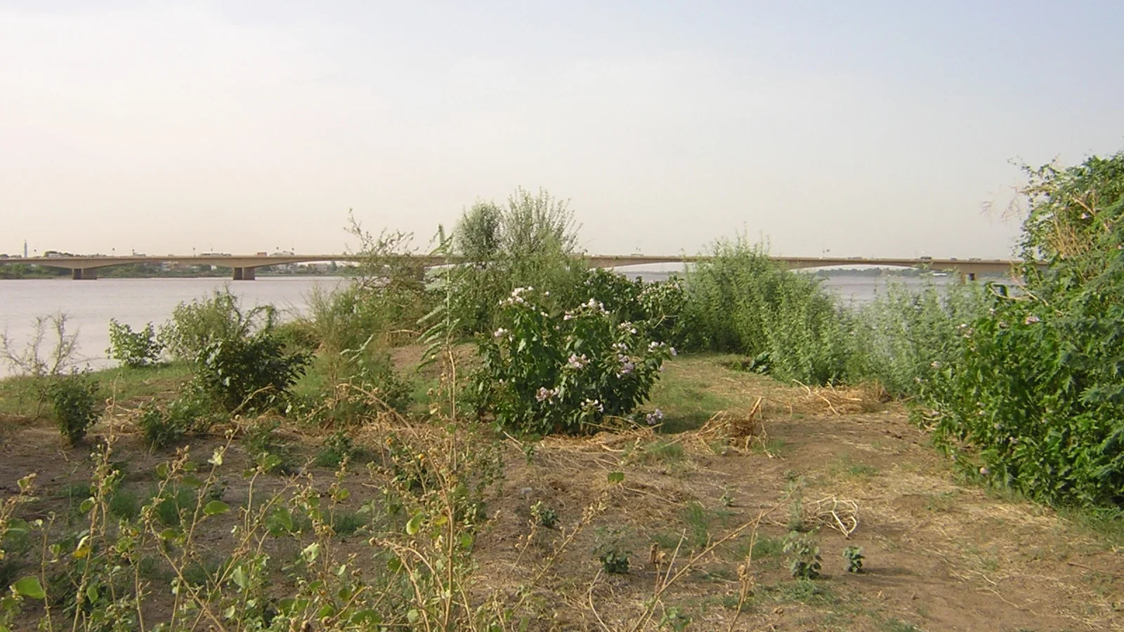
Tripartite Metropolis and Riverine Bridges
The two rivers divide the capital into Khartoum, Omdurman, and Bahri.
Soldiers built an army camp at the strategic river point in 1821.
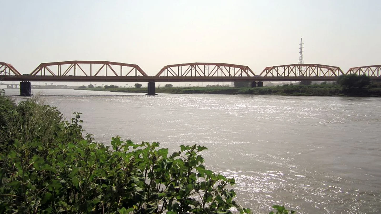
Workers built the historic steel White Nile Bridge between 1924 and 1926.
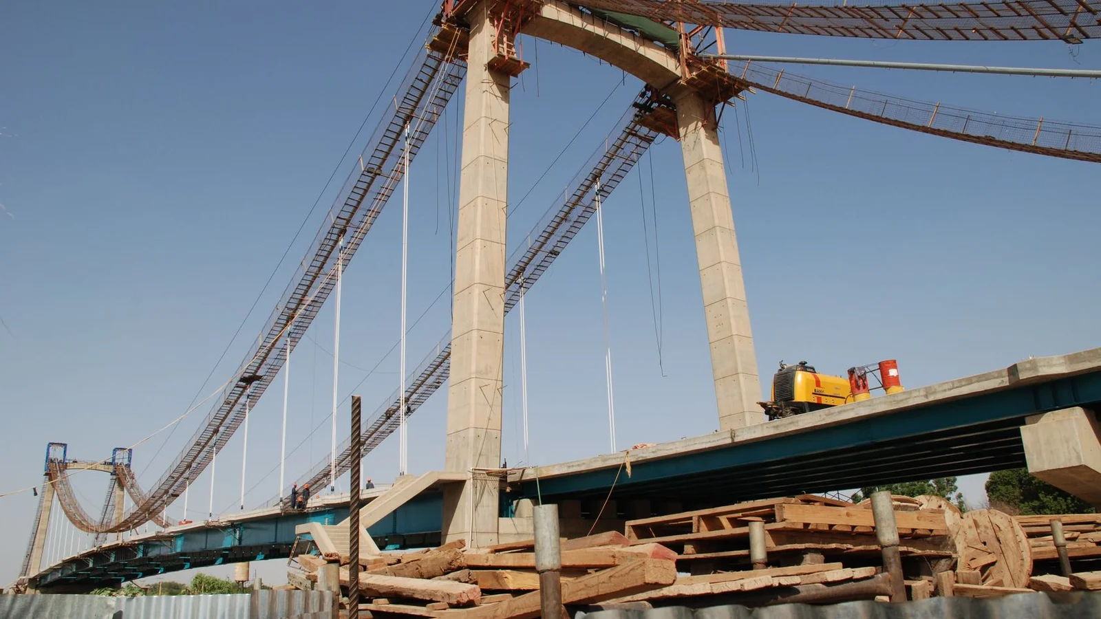
Modern suspension bridges carry thousands of cars and commuters across the water.
Bridges replaced the old wooden passenger boats and small river ferries.
Wide river channels create traffic bottlenecks between the three busy city centers.
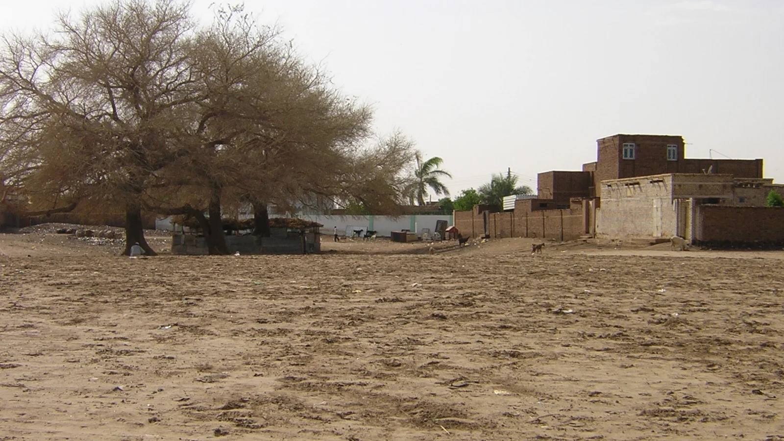
Tuti Island Alluvial Oasis and Community Resilience
Tuti Island is an eight-square-kilometer alluvial landmass at the geographic junction of both rivers.
Nubian Mahas families have lived in island villages for over five hundred years.
Island farmers grow lemon trees, mangoes, and fresh vegetables on fertile silts.
During big floods, villagers organize night watches called taya with sandbags.
Strong river currents wash away soil on the eastern bends of Tuti Island.
Local islanders protect their green farm fields from modern high building projects.
Urban Ecology Water Intakes and Public Space
The Mogran water plant takes river water to supply clean drinking taps.
Water plants use settling basins to remove thick mud during summer flood weeks.
Families visit open parks and drink tea near the riverfront water edge.
Local fishermen catch perch and tilapia fish from small wooden boats.
City wastewater creates environmental pollution problems for river water quality.
People gather on the Nile corniche to celebrate the annual flood arrival.
A2 · Elementary
The Nile Confluence at Khartoum: Two Rivers, the Tripartite Metropolis, and Tuti Island
Where the Blue Nile meets the White Nile at Al-Mogran, divergent currents shape urban bridges, riverbank farming, and municipal life.
Al-Mogran Hydrological Meeting of Two Niles
The White Nile and the Blue Nile converge at Al-Mogran in Khartoum to create the unified main trunk of the Nile River. The two rivers exhibit distinct physical characteristics, with the sediment-heavy Blue Nile appearing dark brown and the slower White Nile displaying a clear greenish-grey hue. Due to differences in water velocity and chemical density, a visible demarcation line separates the two streams for several kilometers downstream before complete mixing occurs.
During the summer monsoon peak between July and September, the Ethiopian highlands supply over eighty percent of the combined Nile flow through the torrential Blue Nile. Upstream on the White Nile, the Jebel Aulia Dam, situated forty kilometers south of the city, regulates storage to sustain river levels and irrigation canals during dry winter months. Sudan's Ministry of Irrigation and Water Resources maintains calibrated hydrometric gauging stations at the confluence to monitor regional flood risks and daily discharge rates.
Tripartite Metropolis and Riverine Bridges
The river confluence physically divides the capital into three distinct municipalities: Khartoum, Omdurman, and Khartoum North, collectively termed the Tripartite Metropolis. This strategic confluence promontory was chosen in 1821 as an armed military encampment and administrative capital under the rule of Ibrahim Pasha. The historic steel truss White Nile Bridge was constructed between 1924 and 1926 to provide the first permanent road and tramway link between Khartoum and Omdurman.
Modern cable-stayed and girder spans, including the Tuti Bridge and Mac Nimir Bridge, channel hundreds of thousands of daily commuters across the river channels. Motorized passenger ferries and wooden rowboats that once carried travelers across the rivers have largely been superseded by multi-lane bridge crossings. The wide river channels create physical transportation bottlenecks that influence metropolitan real estate values and commercial central business districts.
Tuti Island Alluvial Oasis and Community Resilience
Tuti Island occupies an eight-square-kilometer alluvial landmass located directly at the geographic junction where the Blue Nile joins the White Nile. The island has maintained continuous Nubian Mahas community settlements since at least the late fifteenth century, retaining deep clan kinship ties. Island residents practice intensive horticulture on fertile flood silts, cultivating citrus orchards, mango trees, and fresh vegetables for urban municipal markets.
During high river floods, Tuti islanders organize traditional community vigilance watches known as taya to build sandbag barricades and repair earthen levees. Strong seasonal currents around the sharp river bend subject the eastern and southern edges of Tuti Island to chronic riverbank scouring and land loss. Island inhabitants have historically mobilized to reject urban development schemes in order to preserve their agrarian land tenure and community village layout.
Urban Ecology Water Intakes and Public Space
The Mogran Water Works abstracts raw river water near the confluence to provide potable drinking water for central Khartoum commercial and residential districts. High suspended sediment loads during the summer Blue Nile flood require advanced chemical coagulation and mechanical desilting basins at municipal water treatment plants. The riverfront promontory at Al-Mogran serves as a vibrant urban public realm, hosting open-air tea sellers, family leisure gardens, and scenic boat excursions.
Artisanal fishers operating small wooden boats harvest native freshwater fish, including Nile perch and tilapia, at eddies formed by the confluence. Urban wastewater discharge and industrial runoff present ongoing environmental challenges for water quality monitoring programs along the Khartoum riverbanks. The arrival of the annual Nile flood peak is commemorated through traditional riverbank gatherings, community picnics, and music performances along the Nile Corniche.
B1 · Intermediate
Hydrological Meeting of Two Niles, Riverine Bridge Networks, and Island Resilience at Khartoum
An analytical study of Al-Mogran water mixing, steel and suspension bridges, Tuti Island community flood mitigation, and municipal water abstraction.
Al-Mogran Hydrological Meeting of Two Niles
The White Nile and the Blue Nile converge at Al-Mogran in Khartoum to create the unified main trunk of the Nile River. The two rivers exhibit distinct physical characteristics, with the sediment-heavy Blue Nile appearing dark brown and the slower White Nile displaying a clear greenish-grey hue. Due to differences in water velocity and chemical density, a visible demarcation line separates the two streams for several kilometers downstream before complete mixing occurs.
During the summer monsoon peak between July and September, the Ethiopian highlands supply over eighty percent of the combined Nile flow through the torrential Blue Nile. Upstream on the White Nile, the Jebel Aulia Dam, situated forty kilometers south of the city, regulates storage to sustain river levels and irrigation canals during dry winter months. Sudan's Ministry of Irrigation and Water Resources maintains calibrated hydrometric gauging stations at the confluence to monitor regional flood risks and daily discharge rates.
Tripartite Metropolis and Riverine Bridges
The river confluence physically divides the capital into three distinct municipalities: Khartoum, Omdurman, and Khartoum North, collectively termed the Tripartite Metropolis. This strategic confluence promontory was chosen in 1821 as an armed military encampment and administrative capital under the rule of Ibrahim Pasha. The historic steel truss White Nile Bridge was constructed between 1924 and 1926 to provide the first permanent road and tramway link between Khartoum and Omdurman.
Modern cable-stayed and girder spans, including the Tuti Bridge and Mac Nimir Bridge, channel hundreds of thousands of daily commuters across the river channels. Motorized passenger ferries and wooden rowboats that once carried travelers across the rivers have largely been superseded by multi-lane bridge crossings. The wide river channels create physical transportation bottlenecks that influence metropolitan real estate values and commercial central business districts.
Tuti Island Alluvial Oasis and Community Resilience
Tuti Island occupies an eight-square-kilometer alluvial landmass located directly at the geographic junction where the Blue Nile joins the White Nile. The island has maintained continuous Nubian Mahas community settlements since at least the late fifteenth century, retaining deep clan kinship ties. Island residents practice intensive horticulture on fertile flood silts, cultivating citrus orchards, mango trees, and fresh vegetables for urban municipal markets.
During high river floods, Tuti islanders organize traditional community vigilance watches known as taya to build sandbag barricades and repair earthen levees. Strong seasonal currents around the sharp river bend subject the eastern and southern edges of Tuti Island to chronic riverbank scouring and land loss. Island inhabitants have historically mobilized to reject urban development schemes in order to preserve their agrarian land tenure and community village layout.
Urban Ecology Water Intakes and Public Space
The Mogran Water Works abstracts raw river water near the confluence to provide potable drinking water for central Khartoum commercial and residential districts. High suspended sediment loads during the summer Blue Nile flood require advanced chemical coagulation and mechanical desilting basins at municipal water treatment plants. The riverfront promontory at Al-Mogran serves as a vibrant urban public realm, hosting open-air tea sellers, family leisure gardens, and scenic boat excursions.
Artisanal fishers operating small wooden boats harvest native freshwater fish, including Nile perch and tilapia, at eddies formed by the confluence. Urban wastewater discharge and industrial runoff present ongoing environmental challenges for water quality monitoring programs along the Khartoum riverbanks. The arrival of the annual Nile flood peak is commemorated through traditional riverbank gatherings, community picnics, and music performances along the Nile Corniche.
B2 · Upper Intermediate
Hydrodynamics, Urban Morphology, and Alluvial Commons at the Khartoum Confluence
Investigating seasonal flood pulse dynamics, tripartite transportation bottlenecks, communal taya vigilance systems, and water treatment desilting.
Al-Mogran Hydrological Meeting of Two Niles
The White Nile and the Blue Nile converge at Al-Mogran in Khartoum to create the unified main trunk of the Nile River. The two rivers exhibit distinct physical characteristics, with the sediment-heavy Blue Nile appearing dark brown and the slower White Nile displaying a clear greenish-grey hue. Due to differences in water velocity and chemical density, a visible demarcation line separates the two streams for several kilometers downstream before complete mixing occurs.
During the summer monsoon peak between July and September, the Ethiopian highlands supply over eighty percent of the combined Nile flow through the torrential Blue Nile. Upstream on the White Nile, the Jebel Aulia Dam, situated forty kilometers south of the city, regulates storage to sustain river levels and irrigation canals during dry winter months. Sudan's Ministry of Irrigation and Water Resources maintains calibrated hydrometric gauging stations at the confluence to monitor regional flood risks and daily discharge rates.
Tripartite Metropolis and Riverine Bridges
The river confluence physically divides the capital into three distinct municipalities: Khartoum, Omdurman, and Khartoum North, collectively termed the Tripartite Metropolis. This strategic confluence promontory was chosen in 1821 as an armed military encampment and administrative capital under the rule of Ibrahim Pasha. The historic steel truss White Nile Bridge was constructed between 1924 and 1926 to provide the first permanent road and tramway link between Khartoum and Omdurman.
Modern cable-stayed and girder spans, including the Tuti Bridge and Mac Nimir Bridge, channel hundreds of thousands of daily commuters across the river channels. Motorized passenger ferries and wooden rowboats that once carried travelers across the rivers have largely been superseded by multi-lane bridge crossings. The wide river channels create physical transportation bottlenecks that influence metropolitan real estate values and commercial central business districts.
Tuti Island Alluvial Oasis and Community Resilience
Tuti Island occupies an eight-square-kilometer alluvial landmass located directly at the geographic junction where the Blue Nile joins the White Nile. The island has maintained continuous Nubian Mahas community settlements since at least the late fifteenth century, retaining deep clan kinship ties. Island residents practice intensive horticulture on fertile flood silts, cultivating citrus orchards, mango trees, and fresh vegetables for urban municipal markets.
During high river floods, Tuti islanders organize traditional community vigilance watches known as taya to build sandbag barricades and repair earthen levees. Strong seasonal currents around the sharp river bend subject the eastern and southern edges of Tuti Island to chronic riverbank scouring and land loss. Island inhabitants have historically mobilized to reject urban development schemes in order to preserve their agrarian land tenure and community village layout.
Urban Ecology Water Intakes and Public Space
The Mogran Water Works abstracts raw river water near the confluence to provide potable drinking water for central Khartoum commercial and residential districts. High suspended sediment loads during the summer Blue Nile flood require advanced chemical coagulation and mechanical desilting basins at municipal water treatment plants. The riverfront promontory at Al-Mogran serves as a vibrant urban public realm, hosting open-air tea sellers, family leisure gardens, and scenic boat excursions.
Artisanal fishers operating small wooden boats harvest native freshwater fish, including Nile perch and tilapia, at eddies formed by the confluence. Urban wastewater discharge and industrial runoff present ongoing environmental challenges for water quality monitoring programs along the Khartoum riverbanks. The arrival of the annual Nile flood peak is commemorated through traditional riverbank gatherings, community picnics, and music performances along the Nile Corniche.
C1 · Advanced
Fluvial Convergence Dynamics, Tripartite Urban Morphology, and Agrarian Island Enclaves in Khartoum
A critical examination of boundary layer mixing, 1821 military promontory origins, historic and cable-stayed river spans, and bank scouring mechanics.
Al-Mogran Hydrological Meeting of Two Niles
The White Nile and the Blue Nile converge at Al-Mogran in Khartoum to create the unified main trunk of the Nile River. The two rivers exhibit distinct physical characteristics, with the sediment-heavy Blue Nile appearing dark brown and the slower White Nile displaying a clear greenish-grey hue. Due to differences in water velocity and chemical density, a visible demarcation line separates the two streams for several kilometers downstream before complete mixing occurs.
During the summer monsoon peak between July and September, the Ethiopian highlands supply over eighty percent of the combined Nile flow through the torrential Blue Nile. Upstream on the White Nile, the Jebel Aulia Dam, situated forty kilometers south of the city, regulates storage to sustain river levels and irrigation canals during dry winter months. Sudan's Ministry of Irrigation and Water Resources maintains calibrated hydrometric gauging stations at the confluence to monitor regional flood risks and daily discharge rates.
Tripartite Metropolis and Riverine Bridges
The river confluence physically divides the capital into three distinct municipalities: Khartoum, Omdurman, and Khartoum North, collectively termed the Tripartite Metropolis. This strategic confluence promontory was chosen in 1821 as an armed military encampment and administrative capital under the rule of Ibrahim Pasha. The historic steel truss White Nile Bridge was constructed between 1924 and 1926 to provide the first permanent road and tramway link between Khartoum and Omdurman.
Modern cable-stayed and girder spans, including the Tuti Bridge and Mac Nimir Bridge, channel hundreds of thousands of daily commuters across the river channels. Motorized passenger ferries and wooden rowboats that once carried travelers across the rivers have largely been superseded by multi-lane bridge crossings. The wide river channels create physical transportation bottlenecks that influence metropolitan real estate values and commercial central business districts.
Tuti Island Alluvial Oasis and Community Resilience
Tuti Island occupies an eight-square-kilometer alluvial landmass located directly at the geographic junction where the Blue Nile joins the White Nile. The island has maintained continuous Nubian Mahas community settlements since at least the late fifteenth century, retaining deep clan kinship ties. Island residents practice intensive horticulture on fertile flood silts, cultivating citrus orchards, mango trees, and fresh vegetables for urban municipal markets.
During high river floods, Tuti islanders organize traditional community vigilance watches known as taya to build sandbag barricades and repair earthen levees. Strong seasonal currents around the sharp river bend subject the eastern and southern edges of Tuti Island to chronic riverbank scouring and land loss. Island inhabitants have historically mobilized to reject urban development schemes in order to preserve their agrarian land tenure and community village layout.
Urban Ecology Water Intakes and Public Space
The Mogran Water Works abstracts raw river water near the confluence to provide potable drinking water for central Khartoum commercial and residential districts. High suspended sediment loads during the summer Blue Nile flood require advanced chemical coagulation and mechanical desilting basins at municipal water treatment plants. The riverfront promontory at Al-Mogran serves as a vibrant urban public realm, hosting open-air tea sellers, family leisure gardens, and scenic boat excursions.
Artisanal fishers operating small wooden boats harvest native freshwater fish, including Nile perch and tilapia, at eddies formed by the confluence. Urban wastewater discharge and industrial runoff present ongoing environmental challenges for water quality monitoring programs along the Khartoum riverbanks. The arrival of the annual Nile flood peak is commemorated through traditional riverbank gatherings, community picnics, and music performances along the Nile Corniche.
C2 · Mastery
Hydrographic Kinetics, Tripartite Metropolitan Topography, and Alluvial Agrarian Commons at Al-Mogran
A comprehensive analytical monograph detailing seasonal monsoon discharge ratios, bridge corridor evolution, Nubian Mahas kinship tenure, and coagulation thermodynamics.
Al-Mogran Hydrological Meeting of Two Niles
The White Nile and the Blue Nile converge at Al-Mogran in Khartoum to create the unified main trunk of the Nile River. The two rivers exhibit distinct physical characteristics, with the sediment-heavy Blue Nile appearing dark brown and the slower White Nile displaying a clear greenish-grey hue. Due to differences in water velocity and chemical density, a visible demarcation line separates the two streams for several kilometers downstream before complete mixing occurs.
During the summer monsoon peak between July and September, the Ethiopian highlands supply over eighty percent of the combined Nile flow through the torrential Blue Nile. Upstream on the White Nile, the Jebel Aulia Dam, situated forty kilometers south of the city, regulates storage to sustain river levels and irrigation canals during dry winter months. Sudan's Ministry of Irrigation and Water Resources maintains calibrated hydrometric gauging stations at the confluence to monitor regional flood risks and daily discharge rates.
Tripartite Metropolis and Riverine Bridges
The river confluence physically divides the capital into three distinct municipalities: Khartoum, Omdurman, and Khartoum North, collectively termed the Tripartite Metropolis. This strategic confluence promontory was chosen in 1821 as an armed military encampment and administrative capital under the rule of Ibrahim Pasha. The historic steel truss White Nile Bridge was constructed between 1924 and 1926 to provide the first permanent road and tramway link between Khartoum and Omdurman.
Modern cable-stayed and girder spans, including the Tuti Bridge and Mac Nimir Bridge, channel hundreds of thousands of daily commuters across the river channels. Motorized passenger ferries and wooden rowboats that once carried travelers across the rivers have largely been superseded by multi-lane bridge crossings. The wide river channels create physical transportation bottlenecks that influence metropolitan real estate values and commercial central business districts.
Tuti Island Alluvial Oasis and Community Resilience
Tuti Island occupies an eight-square-kilometer alluvial landmass located directly at the geographic junction where the Blue Nile joins the White Nile. The island has maintained continuous Nubian Mahas community settlements since at least the late fifteenth century, retaining deep clan kinship ties. Island residents practice intensive horticulture on fertile flood silts, cultivating citrus orchards, mango trees, and fresh vegetables for urban municipal markets.
During high river floods, Tuti islanders organize traditional community vigilance watches known as taya to build sandbag barricades and repair earthen levees. Strong seasonal currents around the sharp river bend subject the eastern and southern edges of Tuti Island to chronic riverbank scouring and land loss. Island inhabitants have historically mobilized to reject urban development schemes in order to preserve their agrarian land tenure and community village layout.
Urban Ecology Water Intakes and Public Space
The Mogran Water Works abstracts raw river water near the confluence to provide potable drinking water for central Khartoum commercial and residential districts. High suspended sediment loads during the summer Blue Nile flood require advanced chemical coagulation and mechanical desilting basins at municipal water treatment plants. The riverfront promontory at Al-Mogran serves as a vibrant urban public realm, hosting open-air tea sellers, family leisure gardens, and scenic boat excursions.
Artisanal fishers operating small wooden boats harvest native freshwater fish, including Nile perch and tilapia, at eddies formed by the confluence. Urban wastewater discharge and industrial runoff present ongoing environmental challenges for water quality monitoring programs along the Khartoum riverbanks. The arrival of the annual Nile flood peak is commemorated through traditional riverbank gatherings, community picnics, and music performances along the Nile Corniche.
Check your understanding
Choose how closely you want to revisit the article. You can refer back while answering, and review explanations when you finish.
Quick Quiz A1
Try one question, then create a free account for the full Quick Quiz. Sign Up Free
Answer every question before checking. There is no time limit.
Your results
/ 1 correct (%)
Read the explanations to see how each answer connects to the article.
-
Where do the White Nile and Blue Nile join in Khartoum?
1. Answer:
Quick Quiz A2
Try one question, then create a free account for the full Quick Quiz. Sign Up Free
Answer every question before checking. There is no time limit.
Your results
/ 1 correct (%)
Read the explanations to see how each answer connects to the article.
-
Where do the White Nile and Blue Nile converge in Khartoum?
1. Answer:
Quick Quiz B1
Try one question, then create a free account for the full Quick Quiz. Sign Up Free
Answer every question before checking. There is no time limit.
Your results
/ 1 correct (%)
Read the explanations to see how each answer connects to the article.
-
Where do the White Nile and Blue Nile converge in Khartoum?
1. Answer:
Quick Quiz B2
Try one question, then create a free account for the full Quick Quiz. Sign Up Free
Answer every question before checking. There is no time limit.
Your results
/ 1 correct (%)
Read the explanations to see how each answer connects to the article.
-
Where do the White Nile and Blue Nile converge in Khartoum?
1. Answer:
Quick Quiz C1
Try one question, then create a free account for the full Quick Quiz. Sign Up Free
Answer every question before checking. There is no time limit.
Your results
/ 1 correct (%)
Read the explanations to see how each answer connects to the article.
-
Where do the White Nile and Blue Nile converge in Khartoum?
1. Answer:
Quick Quiz C2
Try one question, then create a free account for the full Quick Quiz. Sign Up Free
Answer every question before checking. There is no time limit.
Your results
/ 1 correct (%)
Read the explanations to see how each answer connects to the article.
-
Where do the White Nile and Blue Nile converge in Khartoum?
1. Answer:
