A1 · Beginner
Ancient Cliffs and Farms in Bamiyan Valley
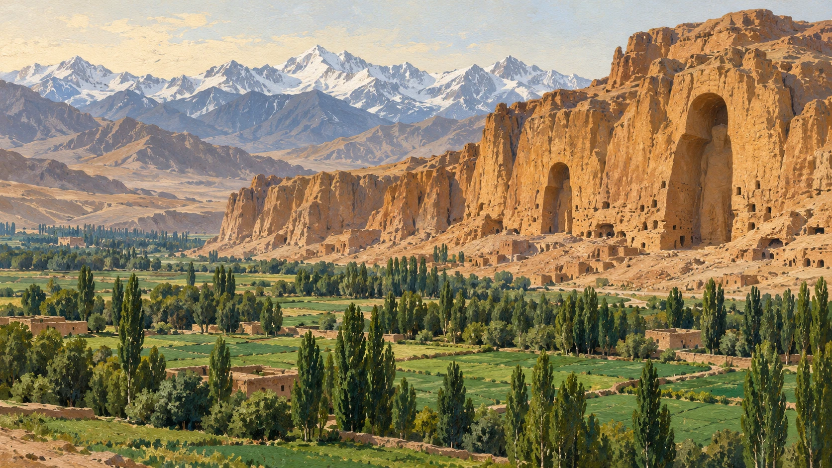
Experts protect giant stone cliff niches and ancient forts while farmers grow food in the valley.
World Heritage List
In 2003, UNESCO placed the Bamiyan Valley on the official World Heritage List.
The United Nations also placed the area on the list of heritage in danger.
Decision 47 COM requires continued safety monitoring of stone cliff niches and old forts.
Officials noted long delays in meeting conservation goals needed to leave the danger list.
International reports describe wall stabilization work without approving large tourist hotels.
Conservation rules require strict protection of authentic historical ruins across the valley zones.
Fixing Stone Cliffs
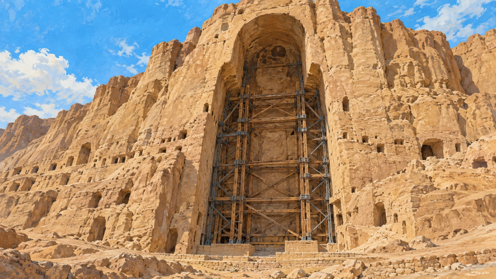
The giant Buddha statues were carved into tall sandstone rock cliffs centuries ago.
Earth tremors and winter freezing cause large cracks across the soft sandstone rock face.
Engineering teams installed strong steel anchor bolts and carbon rods to hold broken stones.
Workers pump special lime mortar into small cracks to secure loose stone blocks.
Electronic sensors measure tiny crack movements along the rim of the Western Buddha niche.
Engineering reports record installed metal bolts without predicting future earthquake dates.
Ancient Cave Paintings
Monks carved hundreds of small caves and prayer rooms into the high sandstone cliff.
Scientific tests proved that artists used natural oil binders in ancient cave paintings.
Surviving wall murals show Buddhist pictures painted with red lead, vermilion, and lapis lazuli.
Wet weather, blowing dust, and rain leaks cause painted plaster to flake off walls.
Skilled conservators apply special liquid glues to protect fragile painted plaster layers.
Laboratory studies test small paint samples without counting tourist visitor numbers inside caves.
Mud Forts on Hills
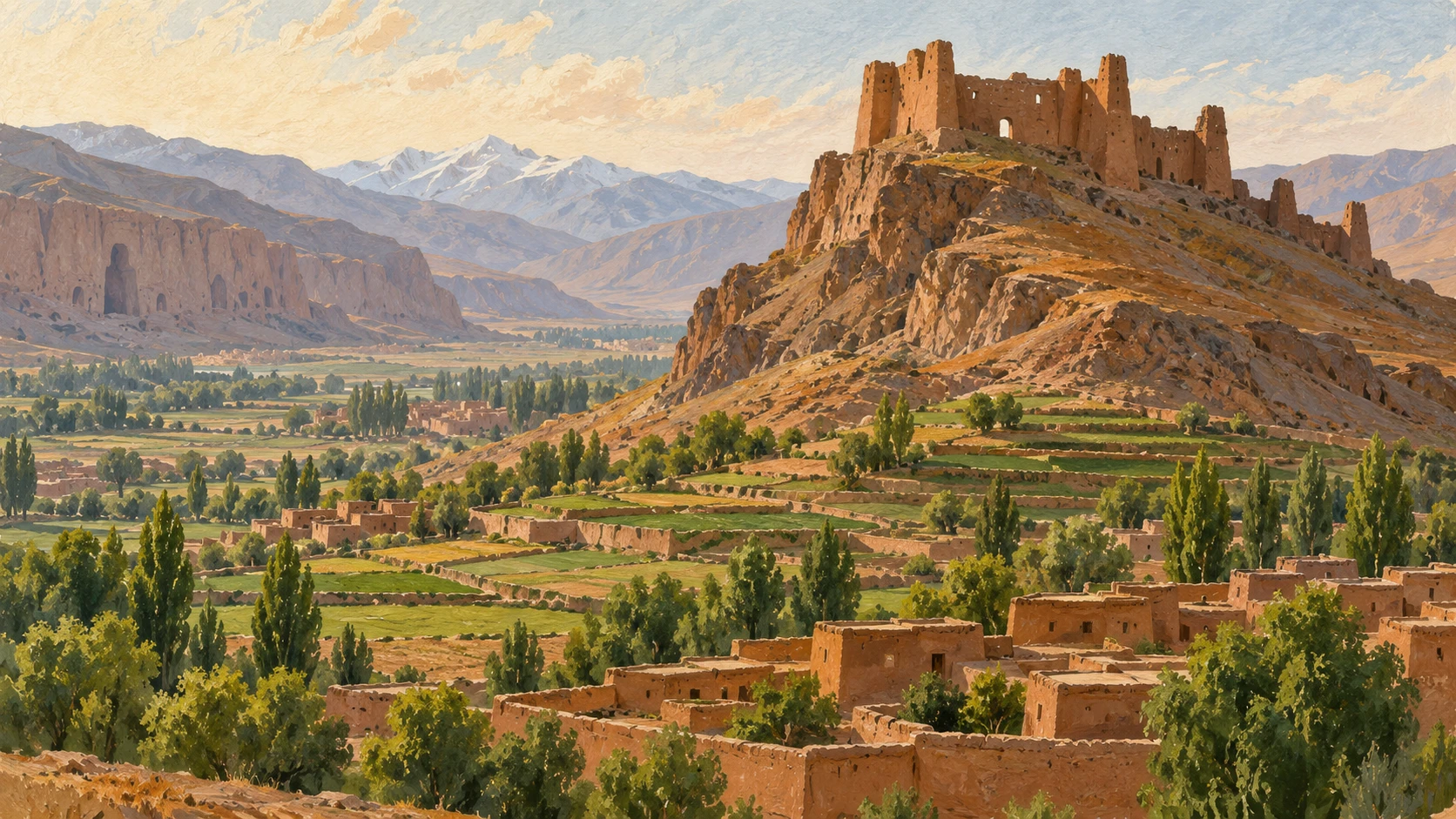
The old mud fortress of Shahr-i Ghulghula stands on a round hill in the central basin.
Shahr-i Zuhak stands at the river meeting point to guard the eastern valley entrance.
Big sun-dried mud walls suffer heavy damage from winter rain storms and melting snow.
Ancient surveys show that both castles guarded busy caravan trade roads connecting Asia with India.
Repair teams build protective mud caps and water drains on top of the castle walls.
Historic maps show old fortress borders without controlling modern farming fields below.
Valley Farms and Water Canals
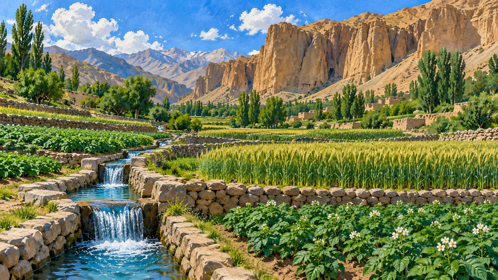
The flat valley floor has green potato fields, wheat plots, and tall poplar trees.
Stone and earth canals carry melting snow water down from the Koh-e Baba mountains.
Local village families grow food on farm plots right next to protected buffer zones.
Potato harvests in Bamiyan provide food for wholesale markets in Kabul and eastern cities.
Traditional community water masters share river water fairly among farming families each week.
Farm land records track crop planting without counting family bank savings or debts.
Life Around Protected Monuments
Heritage committees focus on saving stone monuments rather than counting tourist shop money.
Protecting old ruins does not automatically solve winter poverty for local village families.
Protected heritage borders limit where people can build new family homes or roads.
Official heritage documents give no numbers about daily worker wages in Bamiyan town.
Repairing empty stone niches is a separate goal from building new regional businesses.
Journalistic reports separate historical monument preservation from the daily economic needs of people.
A2 · Elementary
Bamiyan Heritage Preservation and Valley Agriculture
International specialists stabilize cliff niches and earthen forts while farming households maintain irrigation systems across the valley floor.
UNESCO Inscription and the Danger List
In 2003, UNESCO inscribed the archaeological remains and cultural landscape of the Bamiyan Valley.
The World Heritage Committee simultaneously placed the property on the List of World Heritage in Danger.
Decision 47 COM adopted in 2024 requires ongoing structural monitoring of cliff niches and earthen citadels.
International delegations observed extensive delays in establishing formal benchmarks for removal from the Danger List.
Technical evaluation papers report structural consolidation works without approving commercial tourism facilities.
International conservation protocols demand strict preservation of authentic archaeological remnants within designated zones.
Cliff Consolidation and Steel Anchors
The empty cliff niches of the Western and Eastern Buddhas were hollowed from sedimentary sandstone cliffs.
Earthquake tremors and winter freezing-thawing cycles generate severe cleavage hazards along the rock facade.
Specialized geotechnical engineers installed long steel anchor rods and carbon struts to stabilize broken stone blocks.
Injecting fine lime-based grouting secures loosened sandstone slabs along vertical cliff faces.
Digital monitoring sensors detect microscopic crack movements across the upper rim of the Western Buddha niche.
Engineering documentation details physical anchor systems without calculating precise future earthquake dates.
Mural Paintings in Monastic Caves
Hundreds of historic monastic caves and sacred sanctuaries honeycomb the sandstone cliffs of the Bamiyan escarpment.
Scientific spectrometry experiments verified natural drying oil binders in seventh-century Bamiyan wall art.
Remaining sanctuary paintings depict Buddhist symbols rendered with mineral pigments including lapis lazuli and vermilion.
Shifting humidity levels, abrasive dust, and water leaks cause gradual pigment flaking and plaster loss.
Expert restorers apply chemical consolidants to protect fragile decorated plaster surfaces inside monastic chambers.
Laboratory reports analyze microscopic paint fragments without recording tourist admission totals for individual caves.
The Earthen Citadels of Ghulghula and Zuhak
The medieval earthen ramparts of Shahr-i Ghulghula crown a steep conical knoll commanding the central valley basin.
The fortress of Shahr-i Zuhak defends the eastern valley gateway where the Bamiyan and Kalu streams converge.
Towering sun-dried mud bastions experience acute surface deterioration caused by intense rainfall and snowdrifts.
Historic investigations reveal that both fortresses protected valuable caravan routes linking Central Asia to northern India.
Restoration crews place sacrificial earthen capping and drainage channels to arrest wall degradation on fortress summits.
Archaeological border surveys outline historic citadel perimeters without controlling modern agricultural plots below.
Valley Farmland and Mountain Canals
The valley floor serves as a working agrarian landscape filled with potato fields, wheat crops, and poplar groves.
Traditional rock and clay canals channel melting mountain snowpacks from the Koh-e Baba range onto terraced fields.
Smallholder farming households cultivate terraced plots located adjacent to protected archaeological buffer zones.
Commercial potato production across Bamiyan feeds wholesale vegetable markets in Kabul and eastern cities.
Elected community water managers distribute river flows among farming households along mountain tributaries.
Agricultural surveys document crop cultivation acreage without compiling household bank savings or debt ratios.
Conservation Boundaries and Local Realities
UNESCO technical records concentrate strictly on monument stability rather than reporting provincial tourist revenue.
Preserving ancient archaeological ruins does not directly eliminate severe winter poverty among valley residents.
Strict conservation boundaries restrict the construction of new residential buildings and municipal infrastructure.
Heritage monitoring documents provide no systematic facts regarding daily employment wages in Bamiyan town.
Maintaining empty cliff niches represents a distinct cultural goal separate from regional economic modernization.
Professional journalistic analyses separate multilateral safeguarding dossiers from the daily struggles of valley residents.
B1 · Intermediate
Monument Conservation and Agricultural Landscapes in Bamiyan
Engineering teams stabilize sandstone cliffs and medieval earthen citadels while generational canal irrigation sustains valley farmland.
UNESCO World Heritage Decision 47 COM
In 2003, UNESCO officially inscribed the Cultural Landscape and Archaeological Remains of the Bamiyan Valley on the World Heritage List.
Simultaneously, the World Heritage Committee positioned the property on the List of World Heritage in Danger.
Decision 47 COM adopted in 2024 requires continued structural monitoring across cliff niches and historic earthen citadels.
The committee documented prolonged administrative delays in completing the formal benchmarks necessary for removal from the Danger List.
International technical monitoring dossiers record physical stabilization works without endorsing speculative tourist infrastructure expansions.
Multilateral conservation directives enforce rigorous preservation of authentic archaeological monuments across designated landscape zones.
Structural Consolidation of Sandstone Cliff Niches
The monumental empty cliff niches of the Western and Eastern Giant Buddhas were excavated into tertiary sedimentary sandstone formations.
Recurrent seismic tremors and thermal expansion fractures create severe structural cleavage hazards across the vertical cliff face.
Geotechnical engineering teams installed deep steel anchor rods and carbon-fiber reinforcement struts to secure unstable rock blocks.
Precision micro-grouting using formulated lime-based mortars fastens detached sandstone slabs along the soaring vertical cliff walls.
Automated geotechnical sensors continuously track microscopic crack displacement across the upper rim of the Western Buddha niche.
Engineering documentation records physical stabilization hardware without calculating statistical probabilities of future regional earthquakes.
Buddhist Cave Sanctuaries and Early Oil Murals
Hundreds of hand-carved monastic caves and sacred sanctuaries honeycomb the towering sedimentary cliffs of the central Bamiyan valley.
Scientific spectrometry analyses identified drying oil binders in seventh-century Bamiyan cave murals as early global examples of oil art.
Preserved cave paintings exhibit Buddhist iconography rendered with natural mineral pigments including lapis lazuli and vermilion.
Fluctuating ambient humidity, abrasive windblown dust, and rainwater percolation generate progressive pigment flaking and plaster detachment.
Specialized conservation technicians apply chemical consolidants to stabilize fragile painted plaster layers inside accessible sanctuaries.
Laboratory micro-analyses evaluate paint layer chemistry without providing statistical records of tourist visitation within the caves.
Earthen Fortifications of Shahr-i Ghulghula and Zuhak
The medieval earthen fortifications of Shahr-i Ghulghula occupy an isolated conical hill overlooking the central Bamiyan agricultural basin.
The fortress of Shahr-i Zuhak commands the strategic eastern gateway to the valley where the Bamiyan and Kalu river gorges converge.
Immense sun-dried mud-brick defensive walls and bastions endure severe surface erosion from seasonal rains and heavy winter snowpacks.
Historical archaeological surveys demonstrate that both citadels protected vital caravan trade arteries connecting Central Asia with India.
Preservation teams construct sacrificial earthen wall capping and surface drainage systems to arrest structural degradation on the heights.
Archaeological mapping projects document fortified historic boundaries without regulating modern agricultural plots in adjoining valleys.
Valley Farmland and Traditional Canal Networks
The valley basin functions as an active agricultural landscape characterized by irrigated potato terraces, wheat fields, and poplar stands.
Traditional gravity-fed stone and earth canals divert melting snow runoff from the Koh-e Baba mountain range across farm terraces.
Local smallholders and family farmers cultivate agricultural plots situated directly adjacent to designated archaeological buffer zones.
Commercial potato production in Bamiyan supplies high-volume wholesale commodity markets in Kabul and surrounding eastern provinces.
Customary community water masters manage rotational irrigation allocations among agricultural families along mountain tributaries.
Agrarian cadastral records document local crop acreage without calculating household financial savings or family debt ratios.
Conservation Governance and Socioeconomic Realities
UNESCO technical documentation concentrates exclusively on monument stabilization rather than evaluating provincial tourist revenues.
Conserving ancient historical landmarks does not immediately resolve acute winter poverty or household food security hurdles in the valley.
Designated heritage preservation zones impose legal restrictions on residential construction and municipal infrastructure expansion.
Multilateral monitoring dossiers provide zero empirical data regarding prevailing wage labor rates or family living costs in Bamiyan town.
The physical consolidation of empty cliff niches represents a distinct cultural mandate separate from regional economic modernization.
Rigorous journalistic reporting maintains an analytical divide between international heritage safeguarding and local socioeconomic realities.
B2 · Upper Intermediate
Archaeological Conservation and Agrarian Systems in the Bamiyan Valley
An analysis of geotechnical cliff stabilization, mural preservation in Buddhist sanctuaries, and communal irrigation along historical Silk Route corridors.
Multilateral Oversight and Decision 47 COM
UNESCO formalized the inscription of the Cultural Landscape and Archaeological Remains of the Bamiyan Valley on the World Heritage List in 2003.
Simultaneously, the World Heritage Committee entered the property onto the List of World Heritage in Danger in response to structural destruction.
Decision 47 COM adopted in 2024 mandates continuous technical monitoring of cliff niches and medieval earthen citadels.
The committee documented structural delays in completing the formal Desired State of Conservation required for removal from the Danger List.
International monitoring dossiers detail technical stabilization interventions while withholding endorsement for commercial tourist infrastructure.
Multilateral conservation guidelines mandate the rigorous physical preservation of authentic archaeological remnants within designated property zones.
Geotechnical Stabilization of Sandstone Niches
The massive cliff niches of the Western and Eastern Giant Buddhas were carved into tertiary sedimentary sandstone formations.
Seismic tremors and thermal expansion fractures generate severe structural cleavage risks across the sandstone cliff face.
Geological conservation teams installed deep steel anchor bolts and carbon-fiber rods to stabilize fractured rock blocks.
Micro-grouting with specialized lime-based mortars secures detached sandstone fragments along vertical cliff facades.
Automated geological sensors monitor microscopic crack displacement across the Western Buddha niche rim.
Engineering reports document physical anchor installations without calculating long-term regional seismic recurrence probabilities.
Cave Sanctuaries, Organic Binders, and Pigment Chemistry
Hundreds of artificial monastic caves and sanctuaries honeycomb the sandstone cliff walls of the central Bamiyan cliff.
Scientific spectrometry tests identified drying oil binders in seventh-century Bamiyan cave paintings as early examples of oil art.
Surviving cave murals depict Buddhist iconography painted with mineral pigments including lapis lazuli, vermilion, and red lead.
Fluctuating humidity, windblown dust, and rainwater percolation cause gradual pigment flaking and plaster detachment.
Specialized conservators apply consolidants to stabilize fragile painted plaster layers inside accessible monastic sanctuaries.
Chemical laboratory analyses document mural paint micro-samples without providing statistical visitor access counts.
Medieval Citadels of Shahr-i Ghulghula and Zuhak
The medieval earthen fortifications of Shahr-i Ghulghula occupy an isolated conical hill overlooking the central Bamiyan basin.
Shahr-i Zuhak guards the eastern strategic entrance to the valley at the confluence of the Bamiyan and Kalu rivers.
Massive sun-dried mud-brick defensive walls and bastions suffer acute surface erosion from heavy rainfall and snow accumulation.
Historical archaeological surveys indicate that both citadels protected vital caravan trade arteries connecting Central Asia and India.
Heritage conservation teams execute targeted capping and drainage installations to arrest earthen wall degradation on the citadel summits.
Archaeological mapping delineates historic fortified perimeters without regulating modern agricultural boundaries in adjacent valleys.
Terraced Cultivation and the Foladi Irrigation Network
The valley floor functions as an active agricultural landscape with irrigated potato fields, wheat plots, and poplar plantations.
Traditional stone and earth irrigation canals divert melting mountain snow runoff from the Koh-e Baba range across farm terraces.
Subsistence and smallholder farmers cultivate plots directly adjacent to designated archaeological buffer zones.
Commercial potato cultivation in Bamiyan supplies wholesale produce markets in Kabul and eastern provinces.
Customary community water masters oversee rotational irrigation allocations among farming households along the river tributaries.
Agrarian land use records document local crop cultivation without measuring household financial savings or family debt ratios.
Regulatory Buffer Zones and Socioeconomic Divides
UNESCO committee documentation focuses strictly on monument stabilization rather than reporting provincial tourist traffic or commercial revenue.
Preserving ancient cultural landmarks does not automatically resolve acute winter poverty or food security challenges among local residents.
Conservation boundary zones create regulatory restrictions on new residential construction and infrastructure expansion within the valley.
Technical heritage reports provide no systematic data on local wage labor earnings or family cost of living in Bamiyan town.
The physical preservation of empty cliff niches stands as a distinct cultural priority from regional economic development projects.
Rigorous journalistic analysis separates multilateral heritage safeguarding dossiers from the daily socioeconomic realities of valley inhabitants.
C1 · Advanced
Bamiyan Valley: Conservation Protocols and Working Landscapes of a Silk Route Heritage Site
Documentary records of monument stabilization, Buddhist mural conservation, and active agricultural irrigation across the cultural landscape of Bamiyan.
UNESCO World Heritage Decision 47 COM
In 2003, UNESCO inscribed the Cultural Landscape and Archaeological Remains of the Bamiyan Valley on the World Heritage List.
The World Heritage Committee simultaneously placed the Bamiyan property on the List of World Heritage in Danger in 2003.
Decision 47 COM 7A.17 adopted in 2024 requires continued structural monitoring of cliff niches and ancient earthen citadels.
The World Heritage Committee noted prolonged delays in completing the formal Desired State of Conservation for removal from the Danger List.
International monitoring reports document technical stabilization efforts without endorsing speculative visitor infrastructure expansion.
UNESCO conservation guidelines mandate strict physical preservation of authentic archaeological remains across designated property zones.
Sandstone Cliff Niches and Structural Consolidation
The empty cliff niches of the Eastern and Western Giant Buddhas were carved into tertiary sedimentary sandstone formations.
Seismic tremors and thermal expansion fractures generate severe structural cleavage risks across the sandstone cliff face.
Geological conservation teams installed deep steel anchor bolts and carbon-fiber rods to stabilize fractured rock blocks.
Micro-grouting with specialized lime-based mortars secures detached sandstone fragments along vertical cliff facades.
Automated geological sensors monitor microscopic crack displacement across the Western Buddha niche rim.
Engineering reports document physical anchor installations without calculating long-term regional seismic recurrence probabilities.
Buddhist Cave Complexes and Oil-Based Mural Pigments
Hundreds of man-made monastic caves and sanctuaries honeycomb the sandstone cliff walls of the central Bamiyan cliff.
Scientific spectrometry tests identified drying oil binders in seventh-century Bamiyan cave paintings as early examples of oil art.
Surviving cave murals depict Buddhist iconography painted with mineral pigments including lapis lazuli, vermilion, and red lead.
Fluctuating humidity, windblown dust, and rainwater percolation cause gradual pigment flaking and plaster detachment.
Specialized conservators apply consolidants to stabilize fragile painted plaster layers inside accessible monastic sanctuaries.
Chemical laboratory analyses document mural paint micro-samples without providing statistical visitor access counts.
Earthen Citadels of Ghulghula and Zuhak
The medieval earthen fortifications of Shahr-i Ghulghula occupy an isolated conical hill overlooking the central Bamiyan basin.
Shahr-i Zuhak guards the eastern strategic entrance to the valley at the confluence of the Bamiyan and Kalu rivers.
Massive sun-dried mud-brick defensive walls and bastions suffer acute surface erosion from heavy rainfall and snow accumulation.
Historical archaeological surveys indicate that both citadels protected vital caravan trade arteries connecting Central Asia and India.
Heritage conservation teams execute targeted capping and drainage installations to arrest earthen wall degradation on the citadel summits.
Archaeological mapping delineates historic fortified perimeters without regulating modern agricultural boundaries in adjacent valleys.
Valley Agriculture and Foladi Irrigation Canals
The valley floor functions as an active agricultural landscape with irrigated potato fields, wheat plots, and poplar plantations.
Traditional stone and earth irrigation canals divert melting mountain snow runoff from the Koh-e Baba range across farm terraces.
Subsistence and smallholder farmers cultivate plots directly adjacent to designated archaeological buffer zones.
Commercial potato cultivation in Bamiyan supplies wholesale produce markets in Kabul and eastern provinces.
Customary community water masters oversee rotational irrigation allocations among farming households along the river tributaries.
Agrarian land use records document local crop cultivation without measuring household financial savings or family debt ratios.
Conservation Boundaries and Monitoring Limits
UNESCO committee documentation focuses strictly on monument stabilization rather than reporting provincial tourist traffic or commercial revenue.
Preserving ancient cultural landmarks does not automatically resolve acute winter poverty or food security challenges among local residents.
Conservation boundary zones create regulatory restrictions on new residential construction and infrastructure expansion within the valley.
Technical heritage reports provide no systematic data on local wage labor earnings or family cost of living in Bamiyan town.
The physical preservation of empty cliff niches stands as a distinct cultural priority from regional economic development projects.
Rigorous journalistic analysis separates multilateral heritage safeguarding dossiers from the daily socioeconomic realities of valley inhabitants.
C2 · Mastery
Historiographical Landscapes and Geotechnical Safeguarding in the Bamiyan Basin
A critical interrogation of multilateral heritage preservation, structural geomechanics, and agrarian water regimes along the Silk Route cultural corridor.
Epistemological Regimes and Decision 47 COM
The 2003 inscription of the Cultural Landscape and Archaeological Remains of the Bamiyan Valley codified multilateral jurisdiction over the property.
The World Heritage Committee simultaneously inscribed the site on the List of World Heritage in Danger, reflecting structural fragility.
Decision 47 COM 7A.17 adopted in 2024 mandates rigorous geotechnical surveillance across monumental cliff niches and earthen citadels.
Monitoring missions record structural delays in formulating the formal Desired State of Conservation prerequisite for delisting from the Danger List.
Technical dossiers document empirical consolidation interventions while resisting calls for commercial tourist infrastructure.
Multilateral preservation doctrines demand uncompromising conservation of authentic archaeological fabric across designated heritage zones.
Geomechanical Interventions and Structural Cliff Consolidation
The colossal niches of the Western and Eastern Giant Buddhas were excavated into tertiary sedimentary sandstone formations.
Episodic seismic shocks and thermal expansion stresses precipitate severe structural cleavage across the vertical cliff face.
Geotechnical engineers anchored deep high-tensile steel bolts and carbon-fiber reinforcement rods to stabilize fractured rock blocks.
Micro-grouting with engineered lime-based mortars secures detached sandstone fragments along vertical cliff facades.
Automated displacement sensors capture sub-millimeter fissure expansions along the Western Buddha niche rim.
Civil engineering ledgers record anchor installations without quantifying regional tectonic recurrence intervals.
Monastic Sanctuaries, Spectroscopy, and Paint Chemistry
Hundreds of troglodytic monastic sanctuaries and cave complexes perforate the vertical sandstone cliff walls of the central Bamiyan cliff.
Spectrometry investigations confirmed organic drying oil binders in seventh-century Bamiyan cave paintings as early examples of oil art.
Extant sanctuary murals present sophisticated Buddhist iconography painted with mineral pigments including lapis lazuli, vermilion, and red lead.
Micro-climatic humidity swings, aeolian dust scouring, and water infiltration cause continuous pigment flaking and plaster detachment.
Restoration chemists apply specialized consolidants to stabilize fragile painted plaster layers inside accessible monastic sanctuaries.
Chemical spectroscopy records document micro-sample physical properties without calculating statistical visitor access counts.
Citadel Architecture, Mud-Brick Fortifications, and Weathering
The medieval earthen fortifications of Shahr-i Ghulghula occupy an isolated conical hill overlooking the central Bamiyan basin.
The bastion of Shahr-i Zuhak defends the eastern confluence commanding the strategic entry gorge of the Bamiyan and Kalu rivers.
Massive sun-dried mud-brick defensive walls and bastions suffer acute surface erosion from heavy rainfall and snow accumulation.
Archaeological excavations prove that these citadels garrisoned pivotal caravan trade arteries linking Central Asia with India.
Conservation teams apply sacrificial earthen capping and drainage channels to halt masonry degradation on the citadel summits.
Spatial mapping delineates historical fortified perimeters without regulating modern agricultural boundaries in adjacent valleys.
Agrarian Geographies and Communal Water Regimes
The valley floor functions as an active agricultural landscape with irrigated potato fields, wheat plots, and poplar plantations.
Traditional stone and earth irrigation canals divert melting mountain snow runoff from the Koh-e Baba range across farm terraces.
Subsistence and smallholder farmers cultivate plots directly adjacent to designated archaeological buffer zones.
Commercial potato cultivation in Bamiyan supplies wholesale produce markets in Kabul and eastern provinces.
Customary community water masters oversee rotational irrigation allocations among farming households along the river tributaries.
Agrarian land use records document local crop cultivation without measuring household financial savings or family debt ratios.
Socioeconomic Stratification and the Limits of Conservation
UNESCO committee documentation focuses strictly on monument stabilization rather than reporting provincial tourist traffic or commercial revenue.
Preserving ancient cultural landmarks does not automatically resolve acute winter poverty or food security challenges among local residents.
Conservation boundary zones create regulatory restrictions on new residential construction and infrastructure expansion within the valley.
Technical heritage reports provide no systematic data on local wage labor earnings or family cost of living in Bamiyan town.
The physical preservation of empty cliff niches stands as a distinct cultural priority from regional economic development projects.
Rigorous journalistic analysis separates multilateral heritage safeguarding dossiers from the daily socioeconomic realities of valley inhabitants.
Check your understanding
Choose how closely you want to revisit the article. You can refer back while answering, and review explanations when you finish.
Quick Quiz A1
Try one question, then create a free account for the full Quick Quiz. Sign Up Free
Answer every question before checking. There is no time limit.
Your results
/ 1 correct (%)
Read the explanations to see how each answer connects to the article.
-
According to the section on World Heritage List, what does the text identify regarding placed?
1. Answer:
Quick Quiz A2
Try one question, then create a free account for the full Quick Quiz. Sign Up Free
Answer every question before checking. There is no time limit.
Your results
/ 1 correct (%)
Read the explanations to see how each answer connects to the article.
-
According to the section on UNESCO Inscription and the Danger List, what does the text identify regarding inscribed?
1. Answer:
Quick Quiz B1
Try one question, then create a free account for the full Quick Quiz. Sign Up Free
Answer every question before checking. There is no time limit.
Your results
/ 1 correct (%)
Read the explanations to see how each answer connects to the article.
-
According to the section on UNESCO World Heritage Decision 47 COM, what does the text identify regarding officially?
1. Answer:
Quick Quiz B2
Try one question, then create a free account for the full Quick Quiz. Sign Up Free
Answer every question before checking. There is no time limit.
Your results
/ 1 correct (%)
Read the explanations to see how each answer connects to the article.
-
According to the section on Multilateral Oversight and Decision 47 COM, what does the text identify regarding formalized?
1. Answer:
Quick Quiz C1
Try one question, then create a free account for the full Quick Quiz. Sign Up Free
Answer every question before checking. There is no time limit.
Your results
/ 1 correct (%)
Read the explanations to see how each answer connects to the article.
-
According to the section on UNESCO World Heritage Decision 47 COM, what does the text identify regarding inscribed?
1. Answer:
Quick Quiz C2
Try one question, then create a free account for the full Quick Quiz. Sign Up Free
Answer every question before checking. There is no time limit.
Your results
/ 1 correct (%)
Read the explanations to see how each answer connects to the article.
-
According to the section on Epistemological Regimes and Decision 47 COM, what does the text identify regarding cultural?
1. Answer:
