A1 · Beginner
The Tall Brick Tower at the Mountain Rivers
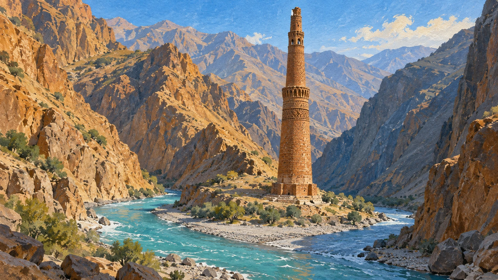
An ancient tower stands in a deep valley where two fast rivers meet.
An Ancient Tower in a Deep Valley
The tall tower of Jam is in Ghor Province. It was constructed in 1194 during the reign of the Ghurid sultan. In 2002 UNESCO placed the monument on the World Heritage List.
The site stands at a river confluence in an isolated canyon. High sandstone cliffs rise steeply above the narrow valley floor. The deep defile holds the flood waters when seasons change.
Archaeological remains sit on the nearby hillsides. Visitors can see old settlement traces, earthen towers, and Jewish cemetery stones. Extreme geographical isolation limits vehicular access.
Fast Water and River Floods
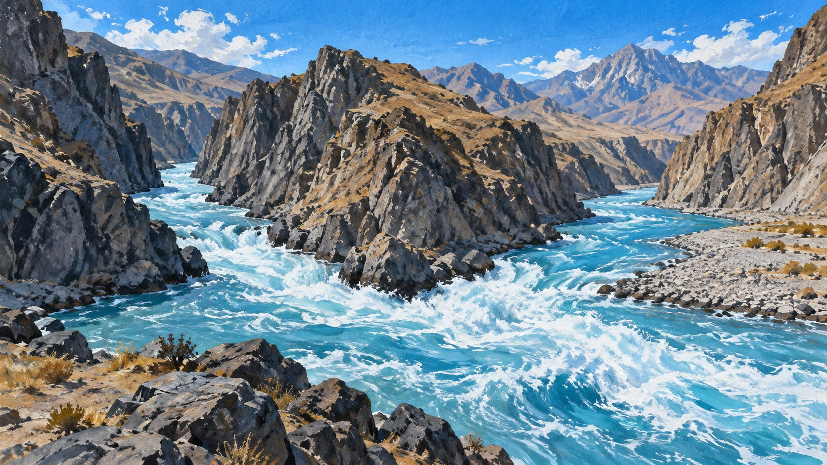
Spring snowmelt from high central mountains creates severe seasonal flash floods. The water fills both river channels very quickly.
Turbulent floodwaters carry heavy gravel sediment against the base of the tower. This strong scouring action hurts the lower walls.
Water cuts into the southern flank and makes the foundation subsoils weak. Infiltration softens clay strata under the stone plinth. Large surge events submerge lower terraces. Discharge velocities exceed five metres per second.
Stone Walls and Metal Baskets
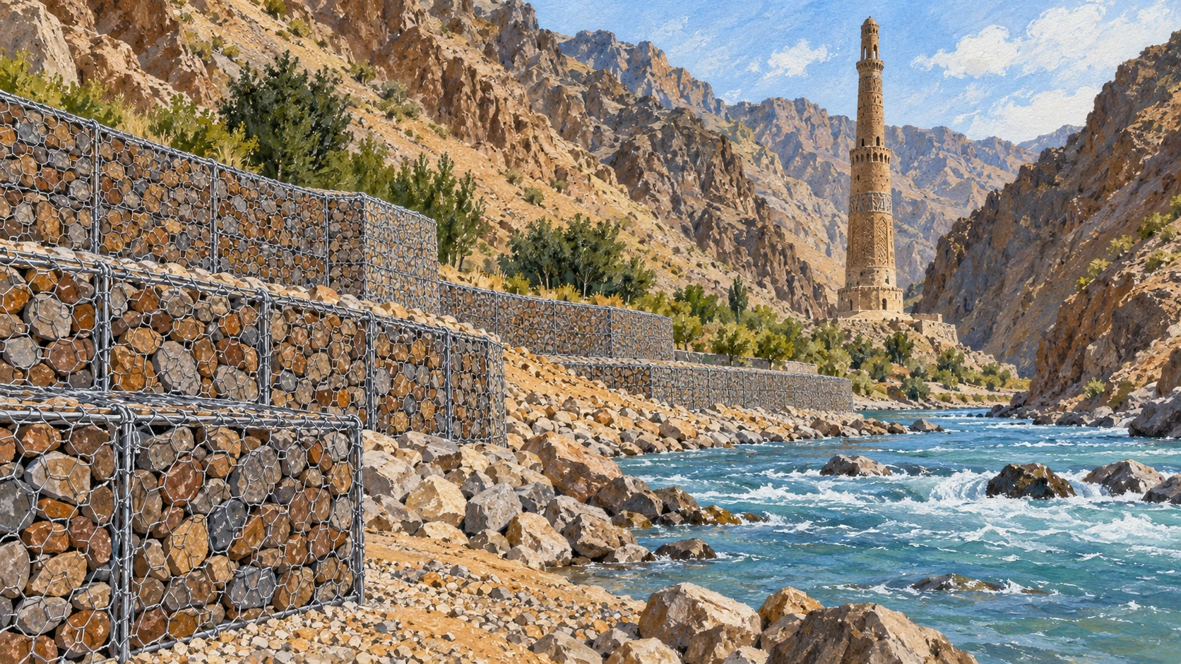
Emergency teams built wire gabion revetments with stone filling along the riverfront. These walls help deflect strong water currents.
Workers put a reinforced stone retaining dike upstream. The dike diverts high velocity flows away from the base plinth.
Heavy boulder riprap sits in scour holes to protect slopes. Workers must repair ruptured baskets after spring damage. Long anchors secure the masonry into bedrock. River dikes require perpetual care.
Brickwork and Pretty Blue Tiles
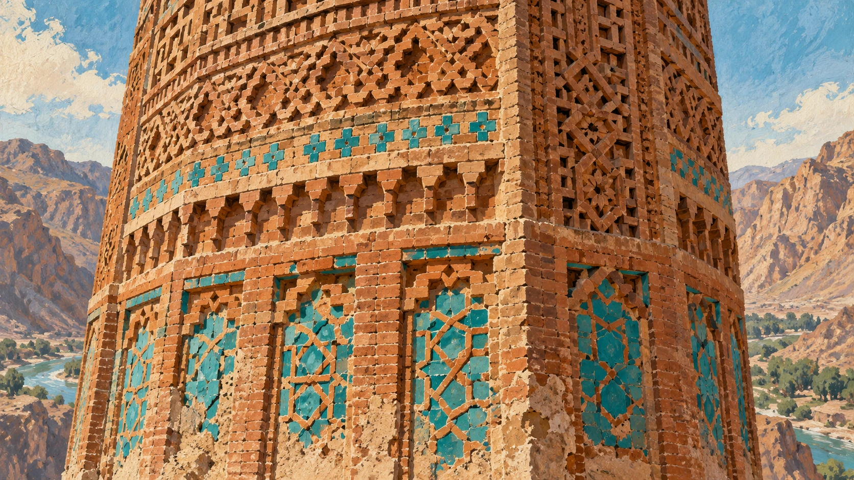
The minaret comprises four tapering tiers. Fired clay bricks and lime mortar form the round body of the structure.
Intricate geometric brickwork reliefs cover the octagonal base and lower shaft. Beautiful Islamic patterns decorate the historic walls.
A bright turquoise glazed ceramic tile inscription wraps around the upper shaft with Quranic verses. Double spiral staircases go upward inside the hollow core. The mortar resists freeze cycles despite summer heat and temperature stresses.
Crossing the Fast Mountain River
The World Heritage Committee reviewed proposals for a suspended pedestrian footbridge. The crossing will help local village residents and work teams.
Traditional canyon crossings used timber trestles and temporary cable ropes. Spring floods often washed those bridges away.
Guidelines require the design to protect the canyon backdrop. Project reports show technical feasibility studies without certifying final completion. Strict editorial boundaries prevent reporting transit before verified documentation arrives.
Caretakers and Daily Monitoring
Local village caretakers watch the river level and report fast water rises. Workers placed tiltmeters on the tower to record structural inclination shifts.
Winter snowdrifts often block mountain dirt tracks. The remote provincial setting has no municipal utility connections or fixed communication networks.
Safeguarding agreements help cultural agencies and provincial authorities work together. Long term preservation needs watershed management across the wide basin rather than simple repairs.
A2 · Elementary
Protecting the Ghurid Minaret of Jam at the Mountain Confluence
A twelfth-century brick minaret stands at an isolated Afghan river junction, facing seasonal floods and steep terrain.
World Heritage Inscription in a Remote Valley
The Minaret of Jam rises sixty-five metres above the valley floor in central Ghor Province. Builders constructed this baked-brick monument in 1194 during the reign of the Ghurid sultan Ghiyath al-Din Muhammad. In 2002, UNESCO inscribed the archaeological remains on the World Heritage List and the danger registry.
The historic monument stands at the exact confluence where the Jam Rud flows into the wider Hari Rud. High sandstone cliffs rise steeply on both riverbanks, creating a deep mountain defile that confines seasonal flood waters. Ancient settlement traces, earthen towers, and Jewish cemetery inscriptions remain visible on nearby hillsides, but extreme geographical isolation restricts vehicular access and makes regular monitoring missions difficult.
River Hydrology and Foundation Moisture
Warm spring weather brings mountain snowmelt that generates severe seasonal flash floods along both river channels. Turbulent floodwaters carry large gravel sediment loads that wash against the masonry base and cause continuous hydraulic scouring.
Severe riverbank undercut erosion along the southern flank destabilizes the subsoils and contributes to a visible structural inclination. Subterranean water infiltration softens the clay-rich alluvial strata beneath the heavy stone plinth, while sudden surge events submerge lower river terraces. During peak spring runoff, hydrological monitors record river discharge velocities exceeding five metres per second.
Gabion Revetments and River Defenses
Conservation teams constructed stone-filled wire gabion revetments along the riverfront to deflect destructive seasonal currents. Upstream, workers installed a reinforced stone retaining dike to divert high-velocity flows away from the vulnerable base plinth.
Teams deposited heavy boulder riprap into eroded riverbed scour holes to stabilize slopes along the embankment. Periodic flood damage requires the systematic repair and replacement of ruptured wire baskets after spring storms pass. Engineers drove specialized geotechnical anchors into underlying bedrock to resist hydraulic uplift, but these dikes still require continuous maintenance against abrasive gravel transport.
Brickwork Architecture and Glazed Inscriptions
The historic minaret comprises four tapering cylindrical tiers built with locally fired clay bricks and strong hydraulic lime mortar. Dense geometric brickwork reliefs cover the octagonal base and lower circular shaft with intricate Islamic decorative patterns.
A prominent turquoise glazed ceramic tile inscription wraps around the upper shaft, displaying historical Quranic verses. Inside the hollow core, double spiral brick staircases wind upward toward upper wooden balcony platforms. Chemical analyses demonstrate that the high-calcium lime mortar survives severe winter freezes, although sharp summer temperature shifts still create micro-thermal expansion stresses.
The Proposed Pedestrian River Footbridge
World Heritage Committee decisions evaluated detailed proposals for a suspended pedestrian footbridge across the Hari Rud near the monument. This proposed bridge aims to provide safe river crossings for local village residents and conservation teams during dangerous high-water periods.
In the past, canyon travelers relied on seasonal timber trestles and temporary cable pulleys, but rushing floodwaters washed them away. Official heritage guidelines require any footbridge engineering to avoid visual interference with the historic monument. Engineering project reports document design feasibility studies, though strict editorial standards prevent reporting regular transit until authorities certify full completion.
Custodial Care and Remote Basin Realities
Local village caretakers living in nearby settlements provide essential custodial watchfulness and quickly report sudden water level increases. In addition, technicians installed electronic tiltmeters and inclinometers directly on the masonry to measure tiny structural inclination shifts across annual cycles.
Heavy winter snowdrifts often block the winding mountain dirt tracks, cutting off the river canyon from the outside world. The remote provincial setting lacks municipal utility connections, electrical grid wiring, and reliable fixed communication lines. Safeguarding agreements now coordinate joint work between national cultural agencies, provincial leaders, and international donors, focusing on broader watershed management across the entire river basin.
B1 · Intermediate
Preserving the Ghurid Minaret at the Meeting of Mountain Rivers
Standing in a rugged valley of Ghor Province, the twelfth-century Minaret of Jam struggles against seasonal mountain torrents and deep geographical isolation.
A Ghurid Masterpiece in a Sandstone Canyon
Rising dramatically above the rocky terrain of Ghor Province, the Minaret of Jam represents an exceptional achievement of medieval architecture. Built in 1194 during the triumphant reign of Ghurid sultan Ghiyath al-Din Muhammad, the 65-metre tower marks the vanished regional power of the Ghurid empire. Recognizing its extraordinary universal value and pressing physical threats, UNESCO inscribed the monument and surrounding archaeological remains on the World Heritage List and the danger roster in 2002.
The monument occupies a dramatic mountain defile at the precise confluence where the Jam Rud meets the flowing waters of the Hari Rud. Towering sandstone cliffs frame both riverbanks, creating a deep canyon that channels torrential mountain runoff during seasonal shifts. Extensive archaeological traces dot the adjacent hillsides, including ruined settlement fortifications, watch towers, and historic Jewish cemetery inscriptions. However, extreme geographical isolation continues to restrict vehicular access and hamper regular scientific monitoring expeditions.
Hydraulic Pressure and Seasonal River Surges
Every spring, rising temperatures trigger rapid snowmelt across the central mountain highlands, creating dangerous flash floods along the river corridors. These swelling currents sweep through the narrow defile, carrying massive gravel sediment loads that generate continuous hydraulic scouring against the exposed foundation masonry of the minaret.
Decades of riverbank undercut erosion along the southern flank have weakened foundation subsoils and contributed to an alarming structural inclination toward the riverbed. Subterranean water infiltration into the basal masonry softens the clay-rich alluvial strata beneath the stone plinth, leaving the monument vulnerable during peak flood events. Seasonal surge events routinely submerge lower river terraces, while hydrological monitoring confirms torrential peak discharge velocities exceeding five metres per second.
Protective Dikes and Geotechnical Interventions
To counter the destructive power of spring floods, international emergency teams collaborated with local craftsmen to construct stone-filled wire gabion revetments along the riverfront. An upstream reinforced stone retaining dike was strategically installed to divert high-velocity currents away from the fragile base plinth.
Engineers also deposited heavy boulder riprap directly into underwater scour holes to stabilize the riverward embankment slopes against collapse. Because turbulent floodwaters continuously batter the riverbank, periodic damage requires the systematic repair and replacement of ruptured wire baskets after every spring flood season. Specialized geotechnical anchors drilled into underlying bedrock help secure the riverside retaining wall against hydraulic uplift, but maintaining these engineered river dikes remains a perpetual necessity against abrasive sediment transport.
Architectural Mastery and Fired-Brick Epigraphy
The architectural composition of the minaret comprises four tapering cylindrical tiers built entirely from locally fired clay bricks and resilient hydraulic lime mortar. Dense geometric brickwork reliefs adorn the octagonal base and lower circular shaft, exhibiting the extraordinary complexity of medieval Islamic decorative traditions.
Around the upper shaft, a stunning turquoise glazed ceramic tile inscription displays Quranic verses that catch the sunlight across the canyon. Inside the hollow core of the tower, double spiral brick staircases lead upward toward former wooden balcony tiers. Comprehensive chemical analyses demonstrate that the historic mortar contains high-calcium lime formulations capable of surviving centuries of freeze-thaw cycles, even as extreme ambient temperature swings between summer heat and winter frost induce micro-thermal expansion stresses.
River Crossings and the Proposed Pedestrian Footbridge
Navigating the turbulent waters of the Hari Rud has long posed severe logistical barriers, leading the World Heritage Committee to examine proposals for a suspended pedestrian footbridge near the minaret. The proposed structure seeks to enable safe river crossings for local village residents and scientific teams during periods of dangerous high water.
Historically, canyon communities relied on fragile timber trestles and seasonal cable pulleys that were frequently washed away by spring floods. Conservation guidelines dictate that any footbridge engineering must avoid visual interference with the historic landmark and its rugged mountain backdrop. Although official project reports detail preliminary engineering feasibility studies, strict editorial criteria preclude reporting routine pedestrian transit until formal commissioning documentation is published.
Community Custodianship and Regional Watershed Management
On-site protection relies heavily on dedicated village caretakers from neighboring settlements, who maintain constant custodial watchfulness and report sudden river level spikes to provincial authorities. Meanwhile, modern electronic tiltmeters and inclinometers installed on the minaret monitor minute structural inclination shifts across varying annual seasons.
During harsh winter months, heavy snowdrifts frequently block mountain dirt access tracks, completely cutting off the river canyon from regional commercial centers. The secluded provincial location lacks electrical grid infrastructure, municipal utility connections, and fixed telecommunications. Formal safeguarding agreements coordinate joint responsibilities between cultural institutions and international agencies, underscoring that long-term preservation demands holistic watershed management across the wider Hari Rud basin rather than piecemeal dike repairs.
B2 · Upper Intermediate
Hydraulic Scour and Structural Stabilization at the Minaret of Jam
Erosion dynamics, geotechnical revetments, and alpine isolation shape conservation protocols at the Ghurid monument in central Ghor.
Heritage Classification and Topographical Confinement
Rising 65 metres within an enclosed mountain valley in Ghor Province, the Minaret of Jam represents an exceptional surviving exemplar of twelfth-century Ghurid architectural ambition. Constructed in 1194 during the reign of sultan Ghiyath al-Din Muhammad, the baked-brick tower was inscribed on the UNESCO World Heritage List and the danger register in 2002 due to severe environmental and geopolitical vulnerabilities.
The monument stands at the precise confluence where the Jam Rud converges with the primary channel of the Hari Rud. High sandstone cliffs rise steeply on both riverbanks, forming a narrow mountain defile that confines flood waters within a constricted hydraulic corridor. Surrounding archaeological remains feature domestic settlement traces, defensive earthen towers, and Jewish cemetery inscriptions on hillside slopes. However, extreme geographical isolation restricts year-round vehicular access and severely complicates baseline conservation monitoring missions.
Hydrological Scour and Subterranean Instability
Annual spring snowmelt across the central mountain plateau unleashes rapid, destructive seasonal flash floods through both river channels. These turbulent floodwaters transport heavy gravel sediment loads that exert persistent hydraulic scouring against the vulnerable foundation masonry of the minaret.
Continuous riverbank undercut erosion along the southern flank has destabilized supporting subsoils, accelerating an alarming structural inclination toward the riverbed. Subterranean water infiltration into the lower masonry softens the clay-rich alluvial strata beneath the stone base plinth, compromising load-bearing capacity. Frequent flood surge events temporarily submerge lower river terraces, while hydrological monitoring records torrential discharge velocities exceeding five metres per second.
Engineering Countermeasures and Gabion Defenses
To mitigate erosive riverbed shear stresses, international engineering teams installed stone-filled wire gabion revetments along the exposed riverfront. Furthermore, an upstream reinforced stone retaining dike was constructed to deflect high-velocity current vectors away from the base plinth.
Engineers placed massive boulder riprap into eroded riverbed scour holes to stabilize riverward embankment slopes against undercutting. The intense kinetic impact of seasonal flooding causes recurring damage, requiring the systematic repair and replacement of ruptured wire gabion baskets each summer. Specialized geotechnical anchors embedded into underlying bedrock resist hydraulic uplift, yet engineered dikes require perpetual maintenance against abrasive bedload transport.
Structural Assembly and Masonry Thermodynamics
The vertical shaft comprises four tapering cylindrical tiers built with locally fired clay bricks bonded by hydraulic lime mortar. Intricate geometric brickwork reliefs cover the octagonal base and lower circular shaft, displaying sophisticated Islamic decorative artistry.
A prominent band of turquoise glazed ceramic tile inscription wraps around the upper shaft, presenting Quranic epigraphy that emphasizes the monument's devotional and imperial functions. Internally, double spiral brick staircases ascend through the hollow core to access former wooden balcony tiers. Chemical analyses reveal high-calcium lime mortar formulations that have resisted centuries of freeze-thaw cycles, though alpine temperature extremes between winter freezes and summer heat continue to generate micro-thermal expansion stresses.
Pedestrian Transit Logistics and Engineering Guidelines
Addressing crossing challenges across the Hari Rud, the World Heritage Committee reviewed proposals for a suspended pedestrian footbridge situated near the minaret. The proposed crossing is designed to facilitate safe river crossings for scientific teams and local village residents during periods of dangerous river discharge.
Historically, canyon communities depended on temporary timber trestles and cable pulleys that were repeatedly washed away by torrential spring floods. Preservation standards mandate that footbridge engineering avoid visual interference with the historic monument and its dramatic canyon setting. Project reports document technical design feasibility studies, but strict editorial guidelines prohibit asserting active pedestrian transit until official commissioning documentation is authenticated.
Custodial Surveillance and Macro-Catchment Management
Practical daily preservation relies on village caretakers from nearby settlements who maintain custodial watchfulness and provide early warnings regarding sudden river level increases. In tandem, high-precision tiltmeters and inclinometers affixed to the tower register minute structural inclination shifts across annual seasonal cycles.
Severe winter snowdrifts regularly close mountain dirt tracks, cutting off vehicular ingress into the river canyon for months. The remote provincial geography lacks grid electricity, municipal utility connections, and permanent telecommunication systems. International safeguarding agreements establish collaborative responsibilities across cultural authorities, demonstrating that sustainable preservation demands regional watershed management across the broader Hari Rud basin.
C1 · Advanced
Minaret of Jam and the Hari Rud Confluence: Hydrology, Gabion Defenses, and River Realities
An isolated twelfth-century Ghurid monument confronts seasonal torrents, foundation instability, and protracted logistical hurdles in the mountains of Ghor.
World Heritage Inscription and the Canyon Confluence Setting
Towering 65 metres above an austere river gorge in central Ghor Province, the Minaret of Jam stands as an extraordinary artifact of Ghurid imperial architecture. Commissioned in 1194 under sultan Ghiyath al-Din Muhammad, this baked-brick monument commemorates the zenith of a dynasty whose reach once stretched across Khurasan and northern India. Recognizing its precarious existence, UNESCO inscribed the archaeological remains on the World Heritage List and the List of World Heritage in Danger in 2002.
The monument occupies a dramatic topographical confluence where the Jam Rud merges directly into the Hari Rud. Sheer sandstone cliffs flank the waterways, creating a deep mountain defile that severely restricts river flood waters during peak seasonal discharge. The surrounding terrain preserves extensive archaeological settlement traces, earthen towers, and hillside Jewish cemetery inscriptions. However, the site's extreme geographical isolation continues to restrict year-round vehicular access and limits formal monitoring missions.
Riverbank Hydrology, Flash Floods, and Hydraulic Scour
Every spring, rising alpine temperatures prompt rapid snowmelt across the central mountain cordillera, unleashing destructive seasonal flash floods down both river channels. These turbulent floodwaters carry heavy gravel sediment loads that inflict continuous hydraulic scouring against the exposed foundation plinth of the minaret.
Persistent riverbank undercut erosion along the southern flank has progressively destabilized underlying subsoils, contributing to a measurable structural inclination toward the riverbed. Simultaneously, subterranean water infiltration softens the clay-rich alluvial strata supporting the massive stone plinth. Periodic surge events submerge the lower river terraces, while hydrological monitoring indicates torrential river discharge velocities exceeding five metres per second.
Protective Gabions, Masonry Dikes, and Engineering Interventions
To counter acute fluvial erosion, international emergency campaigns constructed extensive stone-filled wire gabion revetments along the exposed riverfront. Upstream, a reinforced stone retaining dike was installed to redirect high-velocity currents away from the vulnerable base plinth.
Engineers positioned heavy boulder riprap directly into underwater scour holes to shore up riverward embankment slopes against lateral collapse. The immense hydrodynamic force of spring flooding inevitably causes periodic damage, necessitating the systematic repair and replacement of ruptured wire baskets each subsequent summer. Geotechnical anchors drilled into the underlying bedrock resist hydraulic uplift, yet engineered dikes demand perpetual maintenance against abrasive bedload transport.
Baked-Brick Architecture, Epigraphy, and Glazed Tilework
The architectural schema of the minaret comprises four tapering cylindrical tiers erected entirely from locally fired clay bricks set in hydraulic lime mortar. Dense geometric brickwork reliefs ornament the octagonal base and lower circular shaft, showcasing the pinnacle of medieval Islamic masonry.
Encircling the upper shaft is a celebrated band of turquoise glazed ceramic tile inscription, displaying Quranic verses executed in intricate kufic lettering. Within the hollow core, double spiral interior brick staircases wind upward to provide structural access to upper wooden balcony platforms. Chemical analyses confirm that the historic high-calcium lime mortar formulation possesses remarkable resilience against centuries of freeze-thaw cycles, though alpine temperature extremes generate recurring micro-thermal expansion stresses.
The Proposed Footbridge, River Crossings, and Pedestrian Access
Given the hazardous crossing conditions across the Hari Rud, the World Heritage Committee evaluated proposals for a suspended pedestrian footbridge adjacent to the monument. The proposed span intends to facilitate reliable crossings for conservation specialists and local village residents during periods of dangerous river discharge.
For generations, canyon transit depended on seasonal timber trestles and makeshift cable pulleys that were routinely obliterated by spring floodwaters. Heritage conservation guidelines mandate that any footbridge engineering strictly avoid visual interference with the historic monument and its canyon backdrop. Technical project reports outline feasibility studies, yet rigorous editorial principles preclude reporting regular pedestrian transit until formal commissioning documentation is fully verified.
Heritage Safeguarding, Custodial Monitoring, and Settlement Realities
Day-to-day stewardship relies on local village caretakers from neighboring settlements who maintain custodial watchfulness and provide critical early warnings regarding sudden river level surges. Concurrently, electronic tiltmeters and precision inclinometers mounted on the shaft record micro-structural inclination shifts across annual hydrological cycles.
During the winter season, severe snowdrifts frequently block unpaved mountain access tracks, cutting off the river canyon from exterior transport corridors for months. The secluded provincial environment lacks municipal utility connections, grid electricity, and fixed communication infrastructure. Safeguarding protocols coordinate institutional duties between cultural ministries and international donors, reinforcing that long-term preservation requires holistic watershed management across the broader Hari Rud basin.
C2 · Mastery
Monumental Isolation and Fluvial Dynamics: The Hydraulic Vulnerability of the Ghurid Minaret at Jam
A critical assessment of structural inclination, alluvial scour, and conservation protocols at the secluded intersection of the Hari Rud and Jam Rud.
Sultanic Epigraphy and the Geomorphological Setting
Erected in 1194 under the suzerainty of Ghurid sultan Ghiyath al-Din Muhammad, the 65-metre baked-brick Minaret of Jam constitutes an exceptional apex of Islamic monumental craftsmanship. Flanked by vertical cliffs in the high alpine wilderness of Ghor Province, the monument's historical geography was formally recognized when UNESCO inscribed the archaeological remains on the World Heritage List and the danger register in 2002.
The tower occupies an acute geomorphological confluence where the tributary Jam Rud discharges into the main trunk of the Hari Rud. Soaring sandstone cliffs form an incised mountain defile that exerts rigid hydrodynamic confinement on seasonal flood waters. Beyond the central shaft, the archaeological landscape contains defensive towers, dispersed settlement traces, and Jewish cemetery inscriptions on peripheral slopes. Nevertheless, severe geographical isolation obstructs routine vehicular access and impedes systematic scientific baseline missions.
Hydrological Discharge, Sediment Transport, and Basal Scour
Vernal thermal surges across the central mountain catchment generate rapid snowmelt, precipitating violent seasonal flash floods along the constrained channels. This turbulent runoff carries coarse gravel sediment loads whose abrasive kinetic friction inflicts incessant hydraulic scouring upon the tower's basal stonework.
Lateral undercut erosion on the southern riverbank flank has destabilized supporting subsoils, exacerbating an alarming structural inclination toward the riverbed. Simultaneously, subterranean water infiltration softens the clay-rich alluvial strata underlying the stone base plinth, degrading sub-foundation bearing capacity. Violent surge events temporarily submerge alluvial river terraces, while hydrological monitoring confirms torrential peak discharge velocities exceeding five metres per second.
Structural Stabilization, Boulder Riprap, and Gabion Armoring
To mitigate destructive hydrodynamic vortices, conservation engineers deployed stone-filled wire gabion revetments along the vulnerable riverfront. Upstream, a reinforced stone retaining dike was positioned to divert high-velocity laminar flows away from the base plinth.
Engineers introduced massive boulder riprap into sub-aqueous scour holes to reinforce the riverward embankment slopes against geotechnical failure. Recurrent hydraulic pounding inflicts periodic damage, requiring systematic repair and the replacement of ruptured wire baskets following spring floods. High-tensile geotechnical anchors embedded into underlying bedrock resist destabilizing hydraulic uplift, though engineered dikes demand perpetual maintenance against heavy bedload transport.
Architectural Morphology, Kufic Inscriptions, and Thermodynamics
The architectural superstructure comprises four tapering cylindrical tiers constructed entirely from locally fired clay bricks bonded with hydraulic lime mortar. Intricate geometric brickwork reliefs enshroud the octagonal base and lower circular shaft, demonstrating consummate medieval Islamic geometric mastery.
Girding the upper shaft is a celebrated band of turquoise glazed ceramic tile inscription, containing Quranic epigraphy executed in stylized kufic characters. Within the hollow core, double spiral interior brick staircases wind upward toward ancient timber balcony platforms. Chemical spectrography confirms that the high-calcium lime mortar withstands centuries of freeze-thaw cycles, even as alpine ambient temperature shifts induce micro-thermal expansion stresses throughout the masonry matrix.
Hydraulic Obstacles, Crossing Guidelines, and the Proposed Footbridge
Fluvial transit barriers prompted the World Heritage Committee to deliberate technical proposals for a suspended pedestrian footbridge across the Hari Rud. The proposed crossing is intended to facilitate safe passage for conservation cadres and local village residents during periods of treacherous seasonal runoff.
Historically, canyon passage depended on fragile timber trestles and temporary cable pulleys that were routinely demolished by surging spring floods. Strict heritage preservation standards require footbridge engineering to avert visual interference with the historic monument and its canyon backdrop. Technical project dossiers delineate structural feasibility studies, yet strict editorial guidelines prohibit asserting pedestrian transit before verifiable commissioning documentation is published.
Custodial Surveillance, Instrumentation, and Basin Governance
On-site monitoring relies on local village caretakers who maintain custodial watchfulness and transmit timely alerts regarding sudden river level increases. In tandem, high-precision electronic tiltmeters and inclinometers affixed to the masonry record infinitesimal structural inclination shifts across annual climatic cycles.
Winter snowdrifts systematically blockade mountain dirt tracks, sealing off the river canyon for months at a time. The isolated provincial location possesses no municipal utility connections, grid electricity, or terrestrial telecommunication networks. Preservation compacts establish coordinated frameworks between governmental authorities and international donors, demonstrating that long-term survival demands comprehensive watershed management across the entire Hari Rud basin.
Check your understanding
Choose how closely you want to revisit the article. You can refer back while answering, and review explanations when you finish.
Quick Quiz A1
Try one question, then create a free account for the full Quick Quiz. Sign Up Free
Answer every question before checking. There is no time limit.
Your results
/ 1 correct (%)
Read the explanations to see how each answer connects to the article.
-
According to the section on An Ancient Tower in a Deep Valley, what does the text identify regarding tower?
1. Answer:
Quick Quiz A2
Try one question, then create a free account for the full Quick Quiz. Sign Up Free
Answer every question before checking. There is no time limit.
Your results
/ 1 correct (%)
Read the explanations to see how each answer connects to the article.
-
According to the section on World Heritage Inscription in a Remote Valley, what does the text identify regarding jam?
1. Answer:
Quick Quiz B1
Try one question, then create a free account for the full Quick Quiz. Sign Up Free
Answer every question before checking. There is no time limit.
Your results
/ 1 correct (%)
Read the explanations to see how each answer connects to the article.
-
According to the section on A Ghurid Masterpiece in a Sandstone Canyon, what does the text identify regarding dramatically?
1. Answer:
Quick Quiz B2
Try one question, then create a free account for the full Quick Quiz. Sign Up Free
Answer every question before checking. There is no time limit.
Your results
/ 1 correct (%)
Read the explanations to see how each answer connects to the article.
-
According to the section on Heritage Classification and Topographical Confinement, what does the text identify regarding metres?
1. Answer:
Quick Quiz C1
Try one question, then create a free account for the full Quick Quiz. Sign Up Free
Answer every question before checking. There is no time limit.
Your results
/ 1 correct (%)
Read the explanations to see how each answer connects to the article.
-
According to the section on World Heritage Inscription and the Canyon Confluence Setting, what does the text identify regarding metres?
1. Answer:
Quick Quiz C2
Try one question, then create a free account for the full Quick Quiz. Sign Up Free
Answer every question before checking. There is no time limit.
Your results
/ 1 correct (%)
Read the explanations to see how each answer connects to the article.
-
According to the section on Sultanic Epigraphy and the Geomorphological Setting, what does the text identify regarding under?
1. Answer:
