A1 · Beginner
Butrint and the Waters of the Vivari Channel
An introductory exploration of ancient stone ruins, coastal water channels, Roman monuments, and wetland nature in Southern Albania.
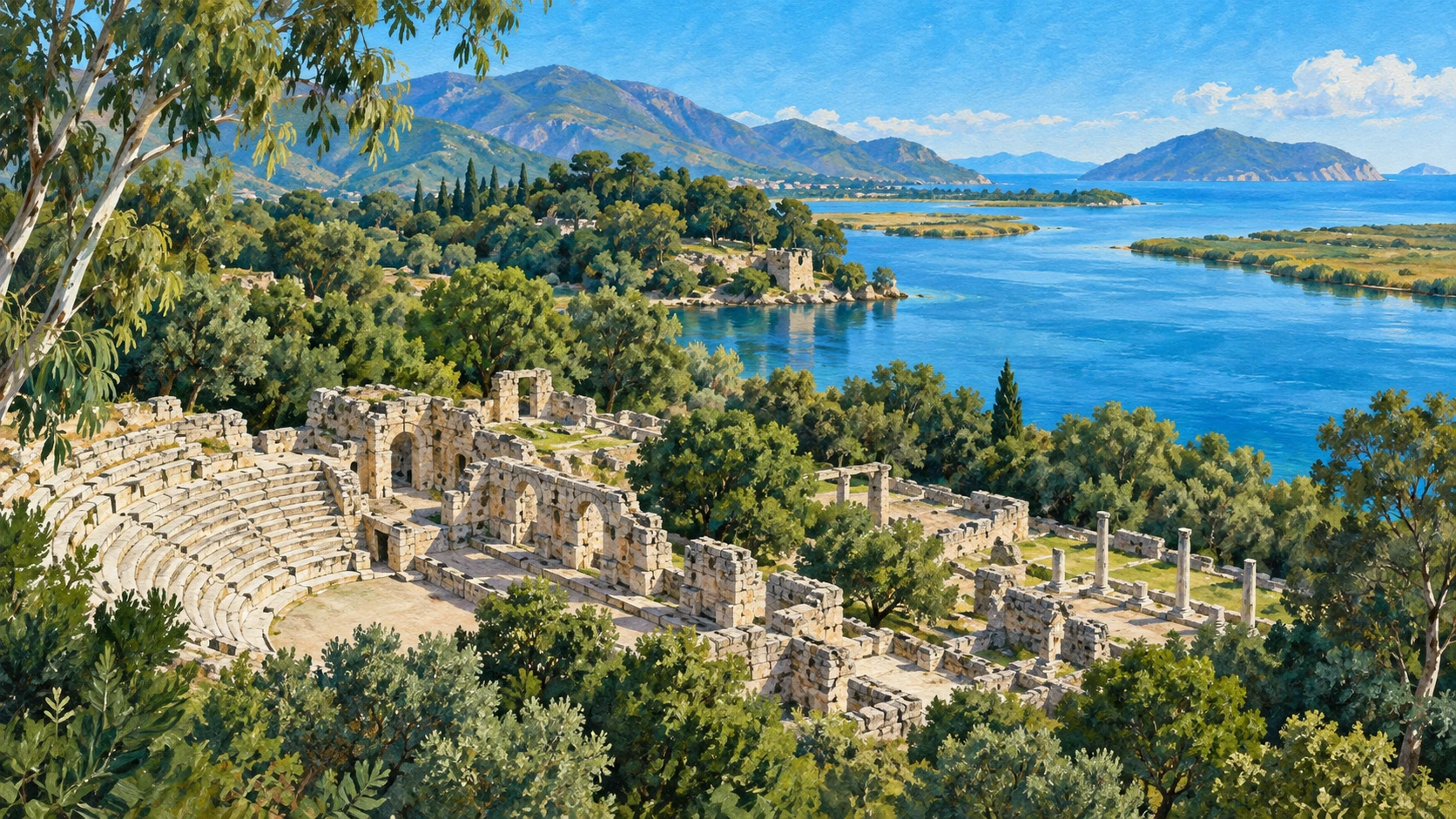
An Ancient Peninsula in a Protected Park
Butrint was inscribed on the UNESCO World Heritage list in 1992. The site occupies a limestone peninsula covering approximately 200 hectares.
The Vivari Channel connects Lake Butrint to the Ionian Sea and Corfu Strait. Dense woodlands of laurel, oak, and eucalyptus shade the old ruins.
Successful conservation led to removal from the in-danger list in 2005. Ramsar designation number 1290 protects the surrounding wetland marsh habitats.
Greek Sanctuaries and the Stone Theatre
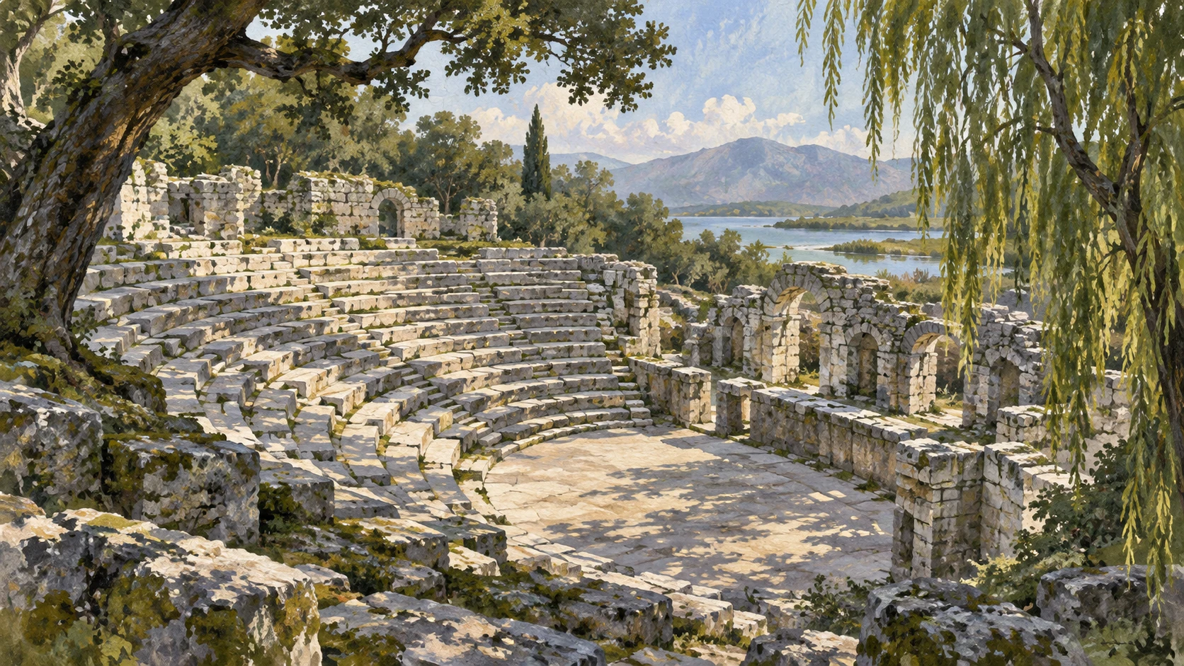
The settlement began as an Epirote Chaonian fortified hill town on the acropolis summit. In the fourth century BC, builders dedicated a sanctuary to Asclepius.
A stone theatre seating approximately 1,500 spectators was carved into the limestone hill. Greek manumission inscriptions record the legal liberation of enslaved people.
Polygonal defensive walls enclosed the early city perimeter. Sacred water practices centered on natural freshwater springs at the limestone hill base.
Roman Colony and the Channel Aqueduct
Julius Caesar visited Butrint in 44 BC and designated a planned veteran colony. Emperor Augustus re-established the settlement as Colonia Augusta Buthrotum.
Roman builders constructed an elaborate aqueduct bridging the Vivari Channel. Public thermal baths featured hypocaust underfloor heating systems.
The grand Triconch Palace stood directly along the waterfront. Commercial port docks accommodated merchant galleys carrying olive oil and wine.
Christian Basilicas and Mosaic Floors
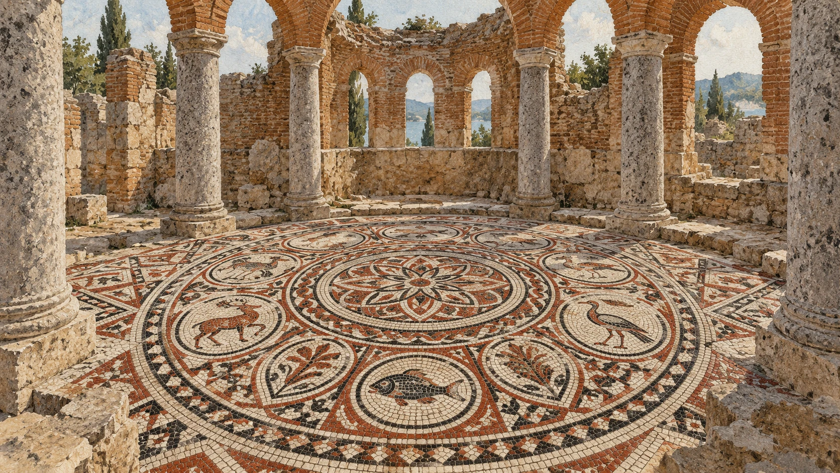
Butrint became the seat of a Christian bishopric under Byzantine administration. Builders erected a monumental sixth-century Baptistery with sixteen circular granite columns.
The Baptistery preserves an intricate polychrome mosaic floor showing animal medallions and peacocks. The Great Basilica was built with carved limestone arches.
Rising groundwater caused defensive contraction toward the acropolis hill. A coastal garrison guarded maritime passage into the interior.
Venetian Forts and Ottoman Towers
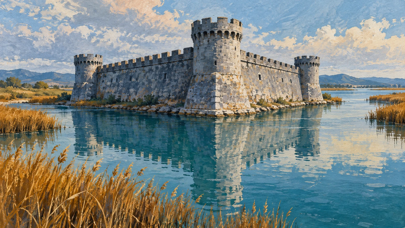
The Republic of Venice controlled Butrint between 1386 and 1797 to guard maritime straits. Military engineers built a triangular stone fortress beside the channel.
A crenelated Venetian tower was erected on the acropolis summit. Venetian administrators controlled lucrative seasonal eel traps across the waterway.
Ali Pasha of Tepelena fortified the mouth of the Vivari Channel around 1807. The passage remained a contested militarized frontier between Venice and the Ottomans.
Managing Water and Welcoming Visitors
Rising sea levels and tidal inundation continuously threaten low-lying stone monuments. Permanent sand covering protects the sensitive Baptistery mosaics from sunlight.
Continuous water pumping manages saline water intrusion in the lower ruins. A landmark management plan guides visitor circulation and conservation.
Annual cultural tourism exceeds 200,000 visitors to the park. Environmental monitoring stations measure groundwater fluctuations along the riparian ecosystem.
A2 · Elementary
Archaeological Heritage and Wetland Landscapes of Butrint
A pre-intermediate field survey of the classical monuments, Roman colonization, early Christian mosaics, and channel hydrology at Butrint.
The World Heritage Peninsula and Coastal Lagoon
Butrint was inscribed on the UNESCO World Heritage list in 1992 as an exceptional testimony to ancient Mediterranean civilizations. The site occupies a limestone peninsula covering approximately 200 hectares within the 9,424-hectare Butrint National Park.
The Vivari Channel serves as a critical hydrographic conduit connecting the brackish waters of Lake Butrint to the Ionian Sea and Corfu Strait. Dense Mediterranean macchia woodlands dominated by laurel, oak, and eucalyptus shade the ancient ruins.
Butrint was inscribed on the List of World Heritage in Danger in 1997 before successful conservation led to its removal from the in-danger list in 2005. Ramsar wetland designation number 1290 was granted to the Lake Butrint complex in 2003 to protect coastal marsh habitats.
Hellenistic Acropolis and the Healing Sanctuary
The settlement originated in the 8th to 7th centuries BC as an Epirote Chaonian fortified hill town on the acropolis summit. In the 4th century BC, a prominent sanctuary dedicated to Asclepius, the Greek god of healing, was established below the acropolis.
A stone theatre seating approximately 1,500 spectators was carved into the natural limestone hill slope during the 3rd century BC. Greek manumission inscriptions carved onto the limestone wall of the parodos record the legal liberation of enslaved individuals in antiquity.
Polygonal defensive stone walls constructed of fitted dry-joint ashlar blocks enclosed the early Hellenistic city perimeter. Water cult practices centered on natural freshwater springs emerging from the limestone base of the acropolis hill.
Roman Colonial Infrastructure and the Vivari Aqueduct
Julius Caesar visited Butrint in 44 BC and designated it as a planned colony for Roman veterans. Emperor Augustus re-established the settlement as Colonia Augusta Buthrotum following his decisive naval victory at the Battle of Actium in 31 BC.
Roman urban expansion saw the construction of an elaborate aqueduct bridging the Vivari Channel to bring freshwater from mountain springs. Roman thermal public baths featuring hypocaust underfloor heating systems were erected adjacent to the ancient sanctuary.
Extensive patrician residences, including the grand Triconch Palace, were built along the waterfront of the Vivari Channel during the late Empire. Commercial port facilities accommodated merchant galleys trading olive oil, wine, and salted fish across the Adriatic and Ionian seas.
Early Christian Monuments and the Great Baptistery
Butrint became the seat of a Christian bishopric during the 5th and 6th centuries AD under Byzantine imperial administration. A monumental 6th-century Baptistery was constructed featuring sixteen circular granite columns arranged in concentric rings.
The Baptistery preserves an intricate polychrome mosaic floor depicting animal medallions, peacocks, stags, and Christian salvation iconography. The Great Basilica was erected as a three-aisled episcopal cathedral with carved limestone arches and a semi-circular apsidal sanctuary.
Rising groundwater and silt accumulation in the low-lying sectors of the city led to progressive defensive contraction toward the acropolis hill. The settlement maintained an active coastal garrison that guarded maritime passage between the Ionian Sea and Byzantine interior provinces.
Venetian Maritime Outposts and Ottoman Fortifications
The Republic of Venice established continuous control over Butrint between 1386 and 1797 to secure the maritime strait opposite Venetian Corfu. Venetian military engineers constructed a triangular stone fortress on the southern bank of the Vivari Channel during the late 15th century.
A crenelated Venetian tower and acropolis castle were erected on the summit to command 360-degree views of naval approaches. Venetian administrators controlled lucrative seasonal eel and fish traps across the Vivari Channel, exporting salted catches to Italian markets.
Ottoman ruler Ali Pasha of Tepelena fortified the mouth of the Vivari Channel around 1807 with a massive coastal sea fortress. The shifting border between Venetian maritime territory and Ottoman mainland possessions made the Vivari Channel a heavily contested militarized frontier.
Hydrological Pressures, Conservation, and Heritage Tourism
Rising sea levels and tidal inundation continuously threaten low-lying stone monuments including the Roman theatre and early Christian baptistery. Permanent sand covering protocols protect the sensitive 6th-century Baptistery mosaics from destructive solar degradation and tourist foot traffic.
Continuous water pumping and drainage channels manage saline water intrusion to prevent salt crystallization in ancient limestone masonry. A landmark integrated management plan was established under the Butrint Management Foundation to ensure sustainable site conservation and public visitor circulation.
Annual cultural tourism exceeds 200,000 visitors, generating essential admission revenues that fund on-site archaeological conservation laboratories. Environmental monitoring stations measure groundwater table fluctuations and salinity levels across the Vivari Channel riparian ecosystem.
B1 · Intermediate
Archaeological Heritage and Channel Ecology at Butrint
An intermediate investigation into Hellenistic sanctuary architecture, Roman colonial urbanism, Byzantine monuments, and estuarine conservation along the Vivari Channel.
The World Heritage Site and Lagoon Hydrology
Butrint was inscribed on the UNESCO World Heritage list in 1992 as an exceptional testimony to ancient Mediterranean civilizations, establishing international recognition for its unique multi-layered urban topography. The archaeological site occupies a limestone peninsula covering approximately 200 hectares within the expansive 9,424-hectare Butrint National Park.
The Vivari Channel serves as a critical hydrographic conduit connecting the brackish waters of Lake Butrint to the Ionian Sea and Corfu Strait, maintaining a delicate estuarine balance between marine tides and freshwater runoff. Dense Mediterranean macchia woodlands dominated by laurel, oak, and eucalyptus form an atmospheric natural canopy shielding the ancient masonry.
Butrint was inscribed on the List of World Heritage in Danger in 1997 before successful conservation led to its removal from the in-danger list in 2005, marking a turning point in professional site protection. Ramsar wetland designation number 1290 was granted to the Lake Butrint complex in 2003 to protect coastal marsh habitats and wintering bird populations.
The Chaonian Acropolis and the Sanctuary of Asclepius
The settlement originated in the 8th to 7th centuries BC as an Epirote Chaonian fortified hill town on the acropolis summit, taking strategic advantage of natural rocky defenses. In the 4th century BC, a prominent sanctuary dedicated to Asclepius, the Greek god of healing, was established below the acropolis, transforming the citadel into a major regional pilgrimage destination.
A stone theatre seating approximately 1,500 spectators was carved into the natural limestone hill slope during the 3rd century BC, utilizing the natural bowl of the hillside for acoustic clarity. Greek manumission inscriptions carved onto the limestone wall of the parodos record the legal liberation of enslaved individuals in antiquity under the religious witness of the god.
Polygonal defensive stone walls constructed of fitted dry-joint ashlar blocks enclosed the early Hellenistic city perimeter, creating a massive fortifications barrier. Water cult practices centered on natural freshwater springs emerging from the limestone base of the acropolis hill, providing sacred purification fluids for visiting pilgrims.
Augustan Colony, the Vivari Aqueduct, and Thermal Baths
Julius Caesar visited Butrint in 44 BC and designated it as a planned colony for Roman veterans, seeking to reward loyal legionaries with fertile coastal estates. Emperor Augustus re-established the settlement as Colonia Augusta Buthrotum following his decisive naval victory at the Battle of Actium in 31 BC, initiating extensive urban rebuilding.
Roman urban expansion saw the construction of an elaborate aqueduct bridging the Vivari Channel to bring freshwater from mountain springs across the watergap to the colonial populace. Roman thermal public baths featuring hypocaust underfloor heating systems were erected adjacent to the ancient sanctuary, reflecting standard imperial civic amenities.
Extensive patrician residences, including the grand Triconch Palace, were built along the waterfront of the Vivari Channel during the late Empire, showcasing luxurious courtyard architecture. Commercial port facilities accommodated merchant galleys trading olive oil, wine, and salted fish across the Adriatic and Ionian seas, confirming Butrint's commercial dynamism.
Byzantine Bishopric, the Great Baptistery, and Cathedral
Butrint became the seat of a Christian bishopric during the 5th and 6th centuries AD under Byzantine imperial administration, serving as an important ecclesiastical diocese along the Epirote coast. A monumental 6th-century Baptistery was constructed featuring sixteen circular granite columns arranged in concentric rings, creating a sophisticated spatial hierarchy.
The Baptistery preserves an intricate polychrome mosaic floor depicting animal medallions, peacocks, stags, and Christian salvation iconography, which ranks among the finest early Christian pavements in the Mediterranean. The Great Basilica was erected as a three-aisled episcopal cathedral with carved limestone arches and a semi-circular apsidal sanctuary for liturgical assemblies.
Rising groundwater and silt accumulation in the low-lying sectors of the city led to progressive defensive contraction toward the acropolis hill as marshland encroached upon residential streets. The settlement maintained an active coastal garrison that guarded maritime passage between the Ionian Sea and Byzantine interior provinces, ensuring secure sea lanes.
Venetian Maritime Outposts and Ottoman Fortifications
The Republic of Venice established continuous control over Butrint between 1386 and 1797 to secure the maritime strait opposite Venetian Corfu, ensuring protected naval access through the channel. Venetian military engineers constructed a triangular stone fortress on the southern bank of the Vivari Channel during the late 15th century to repel hostile Ottoman raids.
A crenelated Venetian tower and acropolis castle were erected on the summit to command 360-degree views of naval approaches, providing early tactical warning against enemy fleets. Venetian administrators controlled lucrative seasonal eel and fish traps across the Vivari Channel, exporting salted catches to Italian markets to generate fiscal revenue.
Ottoman ruler Ali Pasha of Tepelena fortified the mouth of the Vivari Channel around 1807 with a massive coastal sea fortress designed to control commercial access to Lake Butrint. The shifting border between Venetian maritime territory and Ottoman mainland possessions made the Vivari Channel a heavily contested militarized frontier throughout the early modern era.
Hydrological Conservation and Cultural Tourism Management
Rising sea levels and tidal inundation continuously threaten low-lying stone monuments including the Roman theatre and early Christian baptistery, where fluctuating groundwater damages sub-surface foundations. Permanent sand covering protocols protect the sensitive 6th-century Baptistery mosaics from destructive solar degradation and tourist foot traffic, conserving the tesserae in situ.
Continuous water pumping and drainage channels manage saline water intrusion to prevent salt crystallization in ancient limestone masonry, which otherwise causes structural exfoliation and spalling. A landmark integrated management plan was established under the Butrint Management Foundation to ensure sustainable site conservation and public visitor circulation through sensitive archaeological zones.
Annual cultural tourism exceeds 200,000 visitors, generating essential admission revenues that fund on-site archaeological conservation laboratories and local warden staffing. Environmental monitoring stations measure groundwater table fluctuations and salinity levels across the Vivari Channel riparian ecosystem, providing empirical baseline data for climate adaptation strategies.
B2 · Upper Intermediate
Archaeological Stratigraphy and Hydrographic Landscapes of Butrint
An upper-intermediate analysis of urban stratigraphy, Hellenistic sanctuary cults, Roman imperial infrastructure, and hydrological conservation along the Vivari Channel.
UNESCO World Heritage Inscription and Wetland Hydrology
Butrint was inscribed on the UNESCO World Heritage list in 1992 as an exceptional testimony to ancient Mediterranean civilizations, encapsulating over two millennia of political, commercial, and religious evolution. The archaeological complex occupies a limestone peninsula covering approximately 200 hectares within the 9,424-hectare Butrint National Park, surrounded by estuarine waters and shifting alluvial marshes.
The Vivari Channel serves as a critical hydrographic conduit connecting the brackish waters of Lake Butrint to the Ionian Sea and Corfu Strait, regulating vital hydraulic exchange between coastal wetlands and open marine environments. Dense Mediterranean macchia woodlands dominated by laurel, oak, and eucalyptus provide a microclimatic buffer that moderates thermal stress on exposed ancient limestone.
Butrint was inscribed on the List of World Heritage in Danger in 1997 before successful conservation led to its removal from the in-danger list in 2005, demonstrating the effectiveness of concerted national and international intervention. Ramsar wetland designation number 1290 was granted to the Lake Butrint complex in 2003 to protect coastal marsh habitats and vulnerable wetland biodiversity.
The integration of cultural monuments with surrounding coastal lagoons establishes Butrint as a benchmark of holistic landscape preservation in Southern Europe.
Chaonian Acropolis and the Hellenistic Healing Sanctuary
The settlement originated in the 8th to 7th centuries BC as an Epirote Chaonian fortified hill town on the acropolis summit, where steep terrain offered natural defensive advantages against rival coastal powers. In the 4th century BC, a prominent sanctuary dedicated to Asclepius, the Greek god of healing, was established below the acropolis, becoming the sacred and civic focus of the expanding urban center.
A stone theatre seating approximately 1,500 spectators was carved into the natural limestone hill slope during the 3rd century BC, designed with precise acoustic properties to accommodate civic assemblies and theatrical performances. Greek manumission inscriptions carved onto the limestone wall of the parodos record the legal liberation of enslaved individuals in antiquity, providing invaluable epigraphic evidence of ancient social structures.
Polygonal defensive stone walls constructed of fitted dry-joint ashlar blocks enclosed the early Hellenistic city perimeter, exhibiting masterful stone-dressing techniques that required no mortar binding. Water cult practices centered on natural freshwater springs emerging from the limestone base of the acropolis hill, integrating medicinal hydrotherapy with religious devotion.
Colonia Augusta Buthrotum, the Aqueduct, and Waterfront Palaces
Julius Caesar visited Butrint in 44 BC and designated it as a planned colony for Roman veterans, initiating a radical restructuring of the Hellenistic urban layout to accommodate demobilized soldiers. Emperor Augustus re-established the settlement as Colonia Augusta Buthrotum following his decisive naval victory at the Battle of Actium in 31 BC, transforming the town into a showpiece of imperial Roman architectural prestige.
Roman urban expansion saw the construction of an elaborate aqueduct bridging the Vivari Channel to bring freshwater from mountain springs across the tidal divide into the colonial core. Roman thermal public baths featuring hypocaust underfloor heating systems were erected adjacent to the ancient sanctuary, reflecting standard metropolitan bathing rituals.
Extensive patrician residences, including the grand Triconch Palace, were built along the waterfront of the Vivari Channel during the late Empire, featuring monumental reception halls and ornate peristyle courtyards. Commercial port facilities accommodated merchant galleys trading olive oil, wine, and salted fish across the Adriatic and Ionian seas, underscoring the city's role as an estuarine maritime trading hub.
Byzantine Bishopric, the Polychrome Baptistery, and Cathedral
Butrint became the seat of a Christian bishopric during the 5th and 6th centuries AD under Byzantine imperial administration, exercising ecclesiastical authority across the coastal province of Epirus Vetus. A monumental 6th-century Baptistery was constructed featuring sixteen circular granite columns arranged in concentric rings, surrounding a central baptismal font that symbolized spiritual rebirth.
The Baptistery preserves an intricate polychrome mosaic floor depicting animal medallions, peacocks, stags, and Christian salvation iconography, celebrated for its stylistic sophistication and complex theological allegories. The Great Basilica was erected as a three-aisled episcopal cathedral with carved limestone arches and a semi-circular apsidal sanctuary to accommodate diocesan congregational rites.
Rising groundwater and silt accumulation in the low-lying sectors of the city led to progressive defensive contraction toward the acropolis hill as estuarine flooding compromised ground-floor domestic quarters. The settlement maintained an active coastal garrison that guarded maritime passage between the Ionian Sea and Byzantine interior provinces, securing commercial routes against barbarian seaborne incursions.
Venetian Maritime Strongholds and Ottoman Frontier Warfare
The Republic of Venice established continuous control over Butrint between 1386 and 1797 to secure the maritime strait opposite Venetian Corfu, treating the fortified station as an essential victualing base and strategic outpost. Venetian military engineers constructed a triangular stone fortress on the southern bank of the Vivari Channel during the late 15th century to protect channel fisheries and interdict Ottoman naval incursions.
A crenelated Venetian tower and acropolis castle were erected on the summit to command 360-degree views of naval approaches, serving as an unassailable bastion and visual signal station. Venetian administrators controlled lucrative seasonal eel and fish traps across the Vivari Channel, exporting salted catches to Italian markets to generate vital customs revenues.
Ottoman ruler Ali Pasha of Tepelena fortified the mouth of the Vivari Channel around 1807 with a massive coastal sea fortress designed to command access to the Ionian Sea and challenge British maritime hegemony in the Corfu Channel. The shifting border between Venetian maritime territory and Ottoman mainland possessions made the Vivari Channel a heavily contested militarized frontier for centuries.
Environmental Monitoring, In-Situ Conservation, and Tourism Governance
Rising sea levels and tidal inundation continuously threaten low-lying stone monuments including the Roman theatre and early Christian baptistery, accelerating masonry deterioration through wet-dry and freeze-thaw cycles. Permanent sand covering protocols protect the sensitive 6th-century Baptistery mosaics from destructive solar degradation and tourist foot traffic, ensuring chemical stabilization of the lime mortar bed.
Continuous water pumping and drainage channels manage saline water intrusion to prevent salt crystallization in ancient limestone masonry, mitigating sub-efflorescence that leads to mechanical stone breakdown. A landmark integrated management plan was established under the Butrint Management Foundation to ensure sustainable site conservation and public visitor circulation across fragile archaeological sectors.
Annual cultural tourism exceeds 200,000 visitors, generating essential admission revenues that fund on-site archaeological conservation laboratories and specialized stone-restoration specialists. Environmental monitoring stations measure groundwater table fluctuations and salinity levels across the Vivari Channel riparian ecosystem, ensuring proactive scientific risk management in the face of ongoing climate changes.
C1 · Advanced
Archaeological Urbanism, Hydrology, and Stratigraphy at Butrint
An advanced empirical analysis of Mediterranean settlement stratigraphy, Hellenistic sanctuary epigraphy, Roman colonial engineering, and hydrological conservation along the Vivari Channel.
UNESCO World Heritage Inscription and Wetland Hydrology
Butrint was inscribed on the UNESCO World Heritage list in 1992 as an exceptional testimony to ancient Mediterranean civilizations, establishing an internationally celebrated benchmark of diachronic settlement evolution. The archaeological site occupies a limestone peninsula covering approximately 200 hectares within the 9,424-hectare Butrint National Park, bounded by shifting estuarine margins and alluvial sedimentary zones.
The Vivari Channel serves as a critical hydrographic conduit connecting the brackish waters of Lake Butrint to the Ionian Sea and Corfu Strait, regulating complex bidirectional tidal flux and sedimentary deposition cycles. Dense Mediterranean macchia woodlands dominated by laurel, oak, and eucalyptus generate an endemic microclimatic canopy that mitigates solar thermal degradation across exposed architectural ruins.
Butrint was inscribed on the List of World Heritage in Danger in 1997 before successful conservation led to its removal from the in-danger list in 2005, reflecting unprecedented institutional mobilization and rigorous heritage remediation. Ramsar wetland designation number 1290 was granted to the Lake Butrint complex in 2003 to protect coastal marsh habitats and vulnerable aquatic avifauna populations.
The intimate confluence of monumental ruins and protected coastal wetlands positions Butrint as an irreplaceable case study in holistic Mediterranean cultural landscape governance.
The Chaonian Acropolis, Asklepieion Epigraphy, and Theatre Architecture
The settlement originated in the 8th to 7th centuries BC as an Epirote Chaonian fortified hill town on the acropolis summit, commanding maritime visibility across the Corfu Channel. In the 4th century BC, a prominent sanctuary dedicated to Asclepius, the Greek god of healing, was established below the acropolis, elevating the civic profile of the city through pan-Hellenic therapeutic pilgrimage.
A stone theatre seating approximately 1,500 spectators was carved into the natural limestone hill slope during the 3rd century BC, featuring refined cavea geometry that achieved acoustic amplification without structural resonance distortion. Greek manumission inscriptions carved onto the limestone wall of the parodos record the legal liberation of enslaved individuals in antiquity, providing unmatched epigraphic documentation of Hellenistic legal institutions and sacred property conventions.
Polygonal defensive stone walls constructed of fitted dry-joint ashlar blocks enclosed the early Hellenistic city perimeter, showcasing cyclopean precision that resisted seismic tremors through dry-stone friction. Water cult practices centered on natural freshwater springs emerging from the limestone base of the acropolis hill, intertwining hydropathic therapy with religious propitiation.
Caesarian Veteran Colonization, the Aqueduct, and Patrician Domus
Julius Caesar visited Butrint in 44 BC and designated it as a planned colony for Roman veterans, seeking to establish a strategic agrarian foothold along the Epirote coastline. Emperor Augustus re-established the settlement as Colonia Augusta Buthrotum following his decisive naval victory at the Battle of Actium in 31 BC, subsidizing extensive architectural aggrandizement that aligned civic space with Augustan dynastic ideology.
Roman urban expansion saw the construction of an elaborate aqueduct bridging the Vivari Channel to bring freshwater from mountain springs across the tidal watergap to the colonial populace, overcoming endemic estuarine salinity. Roman thermal public baths featuring hypocaust underfloor heating systems were erected adjacent to the ancient sanctuary, establishing Romanized hygienic regimens.
Extensive patrician residences, including the grand Triconch Palace, were built along the waterfront of the Vivari Channel during the late Empire, exhibiting tripartite apsidal architecture, mosaic corridors, and private riverine quays. Commercial port facilities accommodated merchant galleys trading olive oil, wine, and salted fish across the Adriatic and Ionian seas, integrating Butrint into pan-Mediterranean commercial circuits.
Byzantine Bishopric, the Polychrome Baptistery, and Episcopal Basilica
Butrint became the seat of a Christian bishopric during the 5th and 6th centuries AD under Byzantine imperial administration, exercising metropolitan ecclesiastical jurisdiction across the Ionian littoral. A monumental 6th-century Baptistery was constructed featuring sixteen circular granite columns arranged in concentric rings, surrounding an elaborate cruciform immersion font.
The Baptistery preserves an intricate polychrome mosaic floor depicting animal medallions, peacocks, stags, and Christian salvation iconography, celebrated for its stylistic sophistication and complex theological allegories. The Great Basilica was erected as a three-aisled episcopal cathedral with carved limestone arches and a semi-circular apsidal sanctuary that accommodated monumental liturgical processions.
Rising groundwater and silt accumulation in the low-lying sectors of the city led to progressive defensive contraction toward the acropolis hill as marshland encroached upon residential sectors. The settlement maintained an active coastal garrison that guarded maritime passage between the Ionian Sea and Byzantine interior provinces, maintaining tactical oversight of naval routes.
Venetian Maritime Outposts, Channel Fisheries, and Ottoman Artillery Forts
The Republic of Venice established continuous control over Butrint between 1386 and 1797 to secure the maritime strait opposite Venetian Corfu, treating the fortified station as an essential victualing base and strategic outpost. Venetian military engineers constructed a triangular stone fortress on the southern bank of the Vivari Channel during the late 15th century to protect channel fisheries and interdict Ottoman naval incursions.
A crenelated Venetian tower and acropolis castle were erected on the summit to command 360-degree views of naval approaches, providing an unassailable redoubt and visual signal station. Venetian administrators controlled lucrative seasonal eel and fish traps across the Vivari Channel, exporting salted catches to Italian markets to generate substantial fiscal revenues.
Ottoman ruler Ali Pasha of Tepelena fortified the mouth of the Vivari Channel around 1807 with a massive coastal sea fortress designed to command access to the Ionian Sea and challenge British maritime hegemony in the Corfu Channel. The shifting border between Venetian maritime territory and Ottoman mainland possessions made the Vivari Channel a heavily contested militarized frontier throughout the early modern era.
Hydrological Conservation, Salt Crystallization, and Foundation Governance
Rising sea levels and tidal inundation continuously threaten low-lying stone monuments including the Roman theatre and early Christian baptistery, accelerating masonry deterioration through wet-dry and freeze-thaw cycles. Permanent sand covering protocols protect the sensitive 6th-century Baptistery mosaics from destructive solar degradation and tourist foot traffic, ensuring chemical stabilization of the lime mortar bed.
Continuous water pumping and drainage channels manage saline water intrusion to prevent salt crystallization in ancient limestone masonry, mitigating sub-efflorescence that leads to mechanical stone breakdown. A landmark integrated management plan was established under the Butrint Management Foundation to ensure sustainable site conservation and public visitor circulation across fragile archaeological sectors.
Annual cultural tourism exceeds 200,000 visitors, generating essential admission revenues that fund on-site archaeological conservation laboratories and specialized stone-restoration specialists. Environmental monitoring stations measure groundwater table fluctuations and salinity levels across the Vivari Channel riparian ecosystem, ensuring proactive scientific risk management in the face of ongoing climate changes.
C2 · Mastery
Archaeological Urbanism, Landscape Ecology, and Heritage Geopolitics at Butrint
A comprehensive treatise on Mediterranean settlement stratigraphy, Hellenistic sanctuary epigraphy, Roman colonial engineering, Venetian fortifications, and hydrological conservation along the Vivari Channel.
UNESCO World Heritage Inscription and Hydrographic Landscape Geography
Butrint was inscribed on the UNESCO World Heritage list in 1992 as an exceptional testimony to ancient Mediterranean civilizations, embodying an extraordinary archaeological palimpsest spanning prehistoric, Classical, Roman, Byzantine, Venetian, and Ottoman cultural horizons. The monument precinct occupies a limestone peninsula covering approximately 200 hectares within the 9,424-hectare Butrint National Park, framed by brackish lagoons and maritime wetlands.
The Vivari Channel serves as a critical hydrographic conduit connecting the brackish waters of Lake Butrint to the Ionian Sea and Corfu Strait, governing estuarine salinity gradients and seasonal biological migrations. Dense Mediterranean macchia woodlands dominated by laurel, oak, and eucalyptus constitute an endemic microclimatic buffer that attenuates mechanical wind scour and solar thermal shock on fragile ancient masonry.
Butrint was inscribed on the List of World Heritage in Danger in 1997 before successful conservation led to its removal from the in-danger list in 2005, serving as an internationally cited paradigm of targeted emergency stabilization and institutional capacity building. Ramsar wetland designation number 1290 was granted to the Lake Butrint complex in 2003 to protect coastal marsh habitats and endangered aquatic avifauna.
The seamless convergence of monumental architectural stratigraphy and protected paralic wetlands makes Butrint a cornerstone of Mediterranean archaeological landscape conservation.
Epirote Chaonian Acropolis, Asklepieion Epigraphy, and Theatre Acoustics
The settlement originated in the 8th to 7th centuries BC as an Epirote Chaonian fortified hill town on the acropolis summit, commanding strategic naval panoramas over the Corfu Channel. In the 4th century BC, a prominent sanctuary dedicated to Asclepius, the Greek god of healing, was established below the acropolis, transforming the fortified settlement into an internationally revered pan-Hellenic healing sanctuary.
A stone theatre seating approximately 1,500 spectators was carved into the natural limestone hill slope during the 3rd century BC, employing sophisticated parabolic cavea curvature that maximized acoustic intelligibility without structural echo interference. Greek manumission inscriptions carved onto the limestone wall of the parodos record the legal liberation of enslaved individuals in antiquity, providing peerless epigraphic evidence of Hellenistic civic jurisprudence and sacred manumission rituals.
Polygonal defensive stone walls constructed of fitted dry-joint ashlar blocks enclosed the early Hellenistic city perimeter, utilizing trapezoidal and polygonal blocks fitted with hairline joints that dissipated seismic shear forces through friction. Water cult practices centered on natural freshwater springs emerging from the limestone base of the acropolis hill, integrating hydrotherapeutic bathing with sacred chthonic rituals.
Caesarian Veteran Colonization, the Vivari Aqueduct, and Waterfront Domus
Julius Caesar visited Butrint in 44 BC and designated it as a planned colony for Roman veterans, seeking to establish an ideological and agricultural bulwark on the eastern shore of the Ionian Sea. Emperor Augustus re-established the settlement as Colonia Augusta Buthrotum following his decisive naval victory at the Battle of Actium in 31 BC, executing an imperial architectural overhaul that manifested Roman administrative hegemony.
Roman urban expansion saw the construction of an elaborate aqueduct bridging the Vivari Channel to bring freshwater from mountain springs across the tidal watergap to the colonial populace, overcoming localized groundwater salinity through audacious hydraulic infrastructure. Roman thermal public baths featuring hypocaust underfloor heating systems were erected adjacent to the ancient sanctuary, embedding imperial balneary customs into the urban fabric.
Extensive patrician residences, including the grand Triconch Palace, were built along the waterfront of the Vivari Channel during the late Empire, featuring monumental triconch dining halls, mosaic colonnades, and private boat slips. Commercial port facilities accommodated merchant galleys trading olive oil, wine, and salted fish across the Adriatic and Ionian seas, confirming Butrint's role as a nexus of maritime commerce.
Byzantine Bishopric, the Polychrome Baptistery, and Episcopal Cathedral
Butrint became the seat of a Christian bishopric during the 5th and 6th centuries AD under Byzantine imperial administration, exercising ecclesiastical authority across the province of Old Epirus. A monumental 6th-century Baptistery was constructed featuring sixteen circular granite columns arranged in concentric rings, surrounding an elaborate cruciform baptismal piscina.
The Baptistery preserves an intricate polychrome mosaic floor depicting animal medallions, peacocks, stags, and Christian salvation iconography, renowned for its iconographic richness and theological symbolism. The Great Basilica was erected as a three-aisled episcopal cathedral with carved limestone arches and a semi-circular apsidal sanctuary to accommodate diocesan congregational assemblies.
Rising groundwater and silt accumulation in the low-lying sectors of the city led to progressive defensive contraction toward the acropolis hill as marine ingress rendered domestic quarters uninhabitable. The settlement maintained an active coastal garrison that guarded maritime passage between the Ionian Sea and Byzantine interior provinces, maintaining naval surveillance against Ostrogothic and Slavic maritime incursions.
Venetian Maritime Outposts, Commercial Fisheries, and Ottoman Artillery Forts
The Republic of Venice established continuous control over Butrint between 1386 and 1797 to secure the maritime strait opposite Venetian Corfu, treating the fortified station as an essential victualing base and strategic outpost. Venetian military engineers constructed a triangular stone fortress on the southern bank of the Vivari Channel during the late 15th century to protect channel fisheries and interdict Ottoman naval incursions.
A crenelated Venetian tower and acropolis castle were erected on the summit to command 360-degree views of naval approaches, providing an unassailable redoubt and visual signal station. Venetian administrators controlled lucrative seasonal eel and fish traps across the Vivari Channel, exporting salted catches to Italian markets to generate substantial fiscal revenues.
Ottoman ruler Ali Pasha of Tepelena fortified the mouth of the Vivari Channel around 1807 with a massive coastal sea fortress designed to command access to the Ionian Sea and challenge British maritime hegemony in the Corfu Channel. The shifting border between Venetian maritime territory and Ottoman mainland possessions made the Vivari Channel a heavily contested militarized frontier throughout the early modern era.
Hydrological Conservation, Salt Crystallization, and Foundation Governance
Rising sea levels and tidal inundation continuously threaten low-lying stone monuments including the Roman theatre and early Christian baptistery, accelerating masonry deterioration through wet-dry and freeze-thaw cycles. Permanent sand covering protocols protect the sensitive 6th-century Baptistery mosaics from destructive solar degradation and tourist foot traffic, ensuring chemical stabilization of the lime mortar bed.
Continuous water pumping and drainage channels manage saline water intrusion to prevent salt crystallization in ancient limestone masonry, mitigating sub-efflorescence that leads to mechanical stone breakdown. A landmark integrated management plan was established under the Butrint Management Foundation to ensure sustainable site conservation and public visitor circulation across fragile archaeological sectors.
Annual cultural tourism exceeds 200,000 visitors, generating essential admission revenues that fund on-site archaeological conservation laboratories and specialized stone-restoration specialists. Environmental monitoring stations measure groundwater table fluctuations and salinity levels across the Vivari Channel riparian ecosystem, ensuring proactive scientific risk management in the face of ongoing climate changes.
Check your understanding
Choose how closely you want to revisit the article. You can refer back while answering, and review explanations when you finish.
Quick Quiz A1
Try one question, then create a free account for the full Quick Quiz. Sign Up Free
Answer every question before checking. There is no time limit.
Your results
/ 1 correct (%)
Read the explanations to see how each answer connects to the article.
-
In what year was Butrint inscribed on the UNESCO World Heritage list?
1. Answer:
Quick Quiz A2
Try one question, then create a free account for the full Quick Quiz. Sign Up Free
Answer every question before checking. There is no time limit.
Your results
/ 1 correct (%)
Read the explanations to see how each answer connects to the article.
-
Under what international framework was Butrint inscribed in 1992?
1. Answer:
Quick Quiz B1
Try one question, then create a free account for the full Quick Quiz. Sign Up Free
Answer every question before checking. There is no time limit.
Your results
/ 1 correct (%)
Read the explanations to see how each answer connects to the article.
-
Under which international convention was Butrint inscribed as a World Heritage site in 1992?
1. Answer:
Quick Quiz B2
Try one question, then create a free account for the full Quick Quiz. Sign Up Free
Answer every question before checking. There is no time limit.
Your results
/ 1 correct (%)
Read the explanations to see how each answer connects to the article.
-
Under what international convention was Butrint inscribed in 1992?
1. Answer:
Quick Quiz C1
Try one question, then create a free account for the full Quick Quiz. Sign Up Free
Answer every question before checking. There is no time limit.
Your results
/ 1 correct (%)
Read the explanations to see how each answer connects to the article.
-
Under what international convention was Butrint inscribed in 1992?
1. Answer:
Quick Quiz C2
Try one question, then create a free account for the full Quick Quiz. Sign Up Free
Answer every question before checking. There is no time limit.
Your results
/ 1 correct (%)
Read the explanations to see how each answer connects to the article.
-
Under what international convention was Butrint inscribed in 1992?
1. Answer:
