A1 · Beginner
Vjosa River at Permet: Gauge Telemetry and Riverbank Life
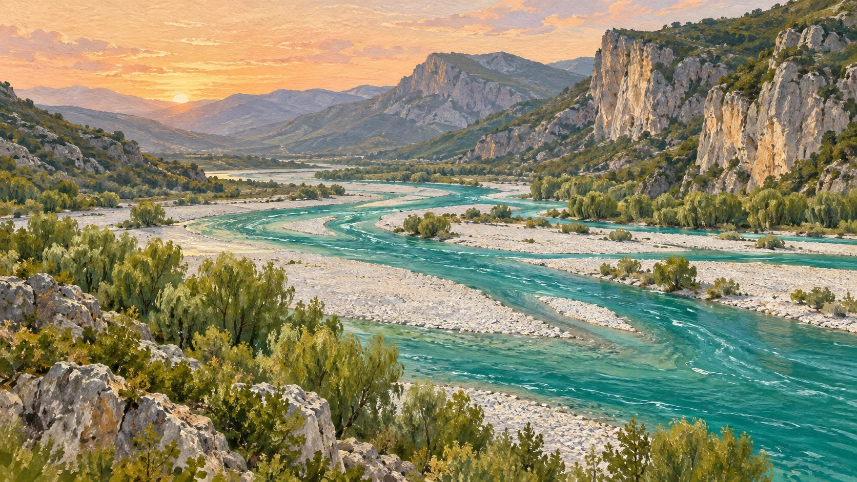
An automated radar station records river levels at Permet while local farmers, municipal teams, and mountain weather guide daily valley routines.
Automated Radar Telemetry at Permet Hydrometer
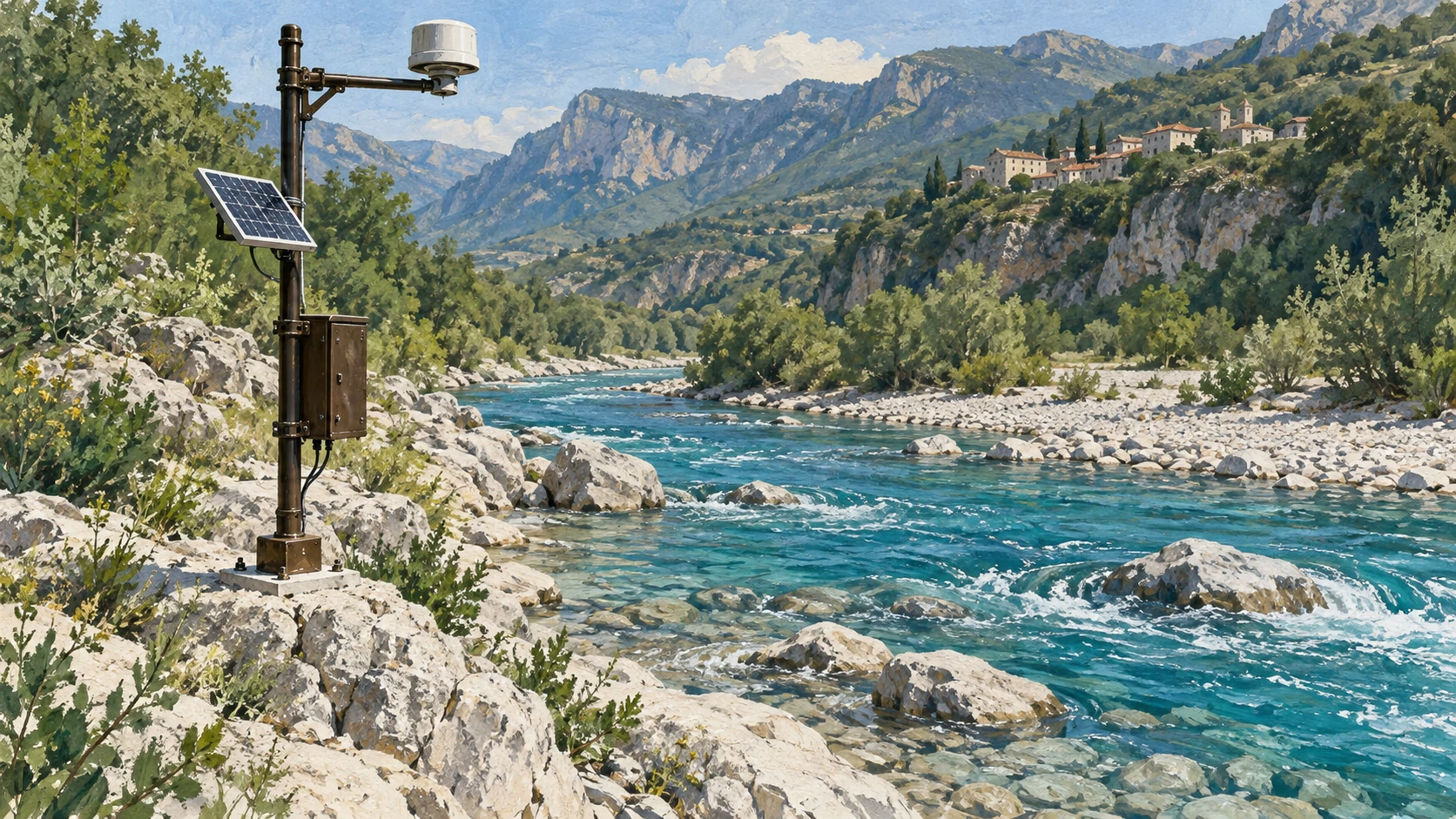
The Permet Hydrometer radar station records Vjosa river water levels at an automated 15-minute interval. Each radar and acoustic pulse sensor measures water stage height relative to the riverbed datum.
The station operates under the HydroVjosa cross-border scientific and river monitoring network. The gauge measures stage height and instantaneous flow rather than human daily schedules.
Hydrological telemetry provides raw stage data without interpreting civic routines. Historical records from April 2022 establish baseline seasonal fluctuations in the upper Vjosa gorge.
Municipal Observation and Riverbank Access
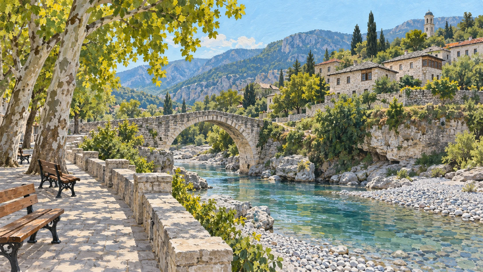
Bashkia Permet municipal administration manages civic access to the riverfront promenade and low-lying gravel banks. Municipal public works coordinate agricultural irrigation gates based on seasonal flow rather than single raw readings.
Local farmers in the Permet valley plan vegetable plots and livestock pastures around river gravel shoals. Independent verification requires correlating instrument readings with municipal notices and farmer schedules.
Named local sources prevent treating an automated water gauge as a substitute for human observation. Field reporting links technical stage heights to bridge crossings, a riverside footpath, and daily routines.
Mountain Runoff and Early Warning Systems
The Institute of Geosciences provides a regional precipitation bulletin and catchment flood hazard forecasts. Upstream rainfall across the Greek Pindus mountains causes rapid stage surges down the Permet gorge.
Permet municipal emergency services monitor bridge clearances and low gravel road access during an autumn downpour. Single static historical gauge readings cannot predict sudden flash runoff or mountain storm swells.
Real-time weather warnings from IGEO combine with radar telemetry to guide civic safety decisions. Riverbank pathways are closed or cleared based on combined meteorological warnings rather than historical averages.
Catchment Hydromorphology Across the River Valley
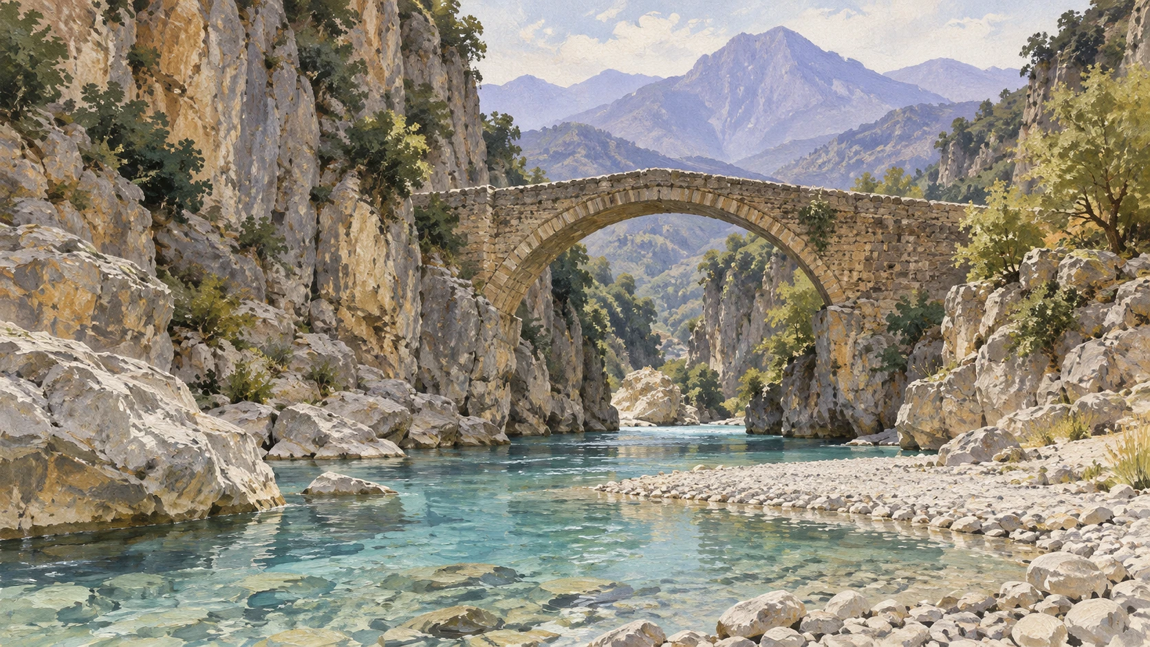
The Vjosa River flows over 270 kilometers from Greece through southern Albania to the Adriatic Sea. The hydromorphological character of the river transforms from a narrow limestone canyon in Permet to braided gravel plains in Tepelene.
Water stage readings at Permet do not reflect discharge rates or flood dynamics in downstream agricultural plains. Each major tributary stream introduces significant hydrological volumes downstream of Permet.
Extrapolating a single Permet gauge reading across the entire 270-kilometer valley distorts regional hydrologic realities. Catchment hydrology requires distinct gauge networks at Tepelene, Memaliaj, Pocem, and Novosele.
Agricultural Irrigation and Seasonal Water Schedules
A true water calendar requires documented seasonal schedules of planting, irrigation diversion, and gravel extraction. Regional Directorate of Agriculture records show structured irrigation calendars from May through September.
Thermal hot springs at Benje near Permet experience visitor and community routines tied to summer water levels. Converting hydrometer telemetry into a cultural or economic calendar demands verified municipal records.
Seasonal water allocation depends on regional council decrees rather than raw hourly gauge pulses. Unverified extrapolation of river heights into timeless folkloric rhythms misrepresents modern river valley life.
Archival Integrity and Conservation Governance
Scientific institutions like HydroVjosa, Euronatur, and Riverwatch archive telemetry logs for peer review. National Agency of Protected Areas integrates hydrometric logs into Vjosa River National Park conservation management.
Cross-referencing radar telemetry with municipal civil defense reports maintains data integrity. Transparent data provenance prevents sensationalized reporting on flood risk and eco-tourism access.
Retaining immutable timestamped records enables rigorous validation by editors, hydrologists, and community planners. Verifiable documentation grounds environmental reporting in empirical reality rather than speculative narrative.
A2 · Elementary
Vjosa River at Permet: Gauge Telemetry and Riverbank Life
An automated radar station records river levels at Permet while local farmers, municipal teams, and mountain weather guide daily valley routines.
Automated Radar Telemetry at Permet Hydrometer
The Permet Hydrometer radar station records Vjosa river water levels at an automated 15-minute interval. Each radar and acoustic pulse sensor measures water stage height relative to the riverbed datum.
The station operates under the HydroVjosa cross-border scientific and river monitoring network. The gauge measures stage height and instantaneous flow rather than human daily schedules.
Hydrological telemetry provides raw stage data without interpreting civic routines. Historical records from April 2022 establish baseline seasonal fluctuations in the upper Vjosa gorge.
Municipal Observation and Riverbank Access
Bashkia Permet municipal administration manages civic access to the riverfront promenade and low-lying gravel banks. Municipal public works coordinate agricultural irrigation gates based on seasonal flow rather than single raw readings.
Local farmers in the Permet valley plan vegetable plots and livestock pastures around river gravel shoals. Independent verification requires correlating instrument readings with municipal notices and farmer schedules.
Named local sources prevent treating an automated water gauge as a substitute for human observation. Field reporting links technical stage heights to bridge crossings, a riverside footpath, and daily routines.
Mountain Runoff and Early Warning Systems
The Institute of Geosciences provides a regional precipitation bulletin and catchment flood hazard forecasts. Upstream rainfall across the Greek Pindus mountains causes rapid stage surges down the Permet gorge.
Permet municipal emergency services monitor bridge clearances and low gravel road access during an autumn downpour. Single static historical gauge readings cannot predict sudden flash runoff or mountain storm swells.
Real-time weather warnings from IGEO combine with radar telemetry to guide civic safety decisions. Riverbank pathways are closed or cleared based on combined meteorological warnings rather than historical averages.
Catchment Hydromorphology Across the River Valley
The Vjosa River flows over 270 kilometers from Greece through southern Albania to the Adriatic Sea. The hydromorphological character of the river transforms from a narrow limestone canyon in Permet to braided gravel plains in Tepelene.
Water stage readings at Permet do not reflect discharge rates or flood dynamics in downstream agricultural plains. Each major tributary stream introduces significant hydrological volumes downstream of Permet.
Extrapolating a single Permet gauge reading across the entire 270-kilometer valley distorts regional hydrologic realities. Catchment hydrology requires distinct gauge networks at Tepelene, Memaliaj, Pocem, and Novosele.
Agricultural Irrigation and Seasonal Water Schedules
A true water calendar requires documented seasonal schedules of planting, irrigation diversion, and gravel extraction. Regional Directorate of Agriculture records show structured irrigation calendars from May through September.
Thermal hot springs at Benje near Permet experience visitor and community routines tied to summer water levels. Converting hydrometer telemetry into a cultural or economic calendar demands verified municipal records.
Seasonal water allocation depends on regional council decrees rather than raw hourly gauge pulses. Unverified extrapolation of river heights into timeless folkloric rhythms misrepresents modern river valley life.
Archival Integrity and Conservation Governance
Scientific institutions like HydroVjosa, Euronatur, and Riverwatch archive telemetry logs for peer review. National Agency of Protected Areas integrates hydrometric logs into Vjosa River National Park conservation management.
Cross-referencing radar telemetry with municipal civil defense reports maintains data integrity. Transparent data provenance prevents sensationalized reporting on flood risk and eco-tourism access.
Retaining immutable timestamped records enables rigorous validation by editors, hydrologists, and community planners. Verifiable documentation grounds environmental reporting in empirical reality rather than speculative narrative.
B1 · Intermediate
Permet River Gauge: How Telemetry and Local Practice Frame the Vjosa
Automated radar sensors record stage height in the upper Vjosa gorge while municipal safety teams and agricultural calendars govern daily valley life.
Automated Radar Telemetry at Permet Hydrometer
The Permet Hydrometer radar station records Vjosa river water levels at an automated 15-minute interval. Each radar and acoustic pulse sensor measures water stage height relative to the riverbed datum.
The station operates under the HydroVjosa cross-border scientific and river monitoring network. The gauge measures stage height and instantaneous flow rather than human daily schedules.
Hydrological telemetry provides raw stage data without interpreting civic routines. Historical records from April 2022 establish baseline seasonal fluctuations in the upper Vjosa gorge.
Municipal Observation and Riverbank Access
Bashkia Permet municipal administration manages civic access to the riverfront promenade and low-lying gravel banks. Municipal public works coordinate agricultural irrigation gates based on seasonal flow rather than single raw readings.
Local farmers in the Permet valley plan vegetable plots and livestock pastures around river gravel shoals. Independent verification requires correlating instrument readings with municipal notices and farmer schedules.
Named local sources prevent treating an automated water gauge as a substitute for human observation. Field reporting links technical stage heights to bridge crossings, a riverside footpath, and daily routines.
Mountain Runoff and Early Warning Systems
The Institute of Geosciences provides a regional precipitation bulletin and catchment flood hazard forecasts. Upstream rainfall across the Greek Pindus mountains causes rapid stage surges down the Permet gorge.
Permet municipal emergency services monitor bridge clearances and low gravel road access during an autumn downpour. Single static historical gauge readings cannot predict sudden flash runoff or mountain storm swells.
Real-time weather warnings from IGEO combine with radar telemetry to guide civic safety decisions. Riverbank pathways are closed or cleared based on combined meteorological warnings rather than historical averages.
Catchment Hydromorphology Across the River Valley
The Vjosa River flows over 270 kilometers from Greece through southern Albania to the Adriatic Sea. The hydromorphological character of the river transforms from a narrow limestone canyon in Permet to braided gravel plains in Tepelene.
Water stage readings at Permet do not reflect discharge rates or flood dynamics in downstream agricultural plains. Each major tributary stream introduces significant hydrological volumes downstream of Permet.
Extrapolating a single Permet gauge reading across the entire 270-kilometer valley distorts regional hydrologic realities. Catchment hydrology requires distinct gauge networks at Tepelene, Memaliaj, Pocem, and Novosele.
Agricultural Irrigation and Seasonal Water Schedules
A true water calendar requires documented seasonal schedules of planting, irrigation diversion, and gravel extraction. Regional Directorate of Agriculture records show structured irrigation calendars from May through September.
Thermal hot springs at Benje near Permet experience visitor and community routines tied to summer water levels. Converting hydrometer telemetry into a cultural or economic calendar demands verified municipal records.
Seasonal water allocation depends on regional council decrees rather than raw hourly gauge pulses. Unverified extrapolation of river heights into timeless folkloric rhythms misrepresents modern river valley life.
Archival Integrity and Conservation Governance
Scientific institutions like HydroVjosa, Euronatur, and Riverwatch archive telemetry logs for peer review. National Agency of Protected Areas integrates hydrometric logs into Vjosa River National Park conservation management.
Cross-referencing radar telemetry with municipal civil defense reports maintains data integrity. Transparent data provenance prevents sensationalized reporting on flood risk and eco-tourism access.
Retaining immutable timestamped records enables rigorous validation by editors, hydrologists, and community planners. Verifiable documentation grounds environmental reporting in empirical reality rather than speculative narrative.
B2 · Upper Intermediate
Measuring the Vjosa at Permet: Telemetry, Fluvial Dynamics, and Civic Time
An automated radar hydrometer tracks river levels in southern Albania while municipal flood protocols and agricultural irrigation schedules define valley realities.
Automated Radar Telemetry at Permet Hydrometer
The Permet Hydrometer radar station records Vjosa river water levels at an automated 15-minute interval. Each radar and acoustic pulse sensor measures water stage height relative to the riverbed datum.
The station operates under the HydroVjosa cross-border scientific and river monitoring network. The gauge measures stage height and instantaneous flow rather than human daily schedules.
Hydrological telemetry provides raw stage data without interpreting civic routines. Historical records from April 2022 establish baseline seasonal fluctuations in the upper Vjosa gorge.
Municipal Observation and Riverbank Access
Bashkia Permet municipal administration manages civic access to the riverfront promenade and low-lying gravel banks. Municipal public works coordinate agricultural irrigation gates based on seasonal flow rather than single raw readings.
Local farmers in the Permet valley plan vegetable plots and livestock pastures around river gravel shoals. Independent verification requires correlating instrument readings with municipal notices and farmer schedules.
Named local sources prevent treating an automated water gauge as a substitute for human observation. Field reporting links technical stage heights to bridge crossings, a riverside footpath, and daily routines.
Mountain Runoff and Early Warning Systems
The Institute of Geosciences provides a regional precipitation bulletin and catchment flood hazard forecasts. Upstream rainfall across the Greek Pindus mountains causes rapid stage surges down the Permet gorge.
Permet municipal emergency services monitor bridge clearances and low gravel road access during an autumn downpour. Single static historical gauge readings cannot predict sudden flash runoff or mountain storm swells.
Real-time weather warnings from IGEO combine with radar telemetry to guide civic safety decisions. Riverbank pathways are closed or cleared based on combined meteorological warnings rather than historical averages.
Catchment Hydromorphology Across the River Valley
The Vjosa River flows over 270 kilometers from Greece through southern Albania to the Adriatic Sea. The hydromorphological character of the river transforms from a narrow limestone canyon in Permet to braided gravel plains in Tepelene.
Water stage readings at Permet do not reflect discharge rates or flood dynamics in downstream agricultural plains. Each major tributary stream introduces significant hydrological volumes downstream of Permet.
Extrapolating a single Permet gauge reading across the entire 270-kilometer valley distorts regional hydrologic realities. Catchment hydrology requires distinct gauge networks at Tepelene, Memaliaj, Pocem, and Novosele.
Agricultural Irrigation and Seasonal Water Schedules
A true water calendar requires documented seasonal schedules of planting, irrigation diversion, and gravel extraction. Regional Directorate of Agriculture records show structured irrigation calendars from May through September.
Thermal hot springs at Benje near Permet experience visitor and community routines tied to summer water levels. Converting hydrometer telemetry into a cultural or economic calendar demands verified municipal records.
Seasonal water allocation depends on regional council decrees rather than raw hourly gauge pulses. Unverified extrapolation of river heights into timeless folkloric rhythms misrepresents modern river valley life.
Archival Integrity and Conservation Governance
Scientific institutions like HydroVjosa, Euronatur, and Riverwatch archive telemetry logs for peer review. National Agency of Protected Areas integrates hydrometric logs into Vjosa River National Park conservation management.
Cross-referencing radar telemetry with municipal civil defense reports maintains data integrity. Transparent data provenance prevents sensationalized reporting on flood risk and eco-tourism access.
Retaining immutable timestamped records enables rigorous validation by editors, hydrologists, and community planners. Verifiable documentation grounds environmental reporting in empirical reality rather than speculative narrative.
C1 · Advanced
Hydrodynamic Telemetry and Civic Reality: Reading the Vjosa River at Permet
Radar stage measurements at Permet provide empirical hydrological telemetry while valley agriculture and municipal governance determine human routines.
Automated Radar Telemetry at Permet Hydrometer
The Permet Hydrometer radar station records Vjosa river water levels at an automated 15-minute interval. Each radar and acoustic pulse sensor measures water stage height relative to the riverbed datum.
The station operates under the HydroVjosa cross-border scientific and river monitoring network. The gauge measures stage height and instantaneous flow rather than human daily schedules.
Hydrological telemetry provides raw stage data without interpreting civic routines. Historical records from April 2022 establish baseline seasonal fluctuations in the upper Vjosa gorge.
Municipal Observation and Riverbank Access
Bashkia Permet municipal administration manages civic access to the riverfront promenade and low-lying gravel banks. Municipal public works coordinate agricultural irrigation gates based on seasonal flow rather than single raw readings.
Local farmers in the Permet valley plan vegetable plots and livestock pastures around river gravel shoals. Independent verification requires correlating instrument readings with municipal notices and farmer schedules.
Named local sources prevent treating an automated water gauge as a substitute for human observation. Field reporting links technical stage heights to bridge crossings, a riverside footpath, and daily routines.
Mountain Runoff and Early Warning Systems
The Institute of Geosciences provides a regional precipitation bulletin and catchment flood hazard forecasts. Upstream rainfall across the Greek Pindus mountains causes rapid stage surges down the Permet gorge.
Permet municipal emergency services monitor bridge clearances and low gravel road access during an autumn downpour. Single static historical gauge readings cannot predict sudden flash runoff or mountain storm swells.
Real-time weather warnings from IGEO combine with radar telemetry to guide civic safety decisions. Riverbank pathways are closed or cleared based on combined meteorological warnings rather than historical averages.
Catchment Hydromorphology Across the River Valley
The Vjosa River flows over 270 kilometers from Greece through southern Albania to the Adriatic Sea. The hydromorphological character of the river transforms from a narrow limestone canyon in Permet to braided gravel plains in Tepelene.
Water stage readings at Permet do not reflect discharge rates or flood dynamics in downstream agricultural plains. Each major tributary stream introduces significant hydrological volumes downstream of Permet.
Extrapolating a single Permet gauge reading across the entire 270-kilometer valley distorts regional hydrologic realities. Catchment hydrology requires distinct gauge networks at Tepelene, Memaliaj, Pocem, and Novosele.
Agricultural Irrigation and Seasonal Water Schedules
A true water calendar requires documented seasonal schedules of planting, irrigation diversion, and gravel extraction. Regional Directorate of Agriculture records show structured irrigation calendars from May through September.
Thermal hot springs at Benje near Permet experience visitor and community routines tied to summer water levels. Converting hydrometer telemetry into a cultural or economic calendar demands verified municipal records.
Seasonal water allocation depends on regional council decrees rather than raw hourly gauge pulses. Unverified extrapolation of river heights into timeless folkloric rhythms misrepresents modern river valley life.
Archival Integrity and Conservation Governance
Scientific institutions like HydroVjosa, Euronatur, and Riverwatch archive telemetry logs for peer review. National Agency of Protected Areas integrates hydrometric logs into Vjosa River National Park conservation management.
Cross-referencing radar telemetry with municipal civil defense reports maintains data integrity. Transparent data provenance prevents sensationalized reporting on flood risk and eco-tourism access.
Retaining immutable timestamped records enables rigorous validation by editors, hydrologists, and community planners. Verifiable documentation grounds environmental reporting in empirical reality rather than speculative narrative.
C2 · Mastery
Fluvial Telemetry and Anthropogenic Schedules: The Vjosa River at Permet
Automated stage telemetry from the Permet radar station documents river dynamics while municipal oversight and irrigation decrees shape valley coexistence.
Automated Radar Telemetry at Permet Hydrometer
The Permet Hydrometer radar station records Vjosa river water levels at an automated 15-minute interval. Each radar and acoustic pulse sensor measures water stage height relative to the riverbed datum.
The station operates under the HydroVjosa cross-border scientific and river monitoring network. The gauge measures stage height and instantaneous flow rather than human daily schedules.
Hydrological telemetry provides raw stage data without interpreting civic routines. Historical records from April 2022 establish baseline seasonal fluctuations in the upper Vjosa gorge.
Municipal Observation and Riverbank Access
Bashkia Permet municipal administration manages civic access to the riverfront promenade and low-lying gravel banks. Municipal public works coordinate agricultural irrigation gates based on seasonal flow rather than single raw readings.
Local farmers in the Permet valley plan vegetable plots and livestock pastures around river gravel shoals. Independent verification requires correlating instrument readings with municipal notices and farmer schedules.
Named local sources prevent treating an automated water gauge as a substitute for human observation. Field reporting links technical stage heights to bridge crossings, a riverside footpath, and daily routines.
Mountain Runoff and Early Warning Systems
The Institute of Geosciences provides a regional precipitation bulletin and catchment flood hazard forecasts. Upstream rainfall across the Greek Pindus mountains causes rapid stage surges down the Permet gorge.
Permet municipal emergency services monitor bridge clearances and low gravel road access during an autumn downpour. Single static historical gauge readings cannot predict sudden flash runoff or mountain storm swells.
Real-time weather warnings from IGEO combine with radar telemetry to guide civic safety decisions. Riverbank pathways are closed or cleared based on combined meteorological warnings rather than historical averages.
Catchment Hydromorphology Across the River Valley
The Vjosa River flows over 270 kilometers from Greece through southern Albania to the Adriatic Sea. The hydromorphological character of the river transforms from a narrow limestone canyon in Permet to braided gravel plains in Tepelene.
Water stage readings at Permet do not reflect discharge rates or flood dynamics in downstream agricultural plains. Each major tributary stream introduces significant hydrological volumes downstream of Permet.
Extrapolating a single Permet gauge reading across the entire 270-kilometer valley distorts regional hydrologic realities. Catchment hydrology requires distinct gauge networks at Tepelene, Memaliaj, Pocem, and Novosele.
Agricultural Irrigation and Seasonal Water Schedules
A true water calendar requires documented seasonal schedules of planting, irrigation diversion, and gravel extraction. Regional Directorate of Agriculture records show structured irrigation calendars from May through September.
Thermal hot springs at Benje near Permet experience visitor and community routines tied to summer water levels. Converting hydrometer telemetry into a cultural or economic calendar demands verified municipal records.
Seasonal water allocation depends on regional council decrees rather than raw hourly gauge pulses. Unverified extrapolation of river heights into timeless folkloric rhythms misrepresents modern river valley life.
Archival Integrity and Conservation Governance
Scientific institutions like HydroVjosa, Euronatur, and Riverwatch archive telemetry logs for peer review. National Agency of Protected Areas integrates hydrometric logs into Vjosa River National Park conservation management.
Cross-referencing radar telemetry with municipal civil defense reports maintains data integrity. Transparent data provenance prevents sensationalized reporting on flood risk and eco-tourism access.
Retaining immutable timestamped records enables rigorous validation by editors, hydrologists, and community planners. Verifiable documentation grounds environmental reporting in empirical reality rather than speculative narrative.
Check your understanding
Choose how closely you want to revisit the article. You can refer back while answering, and review explanations when you finish.
Quick Quiz A1
Try one question, then create a free account for the full Quick Quiz. Sign Up Free
Answer every question before checking. There is no time limit.
Your results
/ 1 correct (%)
Read the explanations to see how each answer connects to the article.
-
How frequently does the Permet Hydrometer radar station record water levels?
1. Answer:
Quick Quiz A2
Try one question, then create a free account for the full Quick Quiz. Sign Up Free
Answer every question before checking. There is no time limit.
Your results
/ 1 correct (%)
Read the explanations to see how each answer connects to the article.
-
At what interval does the Permet Hydrometer radar station record water levels?
1. Answer:
Quick Quiz B1
Try one question, then create a free account for the full Quick Quiz. Sign Up Free
Answer every question before checking. There is no time limit.
Your results
/ 1 correct (%)
Read the explanations to see how each answer connects to the article.
-
At what interval does the Permet Hydrometer radar station record water levels?
1. Answer:
Quick Quiz B2
Try one question, then create a free account for the full Quick Quiz. Sign Up Free
Answer every question before checking. There is no time limit.
Your results
/ 1 correct (%)
Read the explanations to see how each answer connects to the article.
-
At what interval does the Permet Hydrometer radar station record water levels?
1. Answer:
Quick Quiz C1
Try one question, then create a free account for the full Quick Quiz. Sign Up Free
Answer every question before checking. There is no time limit.
Your results
/ 1 correct (%)
Read the explanations to see how each answer connects to the article.
-
At what interval does the Permet Hydrometer radar station record water levels?
1. Answer:
Quick Quiz C2
Try one question, then create a free account for the full Quick Quiz. Sign Up Free
Answer every question before checking. There is no time limit.
Your results
/ 1 correct (%)
Read the explanations to see how each answer connects to the article.
-
At what interval does the Permet Hydrometer radar station record water levels?
1. Answer:
