A1 · Beginner
Uluru and Kata Tjuta in the Red Desert
Discover the giant sacred red rocks rising above Australia's central desert plain.
Giant Red Rocks in the Sand
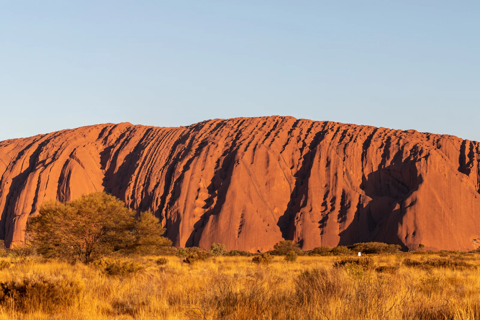
Uluru is a giant sandstone rock that rises 348 meters above the flat desert sand.
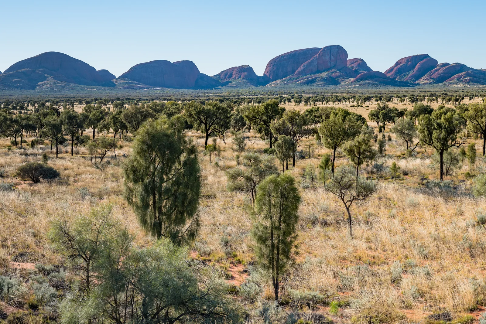
Nearby Kata Tjuta has thirty-six round red domes made of hard river stones.
The huge rocks formed about 550 million years ago during ancient mountain building periods.
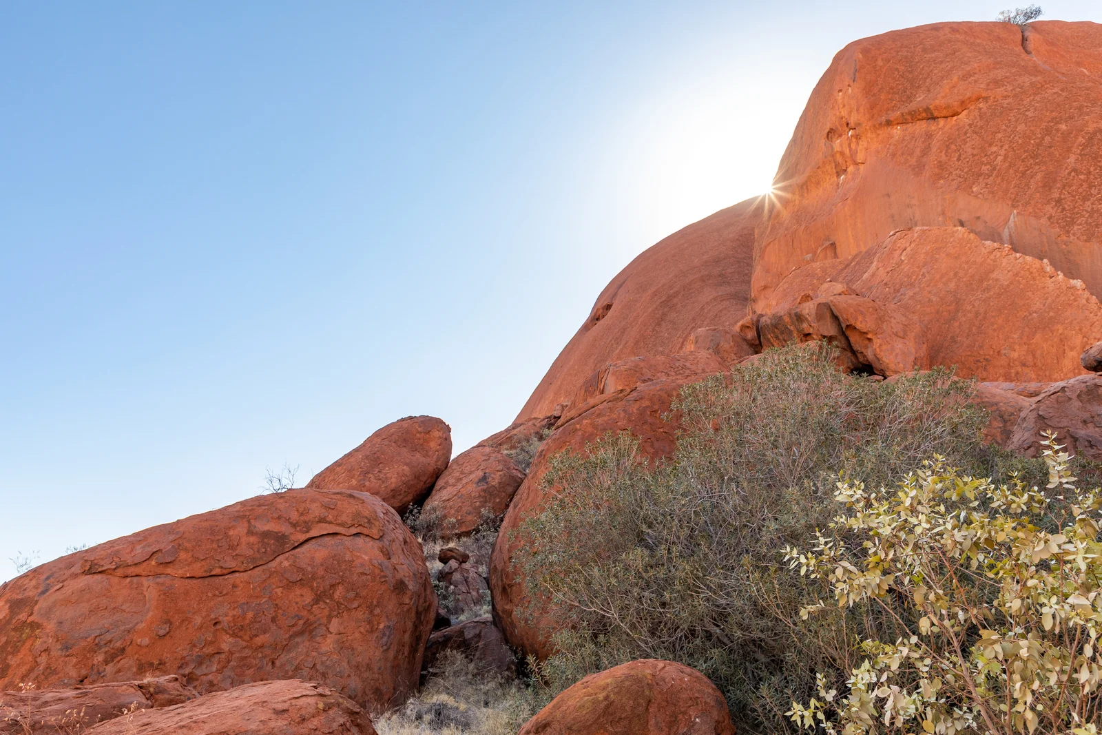
Iron in the sandstone rusts under the sun, giving the rock its bright red color.
The giant monolith turns fiery red and dark purple when the sun rises and sets.
The Mutitjulu waterhole at the rocky base provides fresh water for desert birds and animals.
Ancient Stories and Sacred Places
Anangu Aboriginal people have lived near these sacred red rocks for tens of thousands of years.
Tjukurpa is the sacred law and ancient story that guides daily life and moral rules.
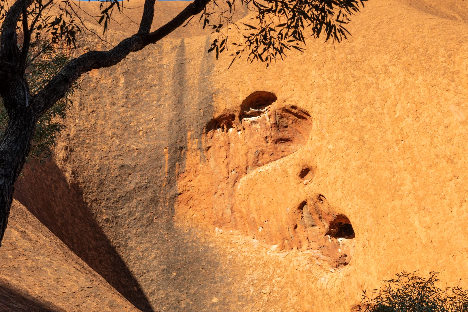
Special marks on the tall rock walls tell the story of Kuniya and Liru fighting.
Specific caves and secret rock fissures are sacred places reserved only for initiated men or women.
Ancient rock art galleries inside cool caves show painted animals, hunting tracks, and ceremonies.
Visitors are asked not to take photographs of sacred ceremonial spots around the rock base.
Colonial History and Giving Back the Land
Surveyor William Gosse saw the big rock in 1873 and called it Ayers Rock.
Government officials created a national park in 1958 and built busy motel rooms near the base.
Australia handed back the freehold title deeds to Anangu Traditional Owners on 26 October 1985.
Anangu immediately leased the national park back to the government for ninety-nine years.
UNESCO named the park a World Heritage site in 1987 and added cultural recognition in 1994.
Hotels and roads moved outside the park boundaries to the new desert town of Yulara.
Caring for Country and Closing the Climb
Anangu Traditional Owners hold the majority of seats on the park board of management.
The park board voted unanimously in November 2017 to stop tourists from climbing the rock.
The climbing ban took full effect on 26 October 2019 to protect sacred spiritual traditions.
Rangers use traditional cool grass burning called waru to stop wild fires and help plants grow.
The desert park protects rare wild creatures like the tiny rufous hare-wallaby and desert skink.
Uluru stands as a proud symbol of First Nations land rights and living desert culture.
A2 · Elementary
Uluru-Kata Tjuta: Sacred Geology and Heritage
Explore the ancient geology, Anangu creation law, and historic land rights milestones of Australia's Red Centre.
Ancient Desert Inselbergs and Red Sandstone
Uluru rises 348 meters above the surrounding sandy plain and 863 meters above sea level in the Northern Territory.
The massive monolith is an inselberg composed of arkose sandstone, while neighboring Kata Tjuta features 36 conglomerate domes.
Geologists trace the formation back 550 million years to erosion and alluvial fans during the ancient Petermann Orogeny.
The distinctive red-ochre exterior comes from the oxidation of iron minerals within the feldspar sandstone grains.
Low-angle sunlight at dawn and dusk causes dramatic color shifts, turning the sandstone walls from crimson to deep purple.
At the southern base, the shaded Mutitjulu Waterhole forms a perennial freshwater oasis that sustains delicate desert life.
Anangu Tjukurpa and Traditional Sacred Sites
Anangu Traditional Owners have inhabited and protected the surrounding Central Desert landscapes for tens of thousands of years.
Tjukurpa forms the fundamental religious law, social philosophy, and moral system explaining the ancestral creation of the landscape.
The physical contours of the sandstone record the epic battle between Kuniya, the woma python, and venomous Liru snakes.
Certain caves and natural rock fissures represent restricted sacred sites reserved strictly for initiated Anangu men or women.
Centuries-old rock art galleries sheltered beneath stone overhangs preserve paintings of ancestral beings, animals, and ceremonial tracks.
Park visitors are strictly requested to respect cultural protocols by refraining from photographing sensitive ceremonial locations.
Colonial Naming and the Historic 1985 Handback
Surveyor William Gosse arrived at the monolith in 1873, christening it Ayers Rock after South Australian Premier Sir Henry Ayers.
A national park was declared in 1958, leading to unmanaged tourist motorcades and motels directly adjacent to the monolith.
On 26 October 1985, Governor-General Sir Ninian Stephen formally presented freehold title deeds back to Anangu Traditional Owners.
The Traditional Owners immediately leased the reserve back to Parks Australia for 99 years under cooperative joint management.
UNESCO inscribed the park for natural values in 1987 and added cultural landscape recognition in 1994.
All commercial motels and airport facilities were removed from the park boundary to the purpose-built desert resort of Yulara.
Joint Management and Closing the Tourist Climb
The Park Board of Management maintains an Anangu majority, ensuring Indigenous cultural priorities lead conservation policies.
In November 2017, the board voted unanimously to close the tourist climb to honor cultural law and prevent spiritual harm.
The permanent climbing prohibition commenced on 26 October 2019, exactly thirty-four years after the historic Handback ceremony.
Anangu rangers apply traditional patch-burning techniques known as waru to prevent massive wildfires and protect arid plant diversity.
The national park serves as a safe sanctuary for vulnerable desert fauna, including the mala, mulgara, and great desert skink.
Uluru endures globally as a sacred spiritual landmark and an inspiring symbol of Indigenous land rights and cultural endurance.
B1 · Intermediate
Uluru-Kata Tjuta: Geological Grandeur and Sacred Custodianship
The sedimentary origins, living Tjukurpa creation law, and political struggle behind Central Australia's dual World Heritage landmark.
Sedimentary Origins and Desert Weathering
Towering 348 meters above the spinifex plains of the Northern Territory, Uluru represents one of the world's most dramatic sandstone inselbergs.
The monolith is composed of steeply tilted arkosic sandstone, while nearby Kata Tjuta consists of 36 distinct conglomerate domes.
Both formations originated approximately 550 million years ago from vast alluvial gravel fans deposited during the ancient Petermann Orogeny.
Surface exposure causes iron minerals within the feldspar matrix to oxidize, generating the vibrant red patina encasing unweathered gray sandstone.
At dawn and sunset, shifting angles of solar radiation produce luminous optical displays, transforming the monolith into saturated shades of crimson.
The base shelters Mutitjulu Waterhole, a permanent freshwater reservoir that sustains delicate desert ecosystems beneath sheer sandstone cliffs.
Tjukurpa Creation Law and Ancestral Topography
Anangu Pitjantjatjara and Yankunytjatjara peoples have maintained continuous ecological custodianship of the surrounding desert lands for tens of thousands of years.
Tjukurpa forms the core philosophical framework, moral code, and religious ontology mapping the creation journeys of ancestral beings.
The weathered fissures and fluting around Mutitjulu map the climactic battle between Kuniya, the woma python woman, and the venomous Liru warrior.
Specific stone overhangs, fissures, and caves are strictly designated as restricted gender sites, accessible only to initiated men or women.
Natural rock art galleries around the base preserve ochre and charcoal paintings depicting ancestral tracks, hunting expeditions, and ceremonial dances.
Cultural management protocols ask travelers to refrain from photographing designated sacred ceremonial areas to respect sacred knowledge.
Colonial Encroachment and the 1985 Handback Agreement
British surveyor William Gosse recorded the monolith in 1873, christening it Ayers Rock in honor of South Australian Chief Secretary Sir Henry Ayers.
The Commonwealth excised the surrounding territory to establish a national park in 1958, permitting invasive tourism development beside the rock.
On 26 October 1985, Governor-General Sir Ninian Stephen presented freehold title deeds back to Anangu Traditional Owners during a historic Handback ceremony.
Anangu Traditional Owners immediately leased the territory back to the Australian Director of National Parks for 99 years under joint management.
UNESCO recognized the park for natural heritage in 1987, followed by an additional cultural landscape inscription in 1994.
All commercial lodges and tourist facilities were relocated beyond the park boundary to the purpose-built desert resort settlement of Yulara.
Indigenous Governance, the 2019 Climb Ban, and Arid Ecology
The Park Board of Management retains a permanent Anangu majority, ensuring Indigenous decision-making governs park administration and conservation policies.
In November 2017, the Board of Management voted unanimously to permanently abolish the dangerous and culturally disrespectful tourist climb.
The permanent climbing ban took legal effect on 26 October 2019, exactly thirty-four years after Handback, bringing profound cultural closure.
Indigenous rangers conduct traditional cool patch-burning practices known as waru to limit dangerous wildfire propagation and encourage seed germination.
The park serves as a protected haven for endangered desert fauna, including the rufous hare-wallaby, crest-tailed mulgara, and great desert skink.
Uluru stands internationally as the spiritual heart of the continent and an enduring emblem of First Nations land justice and resilience.
B2 · Upper Intermediate
Uluru-Kata Tjuta: Sacred Monoliths, Tjukurpa, and Joint Governance
An analysis of arkose sandstone geology, the ancestral ontology of Tjukurpa, and the historic restoration of Anangu land rights.
Neoproterozoic Sedimentation and Desert Geomorphology
Rising 348 meters above the surrounding sandy plain and 863 meters above sea level, Uluru forms an immense Neoproterozoic sandstone inselberg.
The monolith consists of arkose sandstone dipping nearly vertically, while neighboring Kata Tjuta features 36 conglomerate domes thirty kilometers west.
Both geological formations originated around 550 million years ago from alluvial fans eroded during the tectonic Petermann Orogeny.
Intense subaerial weathering oxidizes iron-bearing feldspar minerals across the rock surface, creating a protective red-ochre patina over gray interior strata.
Changing solar angles at sunrise and twilight produce vivid luminescence, shifting the monolith through shades of burnt orange, crimson, and violet.
The shaded southern cliffs shelter Mutitjulu Waterhole, a perennial freshwater oasis that sustains isolated populations of desert wildlife.
Anangu Tjukurpa and the Sacred Physical Landscape
Anangu Pitjantjatjara and Yankunytjatjara Traditional Owners have maintained intimate spiritual custody over this desert country for tens of thousands of years.
Tjukurpa provides the overarching legal system, religious philosophy, and moral cosmology that explains the physical genesis of the landscape.
The cliffs around Mutitjulu preserve physical evidence of the ancestral battle between Kuniya, the woma python woman, and the venomous warrior Liru.
Distinct rock caves, fissures, and cliff alcoves represent restricted sacred sites reserved strictly for initiated men or women under cultural protocols.
Natural rock art galleries around the sheltered base contain stratified ochre paintings chronicling ancestral journeys, animal tracks, and ceremonial rituals.
Anangu request visitors to respect traditional law by not photographing sacred ceremonial sites along the base walking trails.
Colonial Intervention, Tourism Encroachment, and the 1985 Handback
Surveyor William Gosse mapped the monolith in 1873, christening it Ayers Rock in tribute to South Australian politician Sir Henry Ayers.
The federal government established a national park in 1958, leading to unconstrained tourist incursions, motels, and vehicle tracks around the base.
On 26 October 1985, Governor-General Sir Ninian Stephen formally transferred freehold title deeds to Anangu Traditional Owners in a historic Handback.
Anangu immediately executed a 99-year bilateral lease with the Director of National Parks, establishing an innovative model of joint management.
UNESCO recognized the park for superlative natural heritage in 1987 and canonized its living cultural landscape attributes in 1994.
To rehabilitate the sacred base, the Commonwealth dismantled motels and relocated commercial tourism infrastructure to the new settlement of Yulara.
Anangu Board Majority, the Historic Climb Closure, and Arid Conservation
The Park Board of Management maintains an Anangu majority, ensuring traditional cultural authority directs visitor guidelines and ecological stewardship.
In November 2017, the Board of Management voted unanimously to permanently close the tourist climb up the sacred western face of Uluru.
The historic prohibition took effect on 26 October 2019, exactly 34 years after the Handback, ending decades of cultural desecration.
Anangu rangers implement traditional patch-burning techniques known as waru to mitigate catastrophic wildfires and regenerate spinifex grasslands.
The national park functions as an arid biodiversity refugium for endangered native species, including the mala, mulgara, and great desert skink.
Uluru endures globally as a sacred monument of Aboriginal sovereignty, land restitution, and the survival of ancient desert cultures.
C1 · Advanced
Uluru-Kata Tjuta: Structural Geomorphology and Indigenous Jurisprudence
A comprehensive inquiry into Neoproterozoic arkosic sedimentation, Tjukurpa ontological systems, and the socio-legal restitution of Anangu Sea Country.
Neoproterozoic Geomorphology and Weathering Dynamics
Rising 348 meters above the surrounding sandy plain, the monumental inselberg of Uluru constitutes a singular geological feature of the Amadeus Basin.
The formation is composed of steeply inclined coarse-grained arkosic sandstone, whereas neighboring Kata Tjuta comprises an extensive conglomerate archipelago.
Sedimentary accumulation transpired approximately 550 million years ago, precipitated by colossal alluvial fans generated by the Petermann Orogeny.
Subaerial weathering processes induce the surface oxidation of iron-rich feldspar grains, producing a rust-red patina that conceals unweathered gray strata.
Low-angle solar radiation during diurnal transitions produces vivid luminescence, shifting the sheer sandstone facets through saturated shades of crimson.
Beneath the southern escarpment lies Mutitjulu Waterhole, a perennial freshwater refuge that sustains isolated relict desert biodiversity.
Tjukurpa Jurisprudence and Ancestral Geographies
Anangu Traditional Owners have exercised unbroken spiritual custodianship over the Central Desert biome across an archaeological timescale exceeding 60,000 years.
Tjukurpa functions as the foundational moral jurisprudence, ontological anchor, and genealogical archive mapping ancestral creation across the terrain.
The topographical scars and fissures around Mutitjulu embody the primordial clash between Kuniya, the woma python, and the venomous warrior Liru.
Strict customary law classifies specific caverns and escarpment alcoves as restricted sanctuaries accessible exclusively to initiated men or women.
Ancestral rock art galleries across basal overhangs exhibit stratified mineral pigments detailing ancestral migrations, totemic fauna, and ceremonial rituals.
Anangu cultural authorities implore global travelers to abide by customary protocols and avoid photographing designated ceremonial precincts.
Colonial Appropriation, Restitution, and Joint Management
Surveyor William Gosse observed the formation in 1873, christening it Ayers Rock in honor of South Australian Chief Secretary Sir Henry Ayers.
The state excised the territory to establish a national park in 1958, accelerating commercial encroachment through airstrips and motels.
On 26 October 1985, Governor-General Sir Ninian Stephen formally transferred freehold title deeds to Anangu Traditional Owners in a historic Handback.
Anangu immediately executed a 99-year leasehold contract with the Australian Director of National Parks, institutionalizing collaborative joint governance.
UNESCO conferred natural World Heritage status in 1987, culminating in an unprecedented renomination in 1994 as an authentic cultural landscape.
All commercial lodges and transport hubs were subsequently dismantled, executing a complete relocation to the peripheral desert settlement of Yulara.
Anangu Governance, the 2019 Climb Ban, and Desert Ecology
The statutory Park Board of Management maintains a structural Anangu majority, ensuring traditional customary authority directs environmental policy.
In November 2017, the Board of Management voted unanimously to permanently terminate the climbing route across the sacred western ridge.
The formal climb closure became enforceable on 26 October 2019, exactly thirty-four years after the Handback, terminating decades of cultural desecration.
Anangu rangers implement ancestral patch-burning methodologies known as waru, preventing catastrophic wildfire conflagrations and revitalizing plant biodiversity.
The protected national park provides an indispensable arid sanctuary for endangered desert species, including the mala, mulgara, and great desert skink.
Uluru endures internationally as the quintessential symbol of Australian First Nations land justice and the vitality of living Aboriginal culture.
C2 · Mastery
Uluru-Kata Tjuta: Petrologic Genesis, Tjukurpa Cosmology, and Indigenous Restitution
A definitive appraisal of Neoproterozoic arkosic sedimentation, sacred Anangu customary jurisprudence, and the triumph of joint desert governance.
Neoproterozoic Orogeny and Petrologic Weathering
Elevated 348 meters above the Central Australian sand plains, the colossal monolith of Uluru constitutes an iconic geological monument of the Amadeus Basin.
The formation is composed of steeply inclined, poorly sorted arkose sandstone, contrasting with the thirty-six conglomerate domes of neighboring Kata Tjuta.
The sedimentary bedrock was laid down approximately 550 million years ago as torrential alluvial deposits produced during the Petermann Orogeny.
Chemical weathering selectively oxidizes iron-bearing feldspar minerals, encasing the subterranean gray rock in a vibrant red-ochre patina.
Atmospheric scattering at dawn and dusk generates spectacular chromatic shifts, bathing the monolith in saturated shades of burnt orange and crimson.
Deep fissures feed Mutitjulu Waterhole at the southern base, creating a perennial freshwater oasis that shelters ancient desert organisms.
Tjukurpa Cosmology and Ancestral Topography
Anangu Pitjantjatjara and Yankunytjatjara peoples have maintained an unbroken continuum of spiritual connection and ancestral custody across millennia.
Tjukurpa represents the primordial sacred mythology, ethical constitution, and traditional law that animates every aspect of desert existence.
The dramatic geomorphology around the base preserves petrified physical traces of the primordial conflict between ancestral python Kuniya and warrior Liru.
Customary religious law partitions specific caves and weathered fissures into strictly segregated sanctuaries reserved for initiated men or women.
Basal overhangs shelter extraordinary rock art galleries containing natural ochre pigments that chronicle ancestral journeys and ceremonial rites.
Anangu cultural authorities mandate strict visitor protocols, forbidding photography of sacred ceremonial precincts along the base perimeter.
Colonial Appropriation, Handback, and Joint Administration
Colonial surveyor William Gosse sighted the formation in 1873, having christened the landmark Ayers Rock after South Australian Premier Sir Henry Ayers.
The Commonwealth declared a national park in 1958, initiating an era of uncontrolled commercial incursions and vehicular degradation around the base.
On 26 October 1985, Governor-General Sir Ninian Stephen delivered freehold title deeds to Anangu Traditional Owners, completing the historic Handback.
Anangu immediately executed a 99-year bilateral lease with the Director of National Parks, inaugurating an unprecedented model of joint management.
UNESCO inscribed the park for natural values in 1987 and canonized its living cultural landscape attributes in 1994, honoring Anangu stewardship.
Commercial lodging operations were systematically removed beyond the park boundary, consolidating all tourist infrastructure at the resort of Yulara.
Board Sovereignty, the 2019 Climb Prohibition, and Arid Ecology
The statutory Board of Management preserves a decisive Anangu majority, ensuring customary ecological knowledge governs park administration.
In November 2017, the board voted unanimously to terminate the climbing route across the sacred western ridge to uphold spiritual law.
The definitive climb prohibition took effect on 26 October 2019, exactly thirty-four years after the Handback, ending decades of cultural desecration.
Traditional Owner rangers conduct strategic patch-burning regimes known as waru to prevent devastating desert conflagrations and stimulate spinifex regrowth.
The national park functions as an indispensable biodiversity refugium for endangered arid-zone fauna, including the mala, mulgara, and great desert skink.
Uluru endures globally as an unassailable monument of Indigenous sovereignty, human rights restitution, and living Aboriginal heritage.
Check your understanding
Choose how closely you want to revisit the article. You can refer back while answering, and review explanations when you finish.
Quick Quiz A1
Try one question, then create a free account for the full Quick Quiz. Sign Up Free
Answer every question before checking. There is no time limit.
Your results
/ 1 correct (%)
Read the explanations to see how each answer connects to the article.
-
How many meters does Uluru rise above the surrounding desert sand plain?
1. Answer:
Quick Quiz A2
Try one question, then create a free account for the full Quick Quiz. Sign Up Free
Answer every question before checking. There is no time limit.
Your results
/ 1 correct (%)
Read the explanations to see how each answer connects to the article.
-
How many meters does Uluru rise above the surrounding desert sand plain?
1. Answer:
Quick Quiz B1
Try one question, then create a free account for the full Quick Quiz. Sign Up Free
Answer every question before checking. There is no time limit.
Your results
/ 1 correct (%)
Read the explanations to see how each answer connects to the article.
-
How many meters does Uluru rise above the surrounding desert sand plain?
1. Answer:
Quick Quiz B2
Try one question, then create a free account for the full Quick Quiz. Sign Up Free
Answer every question before checking. There is no time limit.
Your results
/ 1 correct (%)
Read the explanations to see how each answer connects to the article.
-
How many meters does Uluru rise above the surrounding desert sand plain?
1. Answer:
Quick Quiz C1
Try one question, then create a free account for the full Quick Quiz. Sign Up Free
Answer every question before checking. There is no time limit.
Your results
/ 1 correct (%)
Read the explanations to see how each answer connects to the article.
-
How many meters does Uluru rise above the surrounding desert sand plain?
1. Answer:
Quick Quiz C2
Try one question, then create a free account for the full Quick Quiz. Sign Up Free
Answer every question before checking. There is no time limit.
Your results
/ 1 correct (%)
Read the explanations to see how each answer connects to the article.
-
How many meters does Uluru rise above the surrounding desert sand plain?
1. Answer:
