A1 · Beginner
The Kura River and Water Life in Azerbaijan
Big flowing rivers, water dams, farm canals, and clean drinking water across the country.
A Great Long River Across the Land
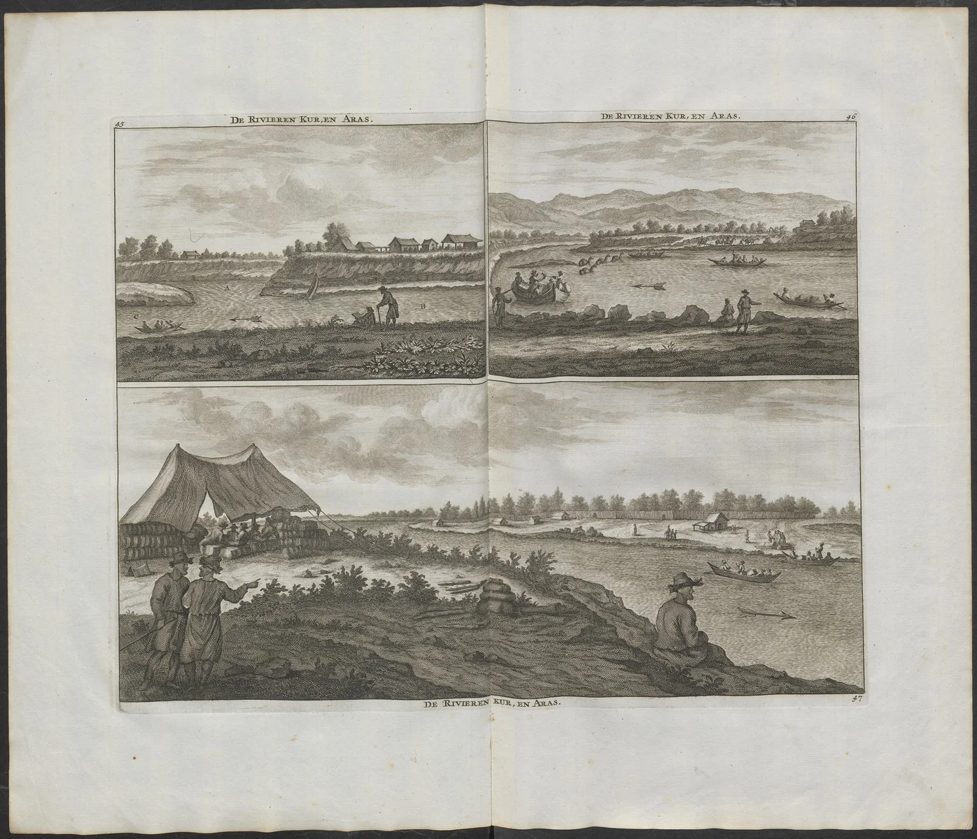
The Kura River is the longest river in Azerbaijan and runs for over 1,500 kilometers.
The water starts in Turkey and flows through Georgia before entering central lowlands of Azerbaijan.
This big river basin covers eighty percent of all land in the country.
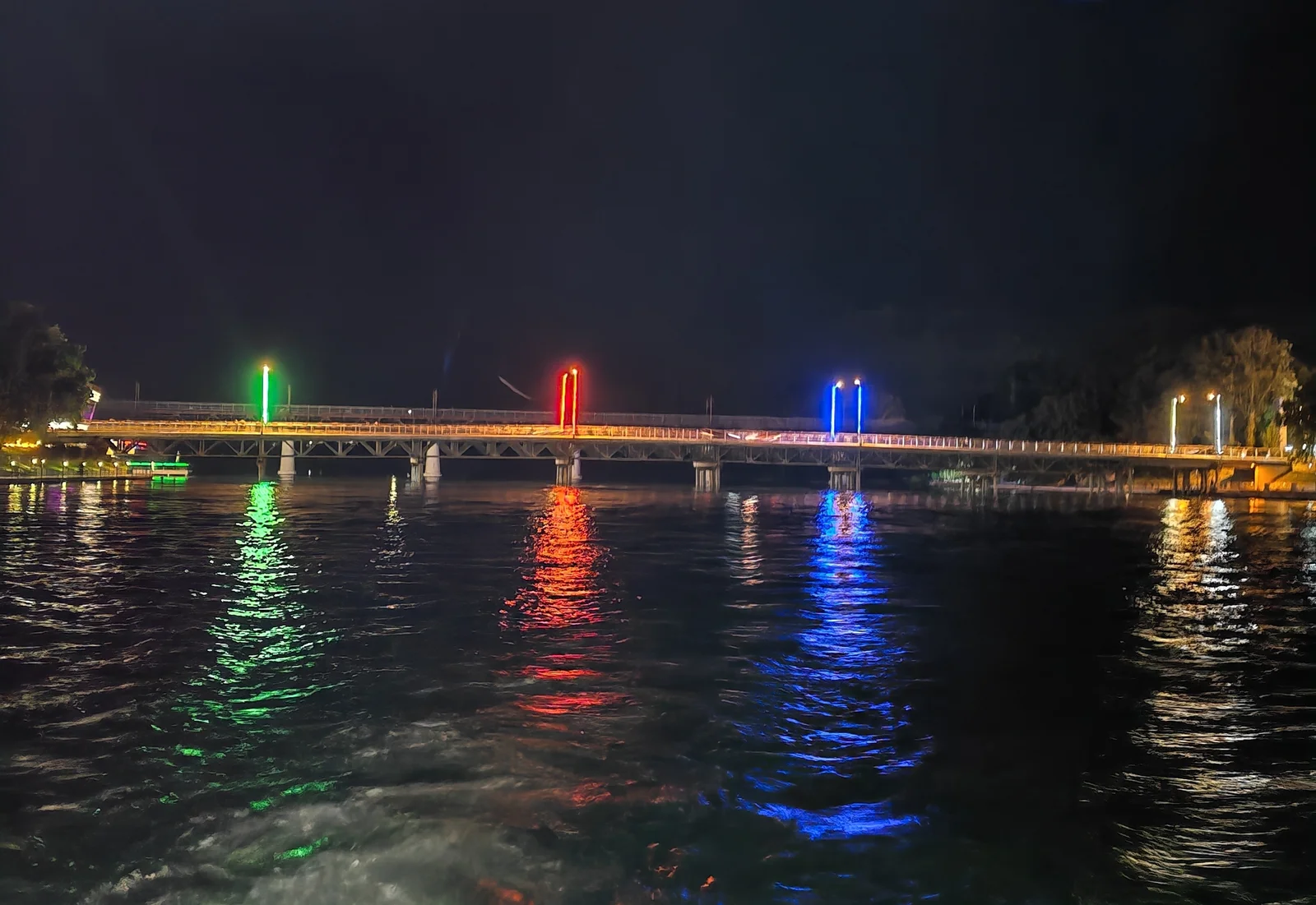
At the town of Sabirabad the wide Aras river joins the Kura River.
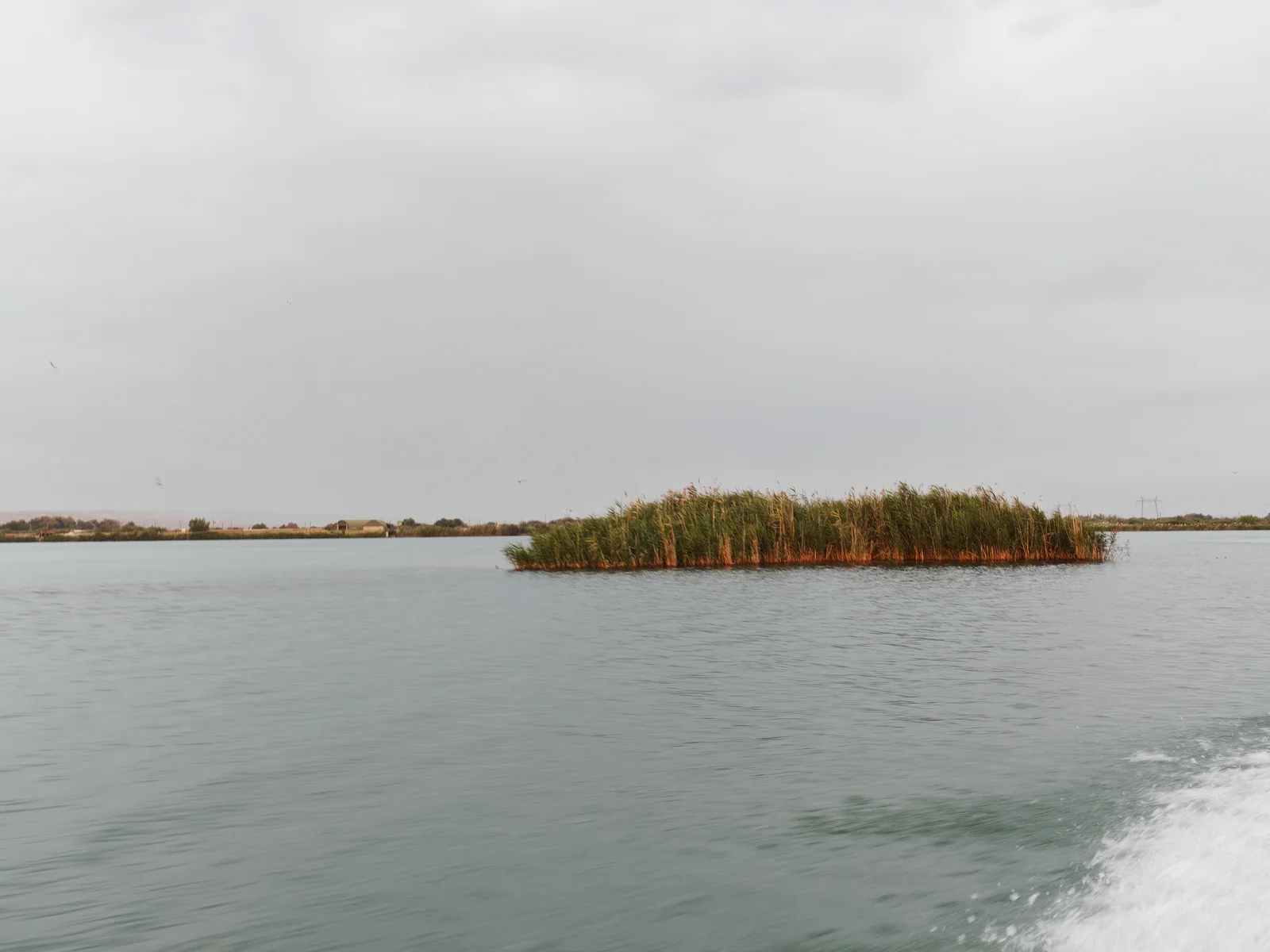
The river passes the flat Salyan plain and enters the Caspian Sea near Neftchala.
Cold mountain snow and seasonal rain give fresh water to this wide river.
The Big Water Dam at Mingachevir
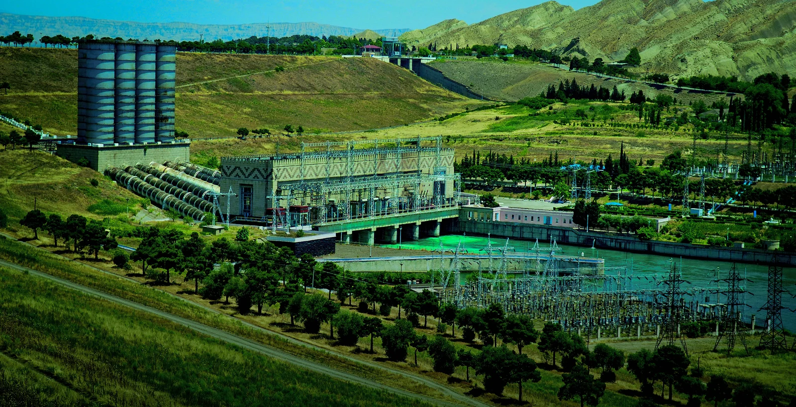
Workers built the big Mingachevir dam in 1953 to hold billions of water.
Local people call this giant lake the Mingachevir Sea because it stops big spring floods.
The power station at the dam makes clean renewable electricity for many homes.
Two long water canals carry river water to large green farm fields.
Sand and river mud collect behind the tall dam over many years.
Operators open gates in dry summer months to keep clean river water flowing.
Water for Farms and Growing Towns
River water helps farmers grow seventy percent of crops like white cotton and sweet fruits.
Large pumping stations and concrete channels send water across flat farm fields.
Hot summer sun dries wet soil so workers build deep drainage ditches against salt.
City plants clean the river water so people have safe drinking water at home.
Village water user groups work together so every family gets a fair share.
Modern farms put in black drip pipes to save water in dry fields.
Sharing Water Across the Border
Most fresh river water comes from outside national borders into Azerbaijan.
Leaders join international meetings to talk about good river rules and care.
Teams from Azerbaijan and Georgia check the water together for factory pollution.
Automated stations on the border test the water quality day and night.
Warm weather and smaller mountain snow mean everyone must save more river water.
Special protected wetlands near the river mouth keep rare Caspian sturgeon fish safe.
A2 · Elementary
Kura River Basin and Water Management in Azerbaijan
River geography, the Mingachevir reservoir, agricultural irrigation systems, and transboundary water agreements.
Hydrological Geography and River Drainage Course
The Kura River is the primary drainage artery of Azerbaijan, spanning a course of 1,500 kilometers.
Rising in Turkey, the river flows across Georgia before entering the central lowlands of Azerbaijan.
The domestic catchment of the Kura basin covers eighty percent of Azerbaijan's national territory.
At the lowland city of Sabirabad, the Kura meets its principal tributary, the Aras River.
The river cuts across the Salyan plain before forming a delta into the Caspian Sea near Neftchala.
Caucasus mountain meltwater and seasonal rains provide essential hydrological recharge for the river.
The Mingachevir Reservoir and Hydraulic Infrastructure
Commissioned in 1953, the Mingachevir Reservoir forms the largest artificial lake in the Caucasus region.
Known as the Mingachevir Sea, the reservoir moderates spring flood surges and protects downstream lowlands.
The Mingachevir Hydroelectric Power Station produces dependable renewable electricity for the national grid.
The Upper Garabagh Canal and Upper Shirvan Canal distribute irrigation water to fertile agricultural farmlands.
River sediment accumulation behind the earthen dam requires regular bathymetric surveying by engineers.
Controlled water releases maintain baseline environmental flows down the riverbed during hot summer weeks.
Agricultural Irrigation Networks and Municipal Water Supply
The Kura River basin sustains seventy percent of irrigated agriculture, including vital cotton and wheat fields.
State agencies operate pumping stations, aqueducts, and concrete drainage canals across the central plain.
Intense summer evaporation requires careful collector-drainage maintenance to stop soil salinization.
Treatment plants purify river water to deliver dependable municipal potable water to growing towns.
Community water user associations coordinate seasonal irrigation schedules to prevent regional water disputes.
Farming enterprises install pressurized pipelines and drip irrigation equipment to eliminate conveyance losses.
Transboundary Basin Cooperation and Environmental Protection
Because seventy percent of surface water originates outside frontiers, transboundary cooperation is vital for water security.
Azerbaijan participates in the UNECE Water Convention dialogue to coordinate cross-border river governance.
Environmental specialists in Azerbaijan and Georgia monitor river quality and industrial wastewater discharges.
Automated frontier monitoring stations record water volume and chemical quality along transboundary borders.
Changing climate conditions and shrinking glaciers reduce summer river runoff across the South Caucasus.
Conservation initiatives protect river mouth wetlands and maintain spawning grounds for endangered sturgeon.
B1 · Intermediate
Kura River Basin and Water Governance in Azerbaijan
South Caucasus river hydrology, Mingachevir reservoir regulation, agricultural canal systems, and transboundary water diplomacy.
Hydrological Trajectory and South Caucasus Drainage Systems
Extending over 1,500 kilometers, the Kura River serves as the primary drainage artery of the South Caucasus.
Originating in northeastern Turkey, the river winds through Georgia before traversing central lowlands toward the Caspian.
The domestic catchment of the Kura basin encompasses sixty-eight thousand square kilometers, covering eighty percent of Azerbaijan.
Near Sabirabad, the river converges with its largest tributary, the Aras, unifying the two major regional watersheds.
Flowing across the fertile Salyan plain, the waterway discharges into the Caspian Sea near Neftchala through a broad delta.
Caucasus glacial meltwater, spring rainfall, and subterranean springs supply the continuous hydrological recharge of the system.
The Mingachevir Reservoir Complex and Flood Mitigation
Engineers completed the monumental Mingachevir Dam in 1953, creating an artificial reservoir holding fifteen billion cubic meters.
Popularly dubbed the Mingachevir Sea, the sixty-kilometer reservoir moderates spring flood crests that historically submerged downstream towns.
Turbines at the Mingachevir Hydroelectric Station deliver substantial clean electrical energy directly into the national power grid.
The Upper Garabagh and Upper Shirvan canals branch from the reservoir, directing vital water toward vast agricultural farmlands.
Ongoing river silt accumulation behind the dam structure requires systematic bathymetric surveying to track storage volume.
Scheduled water releases guarantee necessary baseline flows along the downstream river channel during arid summer periods.
Irrigation Infrastructure, Soil Management, and Urban Supply
The river network supplies seventy percent of national irrigation water, supporting extensive cotton, cereal, and vineyard acreage.
Water authorities manage a vast network of heavy pumping stations, concrete aqueducts, and deep drainage collectors.
Intense summer heat causes rapid water evaporation, necessitating collector-drainage channels to prevent agricultural soil salinization.
Sophisticated municipal filtration facilities process raw river water to furnish reliable potable water for urban residents.
Local water user associations organize seasonal water distribution rosters among farmers to resolve allocation disagreements.
Agricultural operators modernize older earthen irrigation ditches with pressurized tubes and targeted drip-delivery systems.
Cross-Border River Cooperation and Ecological Conservation
With more than seventy percent of its river flows originating beyond national borders, Azerbaijan prioritizes transboundary water security.
The country takes an active part in the UNECE Water Convention National Policy Dialogue to refine river governance standards.
Joint monitoring teams from Azerbaijan and Georgia observe upstream factory discharges and municipal sewage levels in the river.
Automated frontier sensor stations sample incoming river currents around the clock to detect hazardous chemical contaminants.
Receding Caucasian mountain snowpacks and hotter drought seasons decrease summer river volume, underscoring water conservation goals.
Government environmental programs safeguard coastal delta wetlands to preserve vital spawning grounds for Caspian sturgeon.
B2 · Upper Intermediate
Kura River Basin and Water Governance in Azerbaijan
Regional hydrological networks, Mingachevir hydraulic infrastructure, agricultural drainage, and transboundary water diplomacy.
Regional Fluvial Dynamics and Basin Drainage Architecture
Flowing for more than 1,500 kilometers across three nations, the Kura River constitutes the primary hydrological artery of Azerbaijan.
After rising in northeastern Turkey and crossing eastern Georgia, the river bisects the broad central lowlands of Azerbaijan.
The domestic catchment basin encompasses sixty-eight thousand square kilometers, accounting for eighty percent of sovereign Azerbaijani territory.
At Sabirabad, the river absorbs its principal tributary, the Aras, consolidating the northern and southern drainage systems of the Caucasus.
The consolidated fluvial channel navigates the Salyan plain before debouching into the Caspian Sea near Neftchala via an expansive delta.
Perennial glacial meltwater from Caucasus mountain crests and subterranean aquifers furnish vital hydrological recharge to the riverbed.
The Mingachevir Reservoir and Hydraulic Regulation
Constructed in 1953, the Mingachevir Reservoir represents the largest artificial water body in the Caucasus, storing fifteen billion cubic meters.
Affectionately known as the Mingachevir Sea, the sixty-kilometer reservoir buffers spring flood surges to protect downstream settlements.
The facility incorporates the Mingachevir Hydroelectric Power Station, generating crucial renewable electrical capacity for the national grid.
Two massive conduits, the Upper Garabagh Canal and Upper Shirvan Canal, divert regulated reservoir water to hundreds of thousands of hectares.
Progressive sediment accumulation behind the earthen barrier reduces reservoir storage, prompting periodic bathymetric sounding surveys.
Engineered discharge releases preserve mandatory ecological baseline flows throughout the lower river corridor during summer heatwaves.
Irrigation Engineering, Salinity Mitigation, and Potable Delivery
The Kura drainage network supports more than seventy percent of domestic irrigated farming, anchoring national cotton and grain output.
The State Water Resources Agency operates extensive lifting pump stations, concrete-lined aqueducts, and deep drainage networks across the plains.
Severe surface evaporation across arid lowlands requires robust collector-drainage networks to combat destructive soil salinization.
Municipal water utility complexes draw river volume, applying multi-stage purification protocols to generate safe potable drinking supplies.
Community water user associations mediate seasonal volume allocations among farming collectives to prevent local distribution friction.
Irrigation operators systematically replace unlined earthen channels with pressurized subterranean piping and precision drip equipment.
Transboundary Water Diplomacy and Delta Ecosystem Resilience
Because over seventy percent of national freshwater volume originates beyond external borders, transboundary cooperation is vital for water security.
Azerbaijan collaborates within the UNECE Water Convention National Policy Dialogue to harmonize regional catchment management principles.
Bilateral environmental task forces in Azerbaijan and Georgia monitor upstream industrial wastewater and municipal effluents entering the Kura.
High-precision automated testing posts positioned at frontier crossings deliver real-time data regarding transboundary chemical contamination.
Accelerating glacier retreat and diminishing snowpack in the Greater Caucasus curtail summer runoff, necessitating rigorous conservation.
Targeted conservation initiatives protect estuarine wetland sanctuaries in the Kura delta to support endangered Caspian sturgeon stocks.
C1 · Advanced
Kura River Basin and Water Governance in Azerbaijan
South Caucasus river hydrology, the Mingachevir reservoir, agricultural drainage infrastructure, and transboundary water diplomacy.
Hydrological Morphology and Continental Drainage Dynamics
Spanning a course of over 1,500 kilometers, the Kura River functions as the paramount fluvial artery of the South Caucasus drainage basin.
Beginning on the high plateaus of northeastern Turkey, the river flows across Georgia before entering Azerbaijan to traverse central lowlands.
The national catchment encompasses sixty-eight thousand square kilometers, comprising eighty percent of Azerbaijan's sovereign territorial expanse.
At the historic river junction of Sabirabad, the Kura merges with its principal tributary, the Aras, uniting at a monumental confluence.
Downstream, the unified river meanders through the Salyan plain before forming an expansive estuary delta discharging into the Caspian near Neftchala.
The perennial river volume relies upon seasonal snowmelt, subterranean aquifers, and rainfall to maintain continuous hydrological recharge.
The Mingachevir Hydraulic Complex and River Regulation
Completed in 1953, the Mingachevir impoundment represents the largest artificial water reservoir in the Caucasus with fifteen billion cubic meters.
Locally designated the Mingachevir Sea, the sixty-kilometer reservoir moderates catastrophic spring flood inundation across downstream valleys.
An integrated hydroelectric power station utilizes hydraulic pressure to generate baseload renewable electricity for the national grid.
The Upper Garabagh and Upper Shirvan canals establish a vital irrigation diversion network that waters hundreds of thousands of hectares.
Decades of river sedimentation behind the earthen barrage reduce useful capacity, requiring continuous bathymetric surveying.
Controlled discharge protocols ensure that adequate ecological baseline flows sustain downstream aquatic habitats during dry summer cycles.
Irrigation Infrastructure, Agrarian Security, and Municipal Supply
The Kura drainage basin underpins more than seventy percent of national irrigated cultivation, fostering extensive cotton and grain farming.
The State Water Resources Agency administers an immense network of high-volume pump stations, concrete-lined aqueduct routes, and collectors.
High summer temperatures accelerate surface water evaporation, compelling managers to maintain drainage canals to avert severe soil salinization.
Modern treatment installations subject raw river volume to multi-stage water purification before delivering safe potable water to cities.
Democratic water user associations coordinate seasonal allocation quotas among agricultural communities to ensure equitable resource sharing.
Infrastructure modernization initiatives replace porous earthen ditches with pressurized closed conduits to eliminate conveyance loss.
Transboundary Basin Governance and Riparian Conservation
Given that over seventy percent of national freshwater resources originate beyond sovereign frontiers, transboundary cooperation is vital for water security.
Azerbaijan participates in the UNECE Water Convention National Policy Dialogue to advance international water stewardship standards.
Bilateral cooperation protocols with Georgia enable environmental inspectors to sample and quantify upstream industrial effluent discharges.
Automated hydrological monitoring posts positioned along the frontier provide instantaneous alerts regarding transboundary chemical contamination.
Accelerating glacial recession and shifting Caucasian precipitation regimes diminish seasonal river discharge, emphasizing water efficiency.
National conservation programs protect the delicate wetland marshes of the Kura delta to safeguard vital breeding havens for sturgeon.
C2 · Mastery
Kura River Basin and Water Governance in Azerbaijan
South Caucasus river hydrology, the Mingachevir reservoir, agricultural drainage infrastructure, and transboundary water diplomacy.
Hydrological Morphology and Continental Drainage Dynamics
Extending over 1,500 kilometers across the South Caucasus, the Kura River serves as the dominant fluvial drainage axis of Azerbaijan.
Originating in high Anatolian wetlands, the river bisects Georgian topography before traversing the arid central lowlands of Azerbaijan.
The national catchment incorporates sixty-eight thousand square kilometers, comprising eighty percent of Azerbaijan's sovereign watershed.
At the inland confluence of Sabirabad, the river absorbs its principal tributary, the Aras, consolidating regional drainage networks.
Traversing the Salyan plain, the waterway generates an expansive alluvial delta before discharging into the Caspian Sea near Neftchala.
Caucasian snowpack ablation, subterranean discharge, and seasonal storms govern the perennial hydrology of the drainage system.
The Mingachevir Hydraulic Complex and River Regulation
Engineered in 1953, the monumental Mingachevir impoundment retains fifteen billion cubic meters, forming the largest reservoir in the Caucasus.
Designated the Mingachevir Sea, the sixty-kilometer water body acts to attenuate violent spring flood crests that historically plagued the plains.
The installation operates a multi-megawatt turbine powerhouse, providing crucial baseload renewable power to the national grid.
The Upper Garabagh and Upper Shirvan arteries serve as the principal conduit network delivering irrigation water to distant farmlands.
Decades of upstream bedload siltation necessitate regular bathymetric profiling to calibrate active storage volume behind the dam.
Regulated gate discharge safeguards downstream ecological equilibrium across riparian floodplains during searing summer droughts.
Irrigation Engineering, Salinity Mitigation, and Potable Delivery
The Kura drainage network supports more than seventy percent of national arable cultivation, sustaining intensive cotton and grain yields.
The State Water Resources Agency oversees comprehensive infrastructure including high-volume lift stations, aqueducts, and collectors.
Extreme summer evaporation prompts severe capillary salt drawing, requiring collector-drainage networks to combat destructive salinization.
Municipal water filtration installations process raw river water to furnish reliable potable supplies for expanding urban populations.
Local water user associations administer participatory water governance, balancing seasonal withdrawal demands among agrarian districts.
Technicians progressively replace unlined earthen ditches with pressurized subsurface tubing to curb conveyance dissipation.
Transboundary Basin Governance and Riparian Conservation
Because over seventy percent of domestic runoff originates outside sovereign frontiers, proactive diplomacy underpins national water security.
The republic leverages the UNECE Water Convention National Policy Dialogue to harmonize river governance standards and regulatory codes.
Joint monitoring protocols with Georgia enable bilateral authorities to track upstream industrial effluent discharges into the Kura.
Frontier monitoring posts equipped with automated sensors track hydrometric volume and detect sudden transboundary chemical contamination.
Shrinking Caucasian glaciers and shifting precipitation dynamics reduce summer river volume, requiring comprehensive water conservation.
State biodiversity initiatives protect estuarine delta wetlands to conserve irreplaceable riverine spawning beds for Caspian sturgeon.
Check your understanding
Choose how closely you want to revisit the article. You can refer back while answering, and review explanations when you finish.
Quick Quiz A1
Try one question, then create a free account for the full Quick Quiz. Sign Up Free
Answer every question before checking. There is no time limit.
Your results
/ 1 correct (%)
Read the explanations to see how each answer connects to the article.
-
What total length does the Kura River span as the longest river in Azerbaijan?
1. Answer:
Quick Quiz A2
Try one question, then create a free account for the full Quick Quiz. Sign Up Free
Answer every question before checking. There is no time limit.
Your results
/ 1 correct (%)
Read the explanations to see how each answer connects to the article.
-
What total length does the Kura River span as the longest river in Azerbaijan?
1. Answer:
Quick Quiz B1
Try one question, then create a free account for the full Quick Quiz. Sign Up Free
Answer every question before checking. There is no time limit.
Your results
/ 1 correct (%)
Read the explanations to see how each answer connects to the article.
-
What total length does the Kura River span as the longest river in Azerbaijan?
1. Answer:
Quick Quiz B2
Try one question, then create a free account for the full Quick Quiz. Sign Up Free
Answer every question before checking. There is no time limit.
Your results
/ 1 correct (%)
Read the explanations to see how each answer connects to the article.
-
What total length does the Kura River span as the longest river in Azerbaijan?
1. Answer:
Quick Quiz C1
Try one question, then create a free account for the full Quick Quiz. Sign Up Free
Answer every question before checking. There is no time limit.
Your results
/ 1 correct (%)
Read the explanations to see how each answer connects to the article.
-
What total length does the Kura River span as the longest river in Azerbaijan?
1. Answer:
Quick Quiz C2
Try one question, then create a free account for the full Quick Quiz. Sign Up Free
Answer every question before checking. There is no time limit.
Your results
/ 1 correct (%)
Read the explanations to see how each answer connects to the article.
-
What total length does the Kura River span as the longest river in Azerbaijan?
1. Answer:
