A1 · Beginner
Doñana Wetlands: Water, Birds, and Farmland in Spain
Doñana National Park protects large marshes and lakes where river waters meet sandy dunes and berry farms in southern Spain.
Hydrology and Ecology of the Guadalquivir Marshes
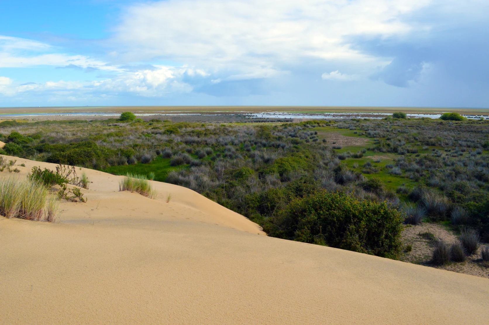
Doñana National Park is a large natural park in Andalusia. It covers over one hundred thousand hectares across Huelva, Seville, and Cádiz provinces. The park sits where the Guadalquivir River flows into the Atlantic Ocean. Winter rains flood the low clay beds and create shallow lagoons for millions of birds.
Small shallow lakes called lucios get fresh water from streams like Arroyo de la Rocina. Tall sand dunes move inland each year and protect the lagoons from ocean winds. The surface lagoons connect directly to underground water in the Almonte-Marismas aquifer.
Intensive Berry Cultivation and Aquifer Pressures
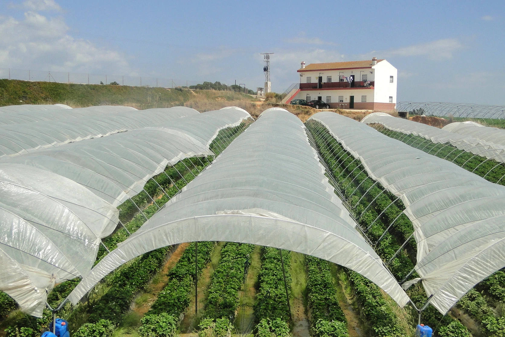
The farms around Doñana grow over ninety percent of Spain's strawberries and blueberries. Workers pick fruit inside eleven thousand hectares of plastic greenhouses. These berry crops need lots of water, which farmers pump from the underground aquifer.
Water managers say several parts of the underground aquifer are in poor condition. Scientists report that fifty-nine percent of the permanent lagoons have dried out. Water police inspect the farms and close down illegal wells to protect the park.
Estuary Management and Downstream Water Demands
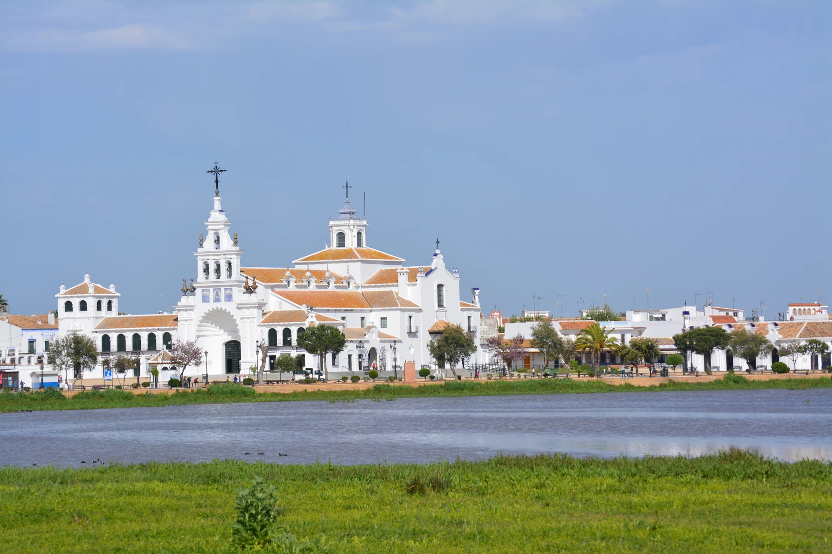
Near the mouth of the river, farmers grow rice across thirty-six thousand hectares of wet fields. During dry years, salty sea water flows up the river and threatens crop fields. Ships also travel up the river channel to reach the Port of Seville.
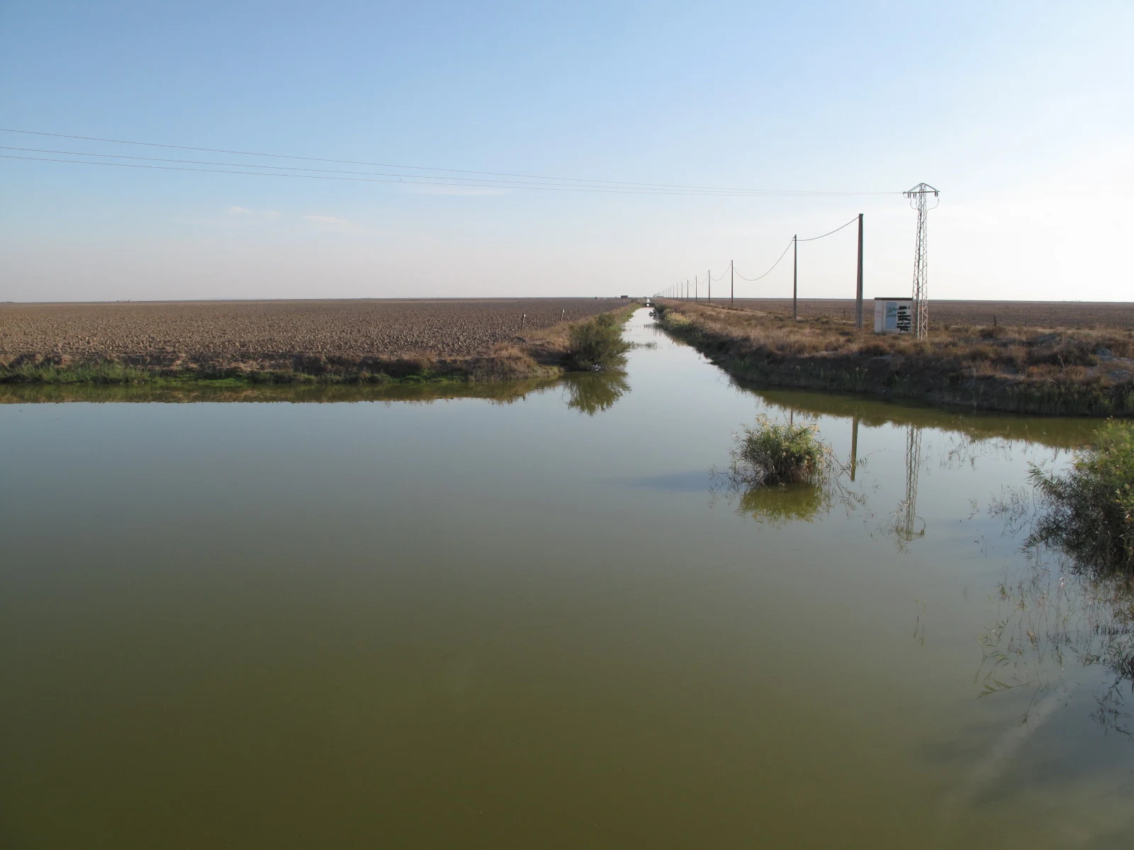
Large water gates help control the mix of fresh water and salt water in the farm canals. The river mouth provides a safe nursery for young fish and shrimp. Upstream on the Guadiamar River, teams test water and soil to clean up old mining pollution.
Ecological Restoration, Legal Mandates, and Transition Plans
A European court ruled that Spain must protect the underground water of Doñana. The government approved over 350 million euros to restore the natural wetlands. Workers reconnect old river channels to bring fresh water back to the marshes.
The government pays farmers money if they stop pumping water or plant trees instead of berries. Automatic test stations measure water levels in the ground every day. Satellites and sensors watch the fields to make sure farms follow water rules.
A2 · Elementary
Doñana Wetlands: Groundwater Demands and Lagoon Conservation
Seasonal marshes, underground aquifers, and soft fruit irrigation shape the ecological balance of Doñana National Park.
Hydrology and Ecology of the Guadalquivir Marshes
Official environmental records confirm that Doñana National Park encompasses over one hundred thousand hectares of marshland, coastal dunes, and Mediterranean scrubland across Huelva, Seville, and Cádiz provinces. Situated at the estuary of the Guadalquivir River along the Atlantic littoral zone, this protected wetland ecosystem constitutes a UNESCO World Heritage site of remarkable geomorphology and biodiversity. Seasonal precipitation floods the impermeable clay marsh beds each winter, generating shallow freshwater lagoons with an extended hydroperiod that host millions of migratory waterfowl traveling between Europe and Africa.
Within this dynamic ecotone, shallow seasonal water bodies known as lucios depend heavily on surface runoff from regional watercourses including Arroyo de la Rocina and Caño del Guadiamar. Shifting coastal sand dunes migrate several meters inland each year across mobile dune ridges, burying pine forests while sheltering interior marsh lagoons from open maritime winds. Complex hydrogeology creates direct connectivity between surface marsh pools and the vast subterranean Almonte-Marismas aquifer system underlying the entire littoral reserve.
Intensive Berry Cultivation and Aquifer Pressures
Surrounding the national park, the agricultural perimeter of Huelva produces over ninety percent of Spain's commercial strawberries and blueberries for European markets, creating a lucrative agro-industrial sector. Soft fruit cultivation occupies approximately eleven thousand hectares of intensive polytunnel plastic greenhouses across the northern forestry belt, transforming the regional landscape. This intensive farming relies on heavy crop irrigation that draws substantial groundwater volumes from the Almonte-Marismas aquifer through thousands of permitted and unpermitted borehole wells.
Severe overabstraction has led river basin authorities to formally declare several groundwater bodies within the Almonte-Marismas system to be in poor quantitative condition. Scientific monitoring by the Estación Biológica de Doñana reveals that fifty-nine percent of the park's permanent lagoons have desiccated or dried out completely due to anthropogenic water extraction and prolonged regional droughts. In response to extreme desiccation, river basin enforcement police conduct regular inspections, executing administrative closures and judicial sealing of illegal borehole installations.
Estuary Management and Downstream Water Demands
Downstream from the berry farms, agricultural users along the lower Guadalquivir basin cultivate thirty-six thousand hectares of flooded rice paddies that depend on reliable freshwater drainage and canal deliveries. Upstream water diversions combined with extended drought cycles accelerate saline intrusion from the Atlantic Ocean, turning freshwater stretches into brackish tidal channels and accelerating salinization of agricultural irrigation intake points. Periodic maintenance dredging along the commercial navigation channel to the Port of Seville further alters riparian riverbed tidal dynamics and sediment dispersion.
Coordinated sluice gates and irrigation canal regulators control the seasonal mixing of freshwater runoff with tidal marine water across low-lying agricultural drainage networks. The estuary also functions as an indispensable biological nursery habitat where local fishing communities harvest juvenile European sea bass, white shrimp, and anchovies that serve as a critical ecological bio-indicator. Farther upstream, continuous environmental monitoring along the Guadiamar River green corridor tracks heavy metal remediation following the historic 1998 Aznalcóllar mine reservoir breach.
Ecological Restoration, Legal Mandates, and Transition Plans
Environmental jurisprudence reached a turning point in 2021 when the Court of Justice of the European Union ruled that Spain violated the Water Framework Directive by failing to prevent groundwater depletion in Doñana. In response, the central government approved the Marco de Actuaciones para Doñana, establishing an investment commitment exceeding 350 million euros for comprehensive ecological restoration and regional economic transition. Restoration initiatives reconnect natural tributary channels, such as Caño Travieso, to reinstate historical surface freshwater inflows into the northern marshland.
Public financial incentives encourage commercial growers to voluntarily abandon intensive berry irrigation, convert cultivated parcels to rainfed farming, or participate in permanent reforestation programs to reduce water quota demands. Concurrently, an automated piezometer network and piezometric monitoring stations continuously record groundwater hydraulic head levels across more than three hundred hydrological test stations. Advanced satellite remote sensing, telemetry data feeds, and telemetric sensors track unauthorized surface diversions in real time, ensuring strict compliance with sustainable hydrology standards.
B1 · Intermediate
Doñana Wetlands: Agricultural Borders and Aquifer Pressures
Balancing intensive strawberry irrigation with wetland preservation along the Guadalquivir estuary tests Spanish water governance.
Hydrology and Ecology of the Guadalquivir Marshes
Official environmental records confirm that Doñana National Park encompasses over one hundred thousand hectares of marshland, coastal dunes, and Mediterranean scrubland across Huelva, Seville, and Cádiz provinces. Situated at the estuary of the Guadalquivir River along the Atlantic littoral zone, this protected wetland ecosystem constitutes a UNESCO World Heritage site of remarkable geomorphology and biodiversity. Seasonal precipitation floods the impermeable clay marsh beds each winter, generating shallow freshwater lagoons with an extended hydroperiod that host millions of migratory waterfowl traveling between Europe and Africa.
Within this dynamic ecotone, shallow seasonal water bodies known as lucios depend heavily on surface runoff from regional watercourses including Arroyo de la Rocina and Caño del Guadiamar. Shifting coastal sand dunes migrate several meters inland each year across mobile dune ridges, burying pine forests while sheltering interior marsh lagoons from open maritime winds. Complex hydrogeology creates direct connectivity between surface marsh pools and the vast subterranean Almonte-Marismas aquifer system underlying the entire littoral reserve.
Intensive Berry Cultivation and Aquifer Pressures
Surrounding the national park, the agricultural perimeter of Huelva produces over ninety percent of Spain's commercial strawberries and blueberries for European markets, creating a lucrative agro-industrial sector. Soft fruit cultivation occupies approximately eleven thousand hectares of intensive polytunnel plastic greenhouses across the northern forestry belt, transforming the regional landscape. This intensive farming relies on heavy crop irrigation that draws substantial groundwater volumes from the Almonte-Marismas aquifer through thousands of permitted and unpermitted borehole wells.
Severe overabstraction has led river basin authorities to formally declare several groundwater bodies within the Almonte-Marismas system to be in poor quantitative condition. Scientific monitoring by the Estación Biológica de Doñana reveals that fifty-nine percent of the park's permanent lagoons have desiccated or dried out completely due to anthropogenic water extraction and prolonged regional droughts. In response to extreme desiccation, river basin enforcement police conduct regular inspections, executing administrative closures and judicial sealing of illegal borehole installations.
Estuary Management and Downstream Water Demands
Downstream from the berry farms, agricultural users along the lower Guadalquivir basin cultivate thirty-six thousand hectares of flooded rice paddies that depend on reliable freshwater drainage and canal deliveries. Upstream water diversions combined with extended drought cycles accelerate saline intrusion from the Atlantic Ocean, turning freshwater stretches into brackish tidal channels and accelerating salinization of agricultural irrigation intake points. Periodic maintenance dredging along the commercial navigation channel to the Port of Seville further alters riparian riverbed tidal dynamics and sediment dispersion.
Coordinated sluice gates and irrigation canal regulators control the seasonal mixing of freshwater runoff with tidal marine water across low-lying agricultural drainage networks. The estuary also functions as an indispensable biological nursery habitat where local fishing communities harvest juvenile European sea bass, white shrimp, and anchovies that serve as a critical ecological bio-indicator. Farther upstream, continuous environmental monitoring along the Guadiamar River green corridor tracks heavy metal remediation following the historic 1998 Aznalcóllar mine reservoir breach.
Ecological Restoration, Legal Mandates, and Transition Plans
Environmental jurisprudence reached a turning point in 2021 when the Court of Justice of the European Union ruled that Spain violated the Water Framework Directive by failing to prevent groundwater depletion in Doñana. In response, the central government approved the Marco de Actuaciones para Doñana, establishing an investment commitment exceeding 350 million euros for comprehensive ecological restoration and regional economic transition. Restoration initiatives reconnect natural tributary channels, such as Caño Travieso, to reinstate historical surface freshwater inflows into the northern marshland.
Public financial incentives encourage commercial growers to voluntarily abandon intensive berry irrigation, convert cultivated parcels to rainfed farming, or participate in permanent reforestation programs to reduce water quota demands. Concurrently, an automated piezometer network and piezometric monitoring stations continuously record groundwater hydraulic head levels across more than three hundred hydrological test stations. Advanced satellite remote sensing, telemetry data feeds, and telemetric sensors track unauthorized surface diversions in real time, ensuring strict compliance with sustainable hydrology standards.
B2 · Upper Intermediate
Hydrogeology and Ecological Conflict in the Doñana Marshlands
Aquifer overabstraction, judicial well closures, and estuarine salinity dynamics govern the environmental landscape of Doñana.
Hydrology and Ecology of the Guadalquivir Marshes
Official environmental records confirm that Doñana National Park encompasses over one hundred thousand hectares of marshland, coastal dunes, and Mediterranean scrubland across Huelva, Seville, and Cádiz provinces. Situated at the estuary of the Guadalquivir River along the Atlantic littoral zone, this protected wetland ecosystem constitutes a UNESCO World Heritage site of remarkable geomorphology and biodiversity. Seasonal precipitation floods the impermeable clay marsh beds each winter, generating shallow freshwater lagoons with an extended hydroperiod that host millions of migratory waterfowl traveling between Europe and Africa.
Within this dynamic ecotone, shallow seasonal water bodies known as lucios depend heavily on surface runoff from regional watercourses including Arroyo de la Rocina and Caño del Guadiamar. Shifting coastal sand dunes migrate several meters inland each year across mobile dune ridges, burying pine forests while sheltering interior marsh lagoons from open maritime winds. Complex hydrogeology creates direct connectivity between surface marsh pools and the vast subterranean Almonte-Marismas aquifer system underlying the entire littoral reserve.
Intensive Berry Cultivation and Aquifer Pressures
Surrounding the national park, the agricultural perimeter of Huelva produces over ninety percent of Spain's commercial strawberries and blueberries for European markets, creating a lucrative agro-industrial sector. Soft fruit cultivation occupies approximately eleven thousand hectares of intensive polytunnel plastic greenhouses across the northern forestry belt, transforming the regional landscape. This intensive farming relies on heavy crop irrigation that draws substantial groundwater volumes from the Almonte-Marismas aquifer through thousands of permitted and unpermitted borehole wells.
Severe overabstraction has led river basin authorities to formally declare several groundwater bodies within the Almonte-Marismas system to be in poor quantitative condition. Scientific monitoring by the Estación Biológica de Doñana reveals that fifty-nine percent of the park's permanent lagoons have desiccated or dried out completely due to anthropogenic water extraction and prolonged regional droughts. In response to extreme desiccation, river basin enforcement police conduct regular inspections, executing administrative closures and judicial sealing of illegal borehole installations.
Estuary Management and Downstream Water Demands
Downstream from the berry farms, agricultural users along the lower Guadalquivir basin cultivate thirty-six thousand hectares of flooded rice paddies that depend on reliable freshwater drainage and canal deliveries. Upstream water diversions combined with extended drought cycles accelerate saline intrusion from the Atlantic Ocean, turning freshwater stretches into brackish tidal channels and accelerating salinization of agricultural irrigation intake points. Periodic maintenance dredging along the commercial navigation channel to the Port of Seville further alters riparian riverbed tidal dynamics and sediment dispersion.
Coordinated sluice gates and irrigation canal regulators control the seasonal mixing of freshwater runoff with tidal marine water across low-lying agricultural drainage networks. The estuary also functions as an indispensable biological nursery habitat where local fishing communities harvest juvenile European sea bass, white shrimp, and anchovies that serve as a critical ecological bio-indicator. Farther upstream, continuous environmental monitoring along the Guadiamar River green corridor tracks heavy metal remediation following the historic 1998 Aznalcóllar mine reservoir breach.
Ecological Restoration, Legal Mandates, and Transition Plans
Environmental jurisprudence reached a turning point in 2021 when the Court of Justice of the European Union ruled that Spain violated the Water Framework Directive by failing to prevent groundwater depletion in Doñana. In response, the central government approved the Marco de Actuaciones para Doñana, establishing an investment commitment exceeding 350 million euros for comprehensive ecological restoration and regional economic transition. Restoration initiatives reconnect natural tributary channels, such as Caño Travieso, to reinstate historical surface freshwater inflows into the northern marshland.
Public financial incentives encourage commercial growers to voluntarily abandon intensive berry irrigation, convert cultivated parcels to rainfed farming, or participate in permanent reforestation programs to reduce water quota demands. Concurrently, an automated piezometer network and piezometric monitoring stations continuously record groundwater hydraulic head levels across more than three hundred hydrological test stations. Advanced satellite remote sensing, telemetry data feeds, and telemetric sensors track unauthorized surface diversions in real time, ensuring strict compliance with sustainable hydrology standards.
C1 · Advanced
Hydrogeological Depletion, Agro-Industry, and River Basin Policy in Doñana
An investigative analysis of aquifer drawdown, European environmental jurisprudence, and wetland restoration in the lower Guadalquivir.
Hydrology and Ecology of the Guadalquivir Marshes
Official environmental records confirm that Doñana National Park encompasses over one hundred thousand hectares of marshland, coastal dunes, and Mediterranean scrubland across Huelva, Seville, and Cádiz provinces. Situated at the estuary of the Guadalquivir River along the Atlantic littoral zone, this protected wetland ecosystem constitutes a UNESCO World Heritage site of remarkable geomorphology and biodiversity. Seasonal precipitation floods the impermeable clay marsh beds each winter, generating shallow freshwater lagoons with an extended hydroperiod that host millions of migratory waterfowl traveling between Europe and Africa.
Within this dynamic ecotone, shallow seasonal water bodies known as lucios depend heavily on surface runoff from regional watercourses including Arroyo de la Rocina and Caño del Guadiamar. Shifting coastal sand dunes migrate several meters inland each year across mobile dune ridges, burying pine forests while sheltering interior marsh lagoons from open maritime winds. Complex hydrogeology creates direct connectivity between surface marsh pools and the vast subterranean Almonte-Marismas aquifer system underlying the entire littoral reserve.
Intensive Berry Cultivation and Aquifer Pressures
Surrounding the national park, the agricultural perimeter of Huelva produces over ninety percent of Spain's commercial strawberries and blueberries for European markets, creating a lucrative agro-industrial sector. Soft fruit cultivation occupies approximately eleven thousand hectares of intensive polytunnel plastic greenhouses across the northern forestry belt, transforming the regional landscape. This intensive farming relies on heavy crop irrigation that draws substantial groundwater volumes from the Almonte-Marismas aquifer through thousands of permitted and unpermitted borehole wells.
Severe overabstraction has led river basin authorities to formally declare several groundwater bodies within the Almonte-Marismas system to be in poor quantitative condition. Scientific monitoring by the Estación Biológica de Doñana reveals that fifty-nine percent of the park's permanent lagoons have desiccated or dried out completely due to anthropogenic water extraction and prolonged regional droughts. In response to extreme desiccation, river basin enforcement police conduct regular inspections, executing administrative closures and judicial sealing of illegal borehole installations.
Estuary Management and Downstream Water Demands
Downstream from the berry farms, agricultural users along the lower Guadalquivir basin cultivate thirty-six thousand hectares of flooded rice paddies that depend on reliable freshwater drainage and canal deliveries. Upstream water diversions combined with extended drought cycles accelerate saline intrusion from the Atlantic Ocean, turning freshwater stretches into brackish tidal channels and accelerating salinization of agricultural irrigation intake points. Periodic maintenance dredging along the commercial navigation channel to the Port of Seville further alters riparian riverbed tidal dynamics and sediment dispersion.
Coordinated sluice gates and irrigation canal regulators control the seasonal mixing of freshwater runoff with tidal marine water across low-lying agricultural drainage networks. The estuary also functions as an indispensable biological nursery habitat where local fishing communities harvest juvenile European sea bass, white shrimp, and anchovies that serve as a critical ecological bio-indicator. Farther upstream, continuous environmental monitoring along the Guadiamar River green corridor tracks heavy metal remediation following the historic 1998 Aznalcóllar mine reservoir breach.
Ecological Restoration, Legal Mandates, and Transition Plans
Environmental jurisprudence reached a turning point in 2021 when the Court of Justice of the European Union ruled that Spain violated the Water Framework Directive by failing to prevent groundwater depletion in Doñana. In response, the central government approved the Marco de Actuaciones para Doñana, establishing an investment commitment exceeding 350 million euros for comprehensive ecological restoration and regional economic transition. Restoration initiatives reconnect natural tributary channels, such as Caño Travieso, to reinstate historical surface freshwater inflows into the northern marshland.
Public financial incentives encourage commercial growers to voluntarily abandon intensive berry irrigation, convert cultivated parcels to rainfed farming, or participate in permanent reforestation programs to reduce water quota demands. Concurrently, an automated piezometer network and piezometric monitoring stations continuously record groundwater hydraulic head levels across more than three hundred hydrological test stations. Advanced satellite remote sensing, telemetry data feeds, and telemetric sensors track unauthorized surface diversions in real time, ensuring strict compliance with sustainable hydrology standards.
C2 · Mastery
Hydrological Governance, Ecohydrology, and Agrarian Transition in Doñana
A critical examination of subterranean hydrodynamics, estuarine ecotones, and socio-ecological restoration agreements in Andalusia.
Hydrology and Ecology of the Guadalquivir Marshes
Official environmental records confirm that Doñana National Park encompasses over one hundred thousand hectares of marshland, coastal dunes, and Mediterranean scrubland across Huelva, Seville, and Cádiz provinces. Situated at the estuary of the Guadalquivir River along the Atlantic littoral zone, this protected wetland ecosystem constitutes a UNESCO World Heritage site of remarkable geomorphology and biodiversity. Seasonal precipitation floods the impermeable clay marsh beds each winter, generating shallow freshwater lagoons with an extended hydroperiod that host millions of migratory waterfowl traveling between Europe and Africa.
Within this dynamic ecotone, shallow seasonal water bodies known as lucios depend heavily on surface runoff from regional watercourses including Arroyo de la Rocina and Caño del Guadiamar. Shifting coastal sand dunes migrate several meters inland each year across mobile dune ridges, burying pine forests while sheltering interior marsh lagoons from open maritime winds. Complex hydrogeology creates direct connectivity between surface marsh pools and the vast subterranean Almonte-Marismas aquifer system underlying the entire littoral reserve.
Intensive Berry Cultivation and Aquifer Pressures
Surrounding the national park, the agricultural perimeter of Huelva produces over ninety percent of Spain's commercial strawberries and blueberries for European markets, creating a lucrative agro-industrial sector. Soft fruit cultivation occupies approximately eleven thousand hectares of intensive polytunnel plastic greenhouses across the northern forestry belt, transforming the regional landscape. This intensive farming relies on heavy crop irrigation that draws substantial groundwater volumes from the Almonte-Marismas aquifer through thousands of permitted and unpermitted borehole wells.
Severe overabstraction has led river basin authorities to formally declare several groundwater bodies within the Almonte-Marismas system to be in poor quantitative condition. Scientific monitoring by the Estación Biológica de Doñana reveals that fifty-nine percent of the park's permanent lagoons have desiccated or dried out completely due to anthropogenic water extraction and prolonged regional droughts. In response to extreme desiccation, river basin enforcement police conduct regular inspections, executing administrative closures and judicial sealing of illegal borehole installations.
Estuary Management and Downstream Water Demands
Downstream from the berry farms, agricultural users along the lower Guadalquivir basin cultivate thirty-six thousand hectares of flooded rice paddies that depend on reliable freshwater drainage and canal deliveries. Upstream water diversions combined with extended drought cycles accelerate saline intrusion from the Atlantic Ocean, turning freshwater stretches into brackish tidal channels and accelerating salinization of agricultural irrigation intake points. Periodic maintenance dredging along the commercial navigation channel to the Port of Seville further alters riparian riverbed tidal dynamics and sediment dispersion.
Coordinated sluice gates and irrigation canal regulators control the seasonal mixing of freshwater runoff with tidal marine water across low-lying agricultural drainage networks. The estuary also functions as an indispensable biological nursery habitat where local fishing communities harvest juvenile European sea bass, white shrimp, and anchovies that serve as a critical ecological bio-indicator. Farther upstream, continuous environmental monitoring along the Guadiamar River green corridor tracks heavy metal remediation following the historic 1998 Aznalcóllar mine reservoir breach.
Ecological Restoration, Legal Mandates, and Transition Plans
Environmental jurisprudence reached a turning point in 2021 when the Court of Justice of the European Union ruled that Spain violated the Water Framework Directive by failing to prevent groundwater depletion in Doñana. In response, the central government approved the Marco de Actuaciones para Doñana, establishing an investment commitment exceeding 350 million euros for comprehensive ecological restoration and regional economic transition. Restoration initiatives reconnect natural tributary channels, such as Caño Travieso, to reinstate historical surface freshwater inflows into the northern marshland.
Public financial incentives encourage commercial growers to voluntarily abandon intensive berry irrigation, convert cultivated parcels to rainfed farming, or participate in permanent reforestation programs to reduce water quota demands. Concurrently, an automated piezometer network and piezometric monitoring stations continuously record groundwater hydraulic head levels across more than three hundred hydrological test stations. Advanced satellite remote sensing, telemetry data feeds, and telemetric sensors track unauthorized surface diversions in real time, ensuring strict compliance with sustainable hydrology standards.
Check your understanding
Choose how closely you want to revisit the article. You can refer back while answering, and review explanations when you finish.
Quick Quiz A1
Try one question, then create a free account for the full Quick Quiz. Sign Up Free
Answer every question before checking. There is no time limit.
Your results
/ 1 correct (%)
Read the explanations to see how each answer connects to the article.
-
In which Spanish region is Doñana National Park located?
1. Answer:
Quick Quiz A2
Try one question, then create a free account for the full Quick Quiz. Sign Up Free
Answer every question before checking. There is no time limit.
Your results
/ 1 correct (%)
Read the explanations to see how each answer connects to the article.
-
How large is Doñana National Park according to official environmental records?
1. Answer:
Quick Quiz B1
Try one question, then create a free account for the full Quick Quiz. Sign Up Free
Answer every question before checking. There is no time limit.
Your results
/ 1 correct (%)
Read the explanations to see how each answer connects to the article.
-
How large is Doñana National Park according to official environmental records?
1. Answer:
Quick Quiz B2
Try one question, then create a free account for the full Quick Quiz. Sign Up Free
Answer every question before checking. There is no time limit.
Your results
/ 1 correct (%)
Read the explanations to see how each answer connects to the article.
-
How large is Doñana National Park according to official environmental records?
1. Answer:
Quick Quiz C1
Try one question, then create a free account for the full Quick Quiz. Sign Up Free
Answer every question before checking. There is no time limit.
Your results
/ 1 correct (%)
Read the explanations to see how each answer connects to the article.
-
How large is Doñana National Park according to official environmental records?
1. Answer:
Quick Quiz C2
Try one question, then create a free account for the full Quick Quiz. Sign Up Free
Answer every question before checking. There is no time limit.
Your results
/ 1 correct (%)
Read the explanations to see how each answer connects to the article.
-
How large is Doñana National Park according to official environmental records?
1. Answer:
