A1 · Beginner
Central Highlands: Cloud Forests and Mountain Water
High mountains catch thick clouds and send clean water through rivers and tunnels to farms across Sri Lanka.
The Hydrological Water Tower and Montane Cloud Forests
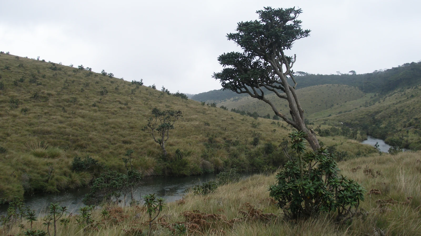
High mountains in central Sri Lanka rise into the clouds and catch heavy rain.
Tall mountain forests catch thick cloud fog and drop clean water into streams.
One hundred and three river streams run down the hills into the wide ocean.
Four large rivers start in the high mountains and give water to family towns.
Thick green moss and dark forest soil soak up flood water like a big sponge.
World leaders protect the high central hills as a famous natural park.
Hydroelectric Cascades and Reservoir Networks
Fast mountain rivers turn big turbine wheels to make clean electricity.
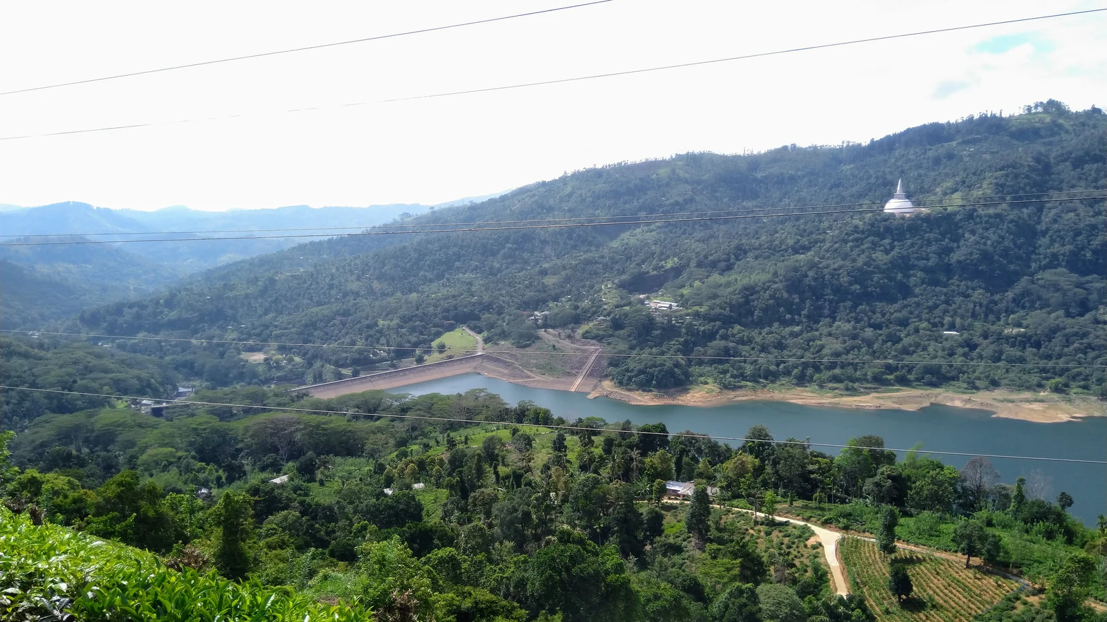
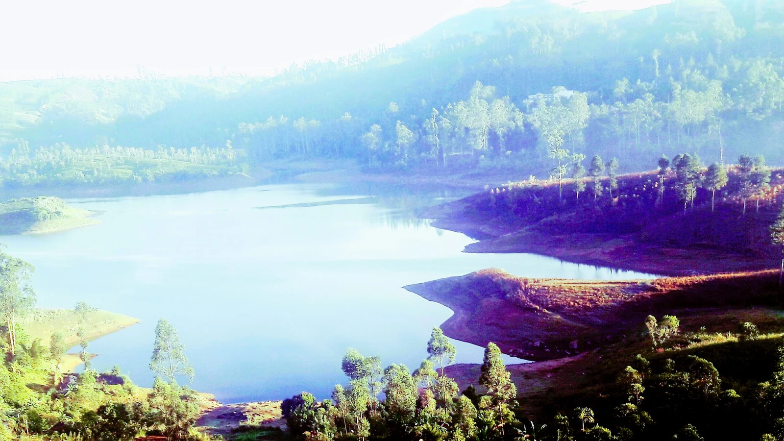
Big lakes like Castlereagh hold mountain water between steep green hills.
Deep mountain reservoirs store water to make power and feed dry farm fields.
Electronic meters send water height numbers to the central city control room.
Water power from the mountains makes more than thirty percent of all home energy.
Workers open dam sluice gates to wash out dark river silt and keep reservoirs deep.
Trans-Basin Diversions and Agricultural Irrigation
Long tunnels carry water under mountains to dry northern farm plains.
The Polgolla water gate sends river water through a long stone tunnel.
Mountain water fills thousands of old village water tanks to grow white rice.
Big fruit and corn farms in dry flat lands depend on mountain dam water.
Water officers meet every week to share river water between towns and crops.
More than two million farming families need mountain water to grow food.
Catchment Conservation, Soil Protection, and Reforestation
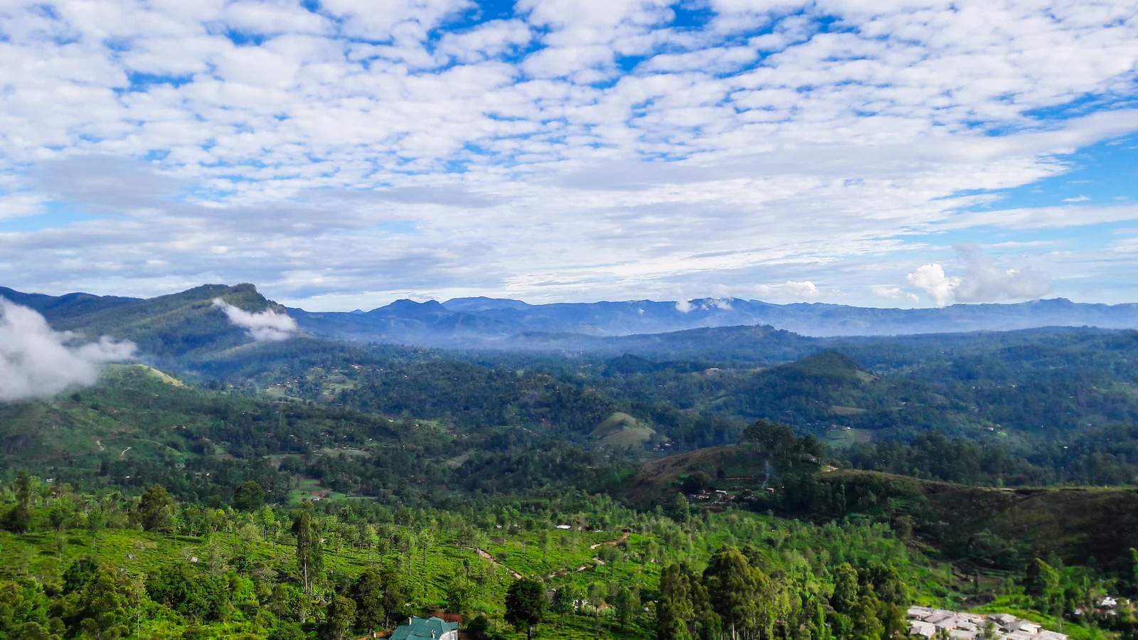
Tea farmers build stone terrace walls on steep hills to stop dirt from washing away.
Tree planters plant strong mountain trees along river banks to stop landslides.
Tall shade trees and green hedge plants help water soak deep into dry ground.
Farm officers visit hill gardens to make sure vegetable beds have good soil.
Village clubs protect clean mountain springs to keep town drinking water safe.
Protecting high mountain forests gives clean water and power to Sri Lanka.
A2 · Elementary
Sri Lanka Central Highlands: Montane Watersheds and Hydroelectric Dams
Cloud forests, river cascades, and trans-basin irrigation channels power cities and nourish lowland agriculture.
The Hydrological Water Tower and Montane Cloud Forests
The Central Highlands of Sri Lanka, rising over two thousand five hundred metres above sea level at Pidurutalagala, serve as the nation's primary hydrological water tower. High-elevation montane cloud forests and wet patana grasslands within Horton Plains and the Peak Wilderness capture atmospheric fog through canopy condensation, adding substantial moisture beyond direct rainfall. The highland massif gives rise to a radial drainage pattern feeding one hundred and three distinct river basins that flow outward across all climatic zones toward the Indian Ocean.
The Mahaweli, Kelani, Kalu Ganga, and Walawe rivers originate from the central mountain ridges, providing over eighty percent of Sri Lanka's perennial surface freshwater discharge. Dense moss-covered forest canopies, peat bogs, and organic leaf litter act as an ecological sponge that absorbs monsoon deluges and gradually releases clean water during dry months. In recognition of its extraordinary biodiversity and critical catchment value, UNESCO inscribed the Central Highlands of Sri Lanka as a World Heritage Natural Site in 2010.
Hydroelectric Cascades and Reservoir Networks
Highland river headwaters power two major interconnected hydroelectric complexes, the Laxapana cascade on the Kelani headwaters and the Mahaweli cascade, generating vital renewable electricity for the national grid. The Laxapana complex utilizes steep elevation drops along the Kehelgamu Oya and Maskeli Oya, channeling water through Castlereagh, Maussakelle, Canyon, and Norton reservoirs into high-head turbines. Multi-purpose reservoirs along the upper Mahaweli basin, including Kotmale and Victoria, impound billions of cubic metres of runoff to balance peak power demand with downstream irrigation requirements.
Modern telemetric hydrological monitoring stations continuously transmit real-time reservoir inflows, dam water levels, and turbine discharge rates to the National System Control Centre in Colombo. Hydroelectric generation from the highland watershed delivers over thirty percent of Sri Lanka's domestic electrical energy during favorable monsoon seasons, shielding the economy from imported fossil fuel costs. Sedimentation traps and sluice flushing protocols are operated regularly at highland dams to remove river silt and preserve active reservoir storage capacity against monsoonal erosion.
Trans-Basin Diversions and Agricultural Irrigation
Trans-basin diversion tunnels and concrete channels transfer water from wet-zone mountain rivers into the arid northern and eastern dry zones of Sri Lanka. The Polgolla Diversion barrage on the Mahaweli River diverts mountain runoff through an eight-kilometre underground tunnel toward the Bowatenna reservoir and the dry-zone plains of Anuradhapura. Diverted highland water replenishes thousands of ancient cascading village tanks, locally termed wewas, that sustain intensive double-cropped paddy rice farming in moisture-deficient lowland districts.
Sugar cane, maize, and commercial fruit plantations across the Mahaweli System H, B, and C agricultural settlements depend exclusively on regulated water releases dispatched from highland dams. The Water Management Secretariat convenes weekly inter-agency panels to schedule seasonal water deliveries, balancing municipal drinking water priorities against agricultural cultivation timetables. Over two million rural farming households across seven provinces rely directly on highland catchment runoff channeled through historic and modern irrigation distribution networks.
Catchment Conservation, Soil Protection, and Reforestation
Under the Soil Conservation Act, commercial tea estates and vegetable farmers cultivating slopes steeper than sixty percent must construct stone contour terraces and vegetative bunds to prevent topsoil loss. Extensive reforestation initiatives along riparian river corridors plant deep-rooting native montane trees to stabilize fragile hillside escarpments against monsoon-triggered landslides. Agroforestry systems on tea plantations incorporate leguminous shade trees and Vetiver grass hedgerows that reduce surface water runoff velocities and enhance deep groundwater recharge.
Agricultural extension officers conduct periodic slope audits to ensure highland market gardens maintain cover crops and sediment retention ponds before seasonal monsoon downpours arrive. Community-led watershed protection societies in rural mountain villages monitor stream clarity and plant buffer strips along freshwater springs to safeguard local drinking supplies. This integrated highland stewardship, linking cloud forest conservation, renewable hydropower, and trans-basin irrigation, preserves Sri Lanka's central water tower as an indispensable living foundation of the national economy.
B1 · Intermediate
Hydrological Architecture of Sri Lanka's Central Highlands Watershed
An analytical study of montane cloud forests, cascade hydroelectric powerhouses, and trans-basin irrigation networks.
The Hydrological Water Tower and Montane Cloud Forests
The Central Highlands of Sri Lanka, rising over two thousand five hundred metres above sea level at Pidurutalagala, serve as the nation's primary hydrological water tower. High-elevation montane cloud forests and wet patana grasslands within Horton Plains and the Peak Wilderness capture atmospheric fog through canopy condensation, adding substantial moisture beyond direct rainfall. The highland massif gives rise to a radial drainage pattern feeding one hundred and three distinct river basins that flow outward across all climatic zones toward the Indian Ocean.
The Mahaweli, Kelani, Kalu Ganga, and Walawe rivers originate from the central mountain ridges, providing over eighty percent of Sri Lanka's perennial surface freshwater discharge. Dense moss-covered forest canopies, peat bogs, and organic leaf litter act as an ecological sponge that absorbs monsoon deluges and gradually releases clean water during dry months. In recognition of its extraordinary biodiversity and critical catchment value, UNESCO inscribed the Central Highlands of Sri Lanka as a World Heritage Natural Site in 2010.
Hydroelectric Cascades and Reservoir Networks
Highland river headwaters power two major interconnected hydroelectric complexes, the Laxapana cascade on the Kelani headwaters and the Mahaweli cascade, generating vital renewable electricity for the national grid. The Laxapana complex utilizes steep elevation drops along the Kehelgamu Oya and Maskeli Oya, channeling water through Castlereagh, Maussakelle, Canyon, and Norton reservoirs into high-head turbines. Multi-purpose reservoirs along the upper Mahaweli basin, including Kotmale and Victoria, impound billions of cubic metres of runoff to balance peak power demand with downstream irrigation requirements.
Modern telemetric hydrological monitoring stations continuously transmit real-time reservoir inflows, dam water levels, and turbine discharge rates to the National System Control Centre in Colombo. Hydroelectric generation from the highland watershed delivers over thirty percent of Sri Lanka's domestic electrical energy during favorable monsoon seasons, shielding the economy from imported fossil fuel costs. Sedimentation traps and sluice flushing protocols are operated regularly at highland dams to remove river silt and preserve active reservoir storage capacity against monsoonal erosion.
Trans-Basin Diversions and Agricultural Irrigation
Trans-basin diversion tunnels and concrete channels transfer water from wet-zone mountain rivers into the arid northern and eastern dry zones of Sri Lanka. The Polgolla Diversion barrage on the Mahaweli River diverts mountain runoff through an eight-kilometre underground tunnel toward the Bowatenna reservoir and the dry-zone plains of Anuradhapura. Diverted highland water replenishes thousands of ancient cascading village tanks, locally termed wewas, that sustain intensive double-cropped paddy rice farming in moisture-deficient lowland districts.
Sugar cane, maize, and commercial fruit plantations across the Mahaweli System H, B, and C agricultural settlements depend exclusively on regulated water releases dispatched from highland dams. The Water Management Secretariat convenes weekly inter-agency panels to schedule seasonal water deliveries, balancing municipal drinking water priorities against agricultural cultivation timetables. Over two million rural farming households across seven provinces rely directly on highland catchment runoff channeled through historic and modern irrigation distribution networks.
Catchment Conservation, Soil Protection, and Reforestation
Under the Soil Conservation Act, commercial tea estates and vegetable farmers cultivating slopes steeper than sixty percent must construct stone contour terraces and vegetative bunds to prevent topsoil loss. Extensive reforestation initiatives along riparian river corridors plant deep-rooting native montane trees to stabilize fragile hillside escarpments against monsoon-triggered landslides. Agroforestry systems on tea plantations incorporate leguminous shade trees and Vetiver grass hedgerows that reduce surface water runoff velocities and enhance deep groundwater recharge.
Agricultural extension officers conduct periodic slope audits to ensure highland market gardens maintain cover crops and sediment retention ponds before seasonal monsoon downpours arrive. Community-led watershed protection societies in rural mountain villages monitor stream clarity and plant buffer strips along freshwater springs to safeguard local drinking supplies. This integrated highland stewardship, linking cloud forest conservation, renewable hydropower, and trans-basin irrigation, preserves Sri Lanka's central water tower as an indispensable living foundation of the national economy.
B2 · Upper Intermediate
Highland Hydrography, Reservoir Cascades, and River Basin Management
Investigating canopy condensation, high-head hydroelectric generation, sluice flushing, and agroforestry watershed protection.
The Hydrological Water Tower and Montane Cloud Forests
The Central Highlands of Sri Lanka, rising over two thousand five hundred metres above sea level at Pidurutalagala, serve as the nation's primary hydrological water tower. High-elevation montane cloud forests and wet patana grasslands within Horton Plains and the Peak Wilderness capture atmospheric fog through canopy condensation, adding substantial moisture beyond direct rainfall. The highland massif gives rise to a radial drainage pattern feeding one hundred and three distinct river basins that flow outward across all climatic zones toward the Indian Ocean.
The Mahaweli, Kelani, Kalu Ganga, and Walawe rivers originate from the central mountain ridges, providing over eighty percent of Sri Lanka's perennial surface freshwater discharge. Dense moss-covered forest canopies, peat bogs, and organic leaf litter act as an ecological sponge that absorbs monsoon deluges and gradually releases clean water during dry months. In recognition of its extraordinary biodiversity and critical catchment value, UNESCO inscribed the Central Highlands of Sri Lanka as a World Heritage Natural Site in 2010.
Hydroelectric Cascades and Reservoir Networks
Highland river headwaters power two major interconnected hydroelectric complexes, the Laxapana cascade on the Kelani headwaters and the Mahaweli cascade, generating vital renewable electricity for the national grid. The Laxapana complex utilizes steep elevation drops along the Kehelgamu Oya and Maskeli Oya, channeling water through Castlereagh, Maussakelle, Canyon, and Norton reservoirs into high-head turbines. Multi-purpose reservoirs along the upper Mahaweli basin, including Kotmale and Victoria, impound billions of cubic metres of runoff to balance peak power demand with downstream irrigation requirements.
Modern telemetric hydrological monitoring stations continuously transmit real-time reservoir inflows, dam water levels, and turbine discharge rates to the National System Control Centre in Colombo. Hydroelectric generation from the highland watershed delivers over thirty percent of Sri Lanka's domestic electrical energy during favorable monsoon seasons, shielding the economy from imported fossil fuel costs. Sedimentation traps and sluice flushing protocols are operated regularly at highland dams to remove river silt and preserve active reservoir storage capacity against monsoonal erosion.
Trans-Basin Diversions and Agricultural Irrigation
Trans-basin diversion tunnels and concrete channels transfer water from wet-zone mountain rivers into the arid northern and eastern dry zones of Sri Lanka. The Polgolla Diversion barrage on the Mahaweli River diverts mountain runoff through an eight-kilometre underground tunnel toward the Bowatenna reservoir and the dry-zone plains of Anuradhapura. Diverted highland water replenishes thousands of ancient cascading village tanks, locally termed wewas, that sustain intensive double-cropped paddy rice farming in moisture-deficient lowland districts.
Sugar cane, maize, and commercial fruit plantations across the Mahaweli System H, B, and C agricultural settlements depend exclusively on regulated water releases dispatched from highland dams. The Water Management Secretariat convenes weekly inter-agency panels to schedule seasonal water deliveries, balancing municipal drinking water priorities against agricultural cultivation timetables. Over two million rural farming households across seven provinces rely directly on highland catchment runoff channeled through historic and modern irrigation distribution networks.
Catchment Conservation, Soil Protection, and Reforestation
Under the Soil Conservation Act, commercial tea estates and vegetable farmers cultivating slopes steeper than sixty percent must construct stone contour terraces and vegetative bunds to prevent topsoil loss. Extensive reforestation initiatives along riparian river corridors plant deep-rooting native montane trees to stabilize fragile hillside escarpments against monsoon-triggered landslides. Agroforestry systems on tea plantations incorporate leguminous shade trees and Vetiver grass hedgerows that reduce surface water runoff velocities and enhance deep groundwater recharge.
Agricultural extension officers conduct periodic slope audits to ensure highland market gardens maintain cover crops and sediment retention ponds before seasonal monsoon downpours arrive. Community-led watershed protection societies in rural mountain villages monitor stream clarity and plant buffer strips along freshwater springs to safeguard local drinking supplies. This integrated highland stewardship, linking cloud forest conservation, renewable hydropower, and trans-basin irrigation, preserves Sri Lanka's central water tower as an indispensable living foundation of the national economy.
C1 · Advanced
Orographic Hydrology, Hydroelectric Cascades, and Watershed Geographies
A critical examination of montane sponge ecology, multi-purpose river impoundments, trans-basin transfers, and slope conservation.
The Hydrological Water Tower and Montane Cloud Forests
The Central Highlands of Sri Lanka, rising over two thousand five hundred metres above sea level at Pidurutalagala, serve as the nation's primary hydrological water tower. High-elevation montane cloud forests and wet patana grasslands within Horton Plains and the Peak Wilderness capture atmospheric fog through canopy condensation, adding substantial moisture beyond direct rainfall. The highland massif gives rise to a radial drainage pattern feeding one hundred and three distinct river basins that flow outward across all climatic zones toward the Indian Ocean.
The Mahaweli, Kelani, Kalu Ganga, and Walawe rivers originate from the central mountain ridges, providing over eighty percent of Sri Lanka's perennial surface freshwater discharge. Dense moss-covered forest canopies, peat bogs, and organic leaf litter act as an ecological sponge that absorbs monsoon deluges and gradually releases clean water during dry months. In recognition of its extraordinary biodiversity and critical catchment value, UNESCO inscribed the Central Highlands of Sri Lanka as a World Heritage Natural Site in 2010.
Hydroelectric Cascades and Reservoir Networks
Highland river headwaters power two major interconnected hydroelectric complexes, the Laxapana cascade on the Kelani headwaters and the Mahaweli cascade, generating vital renewable electricity for the national grid. The Laxapana complex utilizes steep elevation drops along the Kehelgamu Oya and Maskeli Oya, channeling water through Castlereagh, Maussakelle, Canyon, and Norton reservoirs into high-head turbines. Multi-purpose reservoirs along the upper Mahaweli basin, including Kotmale and Victoria, impound billions of cubic metres of runoff to balance peak power demand with downstream irrigation requirements.
Modern telemetric hydrological monitoring stations continuously transmit real-time reservoir inflows, dam water levels, and turbine discharge rates to the National System Control Centre in Colombo. Hydroelectric generation from the highland watershed delivers over thirty percent of Sri Lanka's domestic electrical energy during favorable monsoon seasons, shielding the economy from imported fossil fuel costs. Sedimentation traps and sluice flushing protocols are operated regularly at highland dams to remove river silt and preserve active reservoir storage capacity against monsoonal erosion.
Trans-Basin Diversions and Agricultural Irrigation
Trans-basin diversion tunnels and concrete channels transfer water from wet-zone mountain rivers into the arid northern and eastern dry zones of Sri Lanka. The Polgolla Diversion barrage on the Mahaweli River diverts mountain runoff through an eight-kilometre underground tunnel toward the Bowatenna reservoir and the dry-zone plains of Anuradhapura. Diverted highland water replenishes thousands of ancient cascading village tanks, locally termed wewas, that sustain intensive double-cropped paddy rice farming in moisture-deficient lowland districts.
Sugar cane, maize, and commercial fruit plantations across the Mahaweli System H, B, and C agricultural settlements depend exclusively on regulated water releases dispatched from highland dams. The Water Management Secretariat convenes weekly inter-agency panels to schedule seasonal water deliveries, balancing municipal drinking water priorities against agricultural cultivation timetables. Over two million rural farming households across seven provinces rely directly on highland catchment runoff channeled through historic and modern irrigation distribution networks.
Catchment Conservation, Soil Protection, and Reforestation
Under the Soil Conservation Act, commercial tea estates and vegetable farmers cultivating slopes steeper than sixty percent must construct stone contour terraces and vegetative bunds to prevent topsoil loss. Extensive reforestation initiatives along riparian river corridors plant deep-rooting native montane trees to stabilize fragile hillside escarpments against monsoon-triggered landslides. Agroforestry systems on tea plantations incorporate leguminous shade trees and Vetiver grass hedgerows that reduce surface water runoff velocities and enhance deep groundwater recharge.
Agricultural extension officers conduct periodic slope audits to ensure highland market gardens maintain cover crops and sediment retention ponds before seasonal monsoon downpours arrive. Community-led watershed protection societies in rural mountain villages monitor stream clarity and plant buffer strips along freshwater springs to safeguard local drinking supplies. This integrated highland stewardship, linking cloud forest conservation, renewable hydropower, and trans-basin irrigation, preserves Sri Lanka's central water tower as an indispensable living foundation of the national economy.
C2 · Mastery
Montane Eco-Hydrology, Hydropower Dynamics, and Trans-Basin Spatialities in Sri Lanka
A comprehensive analytical monograph on high-elevation canopy interception, cascade telemetry, cascading tank replenishment, and riparian stewardship in the Central Highlands.
The Hydrological Water Tower and Montane Cloud Forests
The Central Highlands of Sri Lanka, rising over two thousand five hundred metres above sea level at Pidurutalagala, serve as the nation's primary hydrological water tower. High-elevation montane cloud forests and wet patana grasslands within Horton Plains and the Peak Wilderness capture atmospheric fog through canopy condensation, adding substantial moisture beyond direct rainfall. The highland massif gives rise to a radial drainage pattern feeding one hundred and three distinct river basins that flow outward across all climatic zones toward the Indian Ocean.
The Mahaweli, Kelani, Kalu Ganga, and Walawe rivers originate from the central mountain ridges, providing over eighty percent of Sri Lanka's perennial surface freshwater discharge. Dense moss-covered forest canopies, peat bogs, and organic leaf litter act as an ecological sponge that absorbs monsoon deluges and gradually releases clean water during dry months. In recognition of its extraordinary biodiversity and critical catchment value, UNESCO inscribed the Central Highlands of Sri Lanka as a World Heritage Natural Site in 2010.
Hydroelectric Cascades and Reservoir Networks
Highland river headwaters power two major interconnected hydroelectric complexes, the Laxapana cascade on the Kelani headwaters and the Mahaweli cascade, generating vital renewable electricity for the national grid. The Laxapana complex utilizes steep elevation drops along the Kehelgamu Oya and Maskeli Oya, channeling water through Castlereagh, Maussakelle, Canyon, and Norton reservoirs into high-head turbines. Multi-purpose reservoirs along the upper Mahaweli basin, including Kotmale and Victoria, impound billions of cubic metres of runoff to balance peak power demand with downstream irrigation requirements.
Modern telemetric hydrological monitoring stations continuously transmit real-time reservoir inflows, dam water levels, and turbine discharge rates to the National System Control Centre in Colombo. Hydroelectric generation from the highland watershed delivers over thirty percent of Sri Lanka's domestic electrical energy during favorable monsoon seasons, shielding the economy from imported fossil fuel costs. Sedimentation traps and sluice flushing protocols are operated regularly at highland dams to remove river silt and preserve active reservoir storage capacity against monsoonal erosion.
Trans-Basin Diversions and Agricultural Irrigation
Trans-basin diversion tunnels and concrete channels transfer water from wet-zone mountain rivers into the arid northern and eastern dry zones of Sri Lanka. The Polgolla Diversion barrage on the Mahaweli River diverts mountain runoff through an eight-kilometre underground tunnel toward the Bowatenna reservoir and the dry-zone plains of Anuradhapura. Diverted highland water replenishes thousands of ancient cascading village tanks, locally termed wewas, that sustain intensive double-cropped paddy rice farming in moisture-deficient lowland districts.
Sugar cane, maize, and commercial fruit plantations across the Mahaweli System H, B, and C agricultural settlements depend exclusively on regulated water releases dispatched from highland dams. The Water Management Secretariat convenes weekly inter-agency panels to schedule seasonal water deliveries, balancing municipal drinking water priorities against agricultural cultivation timetables. Over two million rural farming households across seven provinces rely directly on highland catchment runoff channeled through historic and modern irrigation distribution networks.
Catchment Conservation, Soil Protection, and Reforestation
Under the Soil Conservation Act, commercial tea estates and vegetable farmers cultivating slopes steeper than sixty percent must construct stone contour terraces and vegetative bunds to prevent topsoil loss. Extensive reforestation initiatives along riparian river corridors plant deep-rooting native montane trees to stabilize fragile hillside escarpments against monsoon-triggered landslides. Agroforestry systems on tea plantations incorporate leguminous shade trees and Vetiver grass hedgerows that reduce surface water runoff velocities and enhance deep groundwater recharge.
Agricultural extension officers conduct periodic slope audits to ensure highland market gardens maintain cover crops and sediment retention ponds before seasonal monsoon downpours arrive. Community-led watershed protection societies in rural mountain villages monitor stream clarity and plant buffer strips along freshwater springs to safeguard local drinking supplies. This integrated highland stewardship, linking cloud forest conservation, renewable hydropower, and trans-basin irrigation, preserves Sri Lanka's central water tower as an indispensable living foundation of the national economy.
Check your understanding
Choose how closely you want to revisit the article. You can refer back while answering, and review explanations when you finish.
Quick Quiz A1
Try one question, then create a free account for the full Quick Quiz. Sign Up Free
Answer every question before checking. There is no time limit.
Your results
/ 1 correct (%)
Read the explanations to see how each answer connects to the article.
-
Where do high mountains in central Sri Lanka rise to catch rain?
1. Answer:
Quick Quiz A2
Try one question, then create a free account for the full Quick Quiz. Sign Up Free
Answer every question before checking. There is no time limit.
Your results
/ 1 correct (%)
Read the explanations to see how each answer connects to the article.
-
What is the highest mountain peak in Sri Lanka serving as part of the central water tower?
1. Answer:
Quick Quiz B1
Try one question, then create a free account for the full Quick Quiz. Sign Up Free
Answer every question before checking. There is no time limit.
Your results
/ 1 correct (%)
Read the explanations to see how each answer connects to the article.
-
What is the highest mountain peak in Sri Lanka serving as part of the central water tower?
1. Answer:
Quick Quiz B2
Try one question, then create a free account for the full Quick Quiz. Sign Up Free
Answer every question before checking. There is no time limit.
Your results
/ 1 correct (%)
Read the explanations to see how each answer connects to the article.
-
What is the highest mountain peak in Sri Lanka serving as part of the central water tower?
1. Answer:
Quick Quiz C1
Try one question, then create a free account for the full Quick Quiz. Sign Up Free
Answer every question before checking. There is no time limit.
Your results
/ 1 correct (%)
Read the explanations to see how each answer connects to the article.
-
What is the highest mountain peak in Sri Lanka serving as part of the central water tower?
1. Answer:
Quick Quiz C2
Try one question, then create a free account for the full Quick Quiz. Sign Up Free
Answer every question before checking. There is no time limit.
Your results
/ 1 correct (%)
Read the explanations to see how each answer connects to the article.
-
What is the highest mountain peak in Sri Lanka serving as part of the central water tower?
1. Answer:
