A1 · Beginner
Galle Fort: Sea Walls, Bastions, and Living History
Galle Fort is a historic stone fortress by the sea where thick ramparts and local families protect centuries of maritime heritage.
Maritime Citadel Origins and Rampart Bastion Architecture
Galle Fort sits on a rocky hill by the ocean in southern Sri Lanka. Portuguese sailors built the first walls in 1588.
Dutch builders expanded the strong stone fort from 1649 onward.
UNESCO added the old town and stone walls to the World Heritage List in 1988 under criteria iv.
The walls enclose 36 hectares with three kilometers of ramparts and fourteen bastions.
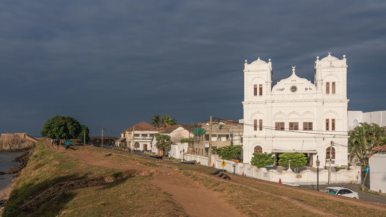
Three large landward walls called Star, Moon, and Sun bastions protected the narrow land entrance.
The oldest stone wall is Zwart Bastion, built in the sixteenth century. British workers built the Main Gate in 1873 for road traffic.
Coral Stone Masonry, Hydraulic Drainage, and Mortar Science
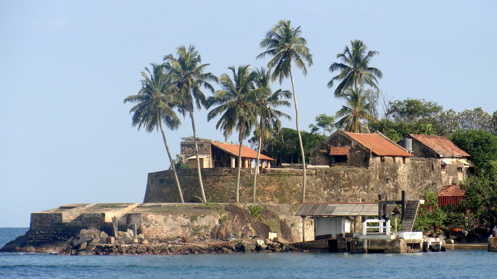
Workers built the fort using heavy granite, red laterite stones, and coastal coral blocks. They joined the stones with traditional lime mortar.
Central Cultural Fund masons mix slaked shell lime, sand, and plant juice to repair ancient walls.
Dutch engineers built deep underground drains that ocean tides washed out twice each day.
Teams clean old water tunnels so rain does not pool behind the stone ramparts.
Salty sea winds and damp monsoon air damage the soft coral stones over time.
Conservators use sonic testing to detect internal voids inside the thick bastion walls.
Marine Wave Defenses, Tsunami Resilience, and Harbor Archaeology
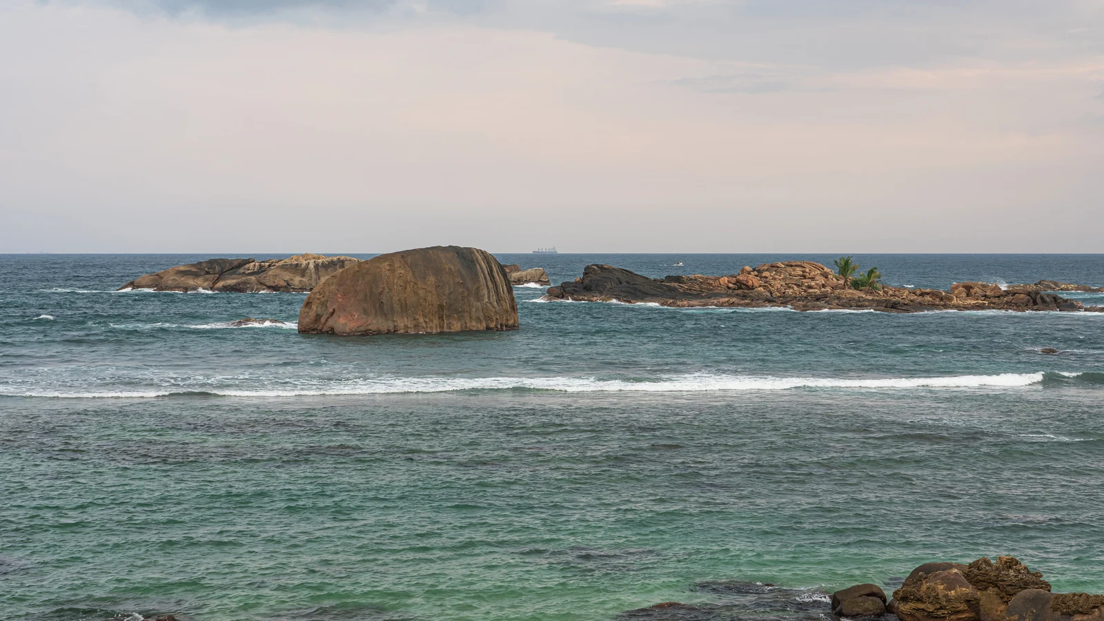
The thick seaward walls stop strong ocean waves and prevent coastline erosion during the monsoon.
During the giant 2004 tsunami, the high stone ramparts blocked huge waves and saved the town.
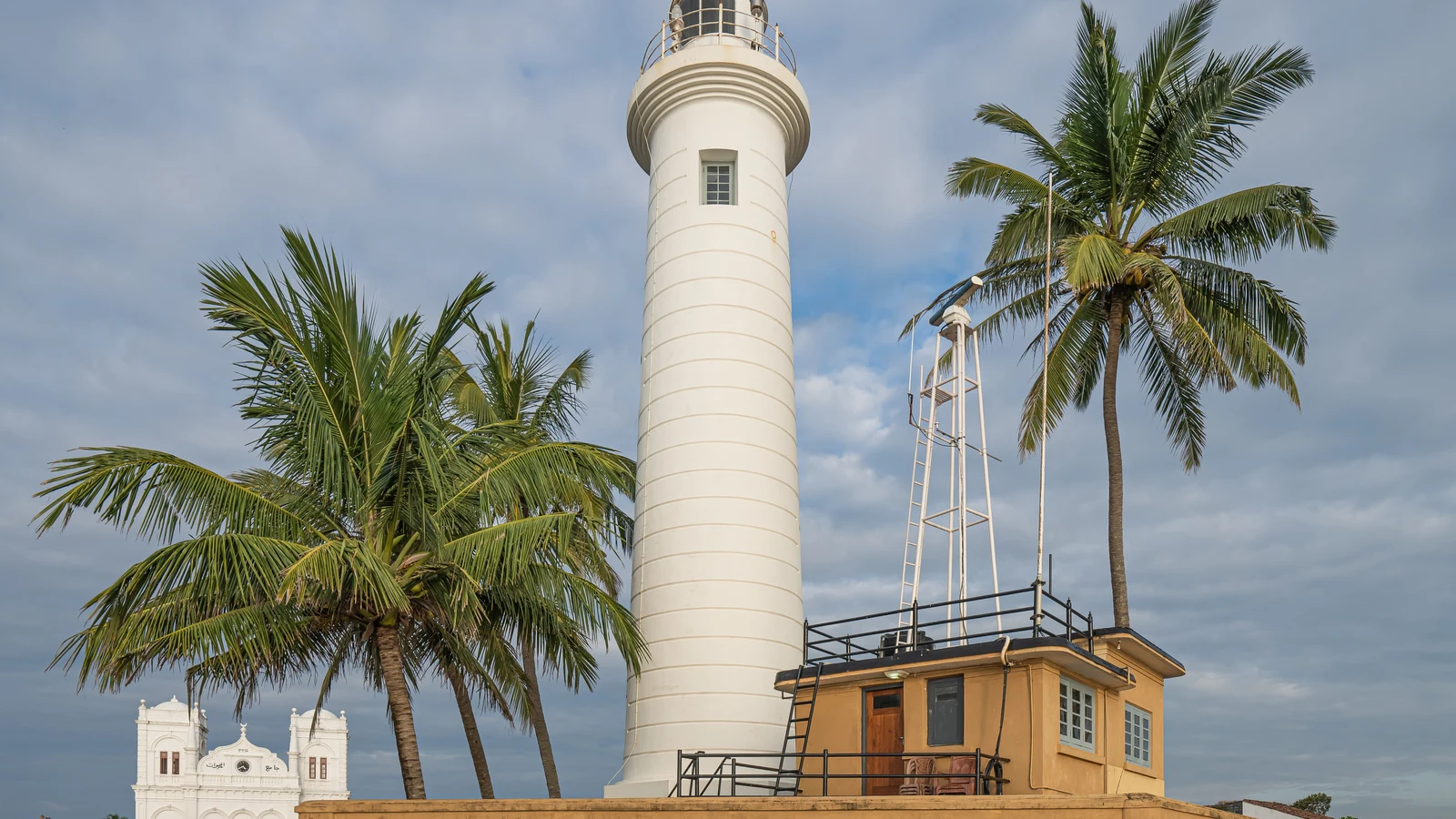
A tall white lighthouse stands on Point Utrecht Bastion. Builders finished this 26-meter tower in 1939.
Divers found over twenty old shipwrecks lying on the seabed of Galle Bay.
Archaeology teams monitor underwater currents around the stone foundations of the sea walls.
Divers use sonar scanners and cameras to make 3D maps of ancient sunken ships in the harbor.
Living Heritage Governance and Adaptive Building Regulations
The Galle Heritage Foundation protects historic buildings and sets clear rules for repairs.
About 2,000 residents live inside the quiet fort streets in historic colonial homes.
Town rules protect clay terracotta roof tiles, wooden sash windows, and wide open verandahs.
New tourist hotels and shops buy old family houses, changing the neighborhood.
Safety officials keep clear tsunami evacuation paths open along high rampart walks.
Good management balances monument preservation with caring for the local community.
A2 · Elementary
Galle Fort Conservation: Bastion Masonry, Sea Walls, and Drainage
Coastal rampart architecture, traditional coral mortar preservation, and tidal sewer systems preserve Galle historic citadel.
Maritime Citadel Origins and Rampart Bastion Architecture
Galle Fort occupies a strategic rocky promontory on the southwestern coast of Sri Lanka, initially fortified by the Portuguese in 1588 and comprehensively rebuilt by the Dutch East India Company from 1649 onward. UNESCO inscribed the Old Town of Galle and its Fortifications on the World Heritage List in 1988 under cultural criteria (iv) as an exceptional example of a fortified European colonial city in South Asia. The defensive perimeter spans 36 hectares enclosed by three kilometers of ramparts and fourteen stone bastions designed according to Dutch trace italienne fortification engineering.
The landward defensive line incorporates three massive stone bastions known as the Star Bastion, Moon Bastion, and Sun Bastion, designed to withstand artillery bombardment across the Galle isthmus. The oldest surviving defensive work within the fort is the Zwart Bastion, or Black Bastion, constructed by the Portuguese in the sixteenth century and later reinforced by the Dutch. In 1873 British colonial authorities breached the landward ramparts between the Sun and Moon bastions to construct the Main Gate for expanded vehicular access into the fort.
Coral Stone Masonry, Hydraulic Drainage, and Mortar Science
The fort ramparts were constructed using dense granite ashlar blocks, locally quarried laterite stones, and coastal coral limestone bonded with traditional slaked lime mortar. Conservation masons employed by the Central Cultural Fund prepare traditional lime mortar using sand, slaked shell lime, and natural plant binders to match historical material permeability. The Dutch engineered an advanced subterranean gravity-fed sewer network beneath the fort streets that flushed twice daily using rising ocean tidal surges.
Modern conservation teams map and clear historic underground storm tunnels to prevent urban runoff water from accumulating behind the heavy stone retaining ramparts. Exposure to maritime salt spray and tropical monsoon humidity causes sub-florescence and salt crystallization that slowly delaminates historic coral stone facing blocks. Conservators conduct non-destructive sonic testing and moisture profiling to detect internal voids within the multi-layered bastion earthworks.
Marine Wave Defenses, Tsunami Resilience, and Harbor Archaeology
The outer seaward ramparts function as massive marine wave deflectors, dissipating southwest monsoon surf and protecting the historic urban grid from coastal erosion. During the catastrophic 2004 Indian Ocean tsunami, the massive stone ramparts deflected giant sea waves, shielding the interior fort settlement from destructive inundation. The 26-meter-tall white cast-iron lighthouse was erected on Point Utrecht Bastion in 1939 to replace an earlier Victorian light structure destroyed by fire in 1934.
Maritime archaeologists from the Central Cultural Fund have documented over twenty historic shipwrecks and submerged anchorages resting on the seabed of Galle Bay. Divers and hydrographic surveyors monitor underwater erosion around the submerged foundations of coastal sea bastions to prevent scouring from heavy harbor currents. Department of Archaeology divers utilize side-scan sonar and photogrammetric 3D mapping to document submerged maritime cultural heritage within the harbor sanctuary.
Living Heritage Governance and Adaptive Building Regulations
The Galle Heritage Foundation administers statutory conservation guidelines regulating architectural modifications, facade preservation, and building heights within the fortified perimeter. Unlike museumified fortresses, Galle Fort remains a living urban quarter with approximately 2,000 residents living in historic Dutch and British colonial streetscapes. Strict municipal regulations mandate the preservation of traditional terracotta roof tiles, timber sash windows, and covered street-facing colonnaded verandahs.
Rapid commercialization and gentrification have converted numerous historic family dwellings into boutique hotels, art galleries, and restaurants, placing pressure on the local residential community. The Southern Province disaster management agency collaborates with local conservation authorities to maintain tsunami evacuation routes along elevated bastion walkways. Sustainable management of Galle Fort balances rigorous physical monument preservation with the cultural continuity of long-settled multi-ethnic communities.
B1 · Intermediate
Maritime Bastion Fortifications and Material Conservation in Galle
An analytical study of Dutch trace italienne engineering, slaked lime mortar restoration, and coastal wave deflection.
Maritime Citadel Origins and Rampart Bastion Architecture
Galle Fort occupies a strategic rocky promontory on the southwestern coast of Sri Lanka, initially fortified by the Portuguese in 1588 and comprehensively rebuilt by the Dutch East India Company from 1649 onward. UNESCO inscribed the Old Town of Galle and its Fortifications on the World Heritage List in 1988 under cultural criteria (iv) as an exceptional example of a fortified European colonial city in South Asia. The defensive perimeter spans 36 hectares enclosed by three kilometers of ramparts and fourteen stone bastions designed according to Dutch trace italienne fortification engineering.
The landward defensive line incorporates three massive stone bastions known as the Star Bastion, Moon Bastion, and Sun Bastion, designed to withstand artillery bombardment across the Galle isthmus. The oldest surviving defensive work within the fort is the Zwart Bastion, or Black Bastion, constructed by the Portuguese in the sixteenth century and later reinforced by the Dutch. In 1873 British colonial authorities breached the landward ramparts between the Sun and Moon bastions to construct the Main Gate for expanded vehicular access into the fort.
Coral Stone Masonry, Hydraulic Drainage, and Mortar Science
The fort ramparts were constructed using dense granite ashlar blocks, locally quarried laterite stones, and coastal coral limestone bonded with traditional slaked lime mortar. Conservation masons employed by the Central Cultural Fund prepare traditional lime mortar using sand, slaked shell lime, and natural plant binders to match historical material permeability. The Dutch engineered an advanced subterranean gravity-fed sewer network beneath the fort streets that flushed twice daily using rising ocean tidal surges.
Modern conservation teams map and clear historic underground storm tunnels to prevent urban runoff water from accumulating behind the heavy stone retaining ramparts. Exposure to maritime salt spray and tropical monsoon humidity causes sub-florescence and salt crystallization that slowly delaminates historic coral stone facing blocks. Conservators conduct non-destructive sonic testing and moisture profiling to detect internal voids within the multi-layered bastion earthworks.
Marine Wave Defenses, Tsunami Resilience, and Harbor Archaeology
The outer seaward ramparts function as massive marine wave deflectors, dissipating southwest monsoon surf and protecting the historic urban grid from coastal erosion. During the catastrophic 2004 Indian Ocean tsunami, the massive stone ramparts deflected giant sea waves, shielding the interior fort settlement from destructive inundation. The 26-meter-tall white cast-iron lighthouse was erected on Point Utrecht Bastion in 1939 to replace an earlier Victorian light structure destroyed by fire in 1934.
Maritime archaeologists from the Central Cultural Fund have documented over twenty historic shipwrecks and submerged anchorages resting on the seabed of Galle Bay. Divers and hydrographic surveyors monitor underwater erosion around the submerged foundations of coastal sea bastions to prevent scouring from heavy harbor currents. Department of Archaeology divers utilize side-scan sonar and photogrammetric 3D mapping to document submerged maritime cultural heritage within the harbor sanctuary.
Living Heritage Governance and Adaptive Building Regulations
The Galle Heritage Foundation administers statutory conservation guidelines regulating architectural modifications, facade preservation, and building heights within the fortified perimeter. Unlike museumified fortresses, Galle Fort remains a living urban quarter with approximately 2,000 residents living in historic Dutch and British colonial streetscapes. Strict municipal regulations mandate the preservation of traditional terracotta roof tiles, timber sash windows, and covered street-facing colonnaded verandahs.
Rapid commercialization and gentrification have converted numerous historic family dwellings into boutique hotels, art galleries, and restaurants, placing pressure on the local residential community. The Southern Province disaster management agency collaborates with local conservation authorities to maintain tsunami evacuation routes along elevated bastion walkways. Sustainable management of Galle Fort balances rigorous physical monument preservation with the cultural continuity of long-settled multi-ethnic communities.
B2 · Upper Intermediate
Hydrodynamic Wave Deflection, Subterranean Drainage, and Living Heritage in Galle Fort
Examining tsunami resilience, sub-florescence stone degradation, and statutory urban conservation controls in southern Sri Lanka.
Maritime Citadel Origins and Rampart Bastion Architecture
Galle Fort occupies a strategic rocky promontory on the southwestern coast of Sri Lanka, initially fortified by the Portuguese in 1588 and comprehensively rebuilt by the Dutch East India Company from 1649 onward. UNESCO inscribed the Old Town of Galle and its Fortifications on the World Heritage List in 1988 under cultural criteria (iv) as an exceptional example of a fortified European colonial city in South Asia. The defensive perimeter spans 36 hectares enclosed by three kilometers of ramparts and fourteen stone bastions designed according to Dutch trace italienne fortification engineering.
The landward defensive line incorporates three massive stone bastions known as the Star Bastion, Moon Bastion, and Sun Bastion, designed to withstand artillery bombardment across the Galle isthmus. The oldest surviving defensive work within the fort is the Zwart Bastion, or Black Bastion, constructed by the Portuguese in the sixteenth century and later reinforced by the Dutch. In 1873 British colonial authorities breached the landward ramparts between the Sun and Moon bastions to construct the Main Gate for expanded vehicular access into the fort.
Coral Stone Masonry, Hydraulic Drainage, and Mortar Science
The fort ramparts were constructed using dense granite ashlar blocks, locally quarried laterite stones, and coastal coral limestone bonded with traditional slaked lime mortar. Conservation masons employed by the Central Cultural Fund prepare traditional lime mortar using sand, slaked shell lime, and natural plant binders to match historical material permeability. The Dutch engineered an advanced subterranean gravity-fed sewer network beneath the fort streets that flushed twice daily using rising ocean tidal surges.
Modern conservation teams map and clear historic underground storm tunnels to prevent urban runoff water from accumulating behind the heavy stone retaining ramparts. Exposure to maritime salt spray and tropical monsoon humidity causes sub-florescence and salt crystallization that slowly delaminates historic coral stone facing blocks. Conservators conduct non-destructive sonic testing and moisture profiling to detect internal voids within the multi-layered bastion earthworks.
Marine Wave Defenses, Tsunami Resilience, and Harbor Archaeology
The outer seaward ramparts function as massive marine wave deflectors, dissipating southwest monsoon surf and protecting the historic urban grid from coastal erosion. During the catastrophic 2004 Indian Ocean tsunami, the massive stone ramparts deflected giant sea waves, shielding the interior fort settlement from destructive inundation. The 26-meter-tall white cast-iron lighthouse was erected on Point Utrecht Bastion in 1939 to replace an earlier Victorian light structure destroyed by fire in 1934.
Maritime archaeologists from the Central Cultural Fund have documented over twenty historic shipwrecks and submerged anchorages resting on the seabed of Galle Bay. Divers and hydrographic surveyors monitor underwater erosion around the submerged foundations of coastal sea bastions to prevent scouring from heavy harbor currents. Department of Archaeology divers utilize side-scan sonar and photogrammetric 3D mapping to document submerged maritime cultural heritage within the harbor sanctuary.
Living Heritage Governance and Adaptive Building Regulations
The Galle Heritage Foundation administers statutory conservation guidelines regulating architectural modifications, facade preservation, and building heights within the fortified perimeter. Unlike museumified fortresses, Galle Fort remains a living urban quarter with approximately 2,000 residents living in historic Dutch and British colonial streetscapes. Strict municipal regulations mandate the preservation of traditional terracotta roof tiles, timber sash windows, and covered street-facing colonnaded verandahs.
Rapid commercialization and gentrification have converted numerous historic family dwellings into boutique hotels, art galleries, and restaurants, placing pressure on the local residential community. The Southern Province disaster management agency collaborates with local conservation authorities to maintain tsunami evacuation routes along elevated bastion walkways. Sustainable management of Galle Fort balances rigorous physical monument preservation with the cultural continuity of long-settled multi-ethnic communities.
C1 · Advanced
Bastion Revetment Engineering, Marine Petrography, and Maritime Archaeology in Galle
A critical investigation of seventeenth-century rampart masonry, non-destructive sonic void diagnostics, and harbor shipwreck management.
Maritime Citadel Origins and Rampart Bastion Architecture
Galle Fort occupies a strategic rocky promontory on the southwestern coast of Sri Lanka, initially fortified by the Portuguese in 1588 and comprehensively rebuilt by the Dutch East India Company from 1649 onward. UNESCO inscribed the Old Town of Galle and its Fortifications on the World Heritage List in 1988 under cultural criteria (iv) as an exceptional example of a fortified European colonial city in South Asia. The defensive perimeter spans 36 hectares enclosed by three kilometers of ramparts and fourteen stone bastions designed according to Dutch trace italienne fortification engineering.
The landward defensive line incorporates three massive stone bastions known as the Star Bastion, Moon Bastion, and Sun Bastion, designed to withstand artillery bombardment across the Galle isthmus. The oldest surviving defensive work within the fort is the Zwart Bastion, or Black Bastion, constructed by the Portuguese in the sixteenth century and later reinforced by the Dutch. In 1873 British colonial authorities breached the landward ramparts between the Sun and Moon bastions to construct the Main Gate for expanded vehicular access into the fort.
Coral Stone Masonry, Hydraulic Drainage, and Mortar Science
The fort ramparts were constructed using dense granite ashlar blocks, locally quarried laterite stones, and coastal coral limestone bonded with traditional slaked lime mortar. Conservation masons employed by the Central Cultural Fund prepare traditional lime mortar using sand, slaked shell lime, and natural plant binders to match historical material permeability. The Dutch engineered an advanced subterranean gravity-fed sewer network beneath the fort streets that flushed twice daily using rising ocean tidal surges.
Modern conservation teams map and clear historic underground storm tunnels to prevent urban runoff water from accumulating behind the heavy stone retaining ramparts. Exposure to maritime salt spray and tropical monsoon humidity causes sub-florescence and salt crystallization that slowly delaminates historic coral stone facing blocks. Conservators conduct non-destructive sonic testing and moisture profiling to detect internal voids within the multi-layered bastion earthworks.
Marine Wave Defenses, Tsunami Resilience, and Harbor Archaeology
The outer seaward ramparts function as massive marine wave deflectors, dissipating southwest monsoon surf and protecting the historic urban grid from coastal erosion. During the catastrophic 2004 Indian Ocean tsunami, the massive stone ramparts deflected giant sea waves, shielding the interior fort settlement from destructive inundation. The 26-meter-tall white cast-iron lighthouse was erected on Point Utrecht Bastion in 1939 to replace an earlier Victorian light structure destroyed by fire in 1934.
Maritime archaeologists from the Central Cultural Fund have documented over twenty historic shipwrecks and submerged anchorages resting on the seabed of Galle Bay. Divers and hydrographic surveyors monitor underwater erosion around the submerged foundations of coastal sea bastions to prevent scouring from heavy harbor currents. Department of Archaeology divers utilize side-scan sonar and photogrammetric 3D mapping to document submerged maritime cultural heritage within the harbor sanctuary.
Living Heritage Governance and Adaptive Building Regulations
The Galle Heritage Foundation administers statutory conservation guidelines regulating architectural modifications, facade preservation, and building heights within the fortified perimeter. Unlike museumified fortresses, Galle Fort remains a living urban quarter with approximately 2,000 residents living in historic Dutch and British colonial streetscapes. Strict municipal regulations mandate the preservation of traditional terracotta roof tiles, timber sash windows, and covered street-facing colonnaded verandahs.
Rapid commercialization and gentrification have converted numerous historic family dwellings into boutique hotels, art galleries, and restaurants, placing pressure on the local residential community. The Southern Province disaster management agency collaborates with local conservation authorities to maintain tsunami evacuation routes along elevated bastion walkways. Sustainable management of Galle Fort balances rigorous physical monument preservation with the cultural continuity of long-settled multi-ethnic communities.
C2 · Mastery
Trace Italienne Morphology, Hydrodynamic Resiliency, and Living Citadel Stewardship in Galle
A comprehensive analytical monograph on maritime fortification architecture, crypto-efflorescent stone decay, and community heritage governance.
Maritime Citadel Origins and Rampart Bastion Architecture
Galle Fort occupies a strategic rocky promontory on the southwestern coast of Sri Lanka, initially fortified by the Portuguese in 1588 and comprehensively rebuilt by the Dutch East India Company from 1649 onward. UNESCO inscribed the Old Town of Galle and its Fortifications on the World Heritage List in 1988 under cultural criteria (iv) as an exceptional example of a fortified European colonial city in South Asia. The defensive perimeter spans 36 hectares enclosed by three kilometers of ramparts and fourteen stone bastions designed according to Dutch trace italienne fortification engineering.
The landward defensive line incorporates three massive stone bastions known as the Star Bastion, Moon Bastion, and Sun Bastion, designed to withstand artillery bombardment across the Galle isthmus. The oldest surviving defensive work within the fort is the Zwart Bastion, or Black Bastion, constructed by the Portuguese in the sixteenth century and later reinforced by the Dutch. In 1873 British colonial authorities breached the landward ramparts between the Sun and Moon bastions to construct the Main Gate for expanded vehicular access into the fort.
Coral Stone Masonry, Hydraulic Drainage, and Mortar Science
The fort ramparts were constructed using dense granite ashlar blocks, locally quarried laterite stones, and coastal coral limestone bonded with traditional slaked lime mortar. Conservation masons employed by the Central Cultural Fund prepare traditional lime mortar using sand, slaked shell lime, and natural plant binders to match historical material permeability. The Dutch engineered an advanced subterranean gravity-fed sewer network beneath the fort streets that flushed twice daily using rising ocean tidal surges.
Modern conservation teams map and clear historic underground storm tunnels to prevent urban runoff water from accumulating behind the heavy stone retaining ramparts. Exposure to maritime salt spray and tropical monsoon humidity causes sub-florescence and salt crystallization that slowly delaminates historic coral stone facing blocks. Conservators conduct non-destructive sonic testing and moisture profiling to detect internal voids within the multi-layered bastion earthworks.
Marine Wave Defenses, Tsunami Resilience, and Harbor Archaeology
The outer seaward ramparts function as massive marine wave deflectors, dissipating southwest monsoon surf and protecting the historic urban grid from coastal erosion. During the catastrophic 2004 Indian Ocean tsunami, the massive stone ramparts deflected giant sea waves, shielding the interior fort settlement from destructive inundation. The 26-meter-tall white cast-iron lighthouse was erected on Point Utrecht Bastion in 1939 to replace an earlier Victorian light structure destroyed by fire in 1934.
Maritime archaeologists from the Central Cultural Fund have documented over twenty historic shipwrecks and submerged anchorages resting on the seabed of Galle Bay. Divers and hydrographic surveyors monitor underwater erosion around the submerged foundations of coastal sea bastions to prevent scouring from heavy harbor currents. Department of Archaeology divers utilize side-scan sonar and photogrammetric 3D mapping to document submerged maritime cultural heritage within the harbor sanctuary.
Living Heritage Governance and Adaptive Building Regulations
The Galle Heritage Foundation administers statutory conservation guidelines regulating architectural modifications, facade preservation, and building heights within the fortified perimeter. Unlike museumified fortresses, Galle Fort remains a living urban quarter with approximately 2,000 residents living in historic Dutch and British colonial streetscapes. Strict municipal regulations mandate the preservation of traditional terracotta roof tiles, timber sash windows, and covered street-facing colonnaded verandahs.
Rapid commercialization and gentrification have converted numerous historic family dwellings into boutique hotels, art galleries, and restaurants, placing pressure on the local residential community. The Southern Province disaster management agency collaborates with local conservation authorities to maintain tsunami evacuation routes along elevated bastion walkways. Sustainable management of Galle Fort balances rigorous physical monument preservation with the cultural continuity of long-settled multi-ethnic communities.
Check your understanding
Choose how closely you want to revisit the article. You can refer back while answering, and review explanations when you finish.
Quick Quiz A1
Try one question, then create a free account for the full Quick Quiz. Sign Up Free
Answer every question before checking. There is no time limit.
Your results
/ 1 correct (%)
Read the explanations to see how each answer connects to the article.
-
In what year did Portuguese sailors build the first walls at Galle?
1. Answer:
Quick Quiz A2
Try one question, then create a free account for the full Quick Quiz. Sign Up Free
Answer every question before checking. There is no time limit.
Your results
/ 1 correct (%)
Read the explanations to see how each answer connects to the article.
-
In what year did the Portuguese initially fortify the promontory of Galle?
1. Answer:
Quick Quiz B1
Try one question, then create a free account for the full Quick Quiz. Sign Up Free
Answer every question before checking. There is no time limit.
Your results
/ 1 correct (%)
Read the explanations to see how each answer connects to the article.
-
In what year did the Portuguese initially fortify the promontory of Galle?
1. Answer:
Quick Quiz B2
Try one question, then create a free account for the full Quick Quiz. Sign Up Free
Answer every question before checking. There is no time limit.
Your results
/ 1 correct (%)
Read the explanations to see how each answer connects to the article.
-
In what year did the Portuguese initially fortify the promontory of Galle?
1. Answer:
Quick Quiz C1
Try one question, then create a free account for the full Quick Quiz. Sign Up Free
Answer every question before checking. There is no time limit.
Your results
/ 1 correct (%)
Read the explanations to see how each answer connects to the article.
-
In what year did the Portuguese initially fortify the promontory of Galle?
1. Answer:
Quick Quiz C2
Try one question, then create a free account for the full Quick Quiz. Sign Up Free
Answer every question before checking. There is no time limit.
Your results
/ 1 correct (%)
Read the explanations to see how each answer connects to the article.
-
In what year did the Portuguese initially fortify the promontory of Galle?
1. Answer:
