A1 · Beginner
The Mahaweli River: Mountains, Big Dams, and Green Rice Fields
The Mahaweli is the longest river in Sri Lanka where mountain rain creates clean electric power and waters dry farmlands.
Highland Headwaters and River Morphology
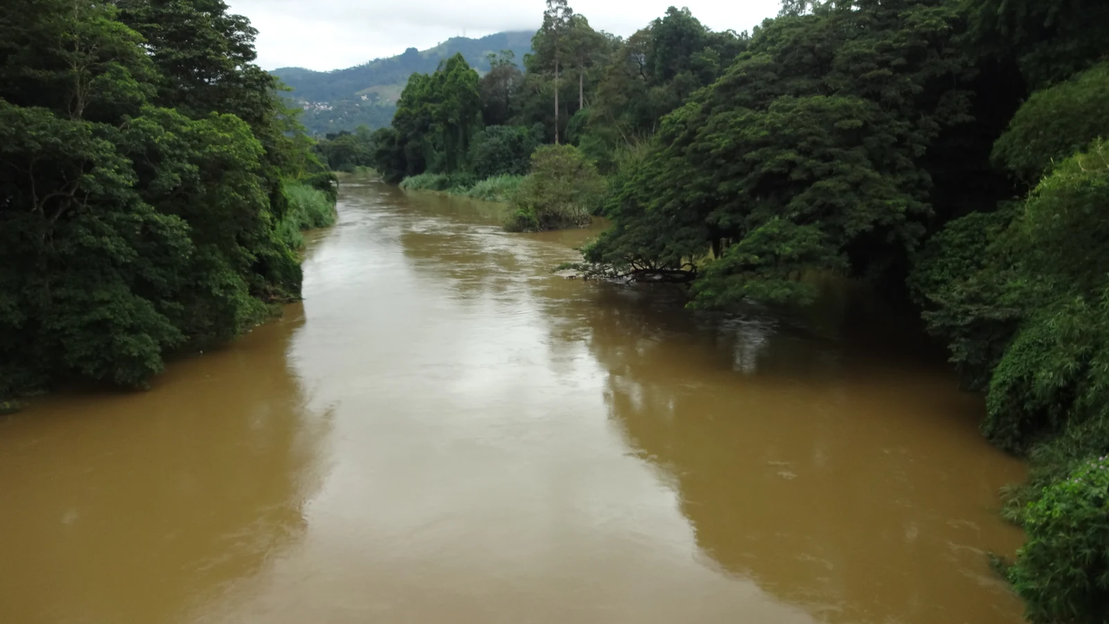
The Mahaweli Ganga is the longest river in Sri Lanka, flowing 335 kilometers to the sea at Trincomalee Bay.
The river basin covers 10,448 square kilometers of land across wet and dry regions.
Heavy monsoon rain over 4,000 millimeters falls on mountain headwaters near Adam Peak and Horton Plains.
The river loops around the green hills of Kandy before flowing north.
At the coast, river water flows into Koddiyar Bay near a deep submarine canyon.
Steep mountain gorges made strong rock locations for building big dams.
The Accelerated Mahaweli Development Programme and Cascade Engineering
In 1977 the government started the Accelerated Mahaweli Development Programme to build dams quickly.
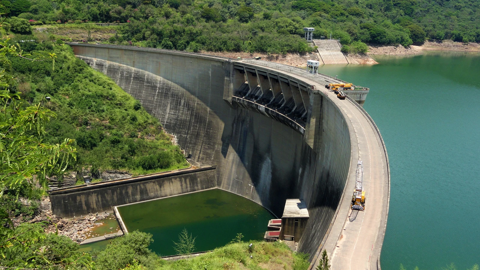
Engineers built major dams including Kotmale, Victoria, Randenigala, and Rantembe.
The 122-meter Victoria Dam is the tallest concrete arch dam in Sri Lanka.
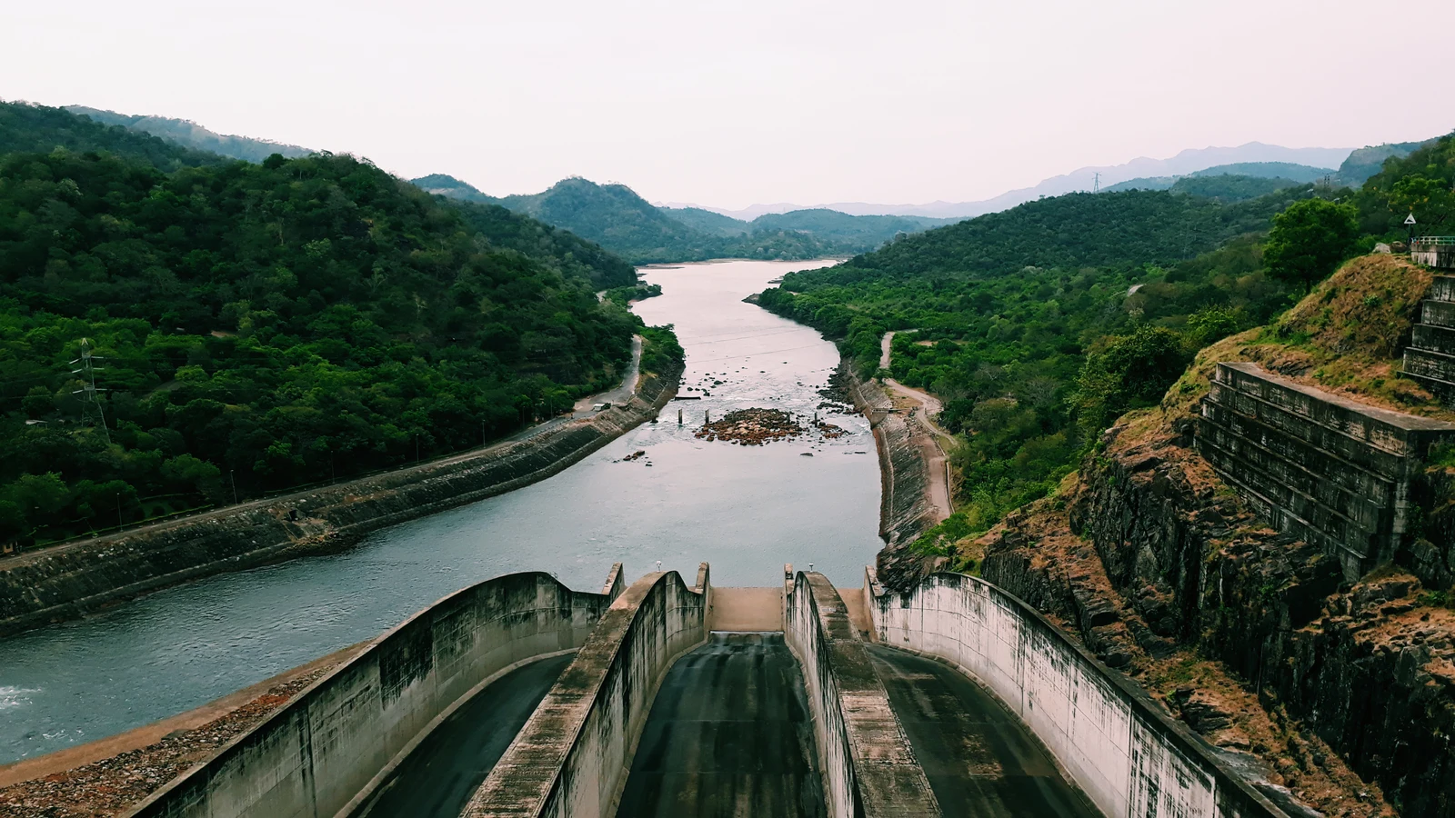
The river dams produce clean hydroelectric power for forty percent of the island.
Deep underground power tunnels carry water down to giant electric turbines.
Officials at the Water Management Secretariat track reservoir levels every day to balance power and farming.
Trans-Basin Diversions and Dry Zone Agricultural Irrigation
The Polgolla Barrage sends river water through a five-mile underground tunnel to Bowatenna.
These waters fill ancient tanks and irrigate dry farmland across the northern plains.
Builders restored the historic Minipe Anicut canal scheme first made by King Aggabodhi.
Long canals bring steady water to thousands of hectares of green paddy fields.
The project helped settle over 100,000 farm families in new farming villages.
Farmer groups share water along small farm canals during dry yala seasons.
Riparian Floodplain Ecology, Villu Wetlands, and Wildlife Corridors
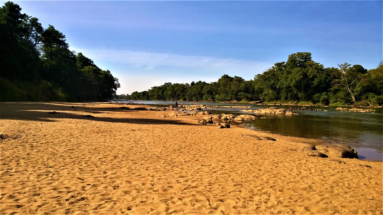
Lowland river plains form wide freshwater marshes called villus.
Somawathiya National Park protects green villu wetlands for wild waterbirds and deer.
Thick riverside forests make a safe path for wild Asian elephant herds.
Large dams change natural downstream flood pulses and cause riverbank erosion.
Mud and silt build up behind highland dams, reducing water storage space.
Good river management balances food and power needs with nature conservation.
A2 · Elementary
The Mahaweli River: Mountain Headwaters, Reservoir Dams, and Dry Zone Canals
Highland monsoon hydrology, hydroelectric dam cascades, and trans-basin diversions structure Sri Lanka primary water network.
Highland Headwaters and River Morphology
The Mahaweli Ganga is Sri Lanka's longest river, flowing 335 kilometers from its mountain headwaters in the Hatton plateau to its marine outfall at Trincomalee Bay. The river basin drains approximately 10,448 square kilometers, representing roughly one-sixth of Sri Lanka's total geographic landmass across wet and intermediate climatic zones. The upper headwaters originate on the high slopes of Adam's Peak and the Horton Plains plateau, where annual monsoon precipitation regularly exceeds 4,000 millimeters.
Before descending into the northern plains, the upper Mahaweli traverses the historic Kandy valley, forming a broad geological horseshoe loop that buffered the royal capital. The river discharges into the Indian Ocean through an estuarine delta into Koddiyar Bay, where a deep submarine canyon extends directly into the continental shelf. Rapid geological downcutting through high crystalline bedrock created steep gorges that provided ideal structural topography for high-head hydroelectric dam construction.
The Accelerated Mahaweli Development Programme and Cascade Engineering
The Accelerated Mahaweli Development Programme, launched in 1977, telescoped a planned thirty-year river basin engineering master plan into an intensive six-year construction initiative. The engineering cascade encompasses five major headworks dams including Kotmale, Victoria, Randenigala, Rantembe, and the Moragahakanda reservoir complex. Victoria Dam stands as the tallest concrete arch dam in Sri Lanka at 122 meters in height, featuring a double-curvature shell spanning the narrow Mahaweli river gorge.
The Mahaweli hydroelectric cascade generates substantial clean renewable power, historically contributing over forty percent of Sri Lanka's total national electrical grid supply. High-pressure subterranean power tunnels and surge chambers direct impounded reservoir waters into underground power turbines before discharging back into the main river channel. The Water Management Secretariat in Colombo monitors real-time reservoir storage, coordinating daily power generation schedules with seasonal agricultural release demands.
Trans-Basin Diversions and Dry Zone Agricultural Irrigation
The Polgolla Barrage upstream of Kandy diverts significant river discharges through an underground five-mile diversion tunnel into the Sudu Ganga and Bowatenna reservoir. Diverted waters feed the extensive dry zone irrigation systems of the North Central and Eastern provinces, supplying historic tanks across Rajarata farmlands. Modern engineers restored and expanded the ancient Minipe Anicut diversion scheme, which dates back to the fifth-century reign of King Aggabodhi II.
The Mahaweli irrigation canal network provides perennial water security across hundreds of thousands of hectares of paddy fields and subsidiary food crop lands. The development initiative facilitated the planned resettlement of over 100,000 agrarian farm families into designated administrative development blocks from System A through System H. Farmer-managed water user associations coordinate distribution turns along tertiary field channels to maximize water productivity during dry season yala cultivation.
Riparian Floodplain Ecology, Villu Wetlands, and Wildlife Corridors
The lowland Mahaweli river corridor creates extensive seasonal floodplains characterized by unique freshwater marshes known locally as villus. Somawathiya National Park and Flood Plains National Park protect vital villu habitats that sustain rich aquatic grasses and migrating waterbird populations. The continuous riverine forest strip functions as an indispensable biological migration corridor connecting wild Asian elephant populations between highland and lowland sanctuaries.
Extensive reservoir impoundments and trans-basin diversions altered natural downstream flood pulses, accelerating riverbank erosion and disrupting fish spawning cycles. Silt accumulation and reservoir sedimentation behind major highland dams reduce effective live storage capacity, necessitating coordinated catchment re-forestation and soil conservation programs. Integrated basin management seeks to balance national energy production and food security with the ecological preservation of fragile estuarine and wetland ecosystems.
B1 · Intermediate
Hydrological Morphology and Multi-Purpose River Basin Engineering along the Mahaweli
An analytical study of the Hatton catchment, Accelerated Mahaweli cascade generation, and Rajarata agricultural irrigation.
Highland Headwaters and River Morphology
The Mahaweli Ganga is Sri Lanka's longest river, flowing 335 kilometers from its mountain headwaters in the Hatton plateau to its marine outfall at Trincomalee Bay. The river basin drains approximately 10,448 square kilometers, representing roughly one-sixth of Sri Lanka's total geographic landmass across wet and intermediate climatic zones. The upper headwaters originate on the high slopes of Adam's Peak and the Horton Plains plateau, where annual monsoon precipitation regularly exceeds 4,000 millimeters.
Before descending into the northern plains, the upper Mahaweli traverses the historic Kandy valley, forming a broad geological horseshoe loop that buffered the royal capital. The river discharges into the Indian Ocean through an estuarine delta into Koddiyar Bay, where a deep submarine canyon extends directly into the continental shelf. Rapid geological downcutting through high crystalline bedrock created steep gorges that provided ideal structural topography for high-head hydroelectric dam construction.
The Accelerated Mahaweli Development Programme and Cascade Engineering
The Accelerated Mahaweli Development Programme, launched in 1977, telescoped a planned thirty-year river basin engineering master plan into an intensive six-year construction initiative. The engineering cascade encompasses five major headworks dams including Kotmale, Victoria, Randenigala, Rantembe, and the Moragahakanda reservoir complex. Victoria Dam stands as the tallest concrete arch dam in Sri Lanka at 122 meters in height, featuring a double-curvature shell spanning the narrow Mahaweli river gorge.
The Mahaweli hydroelectric cascade generates substantial clean renewable power, historically contributing over forty percent of Sri Lanka's total national electrical grid supply. High-pressure subterranean power tunnels and surge chambers direct impounded reservoir waters into underground power turbines before discharging back into the main river channel. The Water Management Secretariat in Colombo monitors real-time reservoir storage, coordinating daily power generation schedules with seasonal agricultural release demands.
Trans-Basin Diversions and Dry Zone Agricultural Irrigation
The Polgolla Barrage upstream of Kandy diverts significant river discharges through an underground five-mile diversion tunnel into the Sudu Ganga and Bowatenna reservoir. Diverted waters feed the extensive dry zone irrigation systems of the North Central and Eastern provinces, supplying historic tanks across Rajarata farmlands. Modern engineers restored and expanded the ancient Minipe Anicut diversion scheme, which dates back to the fifth-century reign of King Aggabodhi II.
The Mahaweli irrigation canal network provides perennial water security across hundreds of thousands of hectares of paddy fields and subsidiary food crop lands. The development initiative facilitated the planned resettlement of over 100,000 agrarian farm families into designated administrative development blocks from System A through System H. Farmer-managed water user associations coordinate distribution turns along tertiary field channels to maximize water productivity during dry season yala cultivation.
Riparian Floodplain Ecology, Villu Wetlands, and Wildlife Corridors
The lowland Mahaweli river corridor creates extensive seasonal floodplains characterized by unique freshwater marshes known locally as villus. Somawathiya National Park and Flood Plains National Park protect vital villu habitats that sustain rich aquatic grasses and migrating waterbird populations. The continuous riverine forest strip functions as an indispensable biological migration corridor connecting wild Asian elephant populations between highland and lowland sanctuaries.
Extensive reservoir impoundments and trans-basin diversions altered natural downstream flood pulses, accelerating riverbank erosion and disrupting fish spawning cycles. Silt accumulation and reservoir sedimentation behind major highland dams reduce effective live storage capacity, necessitating coordinated catchment re-forestation and soil conservation programs. Integrated basin management seeks to balance national energy production and food security with the ecological preservation of fragile estuarine and wetland ecosystems.
B2 · Upper Intermediate
Hydroelectric Cascade Optimization, Trans-Basin Diversions, and Basin Ecology in Sri Lanka
Examining high-head arch dams, subterranean power tunnels, ancient anicut restorations, and villu floodplain dynamics.
Highland Headwaters and River Morphology
The Mahaweli Ganga is Sri Lanka's longest river, flowing 335 kilometers from its mountain headwaters in the Hatton plateau to its marine outfall at Trincomalee Bay. The river basin drains approximately 10,448 square kilometers, representing roughly one-sixth of Sri Lanka's total geographic landmass across wet and intermediate climatic zones. The upper headwaters originate on the high slopes of Adam's Peak and the Horton Plains plateau, where annual monsoon precipitation regularly exceeds 4,000 millimeters.
Before descending into the northern plains, the upper Mahaweli traverses the historic Kandy valley, forming a broad geological horseshoe loop that buffered the royal capital. The river discharges into the Indian Ocean through an estuarine delta into Koddiyar Bay, where a deep submarine canyon extends directly into the continental shelf. Rapid geological downcutting through high crystalline bedrock created steep gorges that provided ideal structural topography for high-head hydroelectric dam construction.
The Accelerated Mahaweli Development Programme and Cascade Engineering
The Accelerated Mahaweli Development Programme, launched in 1977, telescoped a planned thirty-year river basin engineering master plan into an intensive six-year construction initiative. The engineering cascade encompasses five major headworks dams including Kotmale, Victoria, Randenigala, Rantembe, and the Moragahakanda reservoir complex. Victoria Dam stands as the tallest concrete arch dam in Sri Lanka at 122 meters in height, featuring a double-curvature shell spanning the narrow Mahaweli river gorge.
The Mahaweli hydroelectric cascade generates substantial clean renewable power, historically contributing over forty percent of Sri Lanka's total national electrical grid supply. High-pressure subterranean power tunnels and surge chambers direct impounded reservoir waters into underground power turbines before discharging back into the main river channel. The Water Management Secretariat in Colombo monitors real-time reservoir storage, coordinating daily power generation schedules with seasonal agricultural release demands.
Trans-Basin Diversions and Dry Zone Agricultural Irrigation
The Polgolla Barrage upstream of Kandy diverts significant river discharges through an underground five-mile diversion tunnel into the Sudu Ganga and Bowatenna reservoir. Diverted waters feed the extensive dry zone irrigation systems of the North Central and Eastern provinces, supplying historic tanks across Rajarata farmlands. Modern engineers restored and expanded the ancient Minipe Anicut diversion scheme, which dates back to the fifth-century reign of King Aggabodhi II.
The Mahaweli irrigation canal network provides perennial water security across hundreds of thousands of hectares of paddy fields and subsidiary food crop lands. The development initiative facilitated the planned resettlement of over 100,000 agrarian farm families into designated administrative development blocks from System A through System H. Farmer-managed water user associations coordinate distribution turns along tertiary field channels to maximize water productivity during dry season yala cultivation.
Riparian Floodplain Ecology, Villu Wetlands, and Wildlife Corridors
The lowland Mahaweli river corridor creates extensive seasonal floodplains characterized by unique freshwater marshes known locally as villus. Somawathiya National Park and Flood Plains National Park protect vital villu habitats that sustain rich aquatic grasses and migrating waterbird populations. The continuous riverine forest strip functions as an indispensable biological migration corridor connecting wild Asian elephant populations between highland and lowland sanctuaries.
Extensive reservoir impoundments and trans-basin diversions altered natural downstream flood pulses, accelerating riverbank erosion and disrupting fish spawning cycles. Silt accumulation and reservoir sedimentation behind major highland dams reduce effective live storage capacity, necessitating coordinated catchment re-forestation and soil conservation programs. Integrated basin management seeks to balance national energy production and food security with the ecological preservation of fragile estuarine and wetland ecosystems.
C1 · Advanced
Fluvial Geomorphology, Hydraulic Tele-Metering, and Irrigation Agronomy in the Mahaweli Basin
A critical investigation of crystalline bedrock gorges, double-curvature dam mechanics, Polgolla trans-basin diversion, and downstream riparian corridors.
Highland Headwaters and River Morphology
The Mahaweli Ganga is Sri Lanka's longest river, flowing 335 kilometers from its mountain headwaters in the Hatton plateau to its marine outfall at Trincomalee Bay. The river basin drains approximately 10,448 square kilometers, representing roughly one-sixth of Sri Lanka's total geographic landmass across wet and intermediate climatic zones. The upper headwaters originate on the high slopes of Adam's Peak and the Horton Plains plateau, where annual monsoon precipitation regularly exceeds 4,000 millimeters.
Before descending into the northern plains, the upper Mahaweli traverses the historic Kandy valley, forming a broad geological horseshoe loop that buffered the royal capital. The river discharges into the Indian Ocean through an estuarine delta into Koddiyar Bay, where a deep submarine canyon extends directly into the continental shelf. Rapid geological downcutting through high crystalline bedrock created steep gorges that provided ideal structural topography for high-head hydroelectric dam construction.
The Accelerated Mahaweli Development Programme and Cascade Engineering
The Accelerated Mahaweli Development Programme, launched in 1977, telescoped a planned thirty-year river basin engineering master plan into an intensive six-year construction initiative. The engineering cascade encompasses five major headworks dams including Kotmale, Victoria, Randenigala, Rantembe, and the Moragahakanda reservoir complex. Victoria Dam stands as the tallest concrete arch dam in Sri Lanka at 122 meters in height, featuring a double-curvature shell spanning the narrow Mahaweli river gorge.
The Mahaweli hydroelectric cascade generates substantial clean renewable power, historically contributing over forty percent of Sri Lanka's total national electrical grid supply. High-pressure subterranean power tunnels and surge chambers direct impounded reservoir waters into underground power turbines before discharging back into the main river channel. The Water Management Secretariat in Colombo monitors real-time reservoir storage, coordinating daily power generation schedules with seasonal agricultural release demands.
Trans-Basin Diversions and Dry Zone Agricultural Irrigation
The Polgolla Barrage upstream of Kandy diverts significant river discharges through an underground five-mile diversion tunnel into the Sudu Ganga and Bowatenna reservoir. Diverted waters feed the extensive dry zone irrigation systems of the North Central and Eastern provinces, supplying historic tanks across Rajarata farmlands. Modern engineers restored and expanded the ancient Minipe Anicut diversion scheme, which dates back to the fifth-century reign of King Aggabodhi II.
The Mahaweli irrigation canal network provides perennial water security across hundreds of thousands of hectares of paddy fields and subsidiary food crop lands. The development initiative facilitated the planned resettlement of over 100,000 agrarian farm families into designated administrative development blocks from System A through System H. Farmer-managed water user associations coordinate distribution turns along tertiary field channels to maximize water productivity during dry season yala cultivation.
Riparian Floodplain Ecology, Villu Wetlands, and Wildlife Corridors
The lowland Mahaweli river corridor creates extensive seasonal floodplains characterized by unique freshwater marshes known locally as villus. Somawathiya National Park and Flood Plains National Park protect vital villu habitats that sustain rich aquatic grasses and migrating waterbird populations. The continuous riverine forest strip functions as an indispensable biological migration corridor connecting wild Asian elephant populations between highland and lowland sanctuaries.
Extensive reservoir impoundments and trans-basin diversions altered natural downstream flood pulses, accelerating riverbank erosion and disrupting fish spawning cycles. Silt accumulation and reservoir sedimentation behind major highland dams reduce effective live storage capacity, necessitating coordinated catchment re-forestation and soil conservation programs. Integrated basin management seeks to balance national energy production and food security with the ecological preservation of fragile estuarine and wetland ecosystems.
C2 · Mastery
Hydro-Economic Hegemony, Trans-Basin Hydraulic Spatialization, and Riparian Ecology along the Mahaweli
A rigorous analytical treatise on accelerated river engineering, subterranean hydro-mechanical infrastructure, participatory irrigation governance, and villu conservation.
Highland Headwaters and River Morphology
The Mahaweli Ganga is Sri Lanka's longest river, flowing 335 kilometers from its mountain headwaters in the Hatton plateau to its marine outfall at Trincomalee Bay. The river basin drains approximately 10,448 square kilometers, representing roughly one-sixth of Sri Lanka's total geographic landmass across wet and intermediate climatic zones. The upper headwaters originate on the high slopes of Adam's Peak and the Horton Plains plateau, where annual monsoon precipitation regularly exceeds 4,000 millimeters.
Before descending into the northern plains, the upper Mahaweli traverses the historic Kandy valley, forming a broad geological horseshoe loop that buffered the royal capital. The river discharges into the Indian Ocean through an estuarine delta into Koddiyar Bay, where a deep submarine canyon extends directly into the continental shelf. Rapid geological downcutting through high crystalline bedrock created steep gorges that provided ideal structural topography for high-head hydroelectric dam construction.
The Accelerated Mahaweli Development Programme and Cascade Engineering
The Accelerated Mahaweli Development Programme, launched in 1977, telescoped a planned thirty-year river basin engineering master plan into an intensive six-year construction initiative. The engineering cascade encompasses five major headworks dams including Kotmale, Victoria, Randenigala, Rantembe, and the Moragahakanda reservoir complex. Victoria Dam stands as the tallest concrete arch dam in Sri Lanka at 122 meters in height, featuring a double-curvature shell spanning the narrow Mahaweli river gorge.
The Mahaweli hydroelectric cascade generates substantial clean renewable power, historically contributing over forty percent of Sri Lanka's total national electrical grid supply. High-pressure subterranean power tunnels and surge chambers direct impounded reservoir waters into underground power turbines before discharging back into the main river channel. The Water Management Secretariat in Colombo monitors real-time reservoir storage, coordinating daily power generation schedules with seasonal agricultural release demands.
Trans-Basin Diversions and Dry Zone Agricultural Irrigation
The Polgolla Barrage upstream of Kandy diverts significant river discharges through an underground five-mile diversion tunnel into the Sudu Ganga and Bowatenna reservoir. Diverted waters feed the extensive dry zone irrigation systems of the North Central and Eastern provinces, supplying historic tanks across Rajarata farmlands. Modern engineers restored and expanded the ancient Minipe Anicut diversion scheme, which dates back to the fifth-century reign of King Aggabodhi II.
The Mahaweli irrigation canal network provides perennial water security across hundreds of thousands of hectares of paddy fields and subsidiary food crop lands. The development initiative facilitated the planned resettlement of over 100,000 agrarian farm families into designated administrative development blocks from System A through System H. Farmer-managed water user associations coordinate distribution turns along tertiary field channels to maximize water productivity during dry season yala cultivation.
Riparian Floodplain Ecology, Villu Wetlands, and Wildlife Corridors
The lowland Mahaweli river corridor creates extensive seasonal floodplains characterized by unique freshwater marshes known locally as villus. Somawathiya National Park and Flood Plains National Park protect vital villu habitats that sustain rich aquatic grasses and migrating waterbird populations. The continuous riverine forest strip functions as an indispensable biological migration corridor connecting wild Asian elephant populations between highland and lowland sanctuaries.
Extensive reservoir impoundments and trans-basin diversions altered natural downstream flood pulses, accelerating riverbank erosion and disrupting fish spawning cycles. Silt accumulation and reservoir sedimentation behind major highland dams reduce effective live storage capacity, necessitating coordinated catchment re-forestation and soil conservation programs. Integrated basin management seeks to balance national energy production and food security with the ecological preservation of fragile estuarine and wetland ecosystems.
Check your understanding
Choose how closely you want to revisit the article. You can refer back while answering, and review explanations when you finish.
Quick Quiz A1
Try one question, then create a free account for the full Quick Quiz. Sign Up Free
Answer every question before checking. There is no time limit.
Your results
/ 1 correct (%)
Read the explanations to see how each answer connects to the article.
-
How long is the Mahaweli Ganga from mountain source to the sea?
1. Answer:
Quick Quiz A2
Try one question, then create a free account for the full Quick Quiz. Sign Up Free
Answer every question before checking. There is no time limit.
Your results
/ 1 correct (%)
Read the explanations to see how each answer connects to the article.
-
What is the total length of the Mahaweli Ganga from headwaters to sea?
1. Answer:
Quick Quiz B1
Try one question, then create a free account for the full Quick Quiz. Sign Up Free
Answer every question before checking. There is no time limit.
Your results
/ 1 correct (%)
Read the explanations to see how each answer connects to the article.
-
What is the total length of the Mahaweli Ganga from headwaters to sea?
1. Answer:
Quick Quiz B2
Try one question, then create a free account for the full Quick Quiz. Sign Up Free
Answer every question before checking. There is no time limit.
Your results
/ 1 correct (%)
Read the explanations to see how each answer connects to the article.
-
What is the total length of the Mahaweli Ganga from headwaters to sea?
1. Answer:
Quick Quiz C1
Try one question, then create a free account for the full Quick Quiz. Sign Up Free
Answer every question before checking. There is no time limit.
Your results
/ 1 correct (%)
Read the explanations to see how each answer connects to the article.
-
What is the total length of the Mahaweli Ganga from headwaters to sea?
1. Answer:
Quick Quiz C2
Try one question, then create a free account for the full Quick Quiz. Sign Up Free
Answer every question before checking. There is no time limit.
Your results
/ 1 correct (%)
Read the explanations to see how each answer connects to the article.
-
What is the total length of the Mahaweli Ganga from headwaters to sea?
1. Answer:
