A1 · Beginner
Paramaribo Rainy Season Drainage: Kokers and City Canals in Suriname
From heavy tropical sibibusi rains and tidal sluice gates to weekend cleanups and houses on brick pillars, Paramaribo adapts to coastal water every day.
Tropical Precipitation and Coastal Topography
Paramaribo has two rainy seasons with heavy tropical downpours called sibibusi.
The city sits on a low coastal plain along the Suriname River estuary.
Open canal arteries like the Sommelsdijkse Kreek collect rainwater from historic streets.
The Saramacca Doorsteek canal serves as an important southern conduit to move water away.
When heavy rains meet high tides in the river, gravity drainage stops for hours.
Engineers measure peak rainfall intensities exceeding fifty millimeters in single storms.
Kokers Sluice Gates and Pumping Stations
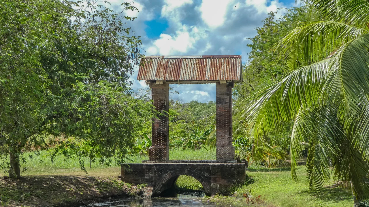
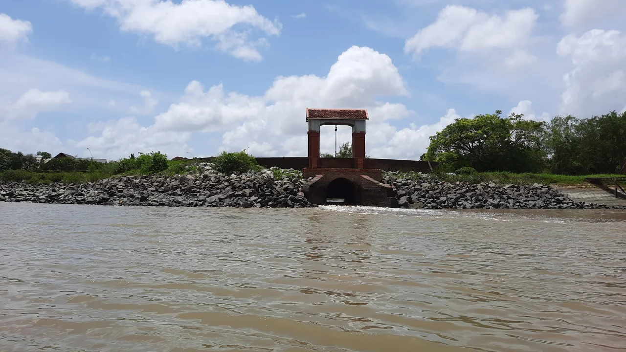
Tidal sluice gates called kokers act as mechanical barriers to keep river water out.
Workers read tide tables daily to open gates during ebb tide and close them during high tide.
Pumping stations called gemalen pump out impounded water when gates must stay closed.
Modern axial pumps discharge large volumes of water into the river every second.
Maintenance workers inspect cables, winches, and counterweights on sluice gates before the rains.
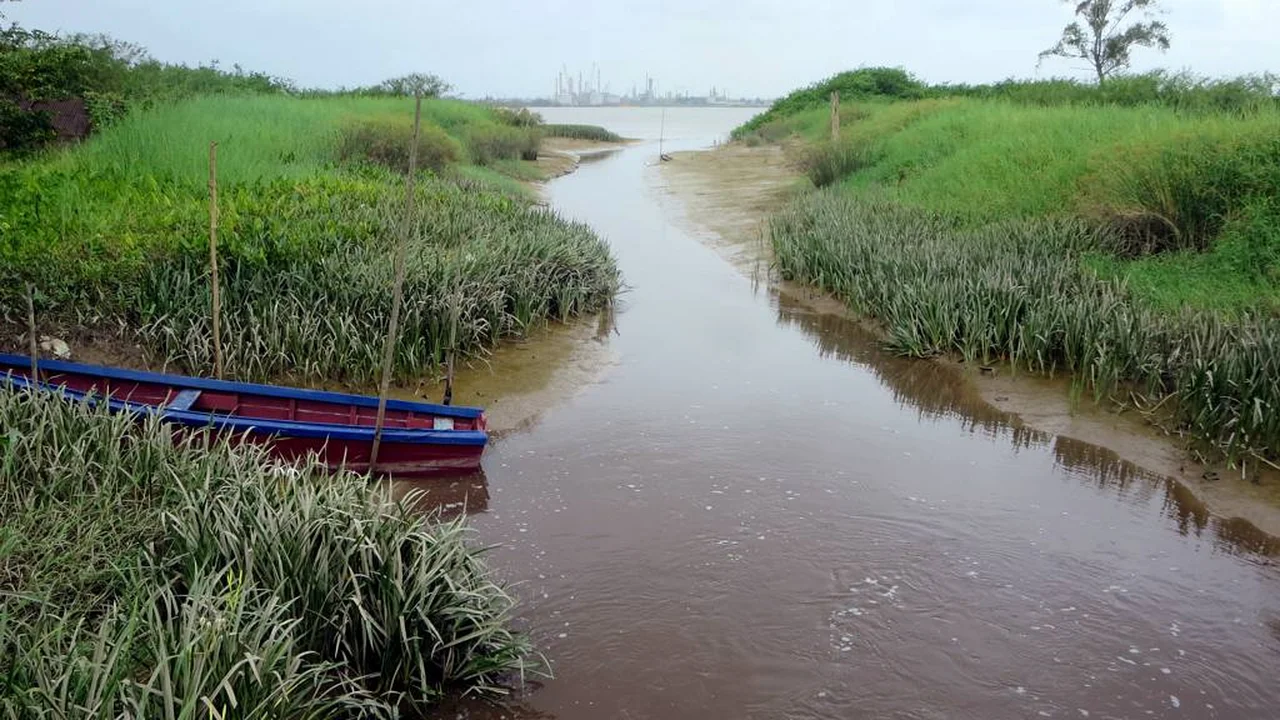
Diggers on floating pontoons clear siltation and mud from canal river mouths.
Canal Maintenance and Neighborhood Clearance
Fast growing water hyacinths and weeds clog neighborhood drainage trenches called trenzen.
Workers use backhoes to clear mud and plants from big canals during seasonal desilting.
City leaders pass bylaws prohibiting people from throwing trash into open gutters.
Neighbors gather for weekend corvée work to clear debris from local street drains.
Plastic bottles thrown into ditches can damage pump impellers at pumping stations.
Workers use high pressure water to clean sandy dirt out of underground culverts.
Urban Mobility Adaptation and Civic Routines
Heavy rain submerges streets, so minibus drivers drive along higher sand ridges.
Residents take precautions by carrying umbrellas, wearing boots, and checking meteorological news.
Shopkeepers build elevated doorways with high thresholds to prevent water from entering stores.
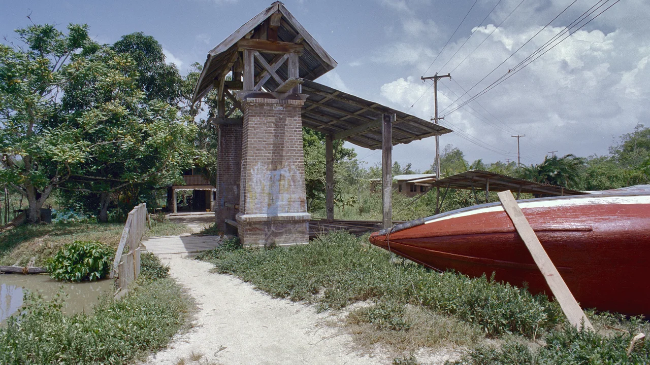
Historic wooden houses stand on brick pillars to keep floors dry above saturated ground.
District disaster teams help families and remove fallen trees during big storms.
City plans include water retention basins and green swales to handle heavy rain.
A2 · Elementary
Paramaribo Rainy Season Drainage: Urban Waterways and Tidal Sluices in Suriname
Examining how low coastal topography, the Sommelsdijkse Kreek, and tidal sluice gates govern daily water flow during Suriname rainy months.
Tropical Precipitation and Coastal Topography
Paramaribo experiences two distinct annual wet seasons, enduring severe convective downpours that locals call sibibusi between May and August, followed by shorter rains in December.
Situated on a flat coastal flood plain just above sea level beside the Suriname River estuary, the capital topography lacks natural elevation gradients for gravity drainage.
The historic city center is transected by long open drainage arteries, including the Sommelsdijkse Kreek, which collects runoff from surrounding colonial streets.
To the south, the Saramacca Doorsteek canal operates as a vital bypass conduit, channeling stormwater between river systems to protect residential neighborhoods.
When heavy cloudbursts coincide with semi-diurnal high tides in the estuary, gravity discharge halts, leaving runoff stranded on central roadways.
Hydrological researchers at Anton de Kom University measure extreme storm intensities, documenting surges exceeding fifty millimeters of rainfall in two hours.
Kokers Sluice Gates and Pumping Stations
Heavy tidal sluice gates, known throughout Suriname as kokers, serve as the primary mechanical barriers defending low urban land against river inundation.
Operators track tide tables daily, lowering sluice gates during flood tide and raising them during ebb flow to allow pooled rainwater to escape.
To relieve waterlogged districts during high river stages, the government operates motorized pumping stations called gemalen that evacuate impounded floodwater.
Modern electro-mechanical axial pumps at major stations discharge multiple cubic meters of storm runoff every second directly into the river channel.
Civil engineering maintenance crews inspect heavy winches, lifting cables, counterweights, and watertight rubber gaskets before each monsoon season begins.
Continuous siltation along canal outfalls requires routine dredging, deploying hydraulic excavators on floating pontoons to remove estuarine sediment.
Canal Maintenance and Neighborhood Clearance
Aggressive tropical aquatic weed growth, particularly water hyacinths and thick grasses, clogs residential drainage trenches known as trenzen.
The Ministry of Public Works coordinates seasonal desilting operations, sending backhoes and specialized aquatic mowers to dredge primary drainage channels.
District authorities enforce municipal bylaws prohibiting illegal dumping of household trash, garden cuttings, and concrete waste into street gutters.
Local residents and merchants organize traditional weekend cleanup sessions known as corvée, pooling manual labor to clear vegetative debris from neighborhood drains.
Carelessly discarded plastic bottles and plastic foam food boxes represent serious hazards, threatening to block intake screens and damage pump impellers.
Underground culverts beneath downtown intersections require regular maintenance, using high-pressure water trucks to dislodge compacted sand.
Urban Mobility Adaptation and Civic Routines
Sudden street flooding during torrential cloudbursts submerges low thoroughfares, forcing minibuses and private cars onto elevated coastal sand ridges.
Residents manage the rainy season through practical precautions, packing sturdy umbrellas, donning waterproof boots, and tracking meteorological alerts.
Downtown store owners along Waterkant install elevated stone barriers and deploy watertight panels across entrance thresholds to keep display rooms dry.
Traditional timber buildings rest upon sturdy brick pillars, raising living quarters well above saturated topsoil and surface inundation.
Paramaribo disaster coordination teams deploy emergency crews to pump out flooded houses and clear fallen branches after violent windstorms.
Long-term urban adaptation programs prioritize building retention basins and vegetated swales to hold surplus stormwater as global sea levels rise.
B1 · Intermediate
Paramaribo Rainy Season Drainage: Hydraulic Systems and Civic Resilience
An analytical study of Paramaribo urban drainage infrastructure, exploring convective storms, motorized gemalen pumps, and community corvée clearance.
Tropical Precipitation and Coastal Topography
Paramaribo experiences two distinct annual wet seasons, enduring severe convective downpours that locals call sibibusi between May and August, followed by shorter rains in December.
Situated on a flat coastal flood plain just above sea level beside the Suriname River estuary, the capital topography lacks natural elevation gradients for gravity drainage.
The historic city center is transected by long open drainage arteries, including the Sommelsdijkse Kreek, which collects runoff from surrounding colonial streets.
To the south, the Saramacca Doorsteek canal operates as a vital bypass conduit, channeling stormwater between river systems to protect residential neighborhoods.
When heavy cloudbursts coincide with semi-diurnal high tides in the estuary, gravity discharge halts, leaving runoff stranded on central roadways.
Hydrological researchers at Anton de Kom University measure extreme storm intensities, documenting surges exceeding fifty millimeters of rainfall in two hours.
Kokers Sluice Gates and Pumping Stations
Heavy tidal sluice gates, known throughout Suriname as kokers, serve as the primary mechanical barriers defending low urban land against river inundation.
Operators track tide tables daily, lowering sluice gates during flood tide and raising them during ebb flow to allow pooled rainwater to escape.
To relieve waterlogged districts during high river stages, the government operates motorized pumping stations called gemalen that evacuate impounded floodwater.
Modern electro-mechanical axial pumps at major stations discharge multiple cubic meters of storm runoff every second directly into the river channel.
Civil engineering maintenance crews inspect heavy winches, lifting cables, counterweights, and watertight rubber gaskets before each monsoon season begins.
Continuous siltation along canal outfalls requires routine dredging, deploying hydraulic excavators on floating pontoons to remove estuarine sediment.
Canal Maintenance and Neighborhood Clearance
Aggressive tropical aquatic weed growth, particularly water hyacinths and thick grasses, clogs residential drainage trenches known as trenzen.
The Ministry of Public Works coordinates seasonal desilting operations, sending backhoes and specialized aquatic mowers to dredge primary drainage channels.
District authorities enforce municipal bylaws prohibiting illegal dumping of household trash, garden cuttings, and concrete waste into street gutters.
Local residents and merchants organize traditional weekend cleanup sessions known as corvée, pooling manual labor to clear vegetative debris from neighborhood drains.
Carelessly discarded plastic bottles and plastic foam food boxes represent serious hazards, threatening to block intake screens and damage pump impellers.
Underground culverts beneath downtown intersections require regular maintenance, using high-pressure water trucks to dislodge compacted sand.
Urban Mobility Adaptation and Civic Routines
Sudden street flooding during torrential cloudbursts submerges low thoroughfares, forcing minibuses and private cars onto elevated coastal sand ridges.
Residents manage the rainy season through practical precautions, packing sturdy umbrellas, donning waterproof boots, and tracking meteorological alerts.
Downtown store owners along Waterkant install elevated stone barriers and deploy watertight panels across entrance thresholds to keep display rooms dry.
Traditional timber buildings rest upon sturdy brick pillars, raising living quarters well above saturated topsoil and surface inundation.
Paramaribo disaster coordination teams deploy emergency crews to pump out flooded houses and clear fallen branches after violent windstorms.
Long-term urban adaptation programs prioritize building retention basins and vegetated swales to hold surplus stormwater as global sea levels rise.
B2 · Upper Intermediate
Paramaribo Rainy Season Drainage: Estuarine Dynamics and Polder Engineering
Investigating the interplay of semi-diurnal Atlantic tides, axial pump stations, outfall siltation, and street traffic rerouting along coastal sand ridges.
Tropical Precipitation and Coastal Topography
Paramaribo experiences two distinct annual wet seasons, enduring severe convective downpours that locals call sibibusi between May and August, followed by shorter rains in December.
Situated on a flat coastal flood plain just above sea level beside the Suriname River estuary, the capital topography lacks natural elevation gradients for gravity drainage.
The historic city center is transected by long open drainage arteries, including the Sommelsdijkse Kreek, which collects runoff from surrounding colonial streets.
To the south, the Saramacca Doorsteek canal operates as a vital bypass conduit, channeling stormwater between river systems to protect residential neighborhoods.
When heavy cloudbursts coincide with semi-diurnal high tides in the estuary, gravity discharge halts, leaving runoff stranded on central roadways.
Hydrological researchers at Anton de Kom University measure extreme storm intensities, documenting surges exceeding fifty millimeters of rainfall in two hours.
Kokers Sluice Gates and Pumping Stations
Heavy tidal sluice gates, known throughout Suriname as kokers, serve as the primary mechanical barriers defending low urban land against river inundation.
Operators track tide tables daily, lowering sluice gates during flood tide and raising them during ebb flow to allow pooled rainwater to escape.
To relieve waterlogged districts during high river stages, the government operates motorized pumping stations called gemalen that evacuate impounded floodwater.
Modern electro-mechanical axial pumps at major stations discharge multiple cubic meters of storm runoff every second directly into the river channel.
Civil engineering maintenance crews inspect heavy winches, lifting cables, counterweights, and watertight rubber gaskets before each monsoon season begins.
Continuous siltation along canal outfalls requires routine dredging, deploying hydraulic excavators on floating pontoons to remove estuarine sediment.
Canal Maintenance and Neighborhood Clearance
Aggressive tropical aquatic weed growth, particularly water hyacinths and thick grasses, clogs residential drainage trenches known as trenzen.
The Ministry of Public Works coordinates seasonal desilting operations, sending backhoes and specialized aquatic mowers to dredge primary drainage channels.
District authorities enforce municipal bylaws prohibiting illegal dumping of household trash, garden cuttings, and concrete waste into street gutters.
Local residents and merchants organize traditional weekend cleanup sessions known as corvée, pooling manual labor to clear vegetative debris from neighborhood drains.
Carelessly discarded plastic bottles and plastic foam food boxes represent serious hazards, threatening to block intake screens and damage pump impellers.
Underground culverts beneath downtown intersections require regular maintenance, using high-pressure water trucks to dislodge compacted sand.
Urban Mobility Adaptation and Civic Routines
Sudden street flooding during torrential cloudbursts submerges low thoroughfares, forcing minibuses and private cars onto elevated coastal sand ridges.
Residents manage the rainy season through practical precautions, packing sturdy umbrellas, donning waterproof boots, and tracking meteorological alerts.
Downtown store owners along Waterkant install elevated stone barriers and deploy watertight panels across entrance thresholds to keep display rooms dry.
Traditional timber buildings rest upon sturdy brick pillars, raising living quarters well above saturated topsoil and surface inundation.
Paramaribo disaster coordination teams deploy emergency crews to pump out flooded houses and clear fallen branches after violent windstorms.
Long-term urban adaptation programs prioritize building retention basins and vegetated swales to hold surplus stormwater as global sea levels rise.
C1 · Advanced
The Hydraulic Topography and Seasonal Flood Adaptation of Paramaribo
A critical journalistic monograph analyzing gravity drainage constraints, mechanical koker regimes, municipal waste bottlenecks, and long-term retention planning.
Tropical Precipitation and Coastal Topography
Paramaribo experiences two distinct annual wet seasons, enduring severe convective downpours that locals call sibibusi between May and August, followed by shorter rains in December.
Situated on a flat coastal flood plain just above sea level beside the Suriname River estuary, the capital topography lacks natural elevation gradients for gravity drainage.
The historic city center is transected by long open drainage arteries, including the Sommelsdijkse Kreek, which collects runoff from surrounding colonial streets.
To the south, the Saramacca Doorsteek canal operates as a vital bypass conduit, channeling stormwater between river systems to protect residential neighborhoods.
When heavy cloudbursts coincide with semi-diurnal high tides in the estuary, gravity discharge halts, leaving runoff stranded on central roadways.
Hydrological researchers at Anton de Kom University measure extreme storm intensities, documenting surges exceeding fifty millimeters of rainfall in two hours.
Kokers Sluice Gates and Pumping Stations
Heavy tidal sluice gates, known throughout Suriname as kokers, serve as the primary mechanical barriers defending low urban land against river inundation.
Operators track tide tables daily, lowering sluice gates during flood tide and raising them during ebb flow to allow pooled rainwater to escape.
To relieve waterlogged districts during high river stages, the government operates motorized pumping stations called gemalen that evacuate impounded floodwater.
Modern electro-mechanical axial pumps at major stations discharge multiple cubic meters of storm runoff every second directly into the river channel.
Civil engineering maintenance crews inspect heavy winches, lifting cables, counterweights, and watertight rubber gaskets before each monsoon season begins.
Continuous siltation along canal outfalls requires routine dredging, deploying hydraulic excavators on floating pontoons to remove estuarine sediment.
Canal Maintenance and Neighborhood Clearance
Aggressive tropical aquatic weed growth, particularly water hyacinths and thick grasses, clogs residential drainage trenches known as trenzen.
The Ministry of Public Works coordinates seasonal desilting operations, sending backhoes and specialized aquatic mowers to dredge primary drainage channels.
District authorities enforce municipal bylaws prohibiting illegal dumping of household trash, garden cuttings, and concrete waste into street gutters.
Local residents and merchants organize traditional weekend cleanup sessions known as corvée, pooling manual labor to clear vegetative debris from neighborhood drains.
Carelessly discarded plastic bottles and plastic foam food boxes represent serious hazards, threatening to block intake screens and damage pump impellers.
Underground culverts beneath downtown intersections require regular maintenance, using high-pressure water trucks to dislodge compacted sand.
Urban Mobility Adaptation and Civic Routines
Sudden street flooding during torrential cloudbursts submerges low thoroughfares, forcing minibuses and private cars onto elevated coastal sand ridges.
Residents manage the rainy season through practical precautions, packing sturdy umbrellas, donning waterproof boots, and tracking meteorological alerts.
Downtown store owners along Waterkant install elevated stone barriers and deploy watertight panels across entrance thresholds to keep display rooms dry.
Traditional timber buildings rest upon sturdy brick pillars, raising living quarters well above saturated topsoil and surface inundation.
Paramaribo disaster coordination teams deploy emergency crews to pump out flooded houses and clear fallen branches after violent windstorms.
Long-term urban adaptation programs prioritize building retention basins and vegetated swales to hold surplus stormwater as global sea levels rise.
C2 · Mastery
Paramaribo Rainy Season Drainage: Coastal Geomorphology, Infrastructure, and Urban Ecology
A comprehensive analytical study of Suriname capital flood management, evaluating estuarine hydraulics, pumping capacity, and climate adaptation in a low-lying delta.
Tropical Precipitation and Coastal Topography
Paramaribo experiences two distinct annual wet seasons, enduring severe convective downpours that locals call sibibusi between May and August, followed by shorter rains in December.
Situated on a flat coastal flood plain just above sea level beside the Suriname River estuary, the capital topography lacks natural elevation gradients for gravity drainage.
The historic city center is transected by long open drainage arteries, including the Sommelsdijkse Kreek, which collects runoff from surrounding colonial streets.
To the south, the Saramacca Doorsteek canal operates as a vital bypass conduit, channeling stormwater between river systems to protect residential neighborhoods.
When heavy cloudbursts coincide with semi-diurnal high tides in the estuary, gravity discharge halts, leaving runoff stranded on central roadways.
Hydrological researchers at Anton de Kom University measure extreme storm intensities, documenting surges exceeding fifty millimeters of rainfall in two hours.
Kokers Sluice Gates and Pumping Stations
Heavy tidal sluice gates, known throughout Suriname as kokers, serve as the primary mechanical barriers defending low urban land against river inundation.
Operators track tide tables daily, lowering sluice gates during flood tide and raising them during ebb flow to allow pooled rainwater to escape.
To relieve waterlogged districts during high river stages, the government operates motorized pumping stations called gemalen that evacuate impounded floodwater.
Modern electro-mechanical axial pumps at major stations discharge multiple cubic meters of storm runoff every second directly into the river channel.
Civil engineering maintenance crews inspect heavy winches, lifting cables, counterweights, and watertight rubber gaskets before each monsoon season begins.
Continuous siltation along canal outfalls requires routine dredging, deploying hydraulic excavators on floating pontoons to remove estuarine sediment.
Canal Maintenance and Neighborhood Clearance
Aggressive tropical aquatic weed growth, particularly water hyacinths and thick grasses, clogs residential drainage trenches known as trenzen.
The Ministry of Public Works coordinates seasonal desilting operations, sending backhoes and specialized aquatic mowers to dredge primary drainage channels.
District authorities enforce municipal bylaws prohibiting illegal dumping of household trash, garden cuttings, and concrete waste into street gutters.
Local residents and merchants organize traditional weekend cleanup sessions known as corvée, pooling manual labor to clear vegetative debris from neighborhood drains.
Carelessly discarded plastic bottles and plastic foam food boxes represent serious hazards, threatening to block intake screens and damage pump impellers.
Underground culverts beneath downtown intersections require regular maintenance, using high-pressure water trucks to dislodge compacted sand.
Urban Mobility Adaptation and Civic Routines
Sudden street flooding during torrential cloudbursts submerges low thoroughfares, forcing minibuses and private cars onto elevated coastal sand ridges.
Residents manage the rainy season through practical precautions, packing sturdy umbrellas, donning waterproof boots, and tracking meteorological alerts.
Downtown store owners along Waterkant install elevated stone barriers and deploy watertight panels across entrance thresholds to keep display rooms dry.
Traditional timber buildings rest upon sturdy brick pillars, raising living quarters well above saturated topsoil and surface inundation.
Paramaribo disaster coordination teams deploy emergency crews to pump out flooded houses and clear fallen branches after violent windstorms.
Long-term urban adaptation programs prioritize building retention basins and vegetated swales to hold surplus stormwater as global sea levels rise.
Check your understanding
Choose how closely you want to revisit the article. You can refer back while answering, and review explanations when you finish.
Quick Quiz A1
Try one question, then create a free account for the full Quick Quiz. Sign Up Free
Answer every question before checking. There is no time limit.
Your results
/ 1 correct (%)
Read the explanations to see how each answer connects to the article.
-
What are the heavy tropical downpours in Paramaribo called?
1. Answer:
Quick Quiz A2
Try one question, then create a free account for the full Quick Quiz. Sign Up Free
Answer every question before checking. There is no time limit.
Your results
/ 1 correct (%)
Read the explanations to see how each answer connects to the article.
-
What local term describes the severe convective downpours experienced in Paramaribo?
1. Answer:
Quick Quiz B1
Try one question, then create a free account for the full Quick Quiz. Sign Up Free
Answer every question before checking. There is no time limit.
Your results
/ 1 correct (%)
Read the explanations to see how each answer connects to the article.
-
What local term describes the severe convective downpours experienced in Paramaribo?
1. Answer:
Quick Quiz B2
Try one question, then create a free account for the full Quick Quiz. Sign Up Free
Answer every question before checking. There is no time limit.
Your results
/ 1 correct (%)
Read the explanations to see how each answer connects to the article.
-
What local term describes the severe convective downpours experienced in Paramaribo?
1. Answer:
Quick Quiz C1
Try one question, then create a free account for the full Quick Quiz. Sign Up Free
Answer every question before checking. There is no time limit.
Your results
/ 1 correct (%)
Read the explanations to see how each answer connects to the article.
-
What local term describes the severe convective downpours experienced in Paramaribo?
1. Answer:
Quick Quiz C2
Try one question, then create a free account for the full Quick Quiz. Sign Up Free
Answer every question before checking. There is no time limit.
Your results
/ 1 correct (%)
Read the explanations to see how each answer connects to the article.
-
What local term describes the severe convective downpours experienced in Paramaribo?
1. Answer:
